My last post about Bukit Kiara, Bukit Kiara: Not All Is Well, was written end of December and reported that JLN had resumed the fence construction at the eastern border of the proposed Kiara park. It is the yellow line in the TRAKS map below.
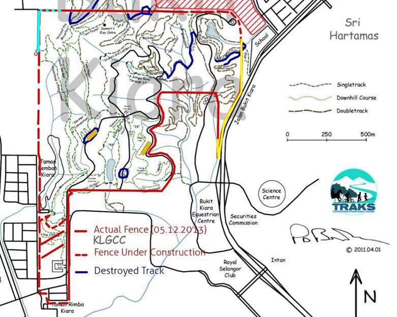
Now they are constructing the fence at the western side, where the park borders TTDI. Indicated in the map by a light blue line. I went there with my friend Pola Singh to have a look.
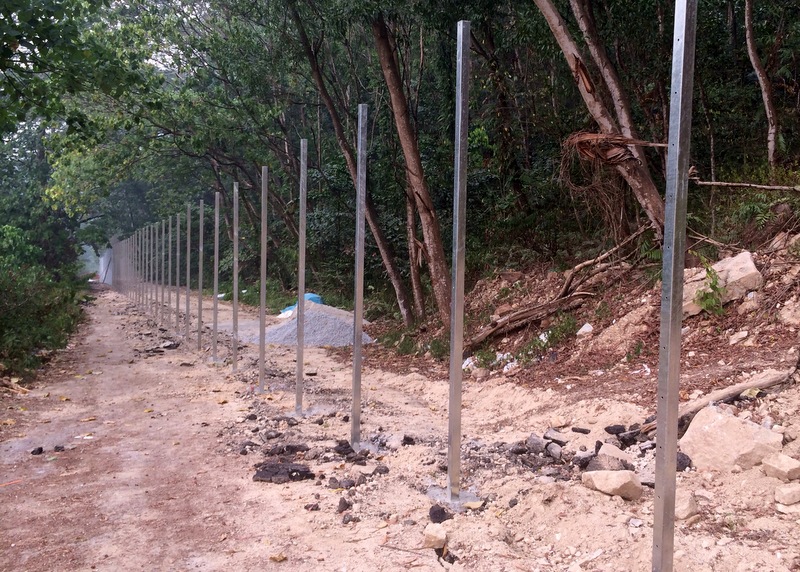
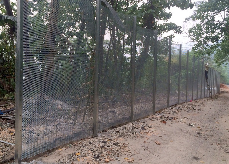
A small unpaved road, leading to a water tank, separates here the hill from the Taman Tun area, and it is this road where they are constructing the fence. The pylons have been cemented, now the workers are applying the actual fence. Halfway a gate has been planned. Near the water tank, the “prison” fence will connect to an old “friendly” existing fence.

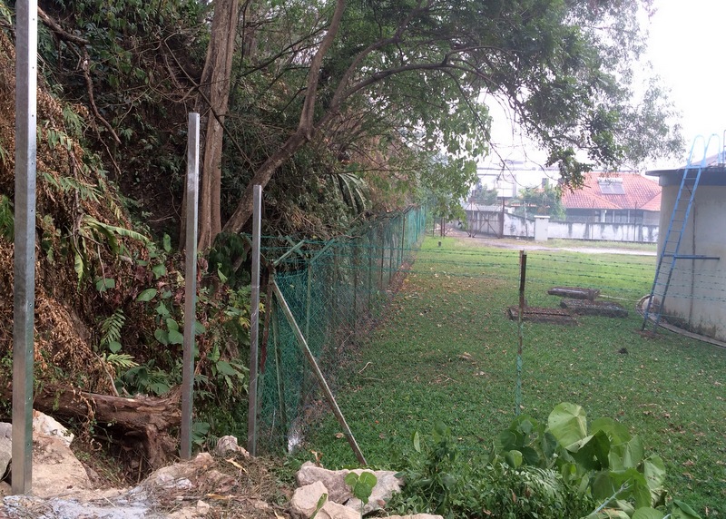
What will they do with this old fence? They will have to replace it, IMHO, otherwise the whole idea of making an unclimbable, high-security prison fence around Bukit Kiara becomes meaningless! Where the fence ends at the northwestern corner, it has to turn 90 degrees (blue dashed line in the TRAKS map) and then go up a very steep slope to connect with the existing northern fence. That will be a very tough job!
On our way back we climbed to the ridge to have a look at another of JLN’s “achievements”, the slope rectification project (see my aforementioned post)
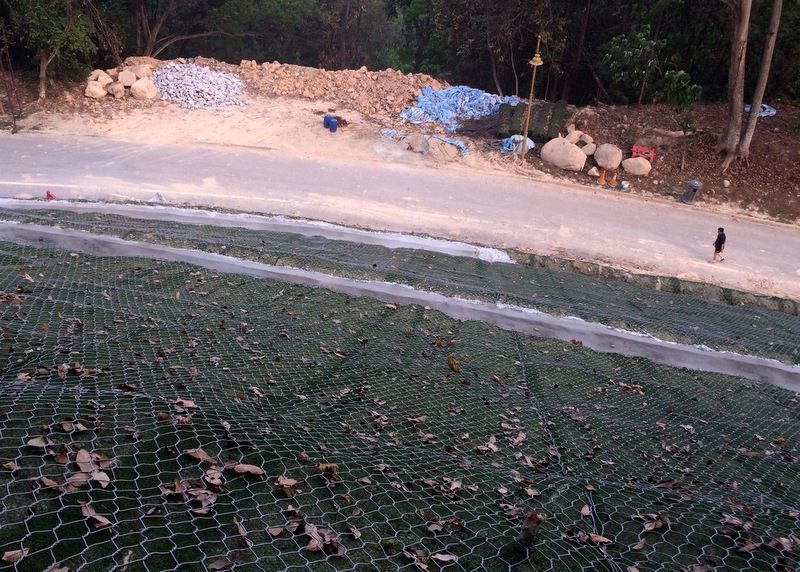
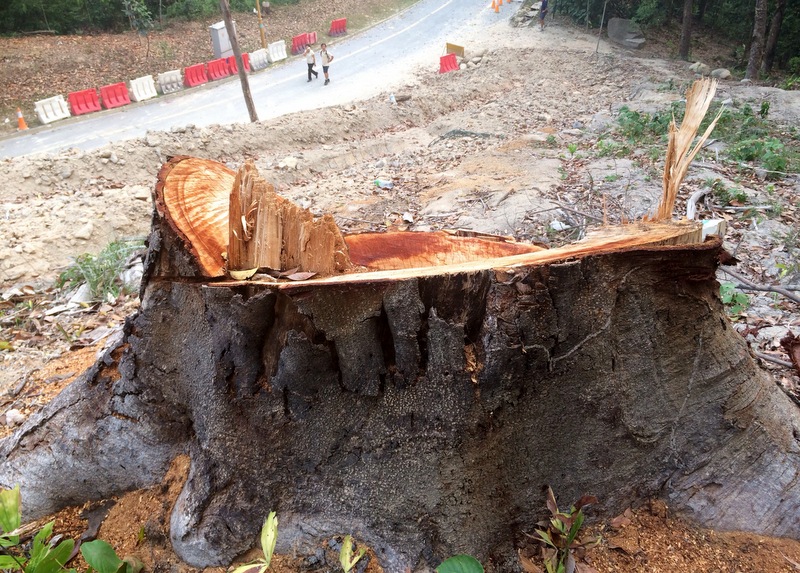
When it became clear that the soil removed from the slope, was just dumped at the other side of the road, destroying more trees and one of the TRAKS trails, a public outcry followed, and they stopped. But the damage was already done, as so often happens in Malaysia…:-( In the beginning they had left one majestic tree standing, but that one now has also been cut down.
Here is a Youtube clip, taken while walking this trail (the 4K trail), until blocked by the JLN-made landslide. Pathetic.
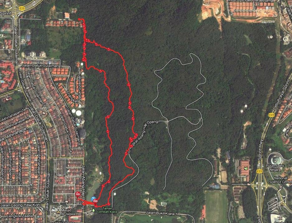
During our hike, I recorded the GPS coordinates and took quite a lot of pictures. It resulted in an EveryTrail report. In the map below you can see our hike, and when you click on it, a slideshow will start.