 |
wrote on Jul 24, 2012:
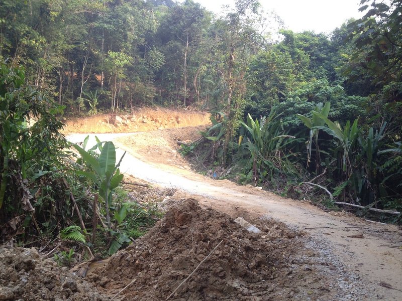
This is the Bar-a-Kuda highway, and 11m wide swath of sterile dirt, thank's to JLN master plan to maximize profits heading their way. It which cuts the single track trail Bar-a-Kuda up hill a bit from this pictured spot. The cement block in the foreground is a bridge abutment at a once-clear stream. The bridge was damaged, destroyed and now being rebricked by JLN's workers. The stream is under that pile of dirty near the banana leaf and is now basically a drain. Downstream it is muddied and silted in due to the dirty plowed in. This is Ulu Penchala, before it enters the Berjaya-leased wasted land, where it flows next to Berjaya's squatter quarters, who toss endless domestic waste into it, and raw horse sewerage flows into the stream. Then it's used to water the golf course, yum, where pesticide and fertilizer placed to please rich-ass golfers, further contaminates things. |
|
|