Stuif's Adventures
| Three times Sg Luit | ||||||||||||||||||||||||||||||||||||||||||||||||
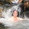
| The first time I visited Sg Luit, was in January 2010, with my friend Keong. In 1943 Spencer Chapman had crossed the main range, from Bentong to KKB, following the Repas and Luit rivers. We wanted to find out if there was still a trail and of course I was also looking for new waterfalls..:-) We found a clear trail and several small waterfalls and cascades. See Following Chapman's footprints for a detailed report. A few months later we did a similar recce from the Bentong side, along the Repas river. Also there we found a trail, but it became clear that a crossing of the main range would be a major expedition. In December 2010 I went back to Sg Luit, this time with friends who had found several waterfalls further upstream! We started early from Kg Pertak and after a few hours trekking we reached the end of the trail near some cascades with a big pool. From here we had to do mainly river trekking, big boulders, not always easy, but very exciting. First we passed a very attractive small waterfall, after another half hour later we reached the impressive main Sg Luit waterfall. Huge pool! Pristine! Back home, combining GPS data with Google Earth, it looked like there could be other waterfalls just around the corner of the main Luit fall (red cross on GE screenshot) So I decided to go one more time and this time camp overnight as far upstream as possible, because it was too far for a day trip. On July 23 I left from Kg Pertak with Keong, Rani, Vincent, Ben and Jim. We were both lucky and unlucky. Lucky because we found that from the lubuk a new trail had been created to the main fall. No idea by whom. So no cumbersome river trekking needed! Unlucky because a heavy downpour started early that day and we had to set up camp before reaching the main fall. We found a suitable location near the small waterfall. The terrain was not level enough for tents, so it was good that we were all using hammocks. At the end of the afternoon the rain stopped, so we could have a nice dinner al fresco. The next morning after breakfast, a few of us continued to the main fall. From there we found a way up the right side. Slippery, scrambling, but it was not far before we arrived at a rocky slope with the next waterfall. Very satisfying experience...:-). This new fall again had a large pool. It was possible to scramble up at the left side. Above this fall there were more cascades and nice pools, before the river split into two streams. I think that the left stream must have been followed by Chapman. Probably in his days there were still logging roads. We could still see traces of it here and there, but very overgrown. The route probably followed by him, is indicated in red. He had to cross the main range at an altitude of ~ 1200 m! | ||||||||||||||||||||||||||||||||||||||||||||||||
| ||||||||||||||||||||||||||||||||||||||||||||||||
| ||||||||||||||||||||||||||||||||||||||||||||||||
|