Stuif's Adventures
| Batu-Templer crossing 2-1-2010 | |||||||||||||||||||||||||||||||||||||||
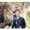
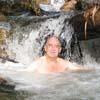
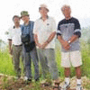
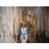
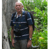
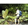
| On the second day of the new year 2010, I have successfully completed a project, which has kept me "busy" for several months. It all started with the interest that my friend Ashleigh and I have in Spencer Chapman. This British soldier managed to survive the Japanese occupation and wrote a book about it, 'The Jungle is Neutral'. In this book he gives detailed descriptions of his travels in the Malayan jungle, from one camp to another. In one of these hikes he traveled from the Batu caves to the Kanching river, with an overnight camp near Sg Udang. Wouldn't it be nice to follow his tracks and do the same? Studying the topo maps, there was a surprise. I had assumed that the famous Kanching falls would be in the Kanching river, but that was not the case! The Kanching river is located in Templer's park, a few km away from the Kanching park...:-) I had visited the Templer falls and knew that the trail continued after the falls. So, on 11-8-2009 Ash and I went to Templer and explored the upper reaches of the Kanching river (red track on the GE map), looking for the Udang river. That day we missed it, but two days later we found it (yellow track). In the meantime I had come to the conclusion that it made no sense to follow this river to the Batu caves, because in Chapman's days the Batu reservoir did not yet exist. Would it be possible to cross the ridge between this reservoir and Templer's park? We decided to do some recce's. On 18-9-2009 Ash and I went to the Batu reservoir and tried a few trails leading to the ridge. The first two were no use, but the third one, starting from Sg Bisul, was bingo! Passing plantations and bamboo forests, we could come quite close to the ridge. We stopped where the path became to overgrown. (light blue trail) A second recce followed on 23-12-2009. Studying the topo map I had found a suitable tributary of the Kanching river, Sg Gagah, that would lead quite close to the ridge. With Ash and Keong we managed to find this river and follow it until about 100 m from the ridge (dark blue trail). Nice surprise: a few unknow waterfalls! That left only a relatively small stretch of about 1 km, but... probably no trail at all, parang needed, and serious chopping. On 30-12-2009 Keong and I managed to do this last leg...:-) Leeches galore, but still a trail to the ridge, although seriously overgrown. From the ridge down to the stream was a tough scramble down. Very happy that we had made it. We went back the same way, to clear the trail for future visits In a sense I had proven my point, that a crossing was possible, what was still missing was a full crossing...:-) So that was what I did, with Rani and Richard, on 2-1-2010. A bit of logistics needed, we went in two cars, parked one at Templer's, then drove to the entrance of the Batu reservoir. We started at 10 am, going was smooth, as the trail was now clear. We reached the ridge after about 2 hours, the scramble down remained difficult, so we deserved our lunch at the Gagah river. The strenuous part finished, the rest of the trip was pure fun. Going was slow, because we kept river trekking where possible. But in this way we found several more nice small falls and cascades. We reached the car at 4:30. Effective trekking time 5 hours. One of my most rewarding adventures in the Malaysian nature....! | |||||||||||||||||||||||||||||||||||||||
| |||||||||||||||||||||||||||||||||||||||
| |||||||||||||||||||||||||||||||||||||||
|