
INTRODUCTION
Twenty years ago I started my own website. Although now in hibernation, this Stuif Site is still online. It has a Science -> Earth category, here is a screenshot of that page. I was quite interested in plate tectonics and continental drift and was planning to write more webpages about it. This never happened, the Earth page remained a “stub”.
But finally I have now decided to write a blog.
Recently I came across an article The Lost Continent of Kumari Kandam in which I found this map: I had never heard about Kumari Kandam and had to check Wikipedia: Kumari Kandam, “a mythical continent, believed to be lost with an ancient Tamil civilization”
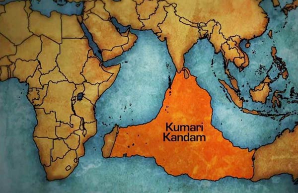
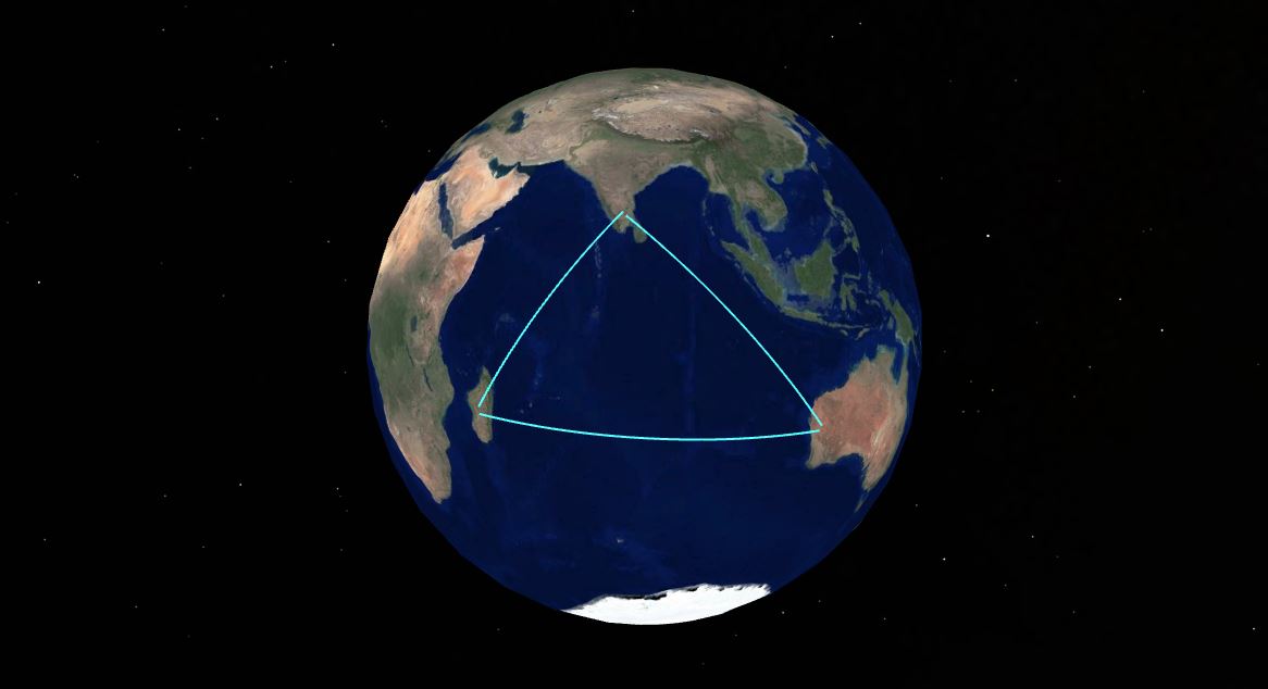
Apparently some Tamil revivalists still think that this continent really existed and actually was the cradle of civilisation, not Mesopotamia . The continent was submerged after the last Ice Age, when sea levels rose, forcing the Tamil people to migrate to other parts of the world. And yes, the sea levels rose after the last Ice Age, more than 120 meters. But have a look at the Google Earth nap of the Indian Ocean, where I have outlined Kumari Kandam. Mean sea depth is ~ 4 km!
So the Kumari Kandam continent never existed. A few months ago I have written a separate blog about this myth: Kumari Kandam & Lemuria .In that post I announced a post about continental drift and plate tectonics. Here it is.
THE STRUCTURE OF EARTH
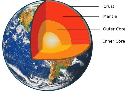
When Earth was formed, 4.55 billion year ago, it was in a completely molten state. The heavier elements sank to the center, the lighter elements rose to the surface. Because of cooling soon a crust developed. Here are two images of present Earth , showing its structure. Basically there are three main layers, the Crust, the Mantle and the Core.
The Core consists mainly of iron and nickel. In the Outer Core they are liquid (high temperature) and are the source of Earth’s magnetic field. The Inner Core is solid, the temperature is even higher, (about 6000 °C) but the pressure is gigantic.
The mantle is basically solid, but the upper mantle is already so hot, that it behaves as a fluid on a timescale of many millions of years. This upper part is called the Asthenosphere. .

The right image gives more details about the size of the various layers. The crust of Earth is very thin, especially under the oceans (~6-7 km). The continental crust is much thicker , 30-70 km and less dense than the oceanic crust. Compare the Earth crust with the shell of a chicken egg, or the skin of an apple
The crust of Earth is not one whole, it is broken in many separate parts, called tectonic plates. Below you see the main tectonic plates at present. They “float” on the mantle, very slowly, about a few cm/year. Red arrows indicate the direction in which they move.
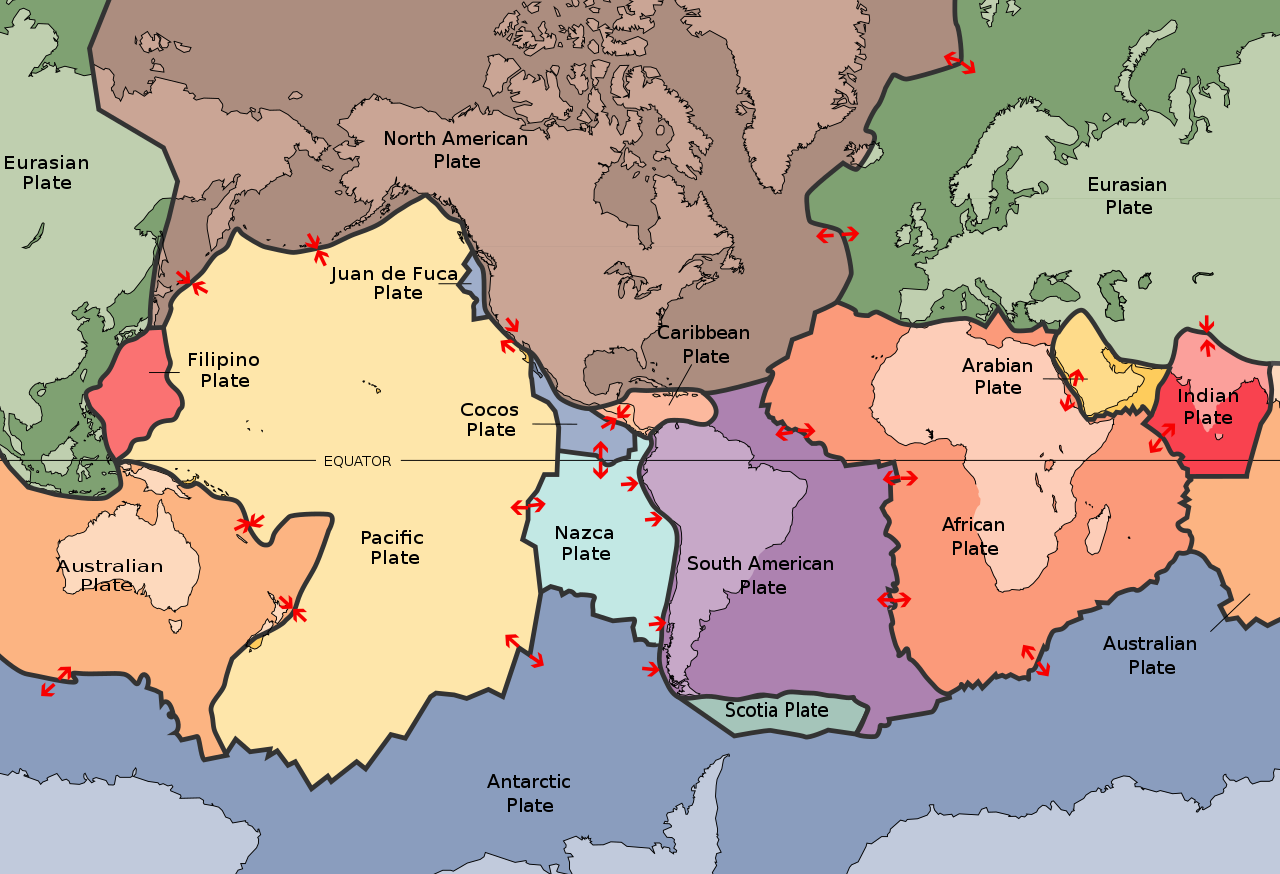
A few comments on this map
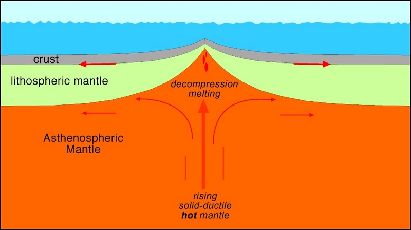
- In the Atlantic Ocean the Eurasian plate and the North America plate move in opposite directions, creating a gap, that is filled by magma from the underlying mantle. They are called Mid-ocean ridges.
- The Eurasian plate and the Indian plate collide, resulting in the Himalayas.
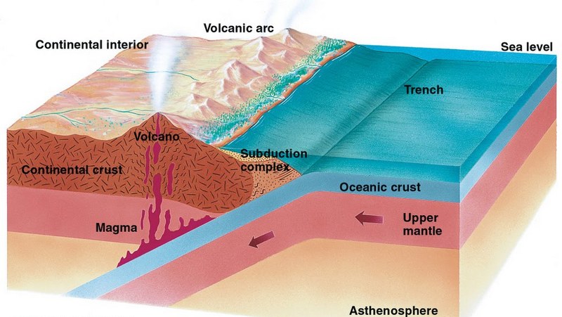
- The Australian plate and the Pacific plate also collide, but here they create a Subduction zone. Because oceanic crust is denser than continental crust. the oceanic crust will go down under the continental crust and merge again with the mantel.
Two images as an illustration: a mid-ocean ridge (left) and a subduction zone (right)
These examples show that plates can change in time, they can also merge or split. In the past Earth has looked different, and in the future it will also look different.
THE PALEOMAP PROJECT
A paleomap is a map of Earth in the past, using information about tectonic plates. The American geologist Christopher Scotese started the Paleomap Project in the 1990s and is still actively working on it. Here are a few of his maps
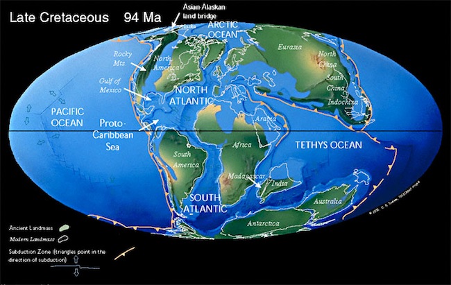
This is a map of Earth, about 200 million year ago. In that period most of of the landmasses were connected and formed a supercontinent, named Pangaea. In the lower part, called Gondwana, you can already see the shapes of present-day Africa, South-America, Antarctica and Australia

Millions of years later, Pangaea has broken apart. Dinosaurs are roaming the earth

Earth starts to look a bit more familiar South-America and Africa have split, with the southern Atlantic Ocean separating them. Eurasia begins to take shape. Australia is still connected to Antarctica. Note that India has split from Africa.
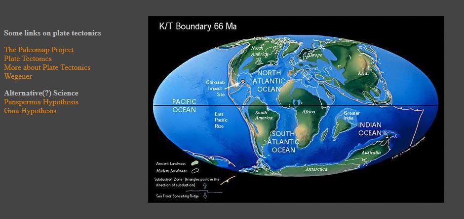
Earth 66 million year ago. The impact of the Chicxulub meteor in Mexico causes the extinction of the dinosaurs and the rise of mammals. India is on a collision course with Asia and Australia has split from Antarctica.

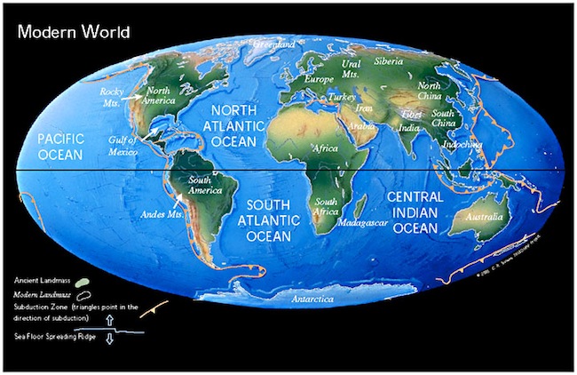
Present Earth..
More maps can be found here. The oldest map shows Earth 513 million years ago
These are static images, it would be nice to follow the development in time through animations The Paleomap Project homepage has many animations , but they do not work anymore, because they are using Java applets, which most browsers don’t accept nowadays. The site has not been updated since 2003 and I assumed that the project had been stopped. But searching information for this blog, I discovered that I was wrong, Scotese is still very active! But nowadays he and his coworkers create YouTube videos. Here is one of them. Time runs backwards, the video starts with the modern Earth and goes back to 750 million year ago.
It is also possible to predict how Earth will look like in the future. Of course such a prediction is less accurate because you have to extrapolate , using current plate movements.. Scotese’s prediction is that in the future another supercontinent will form, which he has called Pangaea Proxima. Here is the video. Notice that Australia will merge with Asia and l Antarctica.with India. The Mediterranean Sea will disappear.
Scotese’s YouTube Video Channel contains more than 70 videos about aspects of plate tectonics and continental drift. I will mention one more here, about the Story of the Malay Peninsula. (There doesn’t exist a Story of the Netherlands because God created the world, but the Dutch created The Netherlands 😉 )Notice how during the Ice Ages the sea-level was so low that the islands of the Malay archipelago were connected. This was called Sundaland. Topic for another post.
A few concluding remarks
- Before Pangaea there have been several more supercontinents. Click here for a list.
- When plate tectonics started on Earth, is still a matter of dispute. Possibly 3 billion year ago.
- It can be argued that plate tectonics has been essential for the development of life. Watch this fascinating video The World before Plate Tectonics.