
We visited Iceland on a 10D9N trip as part of our Europe holidays. Click here for a chronological account of this 7-week holiday. I have split this Iceland report into two parts because we have visited many places in those 10 days. This part describes the many natural wonders of Iceland.
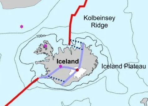
Iceland is unique because of two factors. In the first place it is located on top of the Mid-Atlantic Ridge. Two tectonic plates, the Eurasian and the North-American, are moving apart from each other a few cm per year, magma from the Earth’s mantle fills the gap and gives rise to a suboceanic mountain ridge. Iceland is one of the places where this ridge reaches the surface. Because of its origin, Iceland is volcanic; the last eruption was in 2025. The other factor is its northern location, very close to the Arctic Circle. During the Last Ice Age (~21000 years ago), the island was covered by an icecap of between 1500 and 2000 m thick. Volcanic eruptions beneath such an ice cap can have catastrophic consequences and are responsible for the island’s rugged structure.
Here are two images. One shows the Mid-Atlantic Ridge (in red) and fractures in the Earth’s crust (in blue), the other one the thickness of the icecap (in shades of grey) during the Last Ice Age.

Geothermal Activity
The fractured Earth crust allows groundwater to seep deep underground, where it is heated by magma to hundreds of degrees and returned to the surface, leading to hot springs, steam vents, and geysers. About one-third of Iceland’s electricity production uses this geothermal energy.
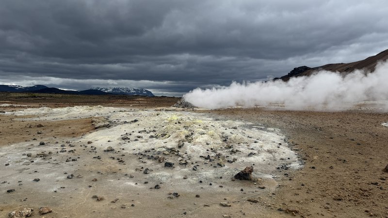
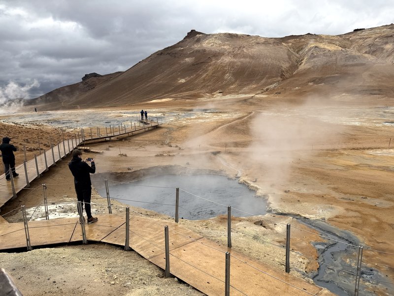
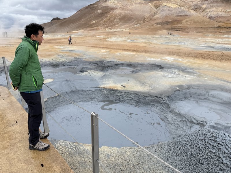
We visited Hveri, the most active geothermal area of Iceland. An alien landscape, steam vents (known as fumaroles), bubbling mud pools, yellow sulfur, and a smell of rotten eggs. Free access, but you have to pay for parking. Well-marked pathways near the pools; to the fumarole,- you could walk on your own. Fascinating.
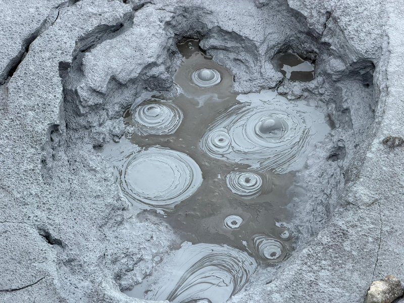


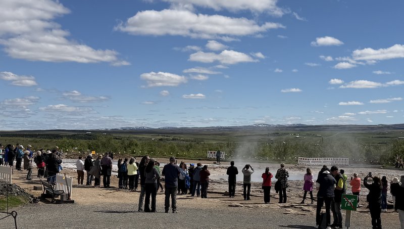
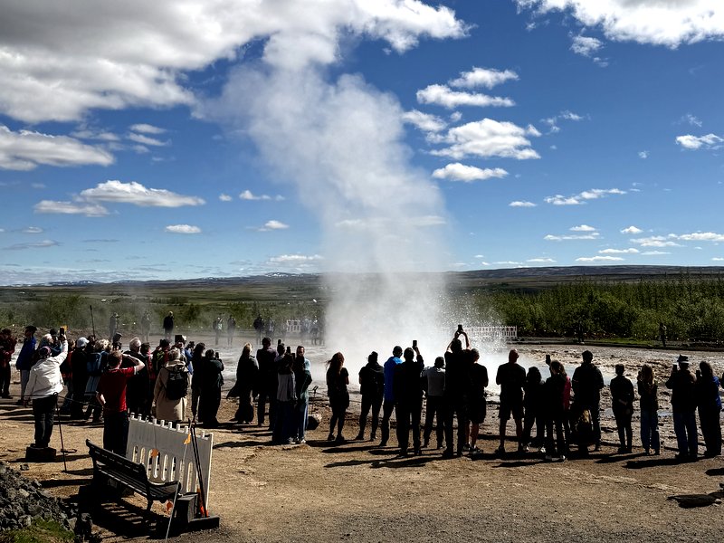
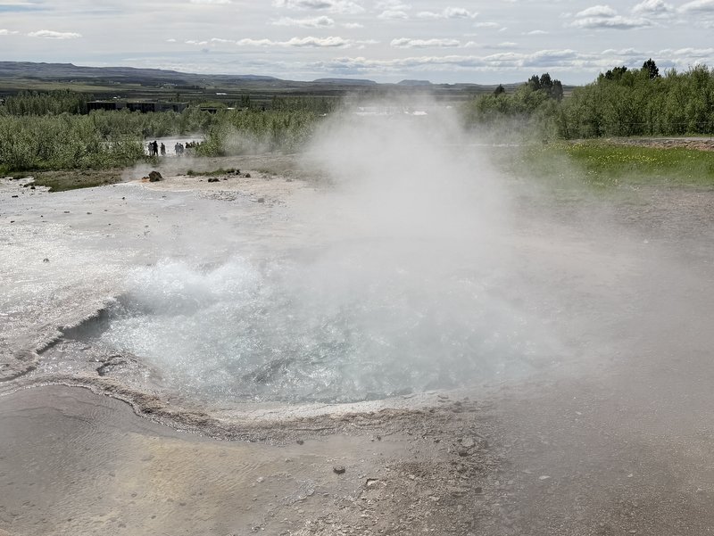
On our last day in Iceland we visited the famous Geysir, one of the most popular tourist attractions. Bus loads of tourists visit the location daily. A geyser is basically a hot spring, where water seeps down though cracks and gets (super) heated. This builds up pressure resulting in an eruption of water and steam. How often this happens, depends on the underground structure. Earthquakes can change this structure, there have been years that eruptions were rare, but presently the Great Geysir erupts every few minutes. Not always to the same height so we stayed for some time, hoping for a powerful one. There are also smaller geysers and mud pools




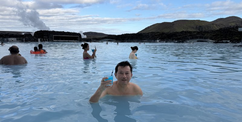
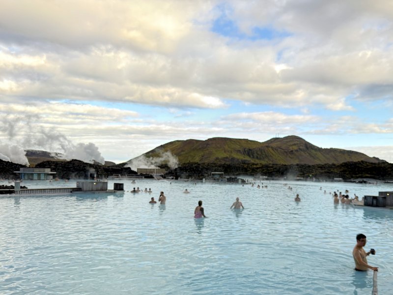
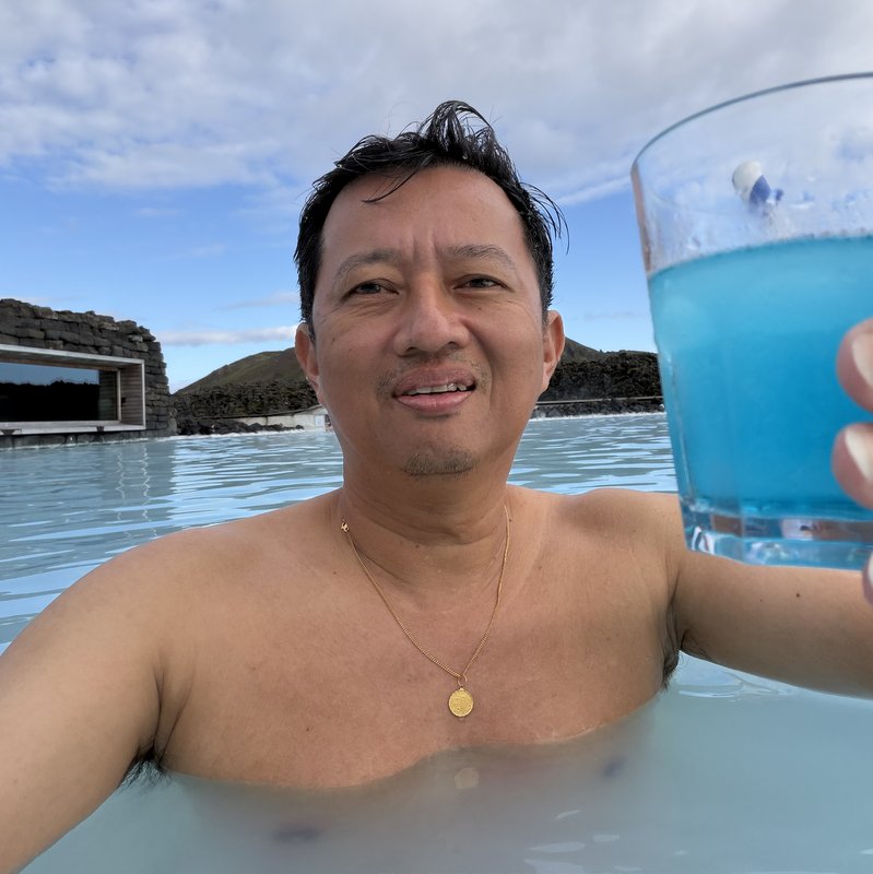
When you tell people that you visited Iceland, they often ask, did you visit the Blue Lagoon? And yes, we did, but it is very overrated and commercial It is actually a byproduct of a nearby geothermal powerplant. The powerplant uses superheated water to generate electricity and hot water for households. Then the wastewater is released in nearby ponds, the Blue Lagoon! Tickets are expensive and you need to book a timeslot. One free (non-alcoholic) drink is provided. Swimming is prohibited, we walked around in the milky blue water.


Glaciers
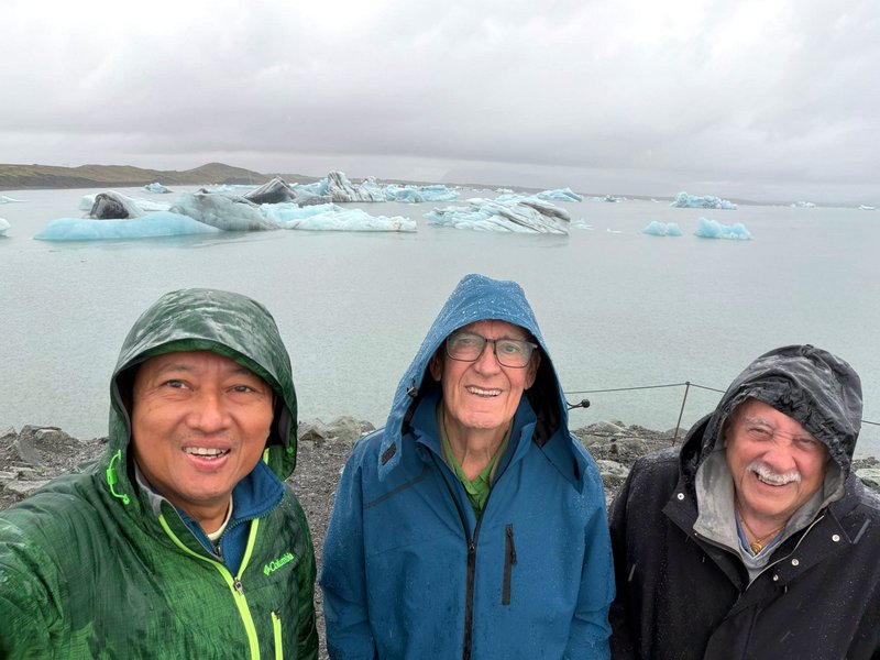
After the Last Ice Age, the icecap that covered Iceland, has melted, but glaciers still cover part of the island, and because of Iceland’s location, they can extend almost to the coast. As glaciers are still retreating, the melting ice forms a glacier lake and when near the sea a glacier lagoon! We visited the Jökulsárlón lagoon. Aric is standing on the beach with the lagoon behind him and far away the front of the glacier. The beach is called Diamond Beach, because the broken glacier pieces melt in the seawater and become transparent, like jewels.




An absolute highlight of our Iceland holiday was a visit to the Katla Volcano Ice Cave. The Katla Volcano in the south of Iceland is one of the most active volcanos of the country. It is covered by an icecap of 200-700 meter thick. Every 40-80 years it has a major eruption, that can lead to a catastrophic glacier flood. The last one was in 1918, until now it is dormant, but closely monitored.
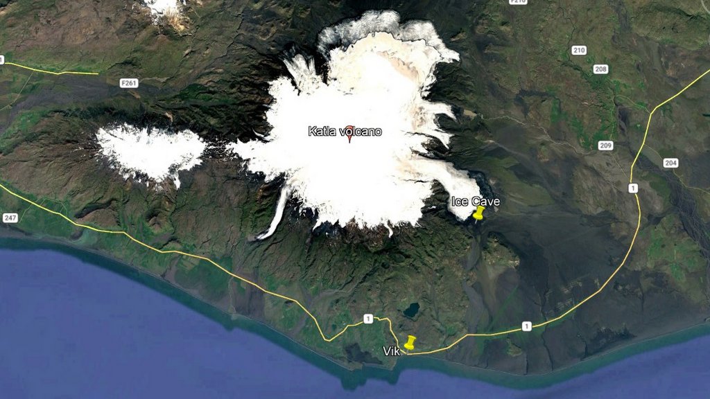
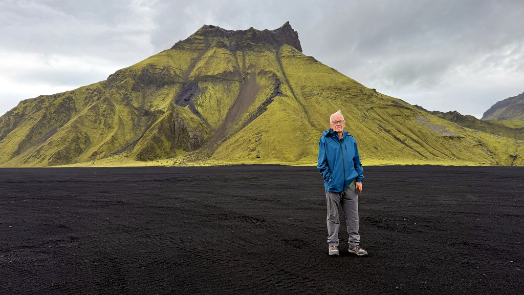
The “expedition” took 3 hours and started from Vik. a small village. After following the Ring Road for a while the super jeep went off road to our first stop, a beautiful black plain with a mossy-green mountain, where an episode of Star Wars had been filmed.


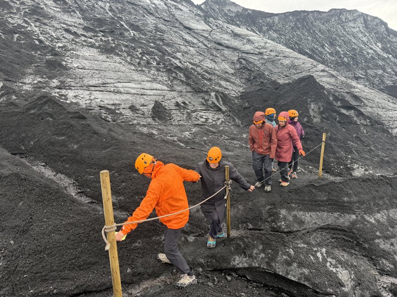
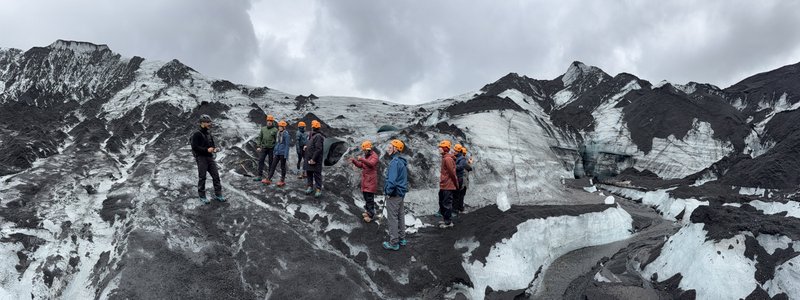
We continued to the glacier, where we were given helmets and crampons. The glacier is covered with black volcanic ash, the ice can be slippery. After putting them on, we were ready to go.


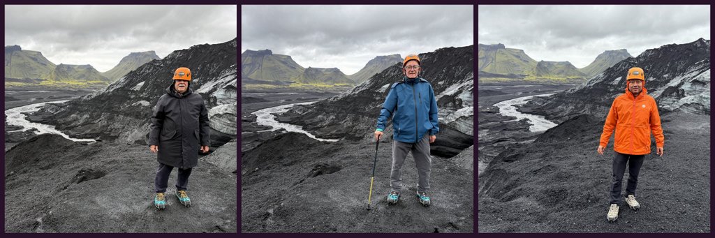
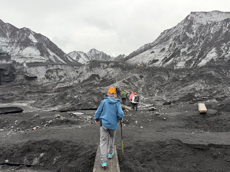
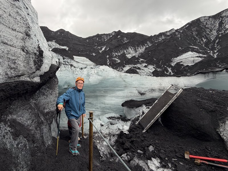
We are walking here on the glacier already/, climbing to the entrance of a man-made tunnel
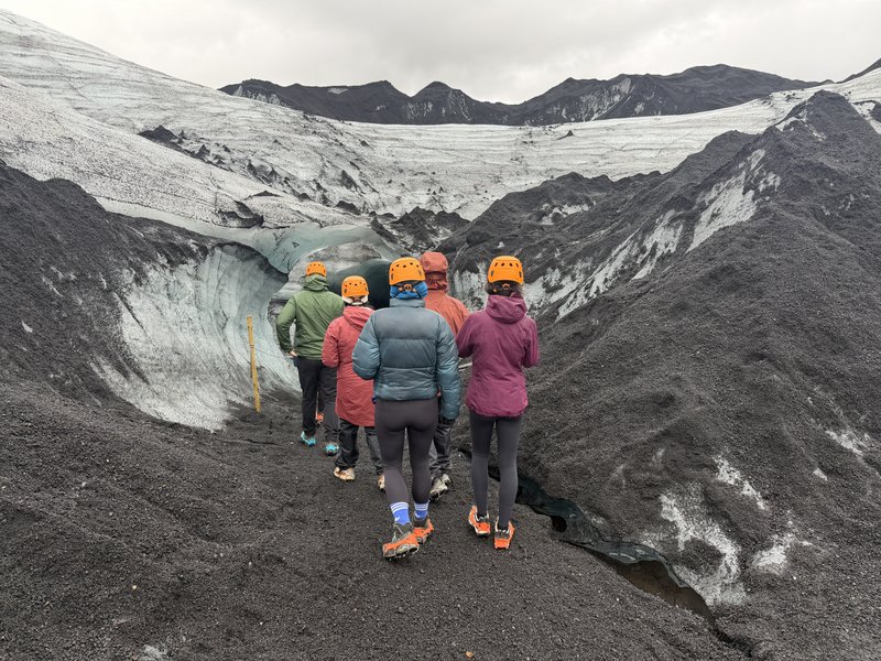
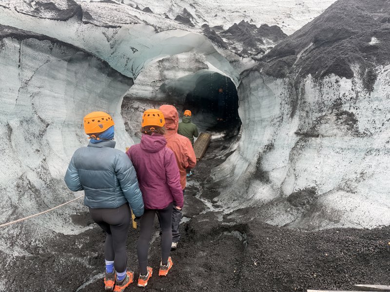
The tunnel is amazing/
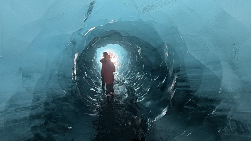
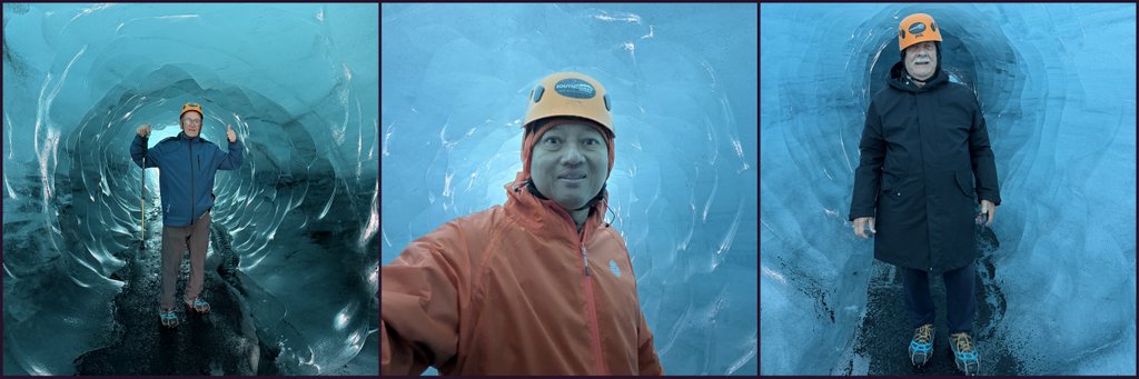
After crossing the tunnel, we are surrounded by glacier.

In the ice cave.
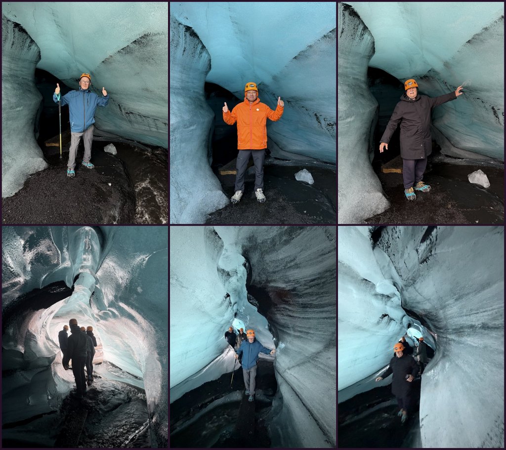
Going back through the tunnel.

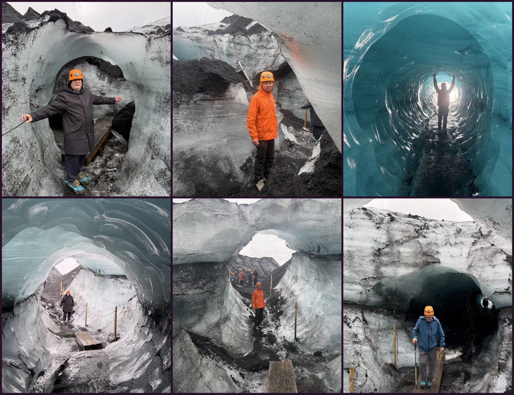
Returning helmets and crampons. What a spectacular adventure.

Waterfalls
Iceland is often called the “Land of Waterfalls” due to over 10.000 falls and cascades, fed by glaciers and rainfall. The volcanic structure of the island, with steep slopes and cliffs, provides a perfect location for often dramatic waterfalls. Here is a List of waterfalls in Iceland.
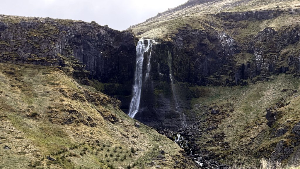
A few hours after we had started our clockwise round trip around the island, we stopped for the first waterfall. A fine example by Malaysian standards, but run of the mill in Iceland.
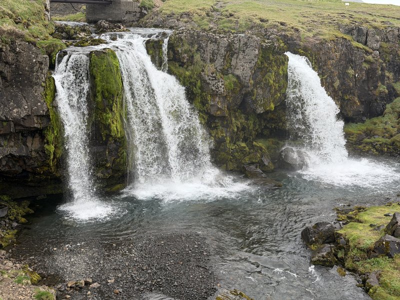
Later on the same day, visited the Kirkjufelllfossl (Foss is the Icelandic word for waterfall).- This is a popular tourist attraction, especially because of the “mountain”. This is not a volcano, but a so-called Nunatak, a rocky outcrop that protruded from the ice field that was here during the Ice Age.


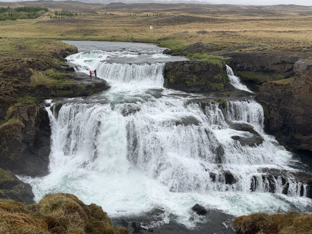
The following day we visited two waterfalls. First, the Kolugljúfur Canyon, 40-50 m deep and 1 km long, eroded by the Víðidals river. The water of this river plunges in several tiers, the Kolufossar waterfalls. Not very tall, but wide with an impressive water volume. –


Later that day, we had a look at the Reykjafossl. This waterfall is on private land, we could visit it, but has recently been closed to visitors. Notice the tiny human figures in the pictures.


The next day we visited the Goðafoss. The water of the Skjálfandafljót river falls from a height of 12 meters over a width of 30 meters. Very impressive.
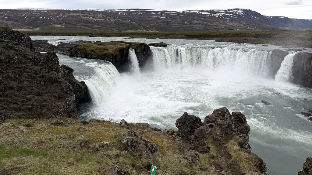

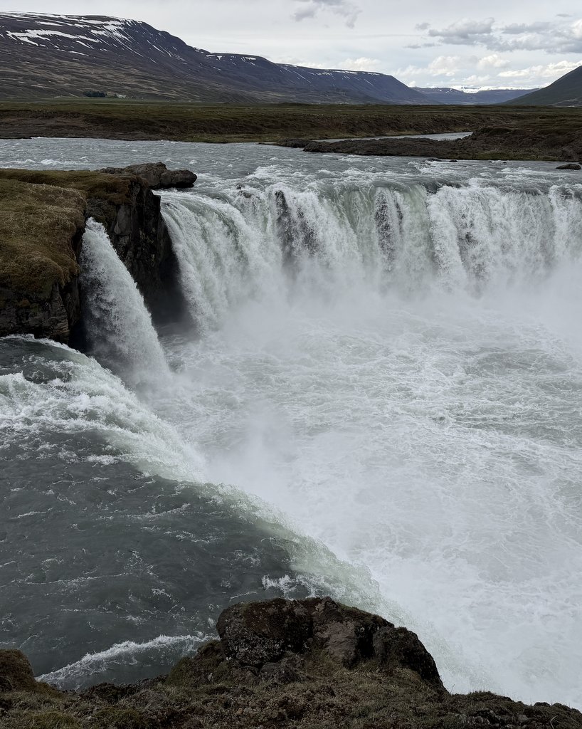
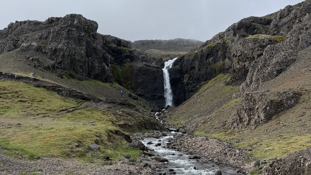
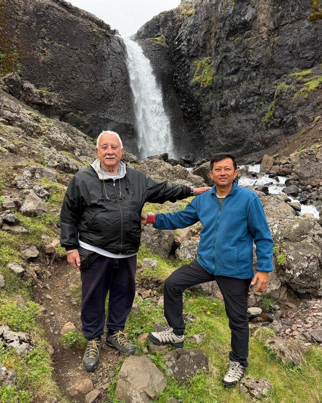
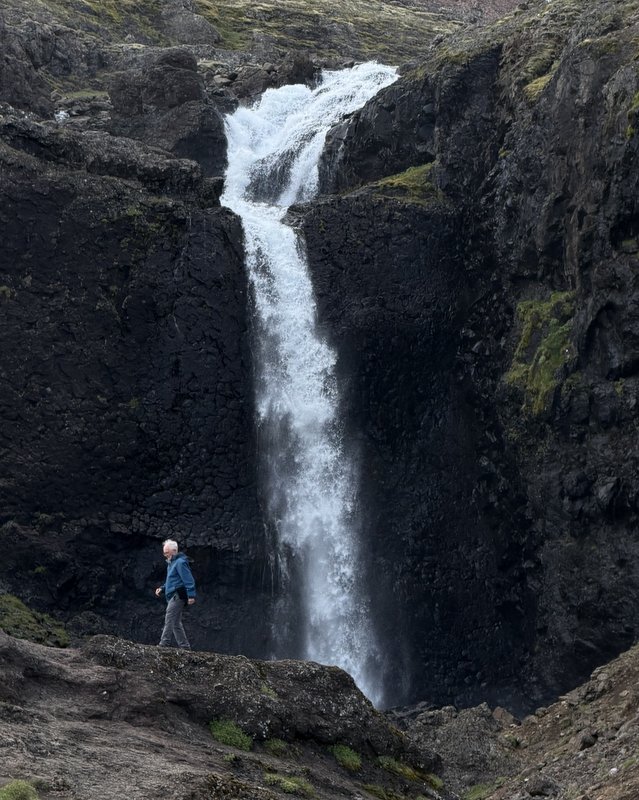
The last three waterfalls are all in substantial rivers, not very tall, but wide with lots of water. Here is a tall waterfall, visible from the Ring Road. A small parking lot with a picnic table, but no name. We walked closer and took pictures. I tried in vain to Google for a name, so we decided to name it ourselves: Lata JAR. Lata is a common name in Malaysia for a waterfall and JAR stands for Jam, Aric, Rodney.
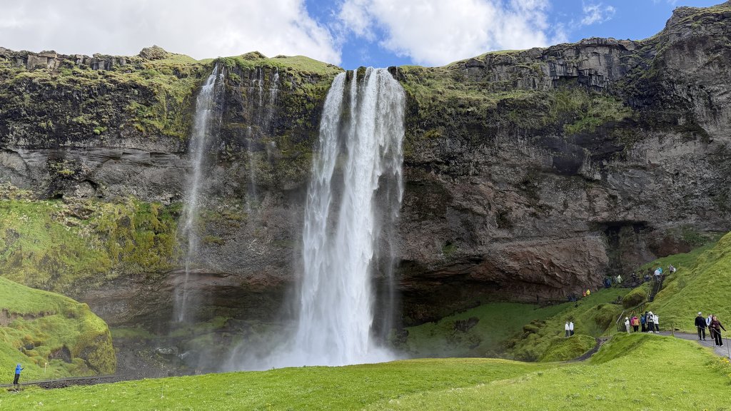
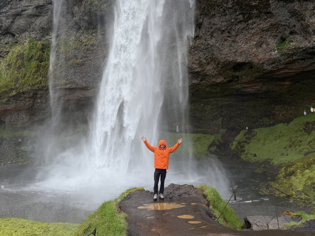
Another tall fall (~60 m), the Seljalandsfoss, is famous for the trail that allows visitors to walk entirely behind the falling water. We were prepared to get wet, and we got wet.

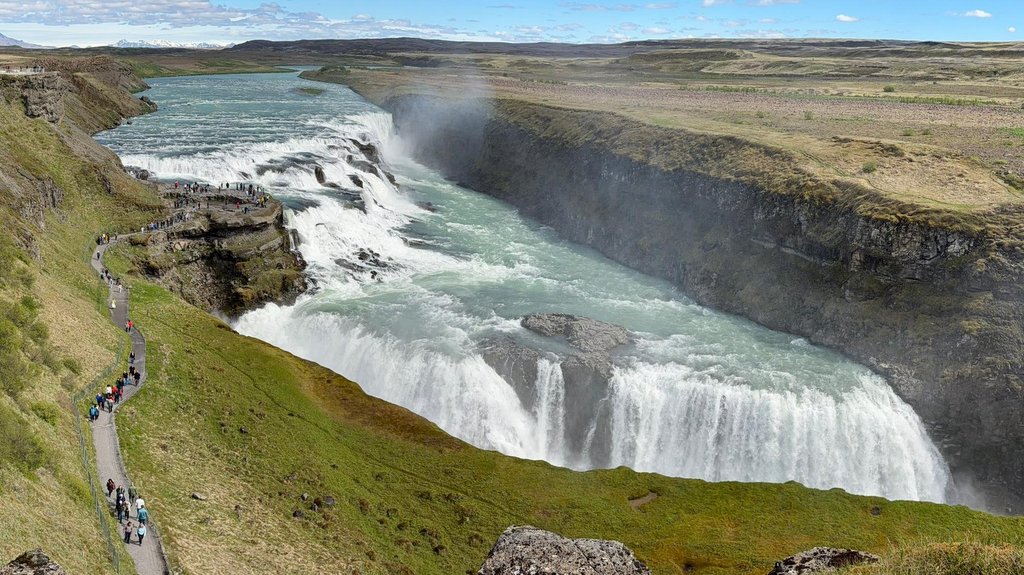
On the last day of our Iceland trip we visited the Gullfoss/
. We just had a quick look, no time to explore this powerful waterfall, a popular day excursion from Reykjavik


Other Natural Attractions
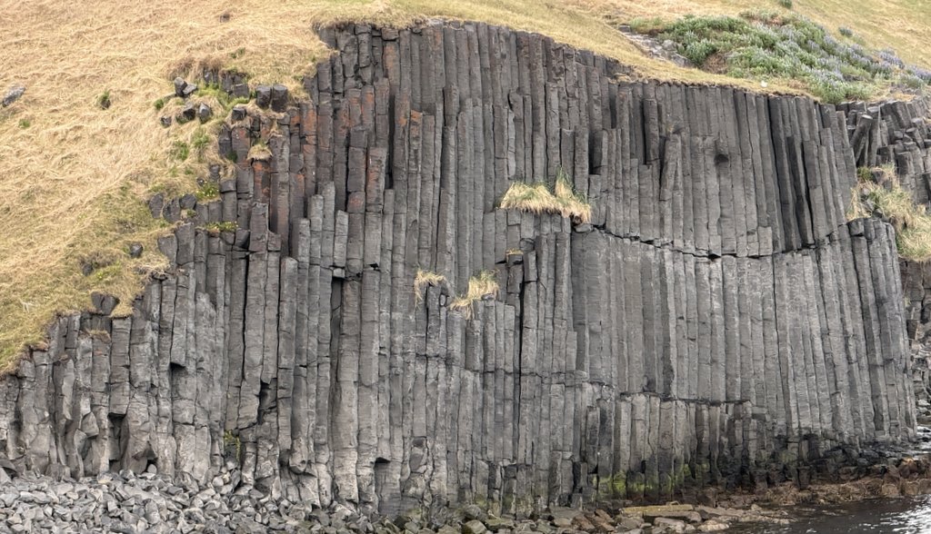
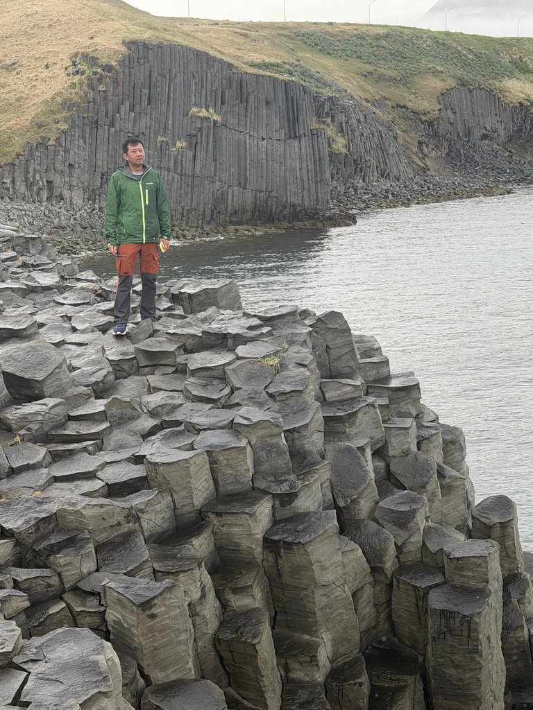
There are many locations where the volcanic origin of Iceland is clearly visible. Here are basalt columns at the coast of North Iceland.-

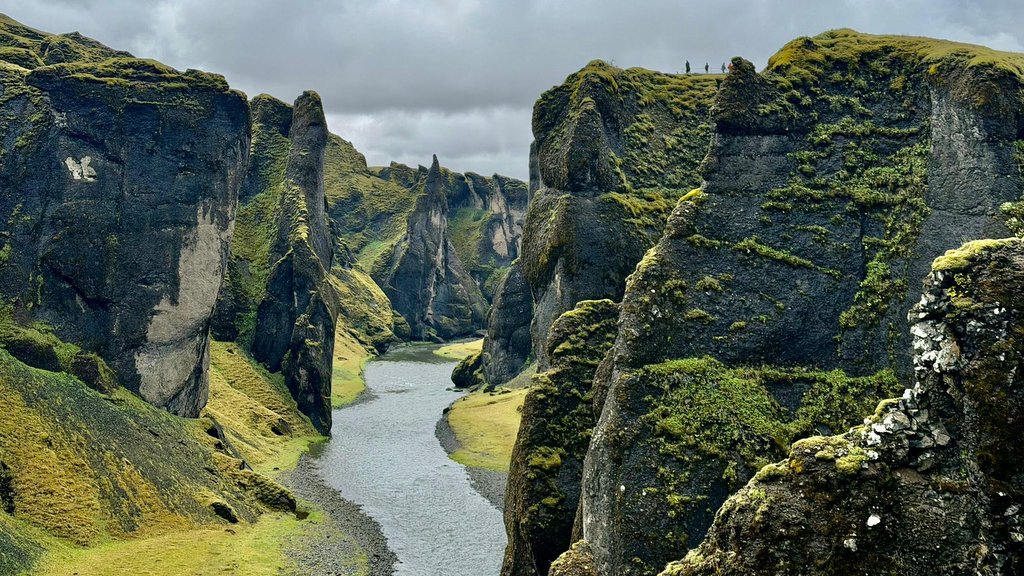
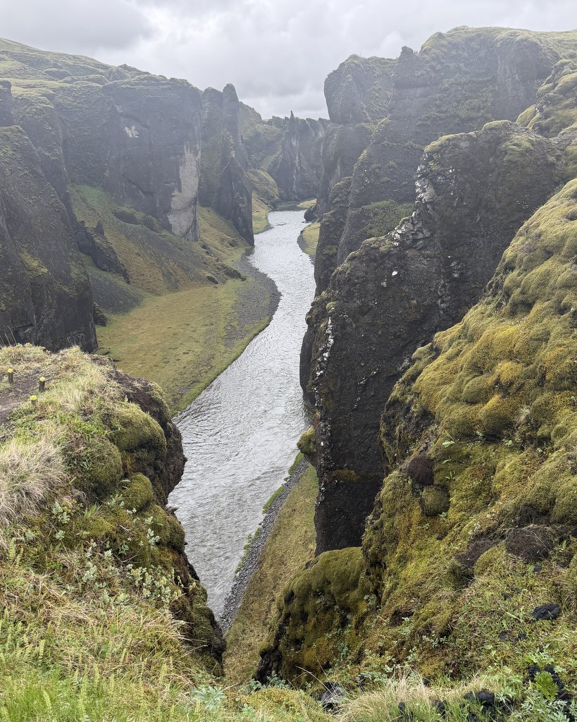
Here is a beautiful canyon, the Fjaðrárgljúfur in the Southern part of the island. Eroded by a river during many millennia. It is up to 100 m deep and about 2 km long.

Summary
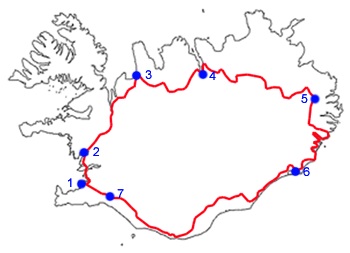
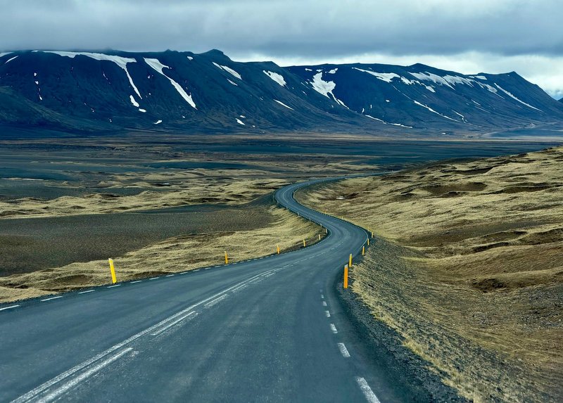
Iceland has a ring road around the island, called Highway 1. The left image shows the route. It is a two-lane road. The blue dots mark populated places. We followed basically this road, clockwise. Rodney was our expert driver, Aric was the navigator. Often we had to take secondary roads to reach a location. We drove around 2400 km in 8 days.
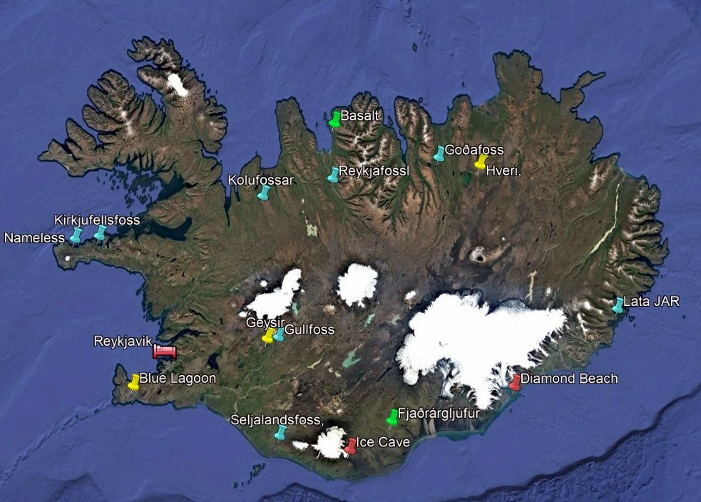
This Google Earth image shows the places we visited, using colored markers. Geothermal (yellow),glaciers (red), waterfalls (blue) and others (green).
In the second part of this Iceland report, more info about the “cultural” places we visited, the places where stayed overnight, the food we had, etc.
Sounds like a great trip, and Jan still has the ability to make things and natural phenomenon interesting and fascinating.
Wah quite an accolade of travel memories well documented. Tq for sharing
Spectaculiar landscape of mountain, waterfall, and icw cave.
Ook hier weer zo’n bijzondere reis. Dat is wat anders dan zon, zee en bruinen.
Wel koud, denk ik. En vochtig, maar zoveel natuur, die je nergens anders tegenkomt. Mooi om te zien, ook met de plaatjes, die je maakte.