
In May the Taiping Heritage society has organised a trip to the Lenggong valley, see my blog THS excursion . Last week THS organised a members night and they had asked me to give a talk about the trip. Preparing for my talk, I collected a lot of information from the Internet, but I had not enough time to present everything in my talk…:-) That is the reason for this post.
In 2012 the Lenggong valley was declared a Unesco world heritage site, because of the many archaeological discoveries made during the last decades. Most notably, the discovery in 1991 of the Perak Man, a well preserved skeleton, dating back to ~ 11.000 BP where BP stands for Before Present and Present is defined as 1-1-1950. In Geology and Archaeology BP has replaced BC (Before Christ) and the politically correct BCE (Before Common Era)
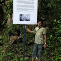
Here is a GE map of the Lenggong region with the location of the various archaeological sites (click to enlarge). The mighty Perak river is clearly visible. The green track is from a trip made in 2007 with my friend Liz Price, Caves and Waterfalls 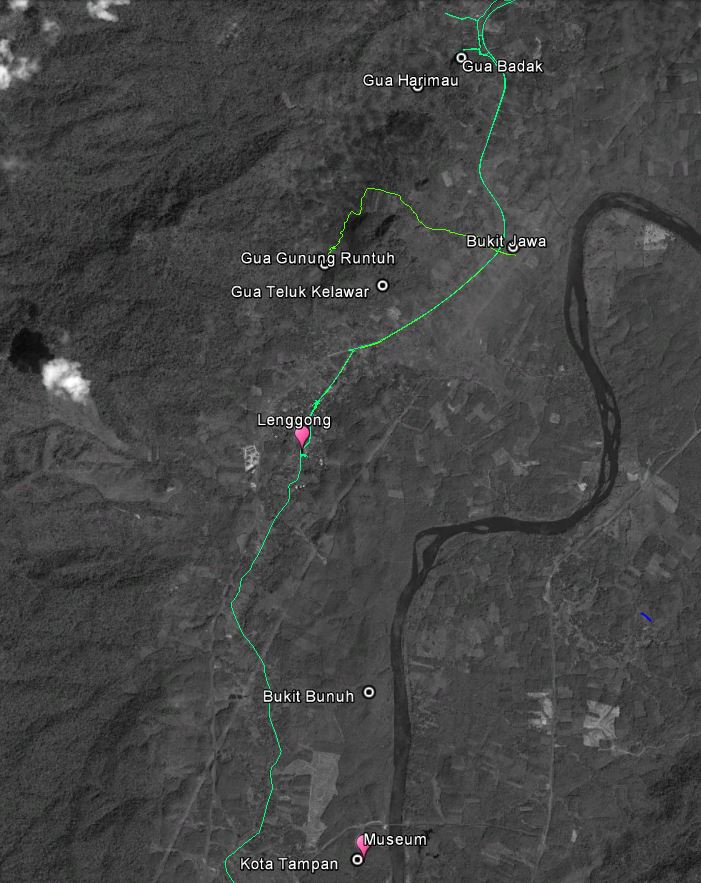
Some comments about the various locations.
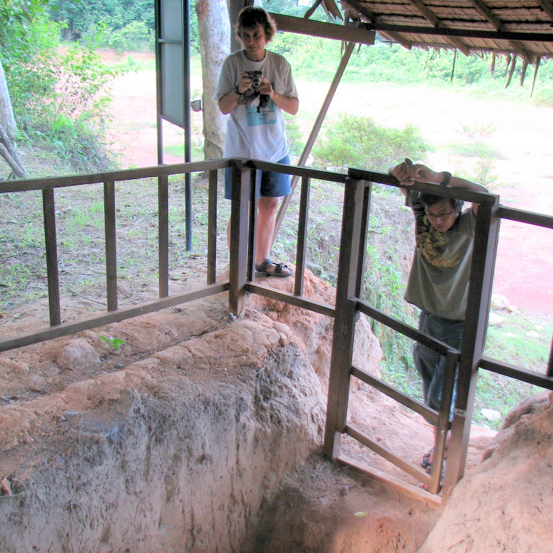
The skeleton of the Perak Man has been found in the Gua Gunung Runtuh. It is now exhibited in the Lenggong Museum. The Gunung Runtuh cave is at the moment closed to the public, but in 2007 we could still enter the cave after a steep climb..:-) The skeleton was originally surrounded by grave gifts, in the museum now it is surrounded by high-tech gadgets to control humidity, etc!
-
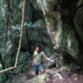
- Steep climb up
-

- The cave entrance
-
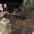
- Where Perak Man was found
-
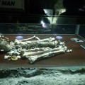
- His present location in the museum
In 2004 another skeleton has been found in the nearby Gua Teluk Kelawar, now called the Perak Woman, dated ~ 8000 BP. I will not be surprised if more discoveries will be made in the future. Because it is clear that this region around the Perak river has been very suitable for human habitation throughout the ages! Limestone caves for shelter, a river (in the past a lake) nearby, etc
The other archaeological sites in the Lenggong valley have until now only shown evidence of human activity in the form of tools and “tool shops”, where these tools were manufactured.
The oldest of these sites is Bukit Jawa, a palaeolithic tool workshop site on the shores of an island in a lake now long ago disappeared. About 200.000-300.000 years ago. Who made those tools? This is before our species, Homo Sapiens sapiens, started the emigration out of Africa. We will only know when fossil remains of hominins are found. We visited Bukit Jawa in 2007, there is not much to see.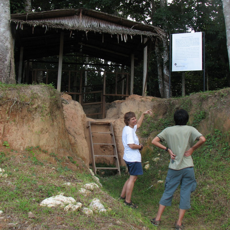
The toolshops at Kota Tampan are younger, about 70.000 year old. Also here no fossils of human remains have been found, but it is quite possible that the people making these tools, belonged to our species (see below). Activity in these workshops came to an abrupt end when the Toba volcano erupted, Kota Tampan tools have been found covered wit the thick layers of ash. At the Kota Tampan location the Lenggong Museum has been built.
Next in age are the toolshops at Bukit Bunuh, about 40.000 years old. Followed by the two caves where the Perak Man and Woman were found.
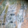
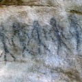
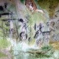
Much younger, about 4000-3000 BP are the graves found in Gua Harimau. And in the nearby Gua Badak, rock paintings have been found, made by the Negrito Orang Asli. Very recent, maybe only 100 year old. But interesting as rock paintings are rare in Malaysia
Altogether an impressive collection of archaeological sites, hopefully they will be preserved well after being declared a World Heritage Site.
Human migration, Out of Sundaland ?
It is about 200.000 years ago that our species, homo sapiens sapiens evolved in Africa. All humans, living these days, have a common ancestor, both in the maternal line (Mitochondrial Eve) and the paternal one (Y-chromosomal Adam). Between 95.000 and 75.000 year ago one of their descendants (Eurasian Adam), started to migrate to Europa and Asia. By analysing the mutations in the DNA of the Y-chromosome of present humans, it is possible to get an idea about the migration route followed by the ancestors.
A few years ago both Aric and I had our DNA analysed (by the Genographic Project). Here is the route followed by our (paternal) ancestor. Our routes split about 35.000 year ago, in what is now called Tajikistan. My line developing into a Caucasian, Aric’s line into a Chinese…:-) See my blog My ancestors for more information about this fascinating topic. 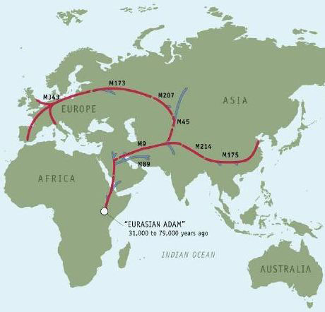
What has this to do with Lenggong, you may ask. Well, the theory of human migration is still a developing theory, with many variations. In the prevalent version, humans migrated to South East Asia from around Taiwan, going south. An alternative option is that the migrants followed more or less the coastal line, via India, arriving in Sundaland, from there spreading in northern direction

Sundaland? Yes, in the period we are talking about, the world was in what is called the Ice Age. The huge amount of ice covering the Arctic and Antarctic resulted in very low sea levels, more than 100 meter lower than nowadays. Present day Sumatra, Borneo, Malaysia formed one land mass, called Sundaland 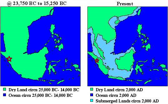
In the map above, the location of the Toba eruption is indicated. This dismal eruption and the following volcanic winter may have had a dramatic effect on the still very small global homo sapiens population, killing most of them and causing what is called a genetic bottleneck It is estimated that the global population of our species at that time was no more than 10.000 – 20.000! It certainly stopped the operation of the Kota Tampan tool shops. But the people living there may have survived in small numbers, because the prevailing winds were westwards. Could it be that after the Toba eruption, further migration took place out of Sundaland?
A fascinating, though rather controversial theory, proposed by the British geneticist Stephen Oppenheimer. No surprise that USM, responsible for much of the archealogical research in the Lenggong valley, is quite happy with this theory. Malaysia as the cradle of humanity!
A meteorite impact at Bukit Bunuh
In 2009 USM announced a spectacular discovery at Bukit Bunuh. At this location many boulders were found of a very special material, called suevite. Suevite can be formed when a meteorite collides with the earth. The ages of these rocks, using fission track dating, has been determined as 1.8 ± 0.6 million year. There are indications of circular craters in the Bukit Bunuh region, so it could well be that between 1.2 and 2.4 million year ago a meteorite has hit here. In itself already an interesting discovery. It became spectacular when in 2007 a hand-axe was found, embedded in a suevite boulder. Meaning that around the time of impact, 1.8 million year ago, hominins were already living at Bukit Bunuh! Here is a newspaper article about the discovery: Early axes found in Perak. The picture shows Dr Mokhtar Saidin, holding up the axe. 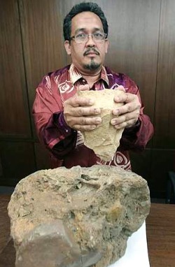
After the jubilant announcement in the media, now already five years ago, it has become disturbingly quiet. I have not been able to find any reference on the Internet to a scientific publication in a peer-reviewed journal. The meteorite impact was supposed to be registered at the Earth Impact Database, but that too has not yet happened. In interviews an age of 1.83 million year is mentioned, without giving the error margin of 0.6 million year, which is scientifically bad practice. Here is a typical example: Interview with Dr. Mokhtar Saidin
Honestly, I have my doubts. Here are a few more links, in case you are interested
Bukit Bunuh, oldest Paleolithic site , quote: “There should be on-going research to get a true picture of the people who settled in this area since 1.83 million years ago and this can change several theories about the Paleolithic people such as the nomadic theory and movement of prehistoric man.”
USM Discovers Concrete Evidence That Can Chance (sic!) The History Of Early Man
Jan very interesting post, something that has interested me for a long time, looking at the DNA trails, you show, I would like to add something to that, with out any doubt there were a few routes out of Africa, one as you rightly show was across what is now the red sea at the horn of Africa, a route too have been proven to have been used by both Homo sapiens and Homo erectus, it is believed that the migration route was then east along the Coast line of what is now the Yemen and onwards, this route has been proven by artefacts found at sea, and the fact that in the area that the artefacts were found there are plenty of fresh water springs that emerge, during these early migrations that area of sea bed would have been dry land it is thought that because of a shortage of water further inland (Moses leading the Israelites across the red would have been quite a possibility), the rest of the journey eastwards is as the maps show.
As to routes into Europe, what early researchers overlooked, was the fact that until 28,000BP the Mediterranean Sea was dry, also the black sea exist until 5900BP which also effected migration northwards, likewise the Sahara desert was a flourishing forest, without any doubt this would be a main migration route northwards into Europe.
I would point out something of interest for Aric, a good percentage of Chinese researchers believe the Chinese are direct descendants of Homo Erectus. Though no DNA proof has yet been established. Something else that might be of interest for you is the Home Erectus remains found on the Flores Islands Indonesia, Homo floresiensis some interesting folk stories the locals tell about little people stealing the local babies. It was also on the migration trail into Australasia.
Not only Chinese researchers believe in this multiregional origin of modern humans, it is an interesting alternative to the Out of Africa theory.
This 4 DVD set by the BBC might interest you, The Incredible Human Journey, narrated by Dr Alice Roberts, covers some of what I explained. RM54.95 on the Times bookshop website.