
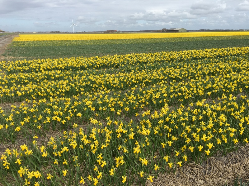
This year I was back in the Netherlands about one month earlier than usual. Here is a view from the train on my way to my sister in North-Holland, a few weeks later there will be plenty of flower fields here.

Now only an occasional field with crocuses (left) and daffodils (right). No tulips yet

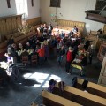
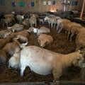
I spent the Easter weekend in Valkkoog, where my sister and her husband are living. A small village with a vibrant social life. There was a traditional egg hunt for the kids and in the church a brunch was served. A few of their neighbours are rearing sheep as a hobby, and this was the time that the ewes were yeaning (hm, I had to look up “ewe” and “yean” in a dictionary)
-
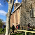
- Church of Valkkoog
-
- Easter morning
-
- Rearing sheep as a hobby
-
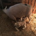
- So cute!
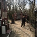
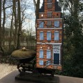
About our visit of the Kranenburgh Museum in Bergen I have already reported in my post Museums, museums, museums. We also visited a very different kind of museum, Tulpenland , about the history of the tulip. A quaint collection of items related to the tulip. A path through a forest brings you to the various exhibits.
-
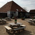
- Tulpenland
-
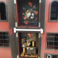
- Different tulip varieties
-
- The history of the tulip
-
- Starting in the Himalayas
Ever heard about the Tulip Mania ? It was a short period in the Dutch Golden Age (17th century) during which prices for tulip bulbs exploded dramatically and then suddenly collapsed. In the Tulpenland garden some Amsterdam merchant houses have been rebuilt on a miniature scale, with information about this “tulpengekte” (tulip madness) where the price of one bulb could be equal to a house…:-)
-
- Amsterdam houses
-
- Tlulipmania info
-
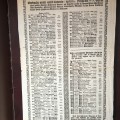
- A price list
-
- A bulb and a house in balancde
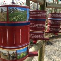
The Netherlands is one of the largest exporters of tulips in the world. Look at the numbers in the picture below (year is not given). Two billion tulip bulbs and a slightly smaller number of tulip flowers, with Germany as the largest buyer.
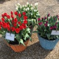
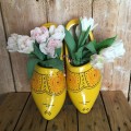
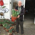
It happened to be the opening day of Tulpenland for the 2016 season, we received a complimentary pot with tulips! Pity I could not take them back to Malaysia..:-(
-
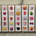
- Tulip varieties
-
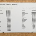
- Export figures
-
- Very Dutch..:-)
-
- A free door gift!
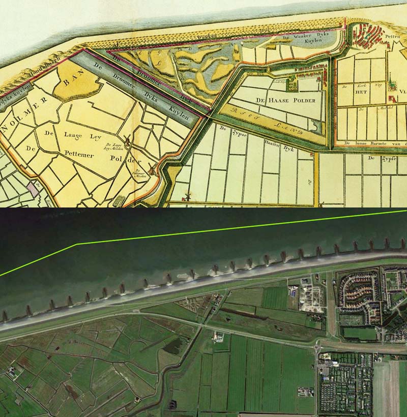
There is a saying: God created the world, but the Dutch created the Netherlands and that seems particularly true for the province of North-Holland! Compare the two maps below. Left a map from 1740, right a recent Google Earth screenshot.
The polders that already existed in 1740 are colored green, with the dykes in red. They are outlined in green in the GE image. Later land reclamation projects are outlined in brown. The first big reclamation project was the Zijpe (1597), the Wieringermeer was only reclaimed in 1930, at the same time as the Afsluitdijk was built, basically transforming a “dangerous” sea (Zuiderzee) into a “quiet” lake (IJsselmeer)
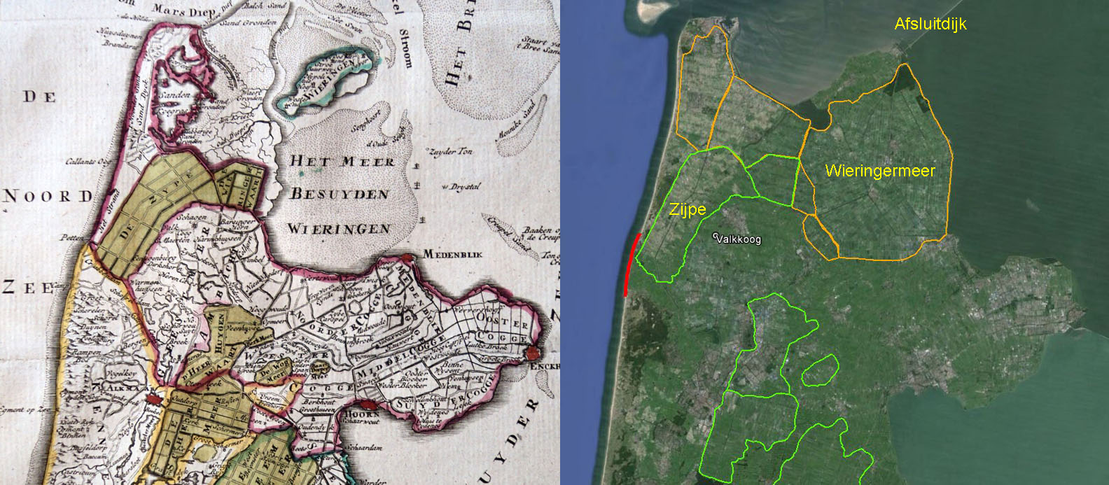
As you can see in the map to the left, there was a sea both east and west of North-Holland! The east side was protected by the Westtfriese Zeedijk, the west side by sand dunes. Nevertheless numerous floods occurred, and one of them, the St. Elizabeth’s flood (1421) breached the dunes near Petten, destroying the village and killing many people. Attempts to create new dunes there were only partly successful, in the following centuries the sea was slowly advancing and the land receding. In the image to the right this weak spot is indicated in red.
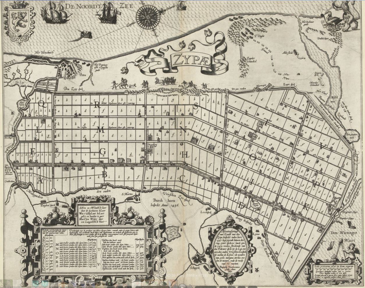
Here is a map published in 1600, showing the Zijpe polder, just drained in 1597. The letters mark the land parcels in the new polder, to be distributed to the various stakeholders. Notice that the map has been oriented almost east-west
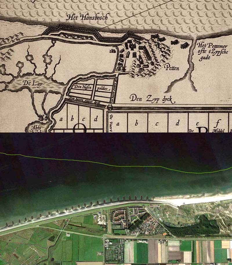
A detail of this map shows the (rebuilt) village of Petten and part of the weak spot in the coastal defense. There is still a small forest there , the Honsbosch. The lower part shows the present situation, with the old coastline indicated. The coastline has receded a lot, the old Petten has been swallowed by the sea, a new Petten has been built.
One more comparison, with a later map, dated ~ 1730. In the meantime more floods had occurred, for example the 1717 Christmas flood. Comparing with the 1600 map, the Lay polder has been drained. The coast line has receded again. The forest is no more.
In the Google Earth image you see basically the Hondsbosche Sea Dyk, made of basalt and concrete, built around 1880. A final solution? In a way, yes, recent floods,like the disastrous 1953 flood, have not affected this sea dyke near Petten. But of course the Netherlands have to prepare for global warming and a resulting rise of seawater levels!
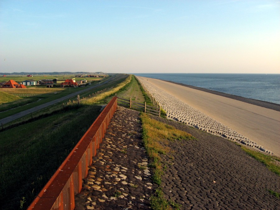
So, what to do? One solution would be to increase the height of this sea dyke again, as has been done in the past a few rimes already. Here is an (Internet) image of the sea dykes, couple of years ago. At the back is the actual Hondsbosch sea dyke, in front the Pettemer one. Forget about the details, just notice that the Pettemer one (different authorities!) has been raised a bit higher than the Hondsbosch one..:-) And notice how much the low-lying farms to the left depend on the strength of these dykes!
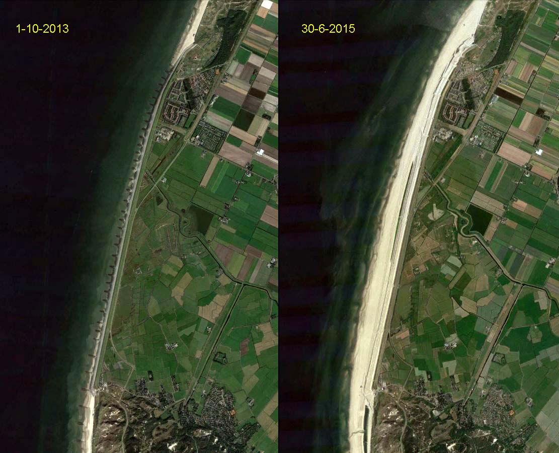
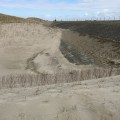
A few years ago it has been decided to try a more audacious solution, instead of raising the dykes, fight back against the sea and create new dunes in front of the existing dyke!
In the last two years about 35 million (!) cubic meters of sand have been dredged from the sea and deposited in front of the existing sea dykes, creating a new “dune-scape”. The result is clearly visible from Google Earth…:-)
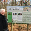
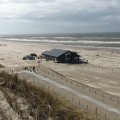
The Netherlands at its best..:-) There is an interesting visitor center in Petten: Informatiecentrum Kust, Zand tegen Zee (in Dutch). From there you can climb the newly created Lookout Dune.
-
- Outside the Visitor Center
-
- View from the new Lookout Dune
-
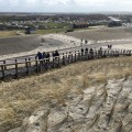
- Nice view of Petten
-
- The old dyke is still there
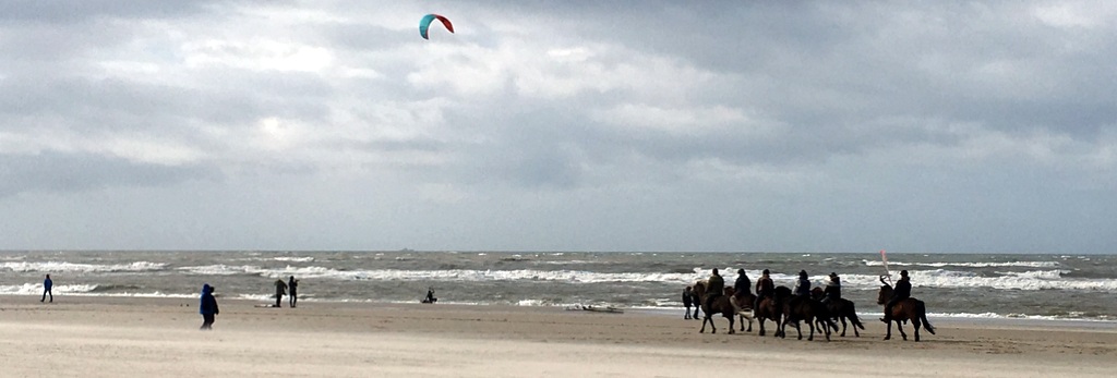
It was cold and windy during our visit. PLenty of kite surfers and horse riders.
North-Holland is a fascinating province. Must spend more time there during my next visit..:-)
Nice report, dear bro! You are welcome to stay longer next time ;-).
Holland land of flowers
Great entry in your blog about the coastal reinforcement near the Hondsbossche Seawall! And thank you for promoting our visitor ‘s centre in Petten!