Five years ago, on CNY 2014, I visited with my friend Joe Yap a number of Houses of Worship in KL. This year I decided to visit cemeteries in KL on CNY day. Not with Joe this time, but with my Dutch friend Paul.
And not as “exhaustive” as the 2014 trip. There are many cemeteries in KL of course, often on the outskirts of the town, we visited only two major ones this time, the Kwong Tong Chinese Cemetery and the Cheras Christian Cemetery.
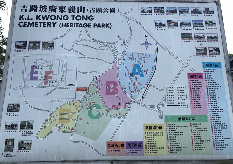
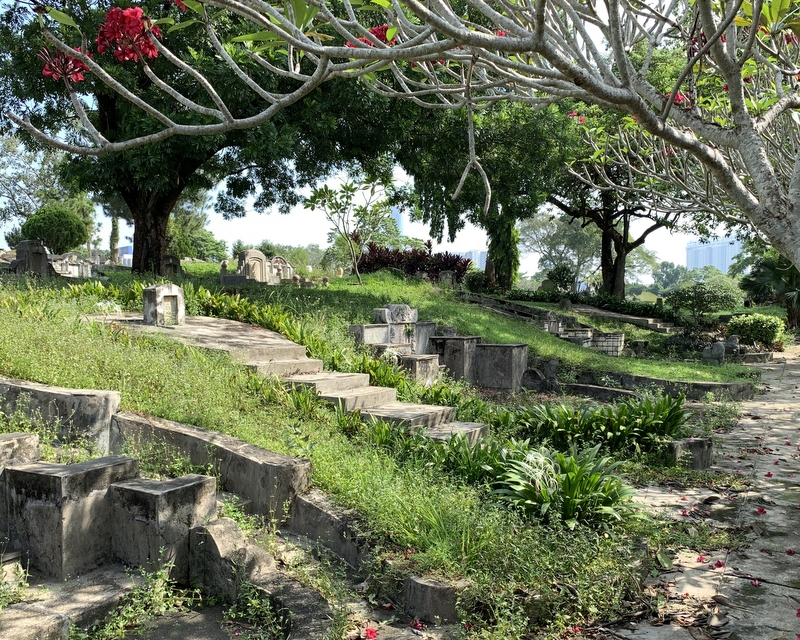
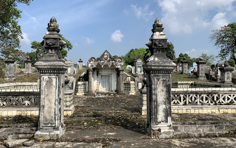
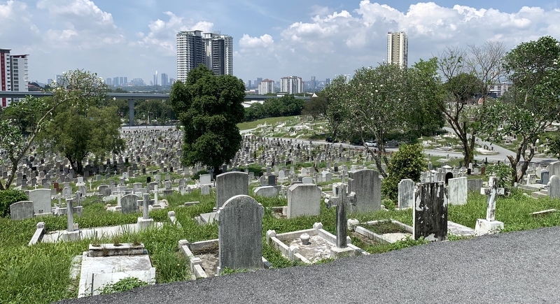
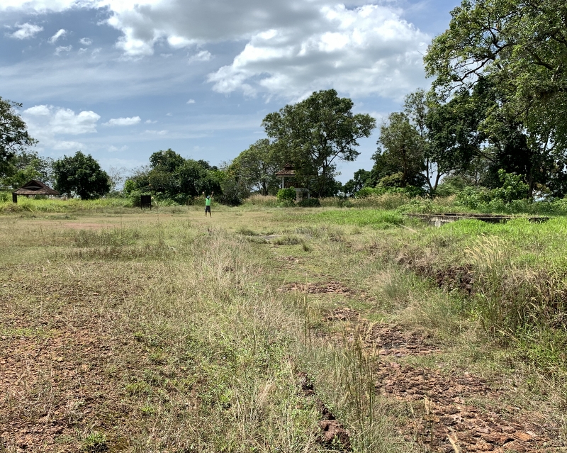
The Kwong Tong cemetery is huge, split in two parts by the Middle Ring Road 1. There are sign boards with information about interesting graves, but only in Chinese.
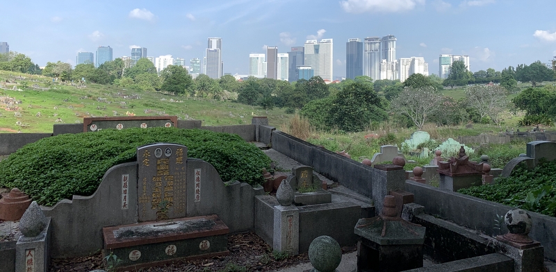
From the sprawling cemetery. you have a nice view of the imposing KL skyline.
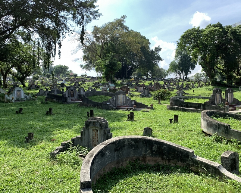
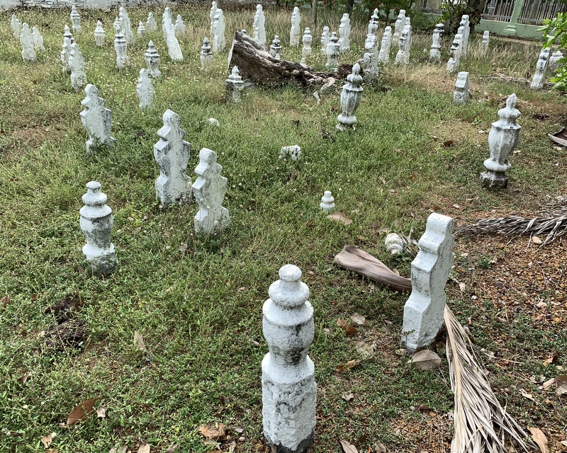
It is a beautiful cemetery. In two months time, at Cheng Beng, it will be crowded with people cleaning the graves of their loved ones, now it was very quiet and serene. I like cemeteries 🙂
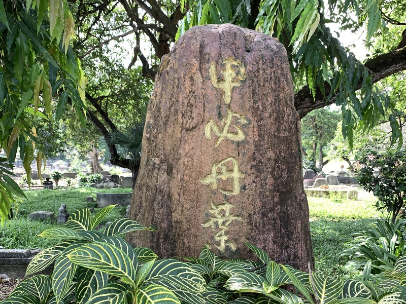
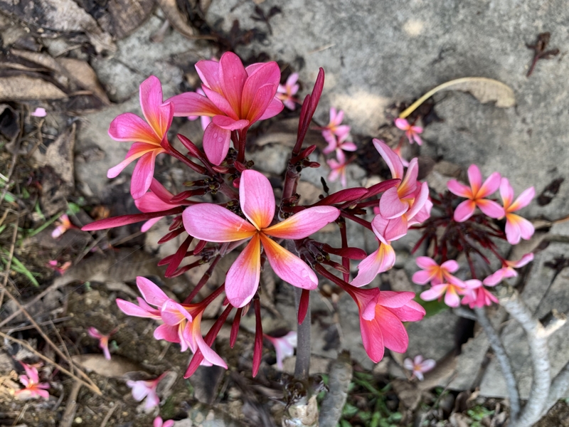
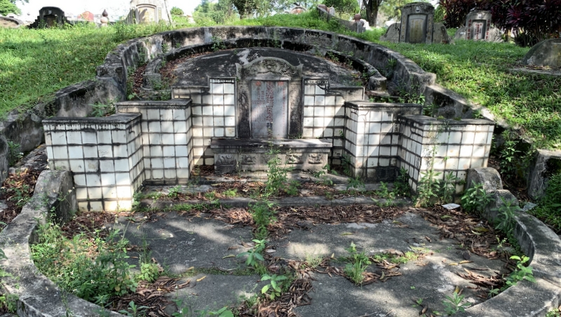
There was one grave in particular I wanted to visit, that of Yap Ah Loy, generally considered to be the founder of Kuala Lumpur. With the help of the very informative Malaysia Traveler website of my friend David, I had found the approximate location, in part C (see the map). Walking around we found without problem the marker stone at the beginning of a small lane leading to his grave and those of a few relatives. Beautiful flowers.
Near his grave a plaque gives information about his life
His grave is nice, but not especially impressive. In case you like to visit yourself, the GPS coordinates are 3° 7.31’N 101° 42.05’E .
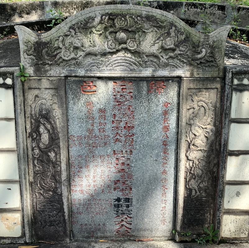
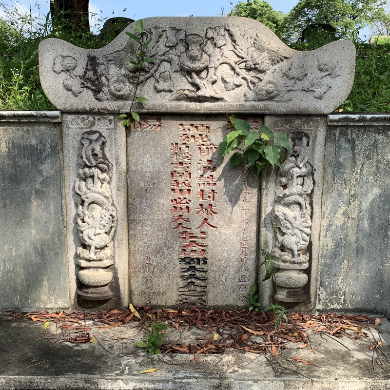
Left the inscription on Yap Ah Loy’s grave, right the inscription on the grave of his wife.
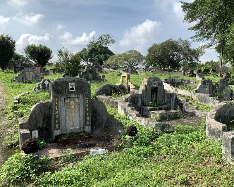
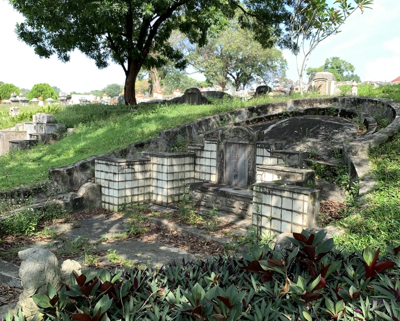
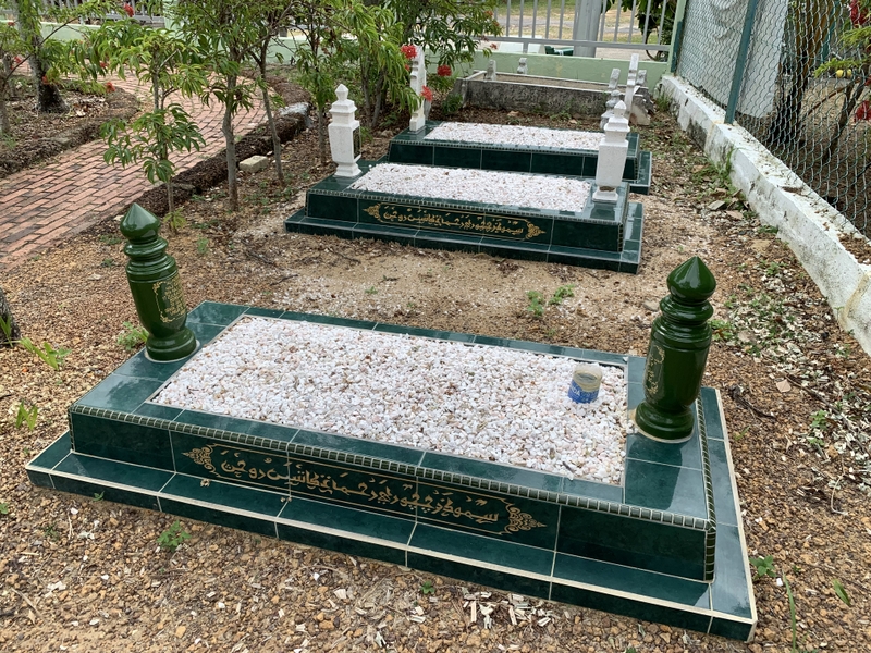
Some of the graves nearby are much more impressive.
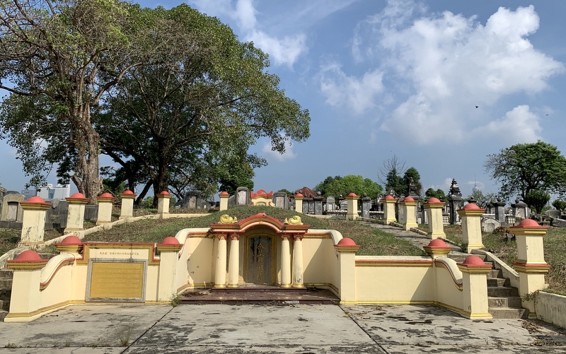
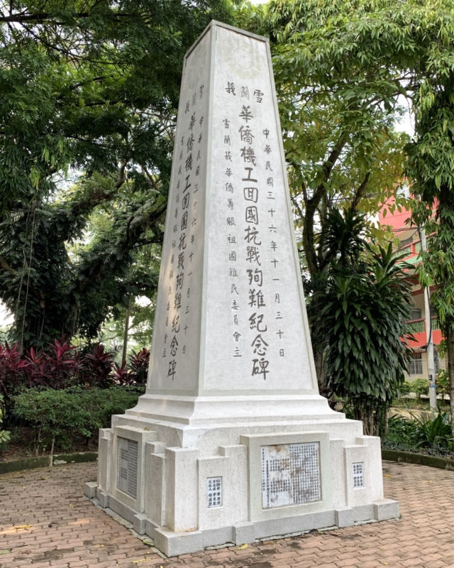
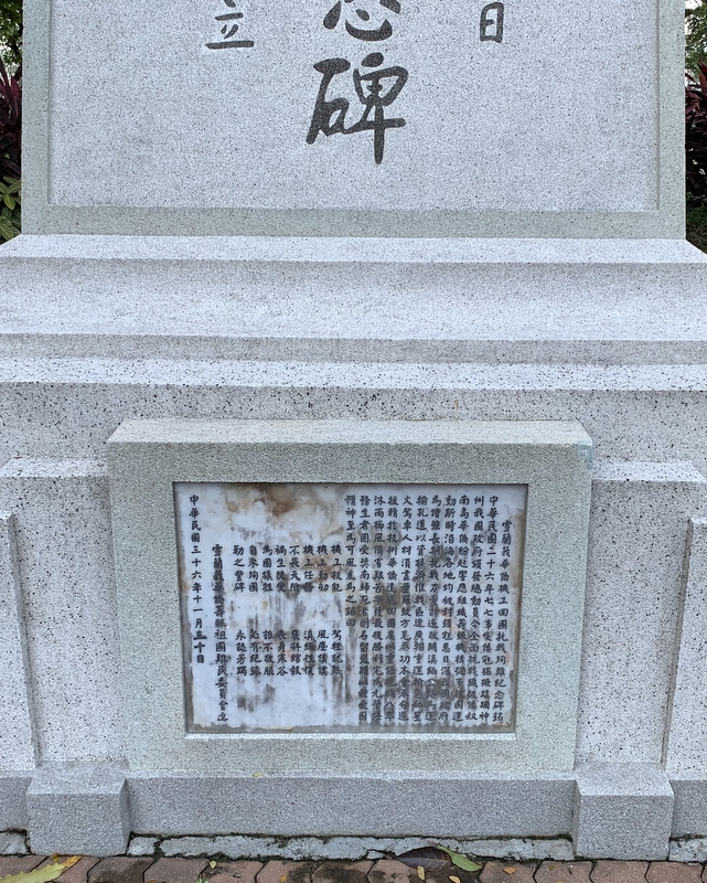
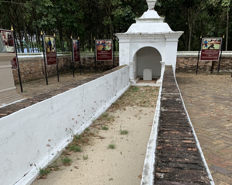
We visited two memorials. This is the Kuomintang Cenotaph, erected in 1947 as a memorial for the Chinese who repatriated to China to fight against the Japanese. I guess they went back after the start of the Second Sino-Japanese war and the Nanjing Massacre in 1937.
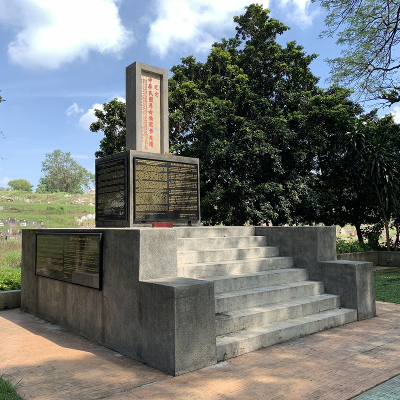
The other memorial is for the victims of the Japanese occupation in World War II. Click on the right picture for background information.
There will be many more interesting things to see in this cemetery, but you really need a guide who is fluent in Chinese.
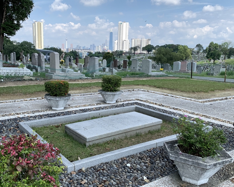
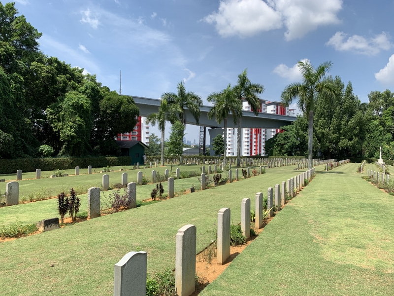
Next we visited the Christian cemetery in Cheras, also with a nice view of the KL skyline.
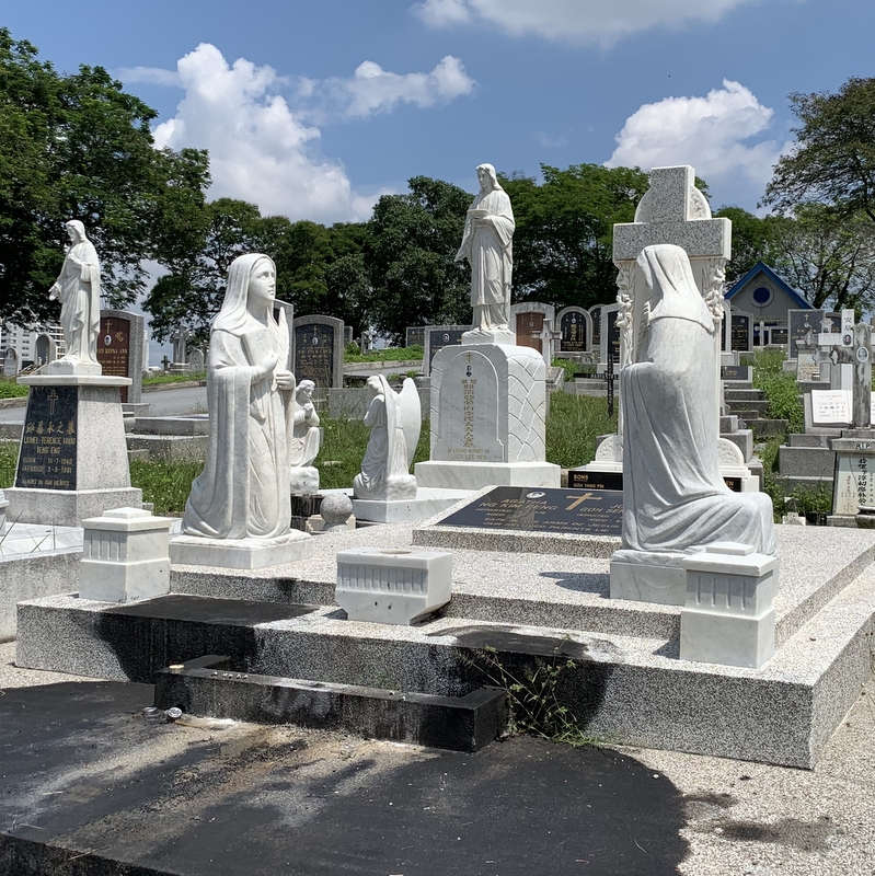
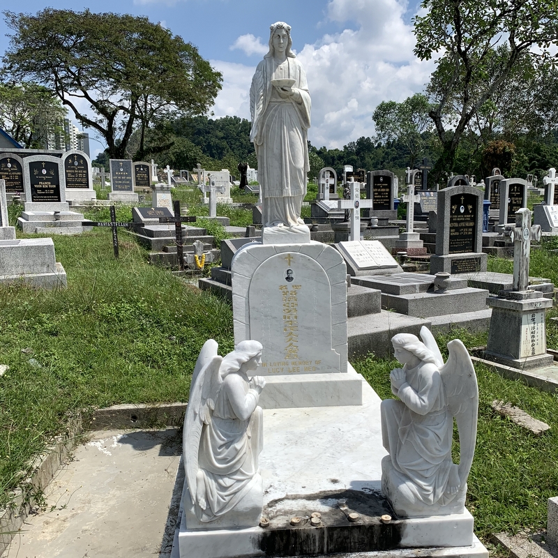
A nice part of this cemetery, probably Roman-Catholic, has beautiful graves with statues of Jesus, Mary and angels.
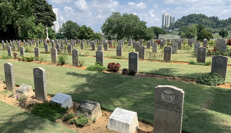
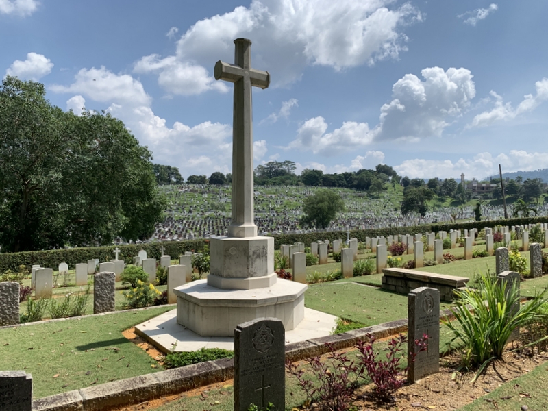
Part of the Cheras cemetery is a war cemetery, immaculately kept by the Commonwealth War Graves Commission. It contains the graves of military personnel, killed during the Malayan Campaign and the Japanese Occupation, but also of those killed during the Malayan Emergency.
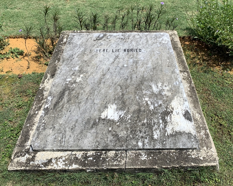
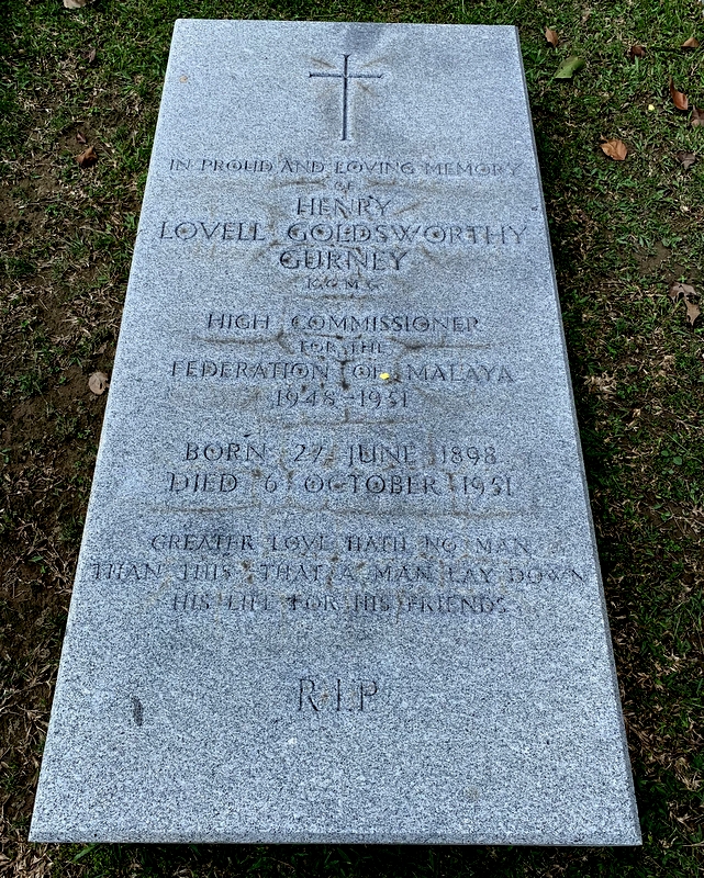
Also in this cemetery I was interested in one grave in particular, that of Henry Gurney, the British High Commissioner, who was killed in 1951 during the Emergency. We found it without much difficulty, next to the war cemetery proper. GPS coordinates are 3° 6.38’N 101° 43.95’E . The tombstone was put in the center of a separate compound and well kept. Not far away another tombstone with “Here lie buried” with illegible names. I was struck by the difference …
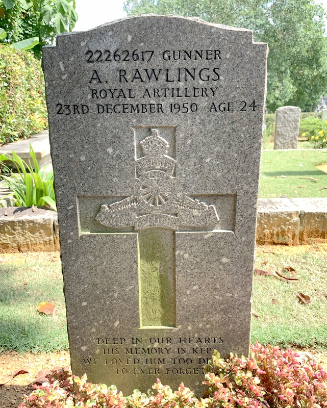
The tombstones of Henry Gurney, and two servicemen, one English, the other one Gurkha. All three killed during the Emergency.
War cemeteries are impressive because many of the people buried there are so young. They gave their lives, so others could live.
Several of my friends feel uncomfortable in a cemetery, but I don’t. Maybe because I don’t believe in an eternal soul or an afterlife?
I am planning to visit more cemeteries in KL. Next on my list is the Ampang Muslim cemetery, where I will try to find the grave of P. Ramlee. There is also a small Japanese cemetery.
Well, not really that far south…:-). We had not been on a trip for some time and decided to make a 2D1N trip to Negeri Sembilan and Melaka.
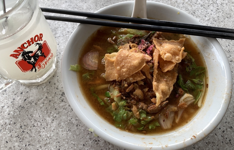
Aric has a few projects. One is to try out assam laksa shops all over Malaysia and report about it on his Assam Laksa website. Another one is to take drone videos of fishing villages along the Malaysian coast. See for example Trip up North 2017 .
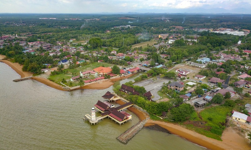
Our first destination was not an assam laksa shop and not a fishing village but…. a mosque! The Old Mosque of Machap was built in 1902 by Datuk Machap, a Makasar descendent from Indonesia. During the Japanese occupation he helped the local Chinese communities and in return they collected money for the renovation of the mosque after the war. That’s why the mosque looks like a Chinese temple!
The mosque is located on the shores of the Durian Tunggal reservoir in Melaka. We were a bit unlucky, because when we arrived at the mosque, it was closed. We waited some time for the caretaker to come back, but finally gave up. So I could only take a picture from a distance.
And of course Aric took some pictures with his drone. The location is very romantic.
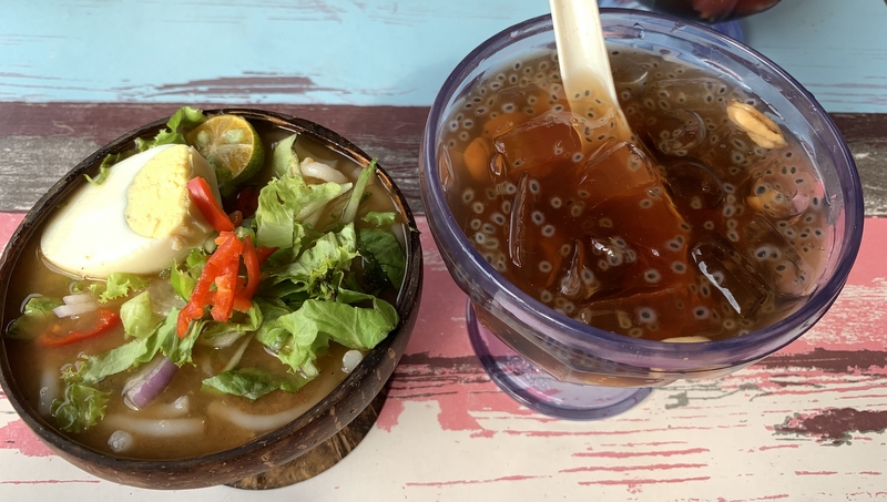
For our lunch we went to the outskirts of Melaka, to Uncle Low’s Cafe. I am not an assam laksa expert, but this one was really nice, I finished the bowl until the last spoon..:-)
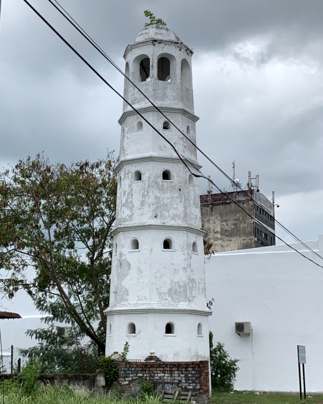
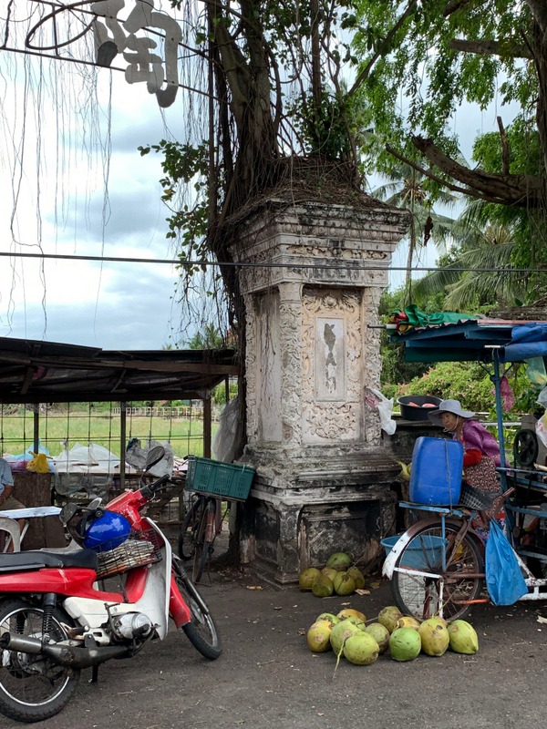
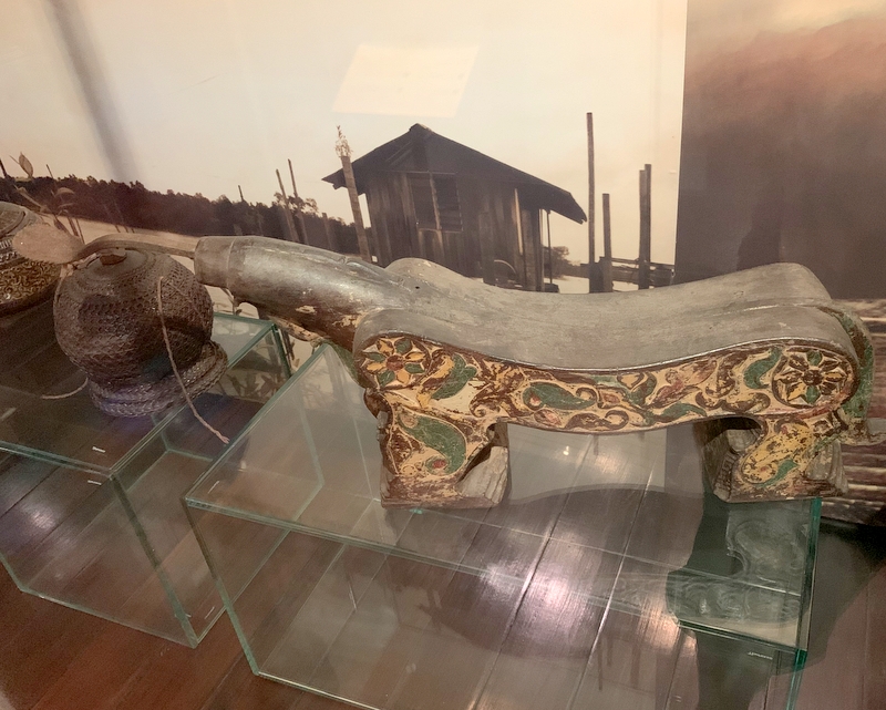
From Melaka we followed the coastal road to our first fishing village, Kuala Sungai Baru. Still in the town, we passed two interesting historical monuments. The Menara Lama Surau Tengkera (1728) in the left picture is all that remains of the oldest mosque in Melaka. Nearby we noticed an interesting isolated pillar, no idea about its history.
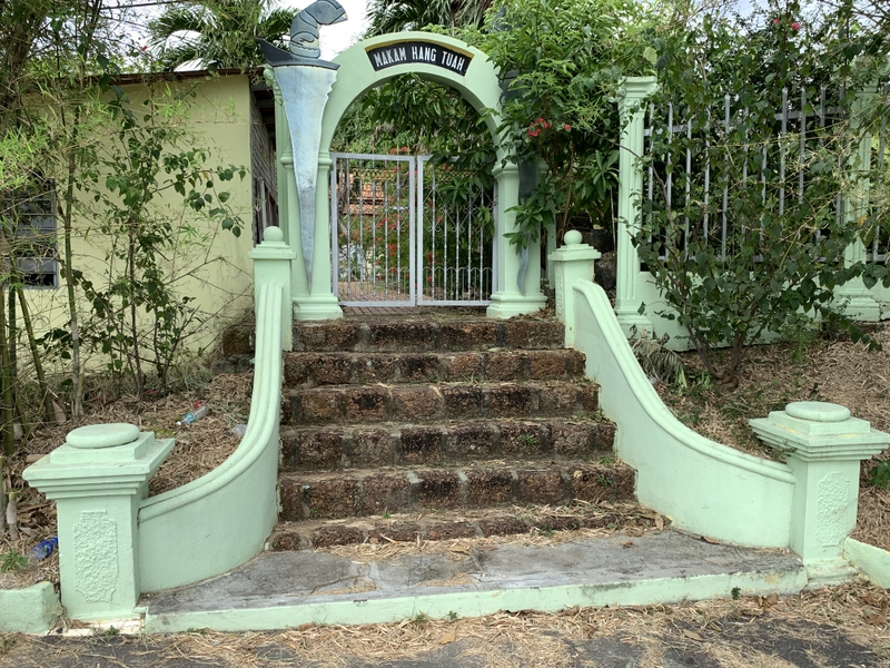
We stopped for a while at Tanjung Kling, 10 km west of Melaka, and visited the Mausoleum of Hang Tuah. Hang Tuah is a famous Malay warrior from the 15th century. There is some controversy about him, did he really exist, was he actually Chinese, etc. The mausoleum is well kept, with posters surrounding the tomb, describing his life.
The huge tomb is surrounded by a Muslim cemetery. A quiet, serene place, not the tourist attraction I was expecting.
Kuala Sungai Baru hardly deserved the name village, it was not more than a few fishing boats, on this drone picture you can not even see them. More conspicuous is the ambitious project in the foreground, with an observation tower, a surau and a few food stalls. Not in good shape, but the food stalls were operating.
The fishing villageSurauObservation tower
Our next stop was at Kuala Linggi. No fishing village, but the remains of a fort, Kota Linggi. This fort was built in 1757 by the Dutch (who at that time controlled Melaka) and the Bugis, to tax the trade on the Linggi river. Here is a drone view of the Linggi river. The fort is located just outside the bottom right corner of the picture.
Not much is left of the fort, except some ramparts. The cannon is fake…:-). You reach the fort by a promenade which was not yet there when I visited the fort in 2008, see my report Linggi Adventure.
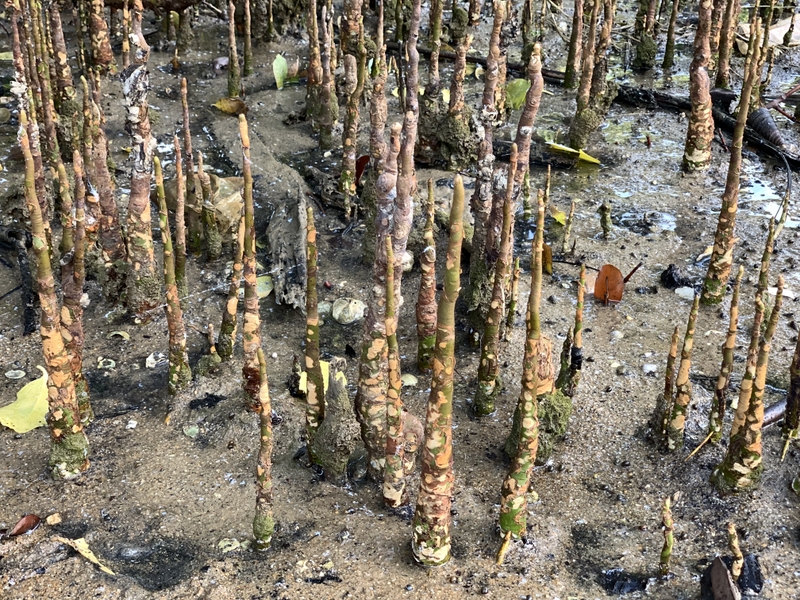
Pantai Cermin was our next destination. No fishing village, but a nice beach. While Aric was droning, I walked along the beach to a mangrove forest.
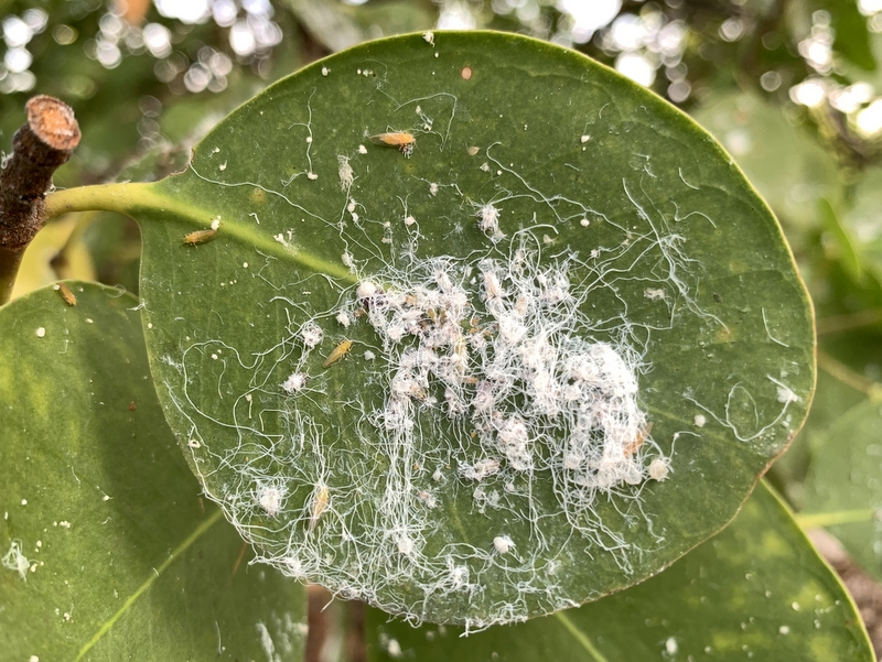
The aerial roots (left) are called pneumatophores, they take oxygen from the air and are characteristic for these mangroves. Many leaves were covered with a kind of woolly substance. A friend explained later to me that they are nests of whiteflies. When you enlarge the photo, you can see a few of these flies.
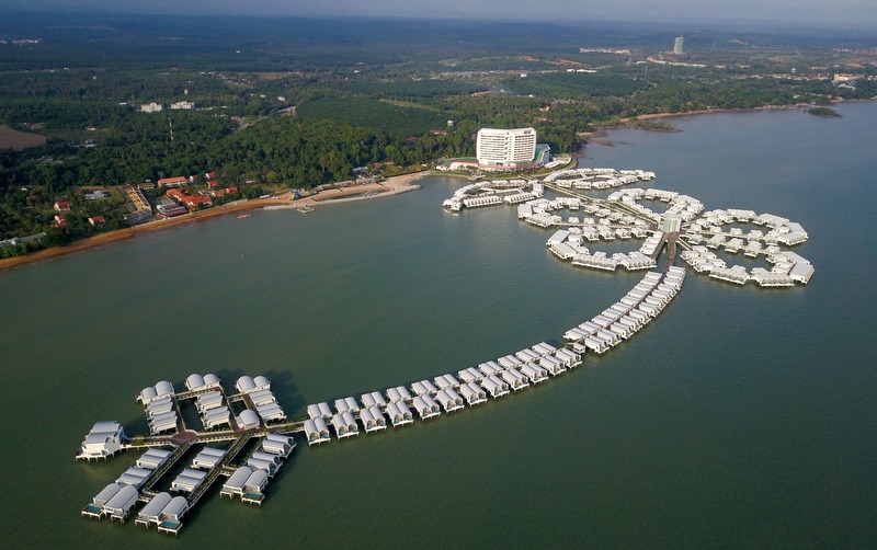
In the meantime Aric took drone videos and pictures of the Hibiscus resort nearby.
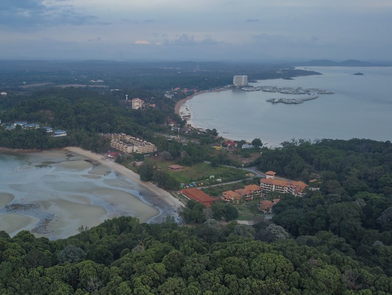
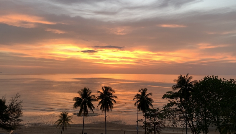
Pantai Cermin is located at the “neck” of the Tanjung Tuan peninsula. Our last stop for the day was another beach at the peninsula itself. To get there we had to climb first halfway to the lighthouse, then follow a trail down. Nice beach. Beautiful evening skies.
Aric droningMe relaxingEnjoying the view
Two drone pictures. The left picture shows Tanjung Tuan with its lighthouse. You can see the beach to the left. The right picture shows the neck of the peninsula. The beach to the right is Pantai Cermin and in the background you can see the Hibiscus resort.
We had booked accommodation in a resort between Tanjung Tuan and Port Dickson, where we took some rest and enjoyed the sunset.
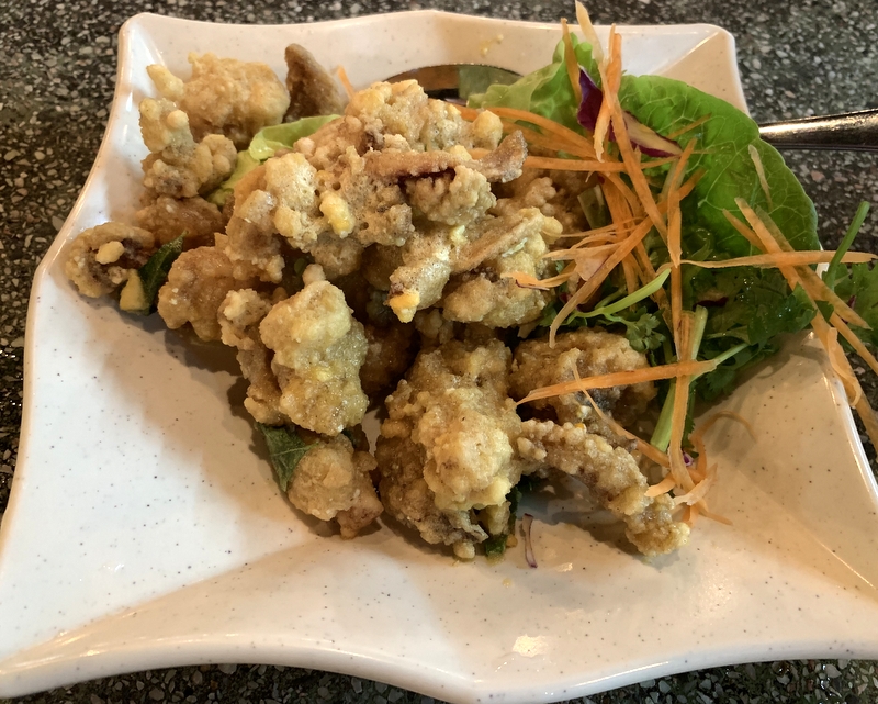
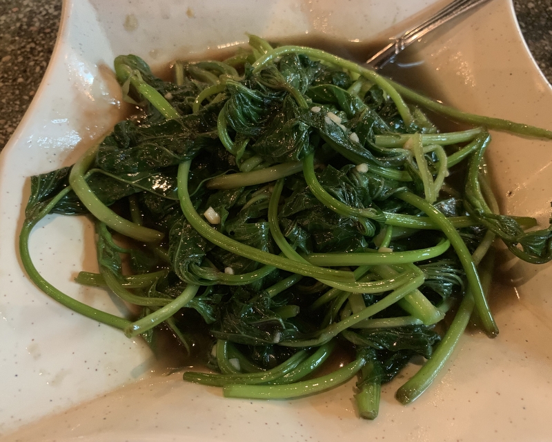
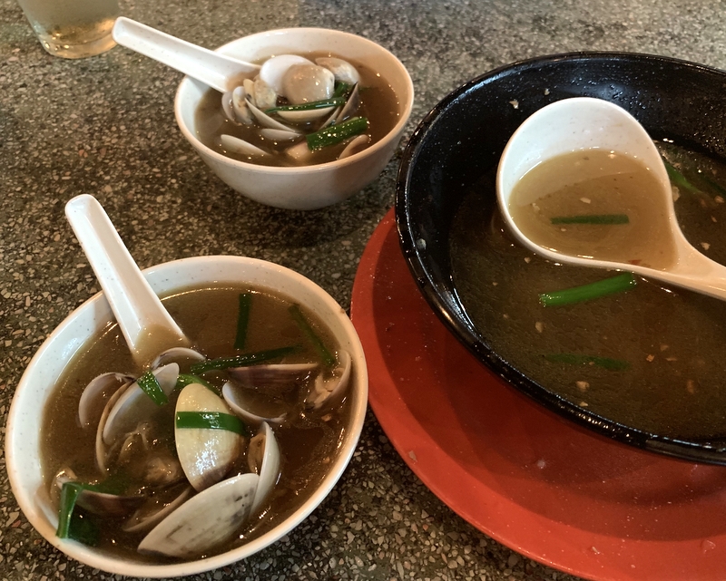
For our dinner we went to the Weng Yin Seafood Village, where we had a light dinner of sotong (cuttlefish) and lala (shells). Excellent food.
Next morning, after breakfast in our resort, we went to Port Dickson and found a few fishing boats there. You can see them in the center of this drone picture.
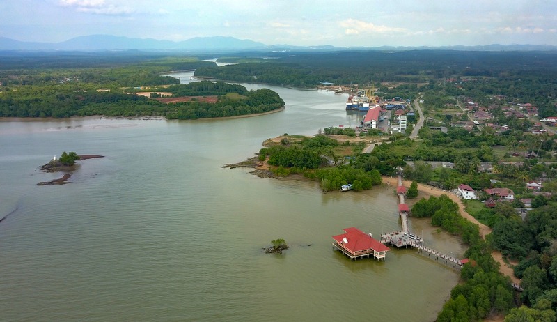
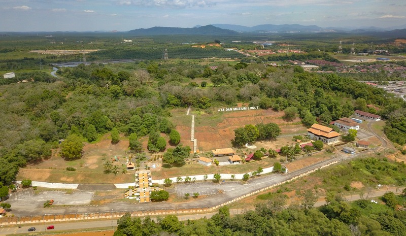
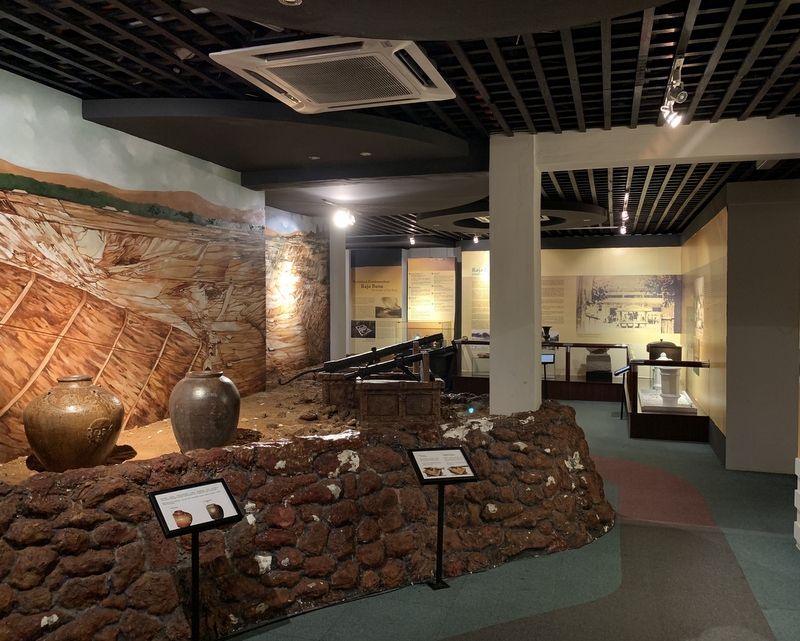
From Port Dickson it is not far to Lukut. In the 19th century, when PD did not yet exist, Lukut was a thriving town, because of the tin mining. In those days the region of Lukut was part of the Selangor Sultanate, but it was effectively controlled by powerful chieftains, like Raja Jumaat, a Bugis prince from Riau. He built a fort in 1847, Kota Lumut. In 1878 the Lukut region was ceded to Sungai Ujong (Negeri Sembilan) and the fort fell into disrepair. Not much is left these days, but there is an interesting museum about the history of the region. Here is drone picture of the museum (the building at the right) and the hill where the fort was located.
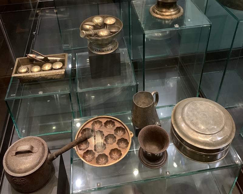
The museum gives information about the tin mining and the history of the Lukut region. Artifacts from daily life, like for example the coconut grater in the left picture. Really worth visiting.
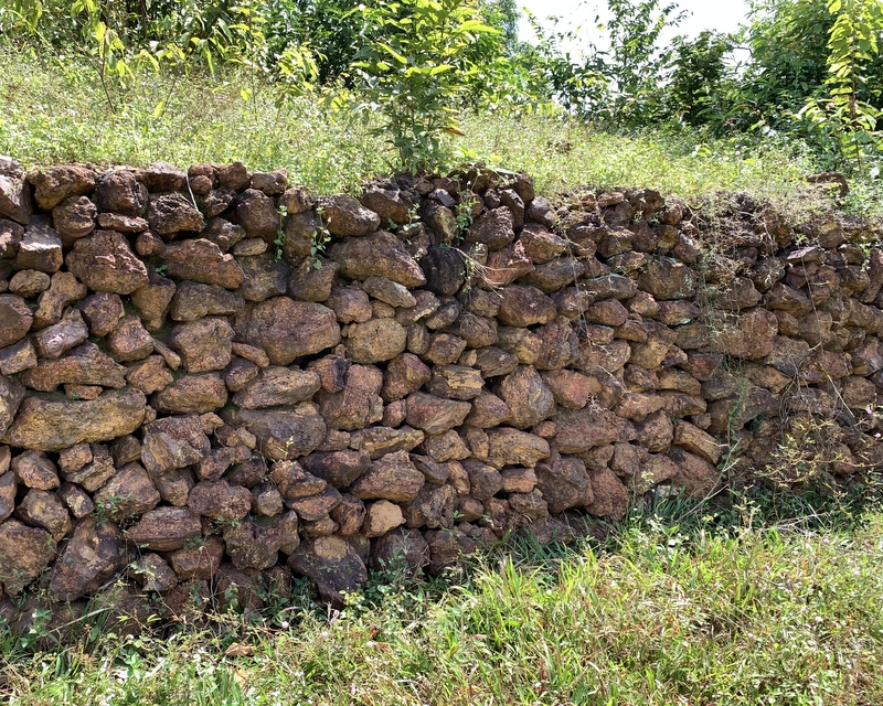
Not much is left of the fort, parts of the remparts. two water reservoirs, the moat. Nowadays you climb the hill from the museum side, the original access road was from the other side, barely visible in the right picture
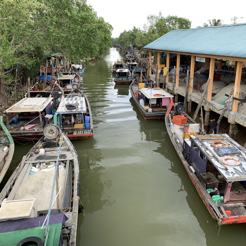
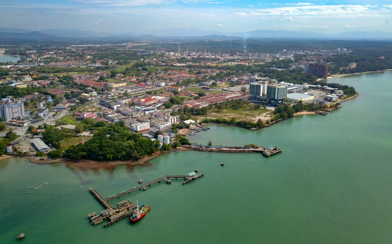
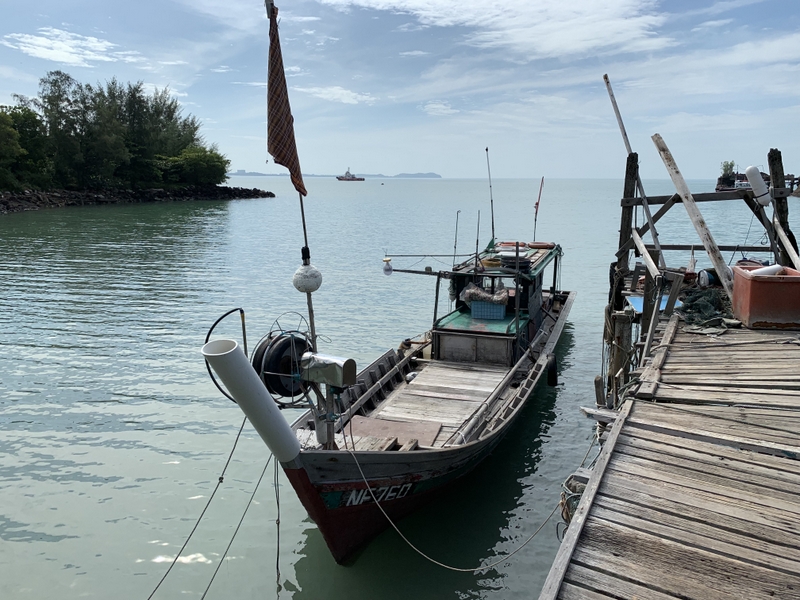
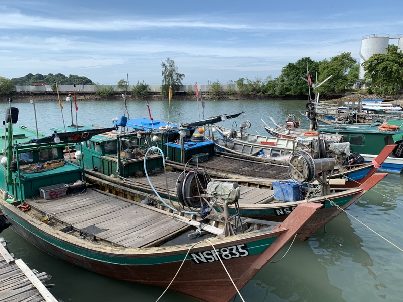
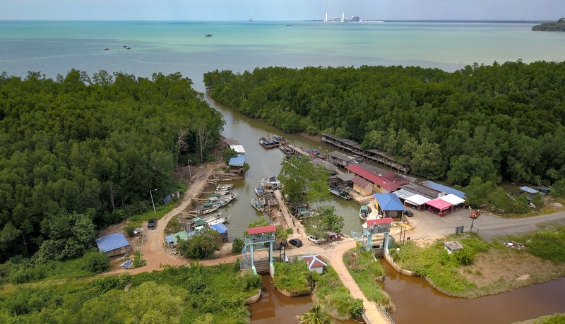
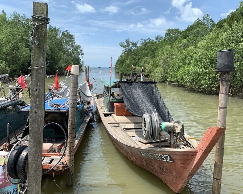
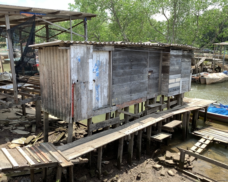
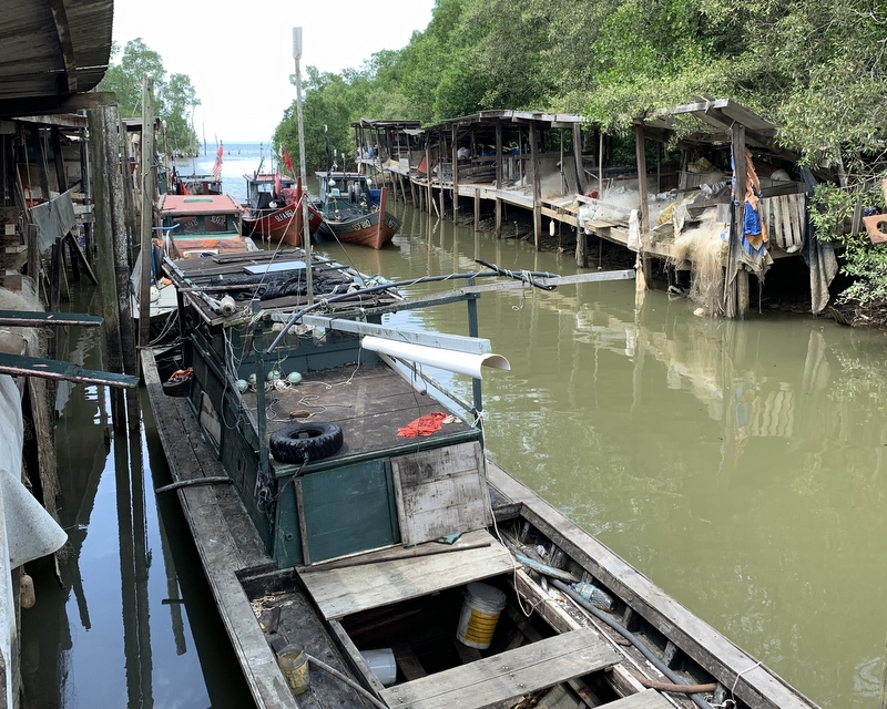
The nearby fishing village of Kuala Lukut was nice. Here is a drone view and some details.
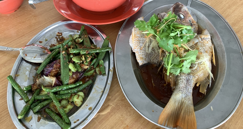
We had planned to have lunch in the popular Soon Huat seafood restaurant, near the jetty, but we found that it opens only for dinner on weekdays, so we had lunch in a small food court close by. Also not bad and probably a lot cheaper.
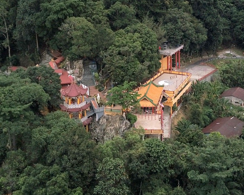
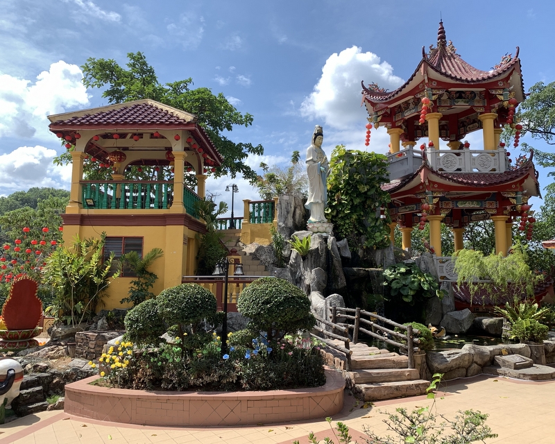
After Lukut we left the coast and drove to Seremban, where we visited the Then Sze Khoon temple, 3 km north of the town center. It is a Taoist temple, established in 1864, beautifully located on a hill slope. Left a drone view, right the central court with a statue of Guan Yin, the goddess of mercy.
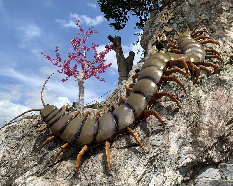
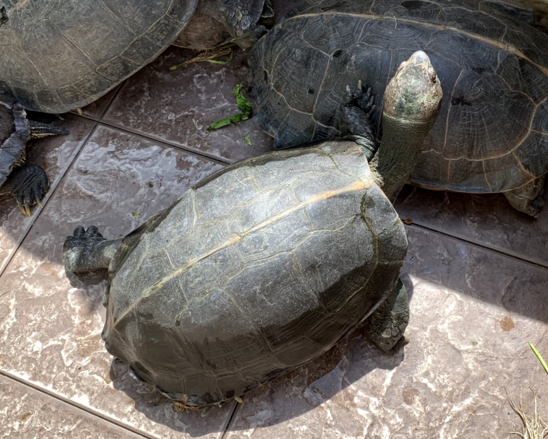
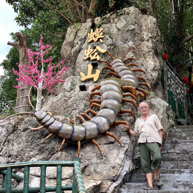
The temple is nicknamed the Centipede Temple. It is said that it brings you luck when you find a centipede on the temple grounds. Besides the gigantic centipede sculpture we did not find any, but there were tortoises.
When we followed the path up the hill we passed several colorful groups of statues. I am not an expert in Chinese mythology, but I think these are (several of) the Eight Immortals from Taoism.
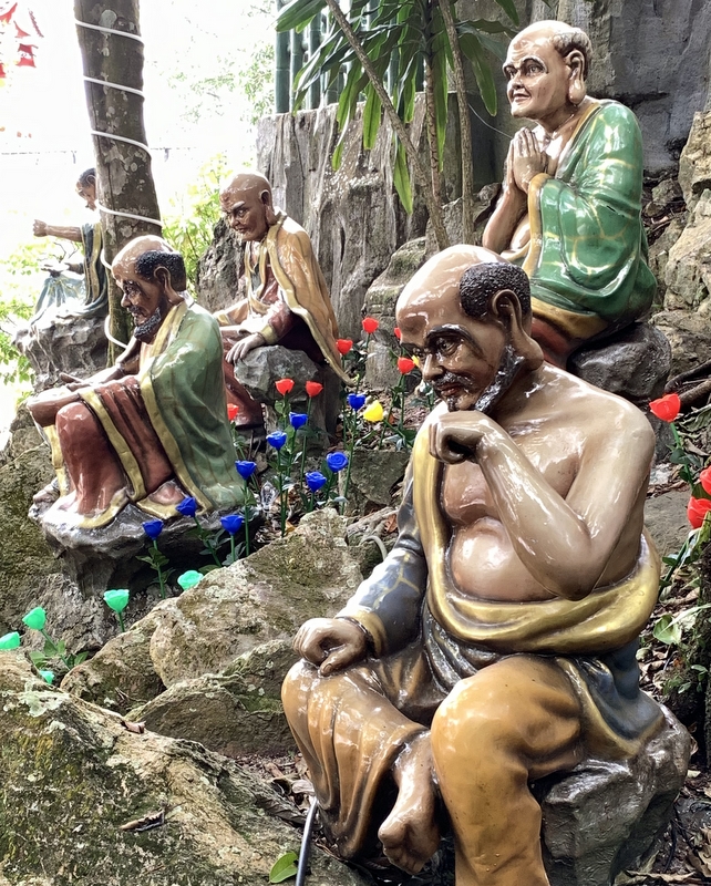
And this could be some of the Eighteen Arhats, which actually belong to (Mahayana) Buddhism. The mixture of Taoism and Buddhism is quite common in Chinese temples.
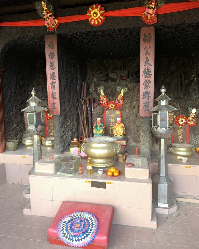
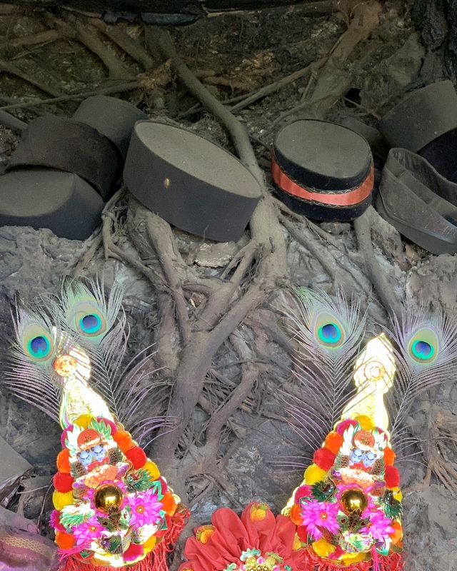
Of course there are many shrines. Left a Taoist shrine, in the middle a Datuk Kong temple. I am very interested in this kind of temples, where local (Malay) spirits/deities are worshipped. No pork here! In the right detail you see the many songkoks left behind by devotees. Also note the tree roots!
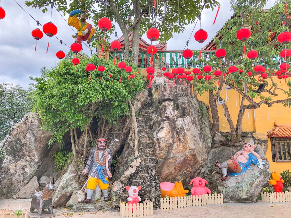
It is no problem to spend a few hours in this temple, there are many things to see. In this picture you see characters from the famous Chinese novel “Journey to the West” where the monk Tripitaka goes on a pilgrimage to find sacred Buddhist texts. He has three companions who help him in the many adventures they experience on the way. The Monkey God (upper left), Pigsy(right) and Sandy (left). When you enlarge the picture you may be able to find me as Tripitaka…:-).
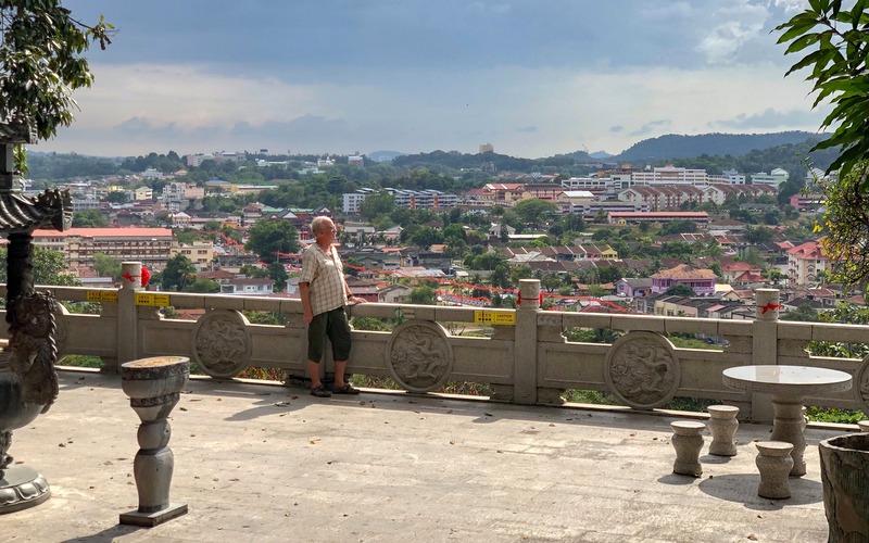
Of course Aric had to use his drone, while I walked around. From the temple terrace you have already a nice view of the surroundings, and of course the drone shows more. The mountain at the horizon, right of the middle, could be Gunung Angsi.
Before we left we took some pictures for the album. Aric is a dragon, I am a monkey, but the Monkey God was too high up, so I stood next to the centipede.
Before we drove back home, we had another assam laksa in Senawang, Laksa Tempurung. Nicely served in a coconut shell, but for the rest quite mediocre. The dessert, Lin Chee Kang, was nice.