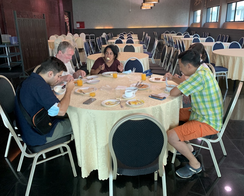
In 1976 I started as physics teacher. at a secondary school in Amstelveen. The physics department had an amanuensis (technical education assistant), Dick Vader, who was also an avid photographer. Of course we are both retired, but still in touch. Recently he sent me a collection of photos taken by him during my first decade of teaching and I can not resist the temptation to publish them in this blog.
I was a hippie in those days, 32 year old when I started, with long hair, that was already beginning to thin 🙂
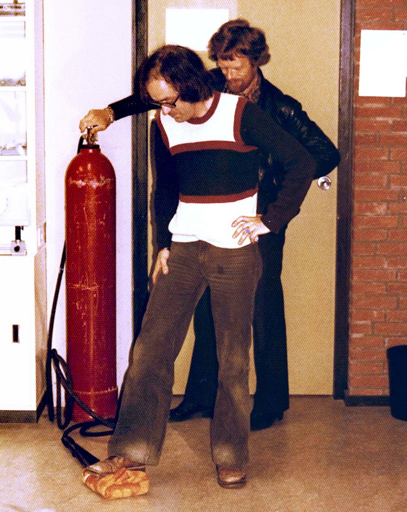
1976-1977, Dick Vader is assisting me to make dry ice, for use in physics experiments
My first year was not easy. As a flower-power hippie, I found it difficult to exert authority. Fortunately I had a small group of final year students, where I could relax after hectic junior classes.
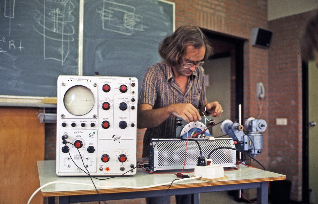
Preparing a demonstration of an alternating current motor
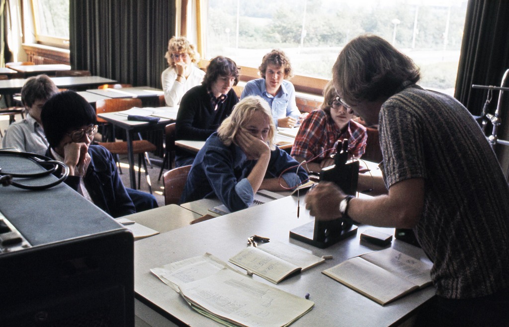
Look how they are watching the demonstration. A teacher’s dream.
I was still smoking pipe in those days. Not in the classroom of course, But no restrictions in the staff room and even the students were allowed to smoke in their own student canteen, and outside the school premises. Those were the days ;-). Soon I changed to cigarettes, to smoke pipe you need to be more relaxed
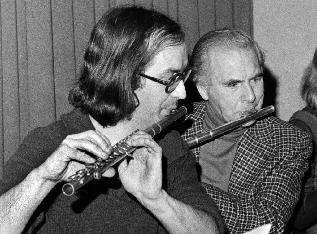
As I played the flute in those days and there was a school orchestra, of course I joined. Here with a French language teacher.
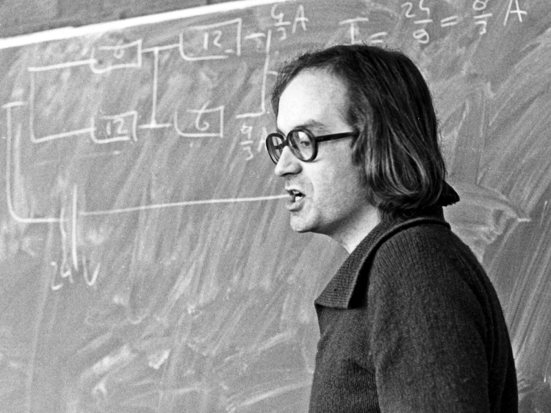
Still in my first year teaching. Explaining electrical circuits. I should have cleaned the blackboard better 😉 .
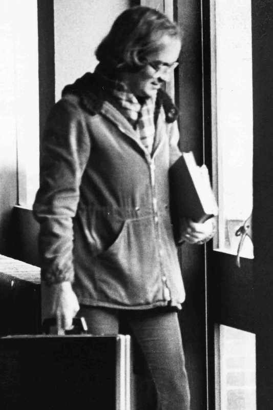
1980-1981 Helping my students with their homework.
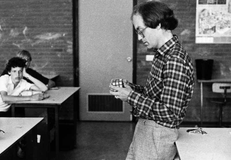
In 1980 Rubik’s Cube became a popular toy. Once I had a competition with my students who could solve it fastest. I remember that I was not bad, but I didn’t win.
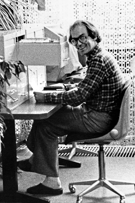
A teacher also has administrative duties (left). Not sure what I am doing in the right picture. Reading a stopwatch? My blackboard is still a mess. Pictures from around 1982
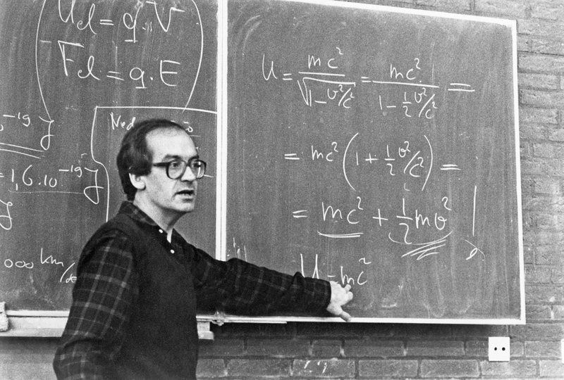
1983-1984 Here I explain a bit of Einstein’s Special Theory of Relativity. Not really part of the physics syllabus, but I liked to show my students a glimpse of what they would learn at university (if they decided to study physics 😉 ).
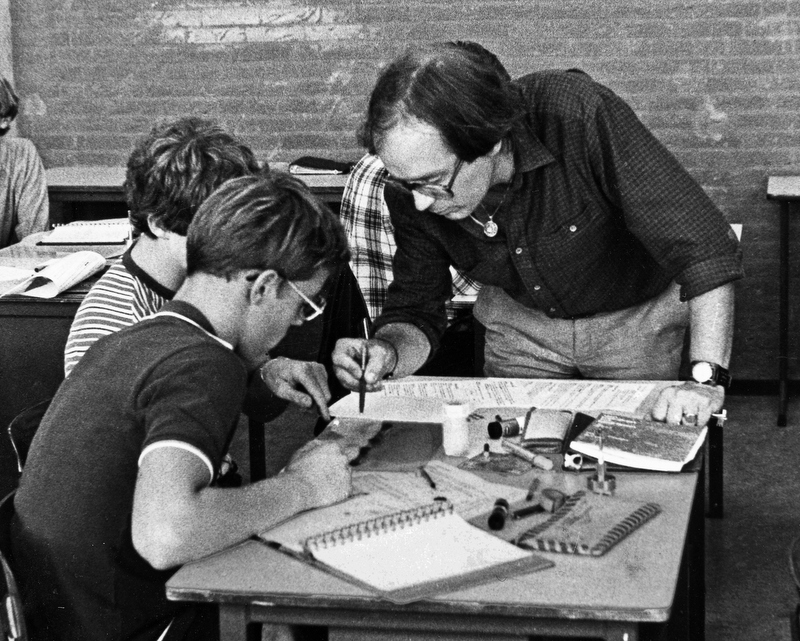
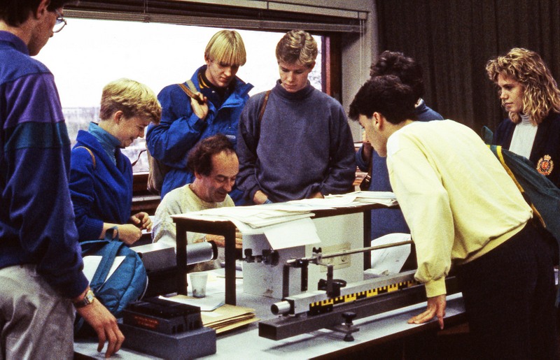
1983-1984 Students in their final year had to do experiments themselves and report about them.
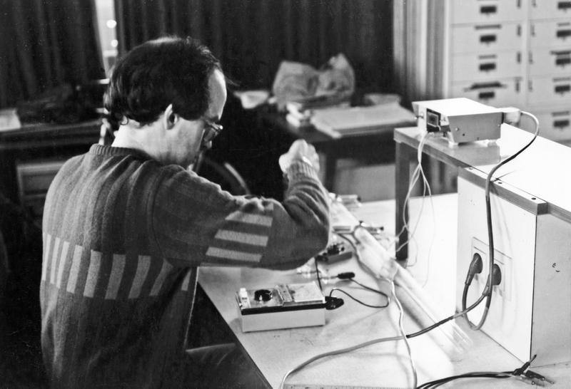
I had also to do experiments myself.
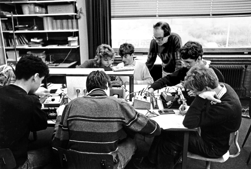
1987 I don’t remember what I am doing here and why my students are so interested to watch me.
This was the last photo , taken by Dick Vader. I continued teaching for another 15 years.
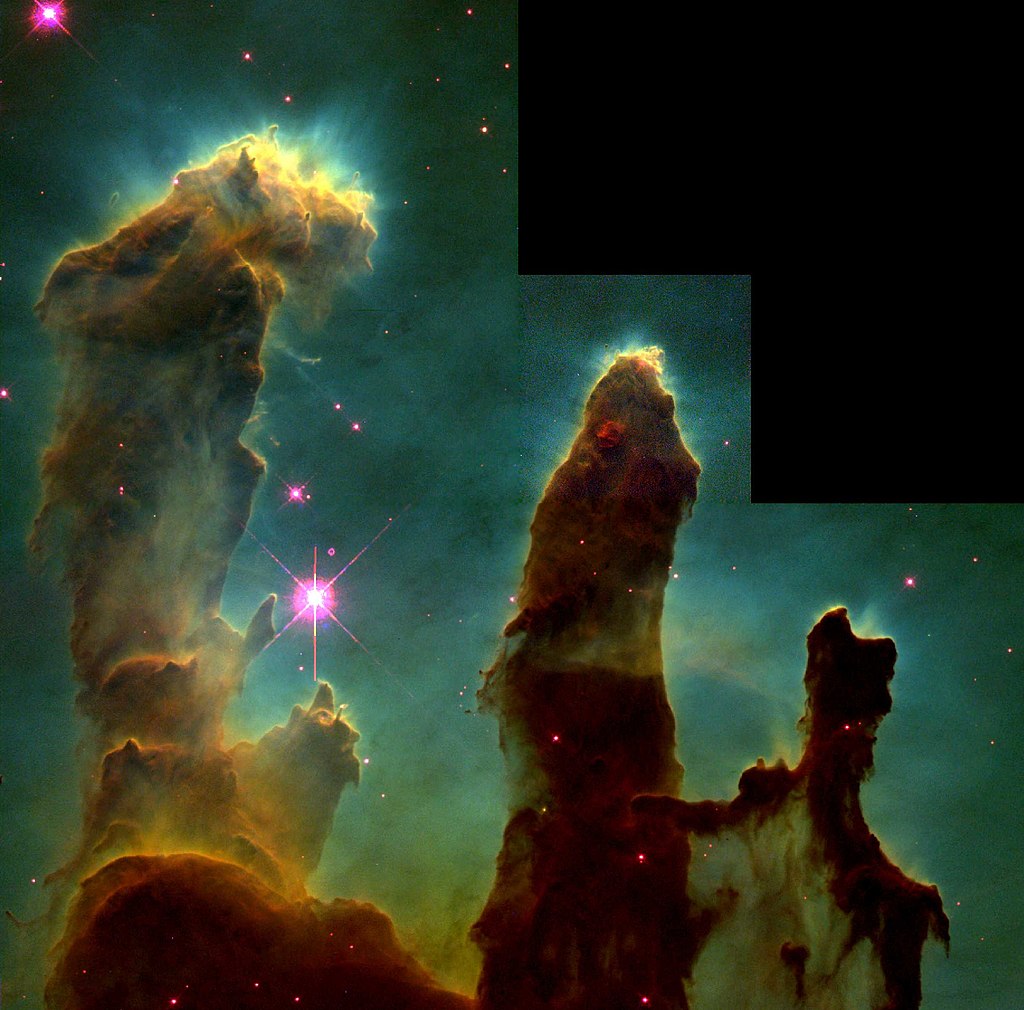
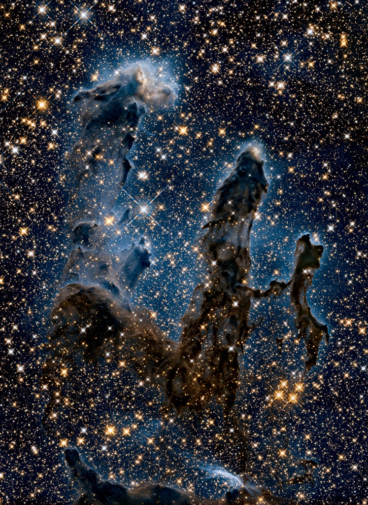
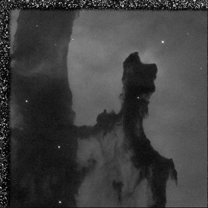
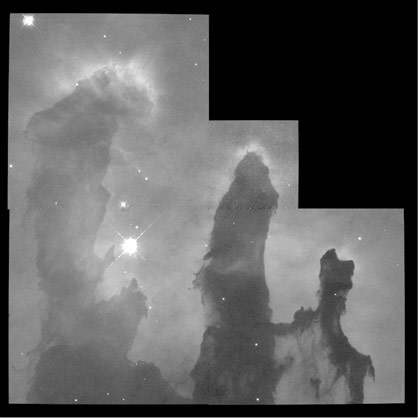
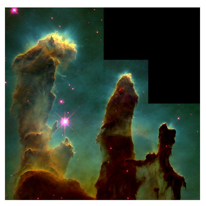
In 1995 NASA published this picture, taken by the Hubble Space Telescope. It shows a small part of the Eagle Nebula and became instantly famous. Because in the “pillars” stars are born, the picture got the name “Pillars of Creation”.
The Hubble Space Telescope was launched in 1990 and is still operating, with quite a few Space Shuttle service missions. To celebrate its 25th anniversary, a new picture of the Pillars of Creation was published in 2015. With a new camera installed, more details are visible,
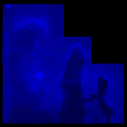
At the same time this picture was published, an infrared picture of the Pillars. Infrared light can travel more easily through dust and clouds and that is why now you see stars in the pillars, where young stars are still being formed. But I hope you wonder how this can be an infrared picture as infrared light is invisible light. The explanation will be the main part of this post.
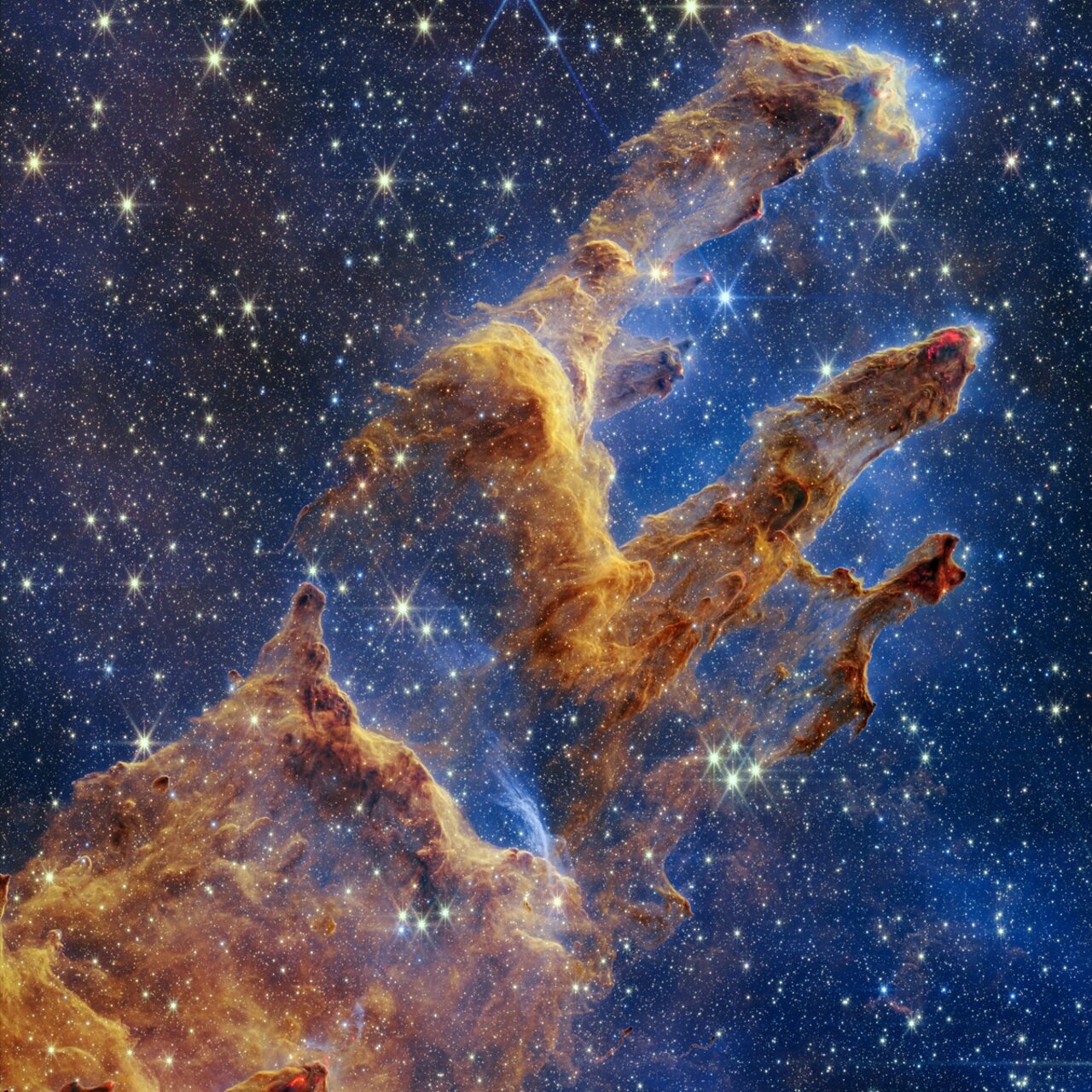
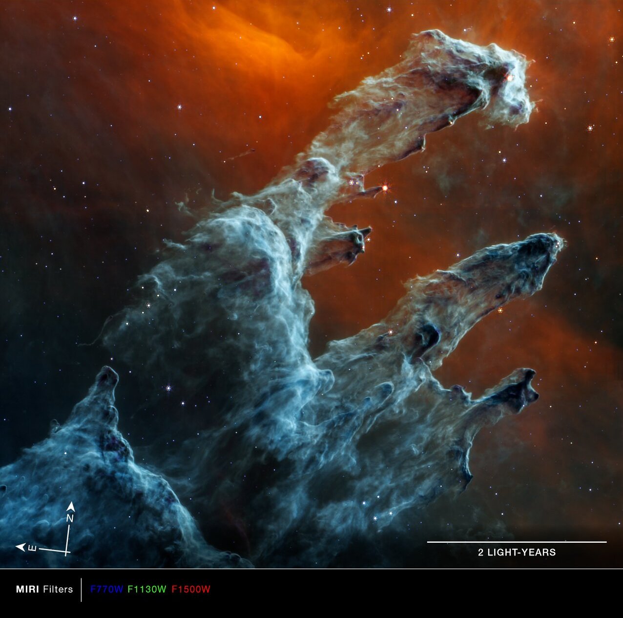
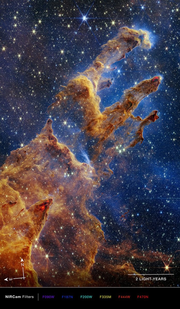
But first here are two pictures, recently taken by the James Webb Space Telescope. The JWST is an infrared telescope has and has two cameras on board to take pictures. The NIRCAM for near infrared light and the MIRI for medium infrared light. Here is the NIRCAM photo
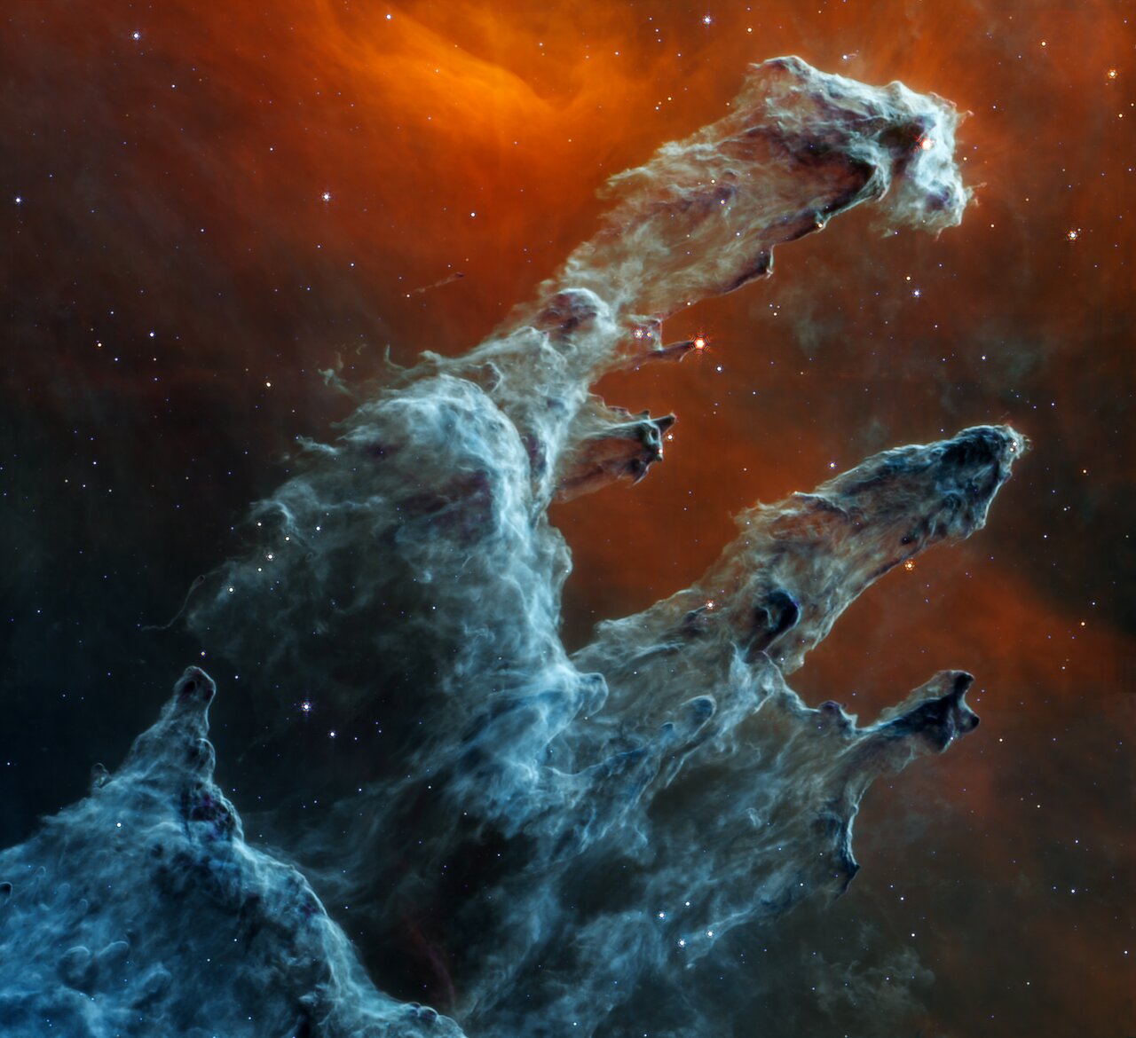
And here is the image from MIRI, Amazingly different. And again, how can these be infrared pictures’?
f
Time to give some explanation about the pictures and also about the Eagle Nebula, where the Pillars of Creation are located.
———————————————– About visible and invisible light
Light is an electromagnetic wave, as are microwaves, radio waves, X-rays etc, They all have different wavelengths. The wavelengths of visible light are often given in nanometers (nm), where 1 nm is 1/billionth meter. Or in micrometer (μm) where 1 μm = 1000 nm. The human eye is sensitive to wavelengths between ~380 and ~750 nanometer and sees the various wavelengths as different colors! The longest wavelengths are seen as red, the shortest as purple/blue with all the “rainbow” colors in between.. In this diagram the electromagnetic spectrum is shown. The infrared part can be subdivided in near infrared, mid infrared and far infrared
The Hubble telescope has two cameras onboard. Most of the iconic Hubble pictures have been taken by the Wide Field Camera. The present wide field camera (WFC3) can take photos in two channels, one for ultraviolet and visible light (UVIS) and the other one for near infrared (NIR), The range of UVIS is 200-1000 nm and of the NIR 800-1700 nm
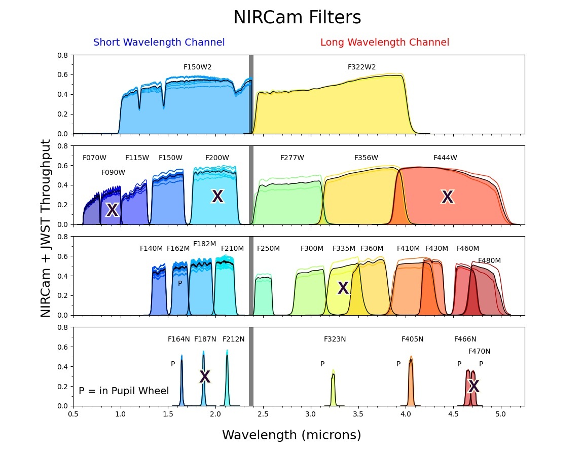
The James Webb has two cameras, the NIRCAM for the near Infrared, range 600-5000 nm and the MIRI for the mid Iinfrared, range 5000-28000 nm (5 μm -28 μm).
Before we describe in some detail how digital cameras record images, it is useful to have a look at the way the human eye sees colors.
———————————————– How does the human eye see colors?
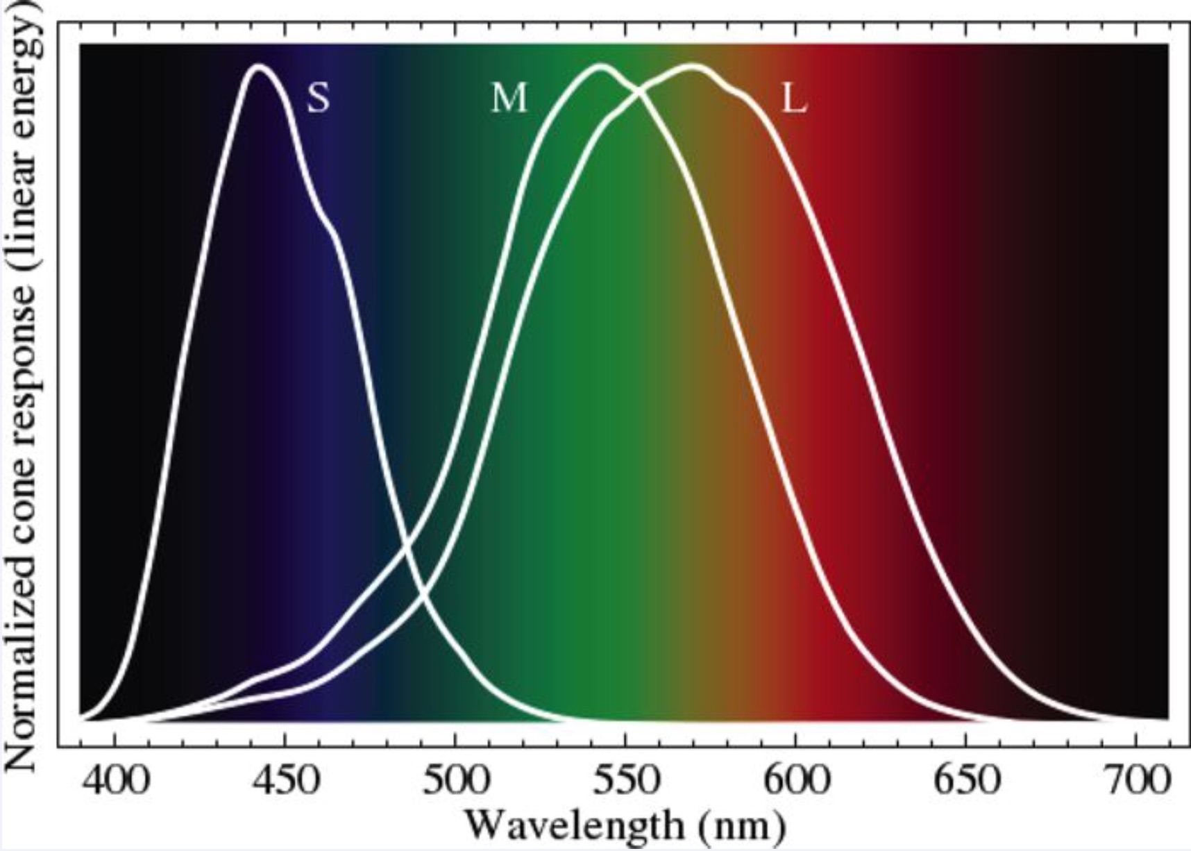
The retina of the human eye contains about 6 million nerve cells, called cones. These cones come in three different types, S, M and L, sensitive to various parts of the spectrum. The S type cones are sensitive to the blue part of the spectrum and are also often called Blue cones, In the same way the other two are often called Green and Red.
The brain is able to combine the response of these RGB- cells. For some people the M and/or L cone cells are not working properly. As a result they are colorblind.
———————————————– How does a digital camera record colors?
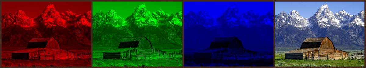
Digital cameras have sensors consisting of millions of individual pixels that record the intensity of the incoming light, basically in a gray scale (black and white). That these cameras can take color pictures is because in front of the sensor there is a color filter, consisting of a mosaic of millions of red, green and blue “pixels”. A so-called Bayer filter. See the diagram below. Taking a picture, means actually taking a red, green and blue picture at the same time, but these pictures are “incomplete”. By mathematical techniques (interpolation) the full color pictures are constructed.
.
Here is an example, where three images, in red, green and blue, when combined, give the full image in natural colors.
The sensors in space telescopes do not have these Bayer filters, they just record the image in gray scales. However, various filters can be placed in front of the sensor and multiple images can be taken of the same object. For example, the Hubble WFC3 camera has a huge choice of filters, 47 for the UVIS channel and 14 for the IR channel.
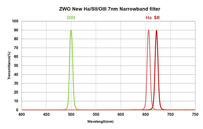
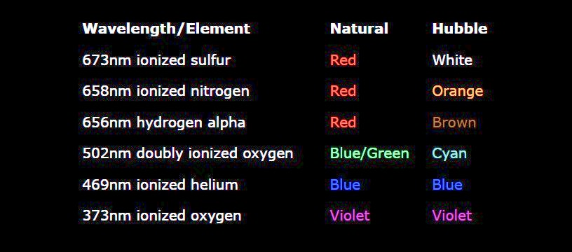
Why so many? Some filters are broadband, they pass a wide range of wavelengths. From a scientific point of vew the narrowband filters are interesting because they pass only the light emitted by specific elements. Here is one example, hydrogen (H) emits red light with a very specific wavelength of 656 nm. So one of the filters only passes wavelengths around that value and a picture taken with this filter shows the presence of hydrogen. Similar filters can be used to check the presence of oxygen (O), sulphur (S) etc.
———————————————– The Pillars of Creation pictures are “false-color” pictures!
On 1 April 1995, astrophysicists Jeff Hester and Paul Scowen published an article The Eagle Nebula, in which they showed a picture of the Pillars of Creation. If you think that was “just” a picture taken by the Hubble telescope, you are seriously mistaken. The PBS/NOVA website More than just a pretty picture explains in 19(!) webpages how the iconic photo was created. Very readable,
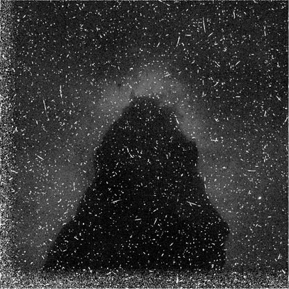
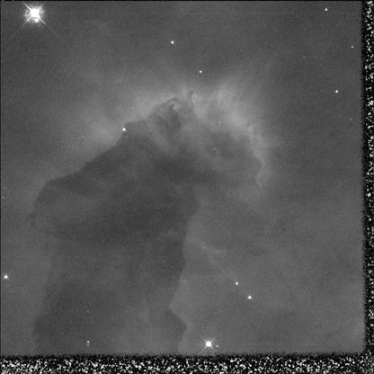
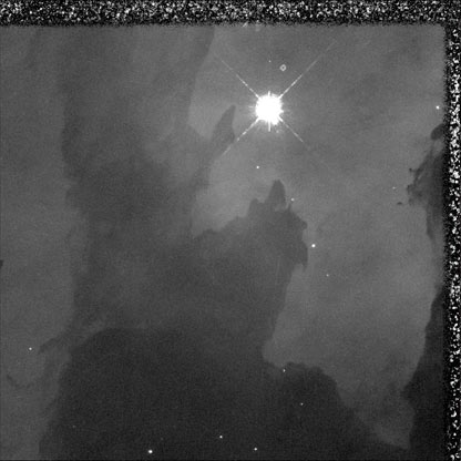
The WFC2 consisted actually of four cameras, each recording a quadrant. The top-right quadrant camera was slightly different, zooming to show more details. Resizing it to the format of the other three, causes the characteristic Hubble image with the “steps” in one corner. Here is the original image of this top right quadrant, in gray scales. What a mess. For an explanation how to clean this image, see the website. The second image shows the result of the various cleaning operations. What a difference !
We can do the same for the other quadrants.
top leftbottom leftbottom right
Now we can “glue” the four parts together. You can still see a bit the seams between the four images.
For this mage a filter was used that only let blue-green light through from (doubly ionised) Oxygen atoms (OIII). Two more filters were used to create images in the same way. One filter let only the reddish light from Hydrogen atoms through (Ha), the other one selected reddish(!) light from ionised Sulphur atoms SII). Three narrowband filters, two of them in the same color range.
Here are the three filtered images
SII filterHa filterOIII filter
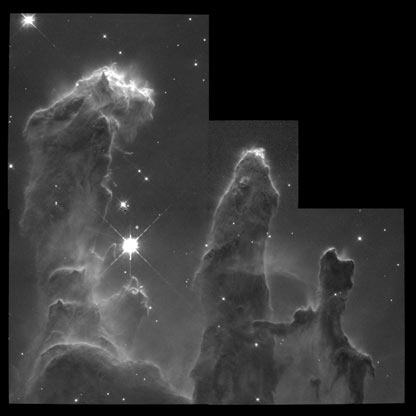
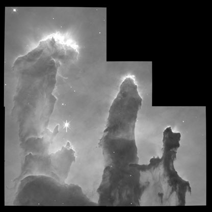
You might expect that the next step would be to give these image’s color corresponding to the filter used for each of them. The Ha and SII reddish and the OIII one greenish. But that is NOT what Hester and Scowen did. They assigned the RGB colors to the three images. Blue to the OIII image, Green tot the Ha image and Red to the SII image.
SIIHaOIII
Final step is to combine them: the Pillars of Creation.
The main reason to assign “false colors” to the pictures is to enhance the contrast and to see how the various elements are distributed. Almost all Hubble photos are false color (also called pseudo color). Using the three narrowband filters for S, H and O and assigning them to RGB is so common that it is often called the Hubble Palette. Doing a Google image search for Hubble Palette gives a huge number of hits. Here is a part.
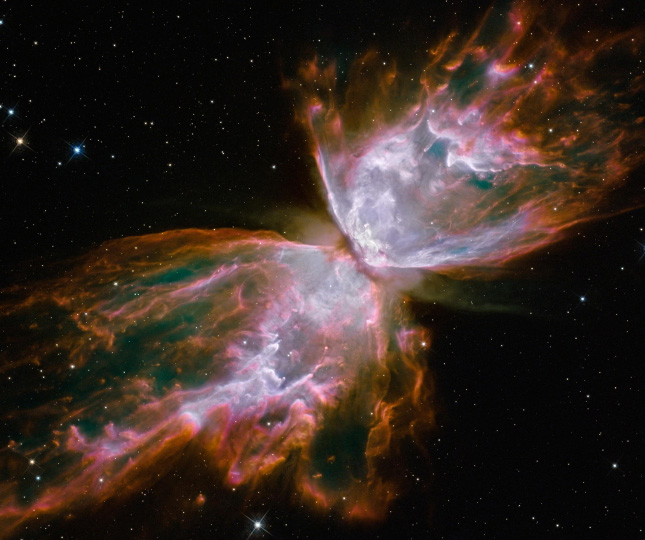
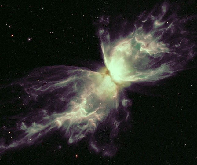
Other combinations of narrowband filters are also used. Here is an example where 6 filters have been used for the Butterfly Nebula. Besides SII, Ha and OIII, also ionised nitrogen, helium and oxygen. In the table the natural colors are given and also the colors assigned in the Hubble palette.
An American astrophotographer got curious how this nebula would look in the natural colors. Here are two images’, left the false color one and right the picture in natural colors. It is clear that the artificial image reveals many more details
It must be clear now that while with the Hubble telescope you have a choice to use false colors, with the JWST there is no other option, as infrared light is not visible. Here are the filters used for the MIRI camera. The colors suggested for the various infrared ranges are not significant, just to guide the eye.
For the MIRI picture three filters were used, F770W, F1130W and F1500W. In the above diagram I have marked them. For this picture they are assigned Blue, Green and Red respectively.
The NIRCam camera has many more filters, broadband, narrowband etc.
For the NIRCam picture 6 filters have been used, marked in the diagram above.
t
I have read somewhere that creating these images should be considered as art and I agree.
———————————————– The Eagle Nebula
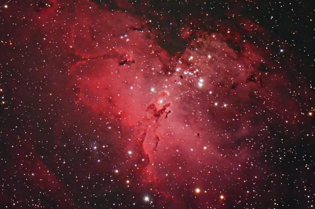
Finally a few remarks about the Eagle Nebula. When massive stars die, they can “explode” as a supernova, erupting their remnants into space. In these clouds of dust and various elements, new stars can be formed. The Eagle Nebula is such a cloud, here is a picture taken by an astrophotographer, using a telescope and a DSLR camera! Many of the bright spots in this picture are young stars already formed in the cloud. These stars are so hot that they emit UV light and even X-rays. This radiation can has enough energy to ionize the cloud. Such a cloud is called an emission nebula. The dominant reddish color is caused by hydrogen
The Eagle nebula is located about 7000 lightyear away and is huge, roughly 70 x 55 lightyear. It is a young nebula, estimated age is 5.5 million year. It is also a temporary event, the forming of new stars still continues and the radiation those stars will erode the nebula.
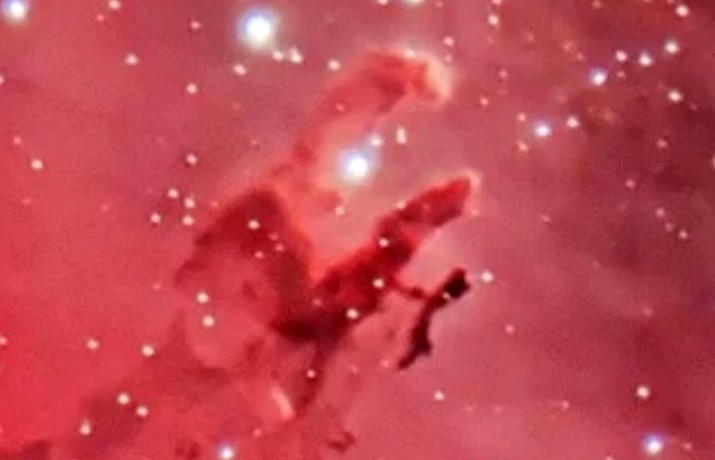
In the center of the above image, you can see the pillars of creation.Here is a dteail. Comapre it with the images of Hubble and Webb. Even these pillars are huge, the logext one is about 4 lightyear long.
A final remark. From the Hubble and Webb picture you might think that the pillars are almost like rock, impenetrable. But this is not true at all. The density of nebulas varies between 100 – 1 million particles per cubic cm. A high vacuum on earth still has considerably more particles per cubic cm. It is just the huge size that makes the pillars look like solid.
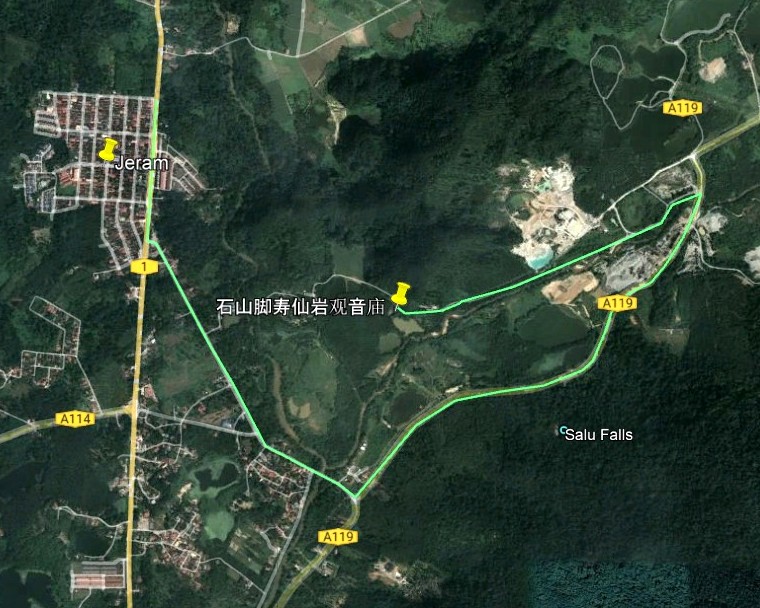
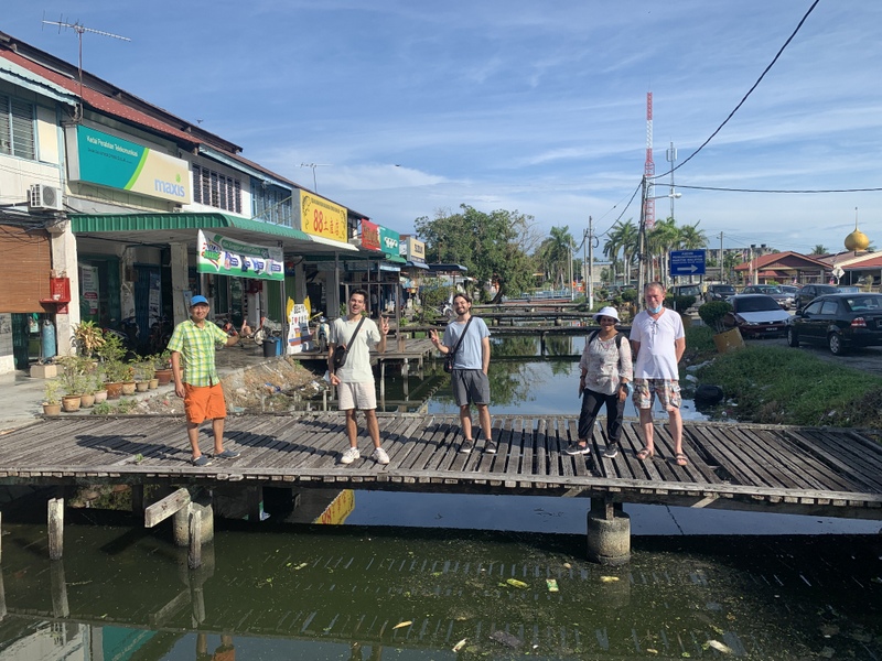
On 22 October Free Malaysia Today had an article with the intriguing title Mysterious 135-year-old temple in Perak’s jungles .Of course I was interested and wanted to have a look myself. But where was this temple located? The article mentioned Jeram and Jalan Chenderiang. Still a bit too vague. Fortunately my friend Siak Hong Law had visited the temple many years ago, he gave me the exact location. The temple is actually on Google Maps, named as 石山脚寿仙岩观音庙, which Google translates as the Shouxianyan Guanyin Temple at the foot of Shishan
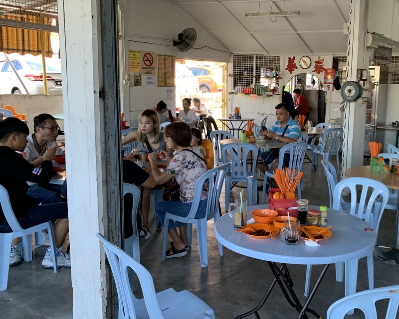
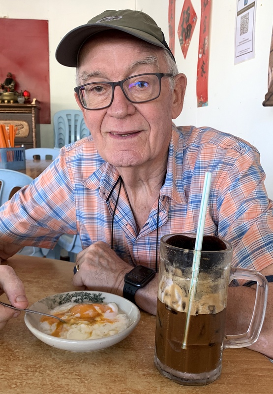
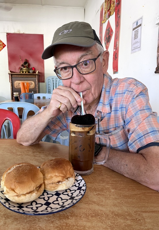
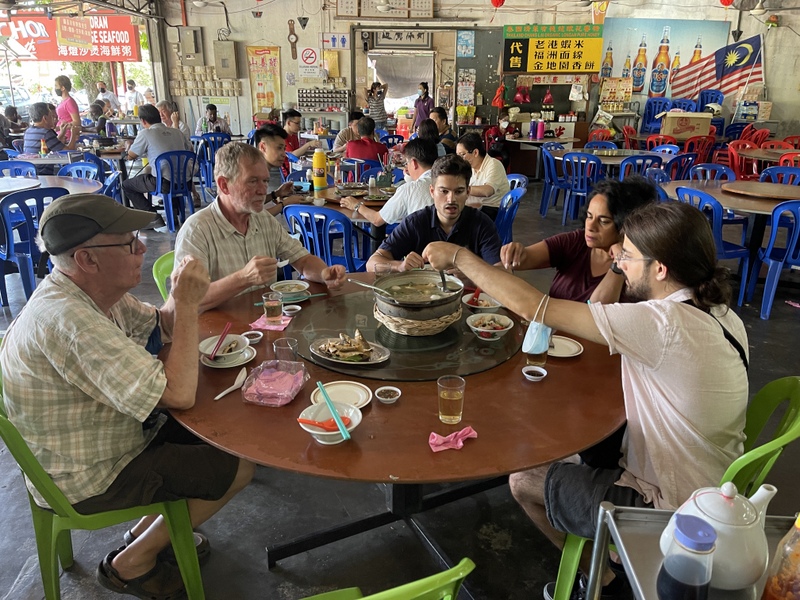
As the temple is still a two hours drive from PJ, Aric and I decided to make it a day trip, combine the temple with waterfalls and food. We started with breakfast in Tanjung Malim. The Thye Fah coffee shop is popular and well patronised.
The coffee shopMany customers
Their special ice coffee has a frozen coffee heart on top. I had my half-boiled eggs, the buns with butter and kaya were really delicious. A good start of the day.
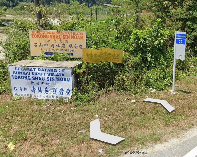
After our breakfast, we drove to Jeram and from there to the temple. In the left picture you see how to drive, first following the Chenderiang road until you turn left into a small road. I forgot to take a picture of the junction, so I took a screenshot of Google Street View. The description by the author of the FMT article of the temple as “hidden in the depths of a thick jungle.” and of the road as “you have to travel along a stretch of dirt road snaking through an oil palm plantation” shows that he has a rich imagination. The road is tarred, passing a few industrial sites, then following the peaceful Sg Dipang. No jungle at all.
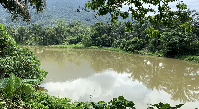
After less than 2 km, this road ends at a clearing, next to a former tin mining lake. Peaceful surroundings.
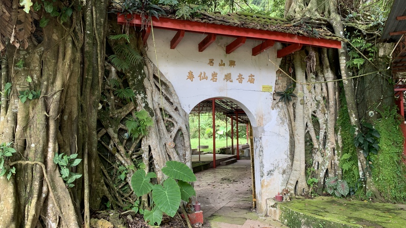
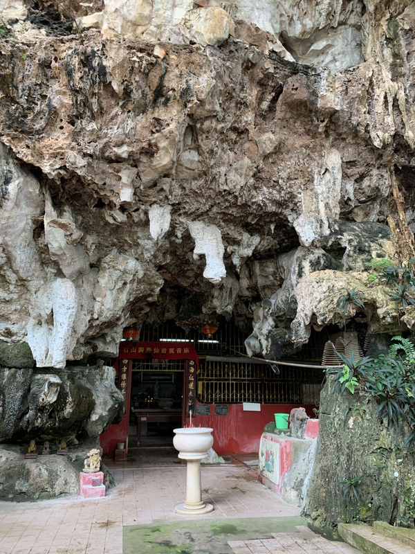
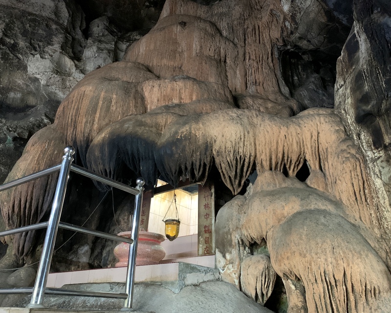
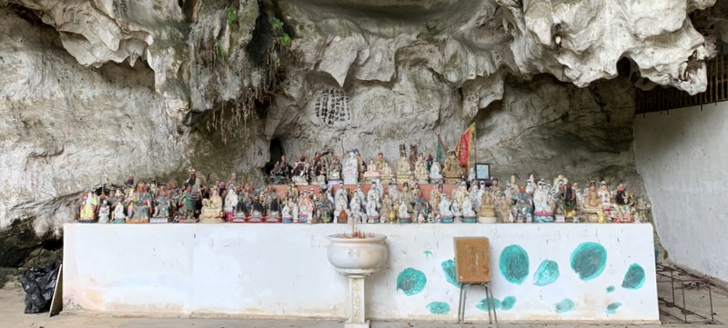
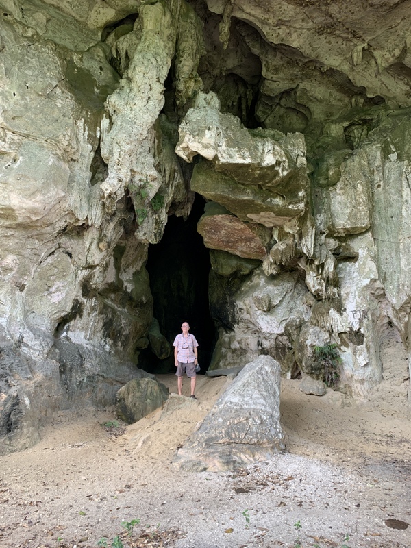
The entrance of the temple
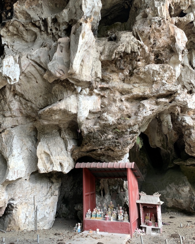
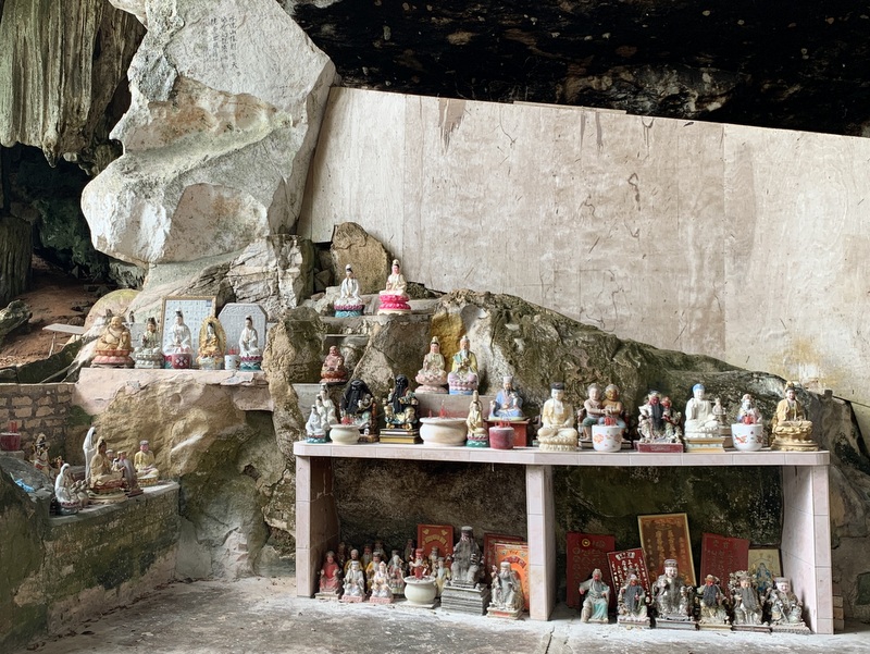
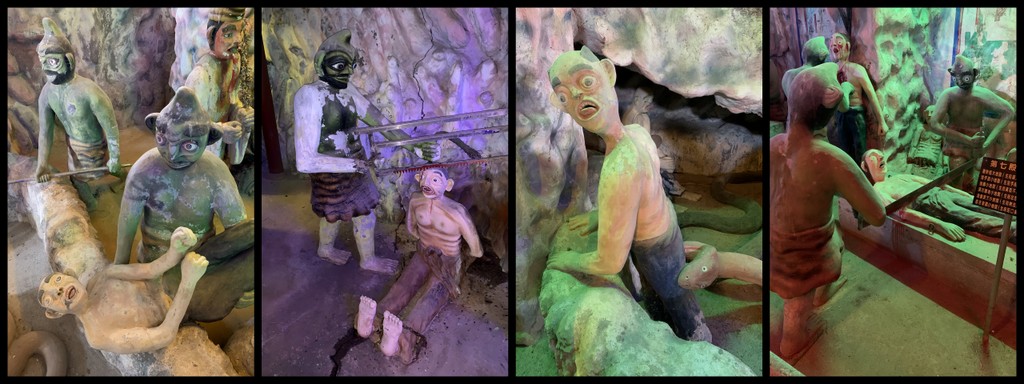
The temple complex is partly built inside a limestone cave. Overgrown with trees. It is a Taoist temple dedicated to Guan Yin, the Goddess of Mercy. According to the FMT article more than 135 year old.
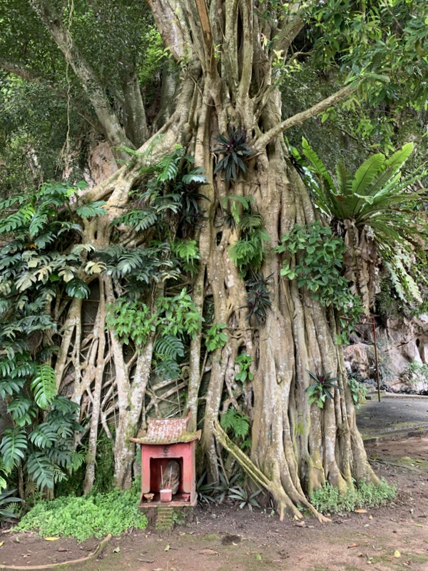
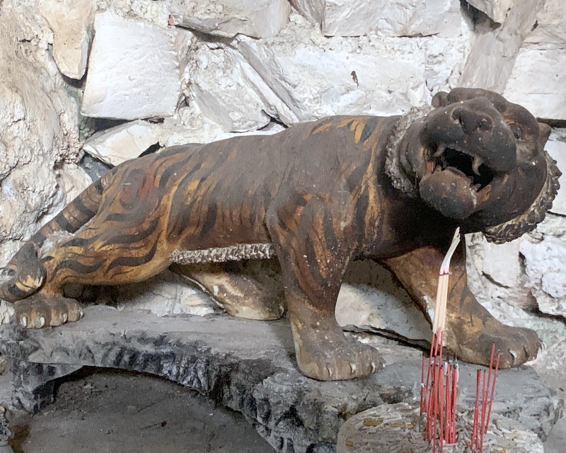
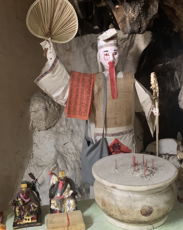
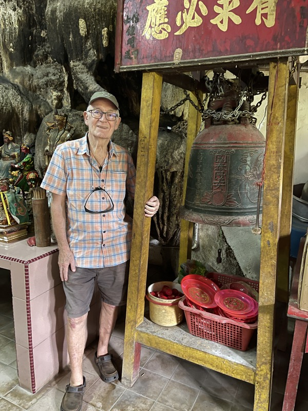
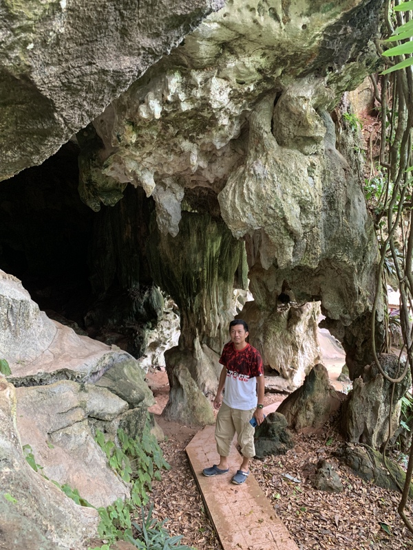
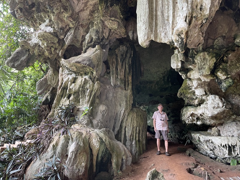
Here is a collection of pictures, taken inside and outside the temple.
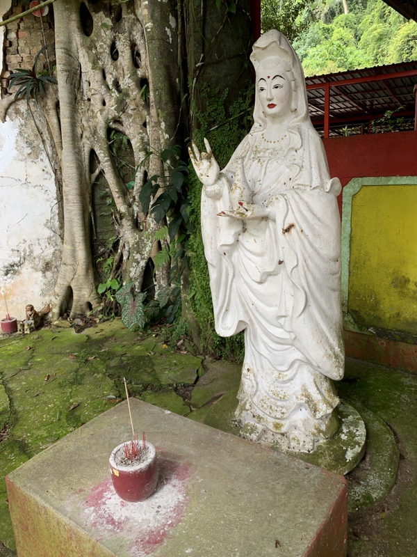
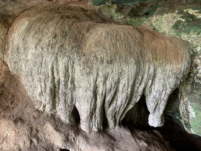
Guan YinNice flowstone formations
Left a statue of Guan Yin, right a statue of the White Guard, one of the Heibai Wuchang deities, escorting the souls of the deceased to the underworld.
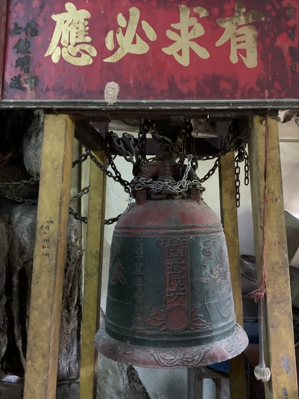
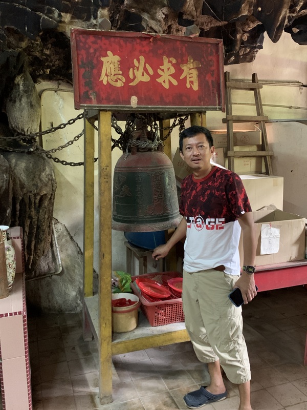
The friendly caretaker told us that the temple bell was quite old and that attempts have been made to steal it. The bell is now tied with metal chains to its scaffolding.
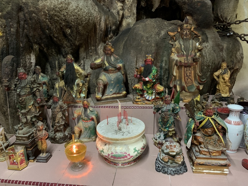
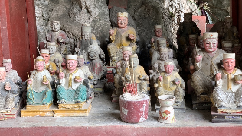
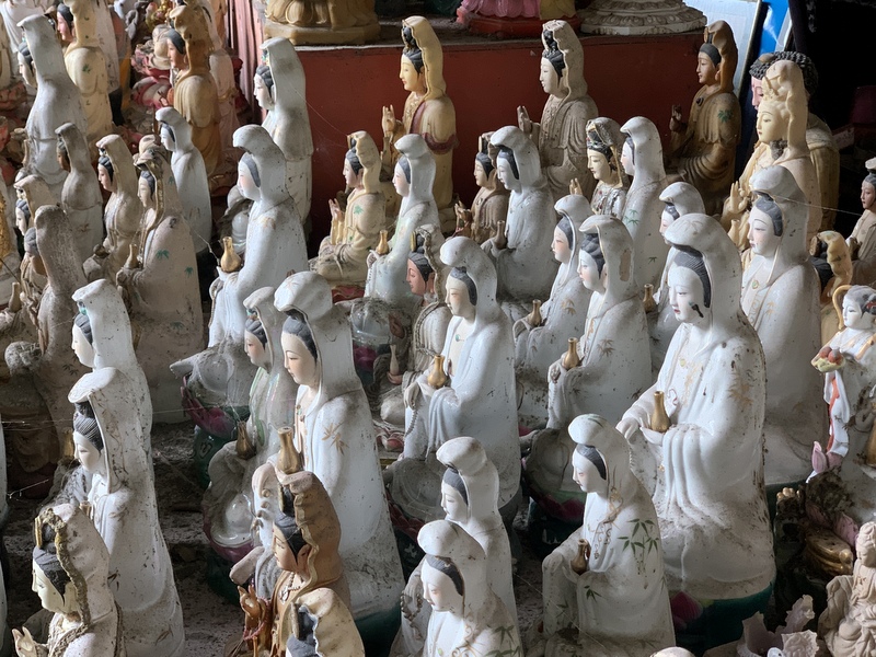
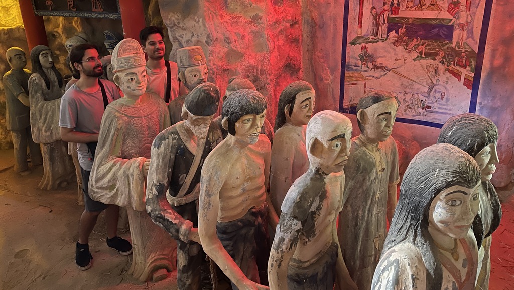
Next to the temple there is a fascinating collection of idols, left there by devotees who had no place for them in their home and didn’t want to destroy them.
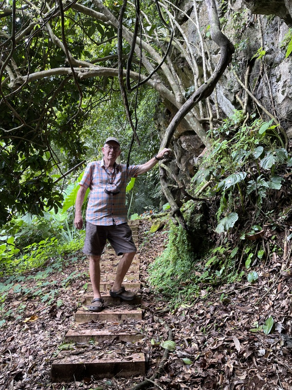
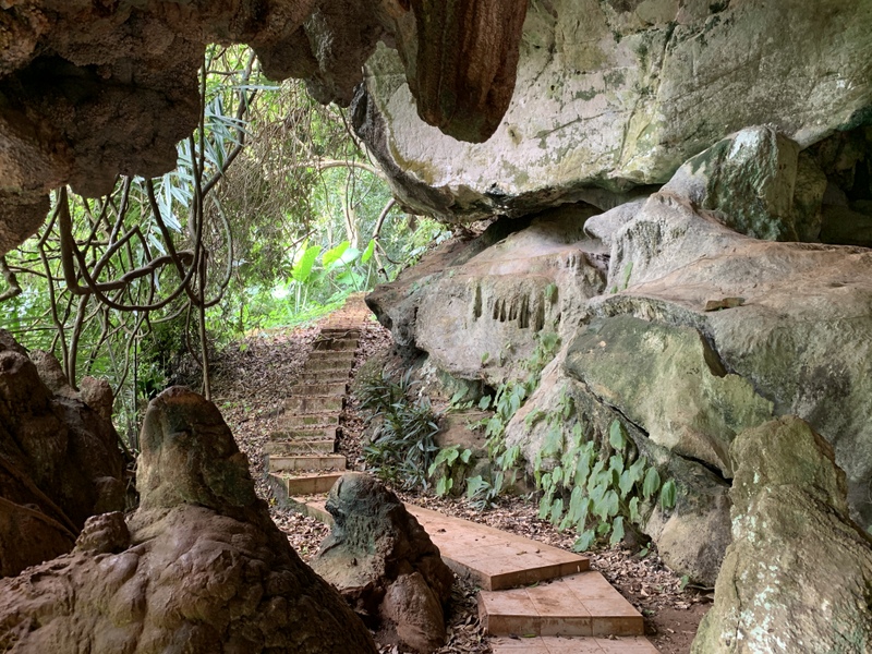
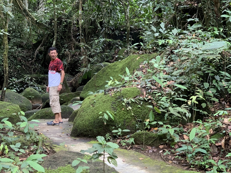
We walked around a bit, there are many small caves
It was a very rewarding visit.
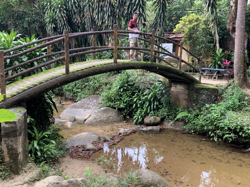
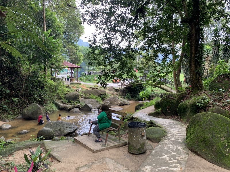
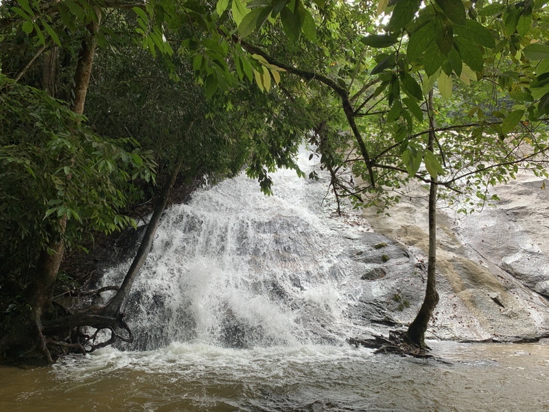
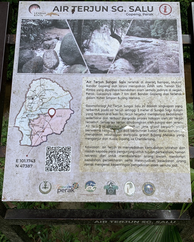
Quite near the temple complex there are popular waterfalls, the Salu Falls. We had a look at the lower fall, easily accessible on a cemented path
It’s only a short walk and you can see and hear the fall from some distance already.
Here is the waterfall. There are more upper tiers, but they are more difficult to reach..
The Salu falls have now been upgraded to the Taman Eko Rimba Sungai Salu. Taman Eko Rimba is a fashionable concept, you can find them now all over Malaysia..
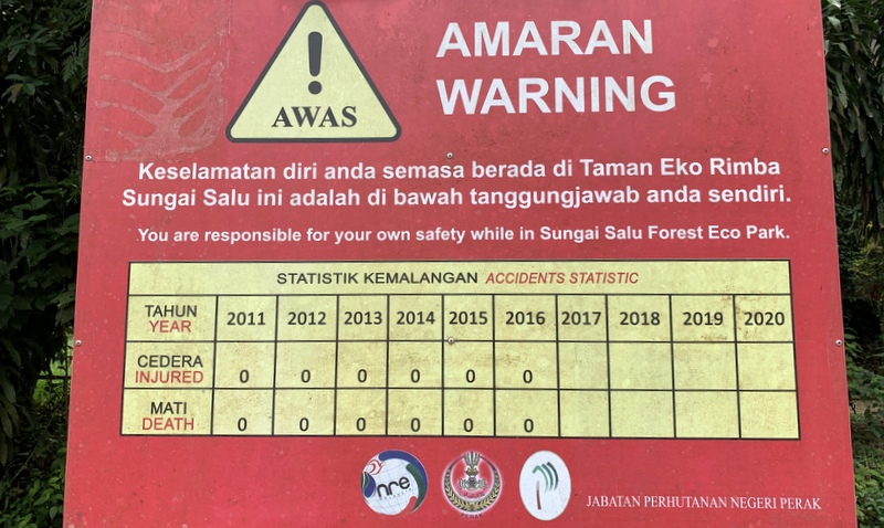
I had to smile about the warning signboard. Started in 2011, counting yearly accidents and fatalities. I guess that when nothing had happened in the following 6 years, they gave up updating the signboard.
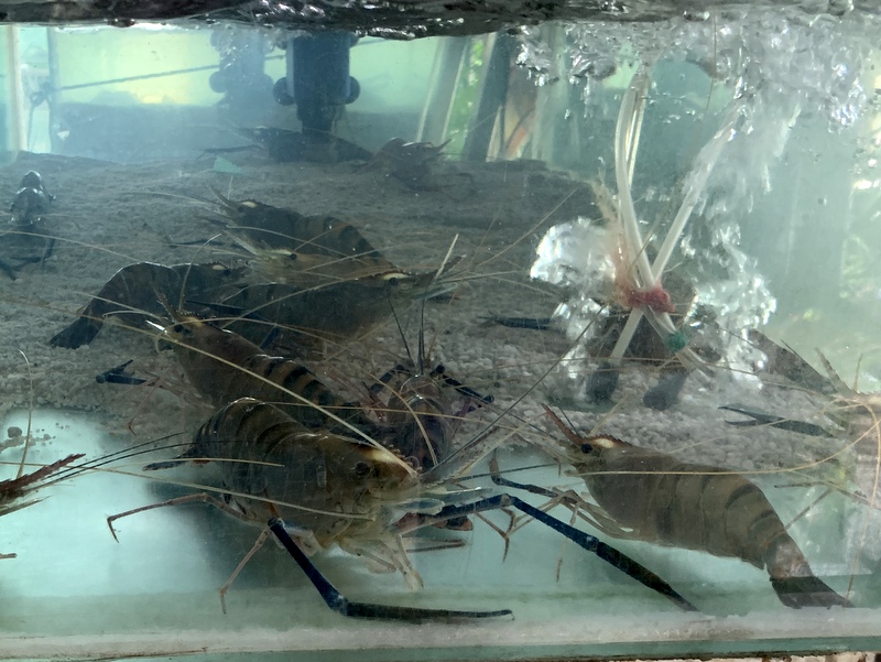
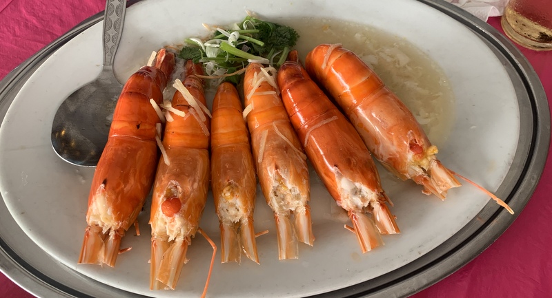
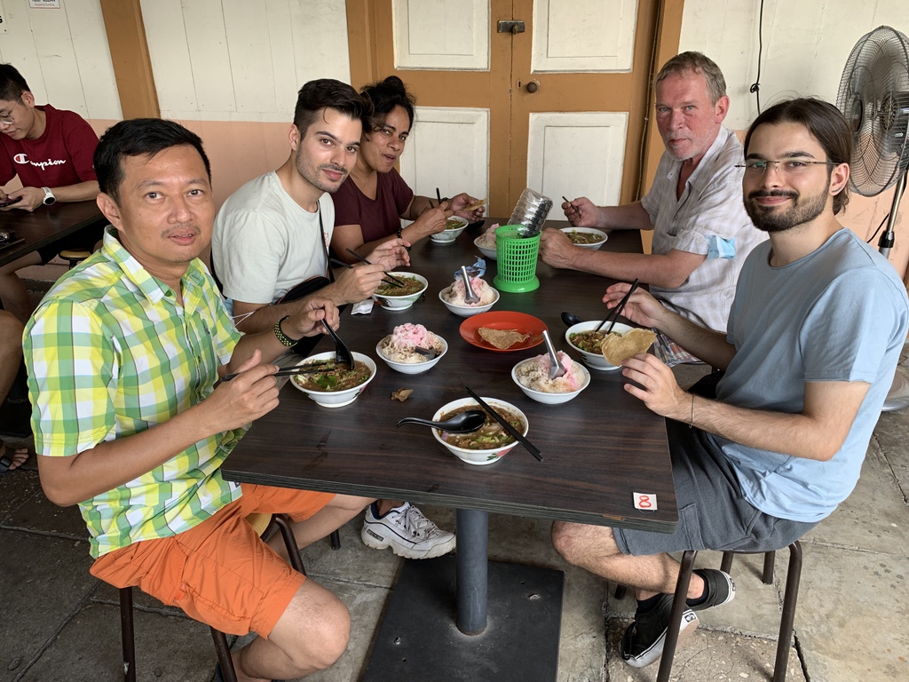
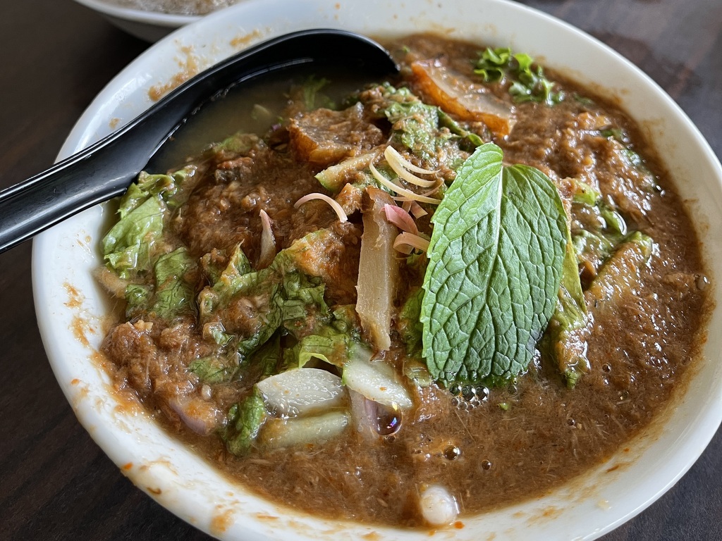
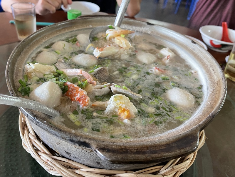
Time for lunch! We were not far from Tanjung Tualang, famous for its udang gala restaurants. We had our lunch in the You Kee restaurant. We knew that the prawns would not be cheap, but they were delicious, We had three big prawns each and there was Tofu and paku salad. The bill was RM 97, value for money.
paku saladtaufu
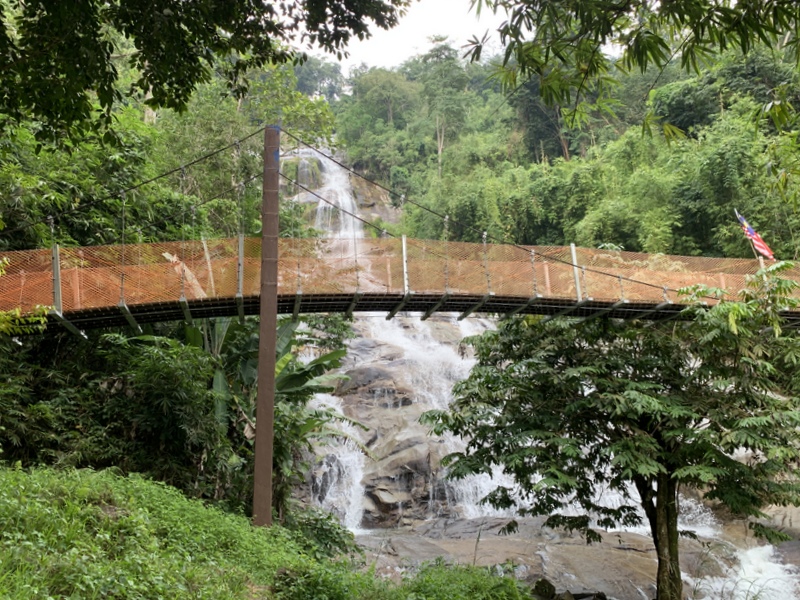
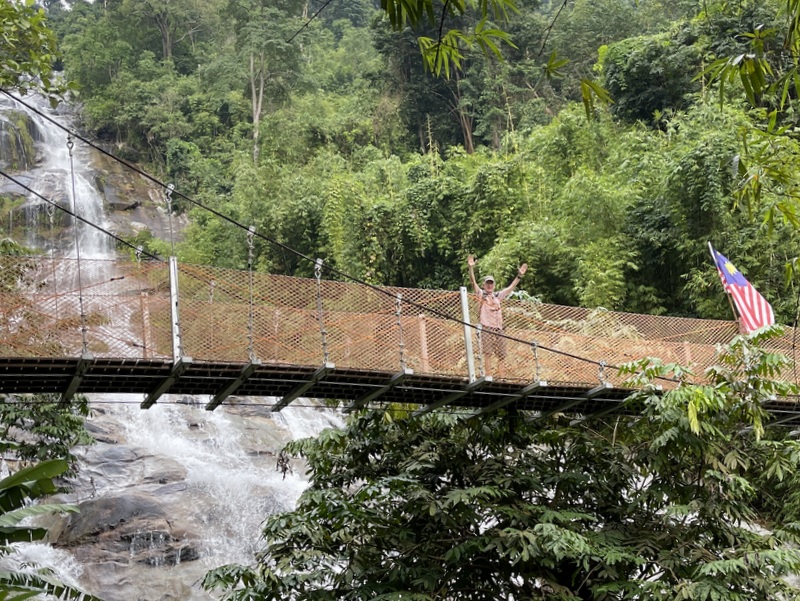
On our way back home we noticed that we were not far from the Lata KInjang waterfall. Most Malaysians will have seen this waterfall, driving on the North-South highway. Not many will have visited the falls. Also these falls have been upgraded and are now named Taman Eko Rimba Lata Kinjang. Access is not cheap, we paid RM 21! (Foreigner RM 10, Malaysian adult RM 6 and car park RM 5). Here are some pictures. It was already a bit late in the afternoon, we just walked to the hanging bridge and back again. We reached our car just before it started to rain.
Notice me on the bridge
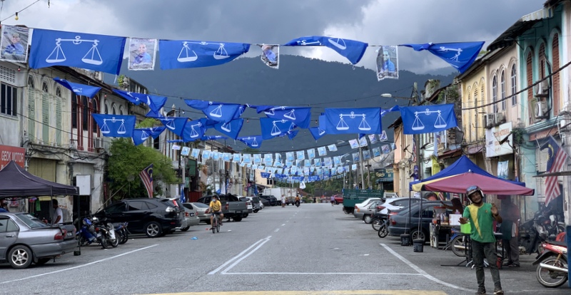
We made this trip on 16 November 2022, three days before the GE15 elections. This is the small town of Chenderiang, near Lata Kinjang.
A rewarding day trip, very Malaysian. A combination of Culture, Nature and Food. Malaysia Boleh!
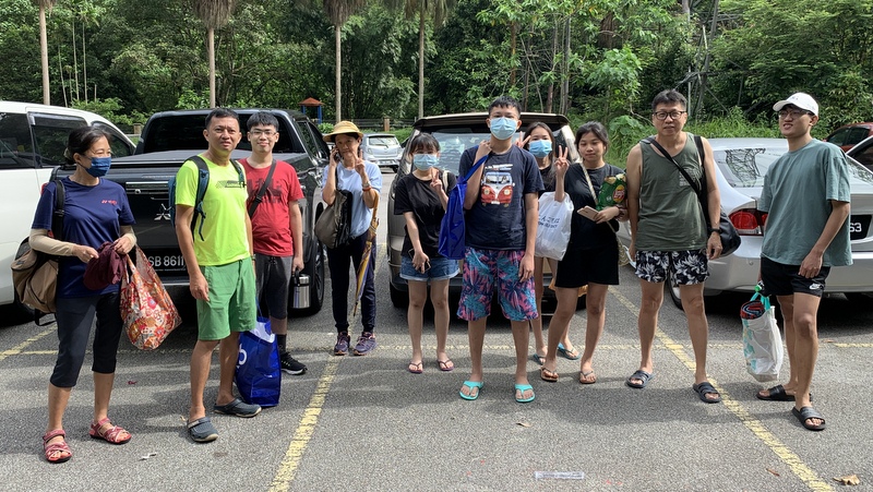
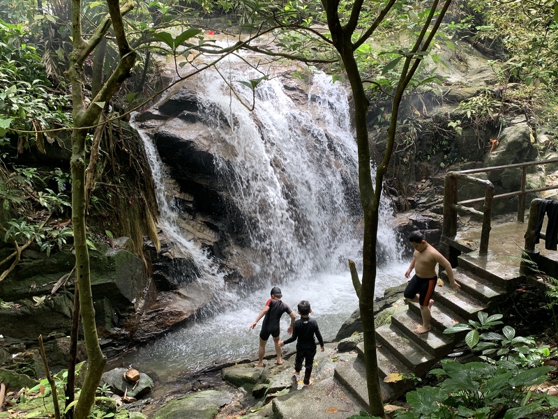
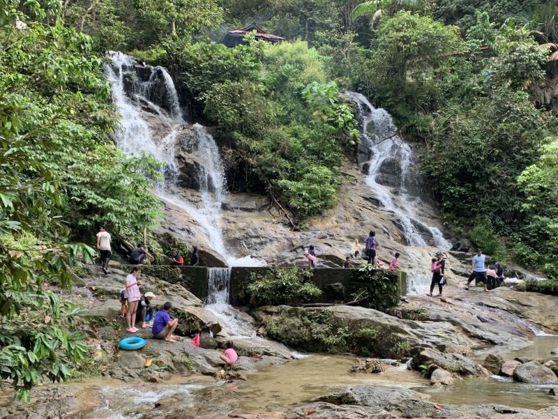
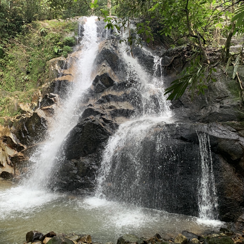
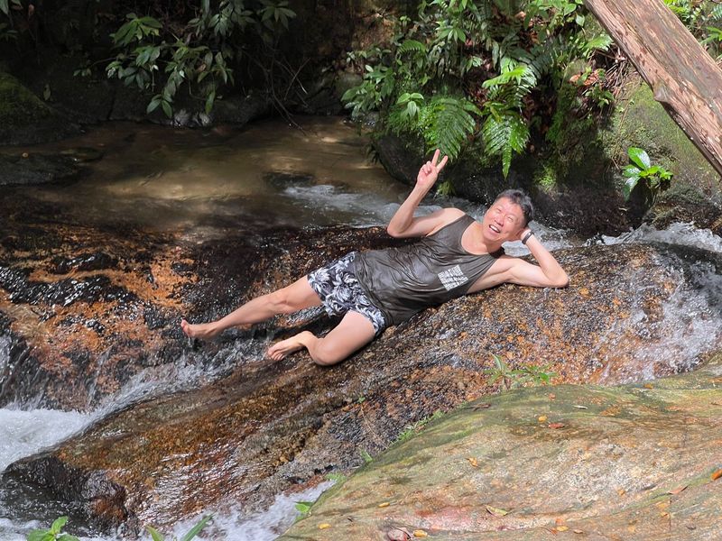
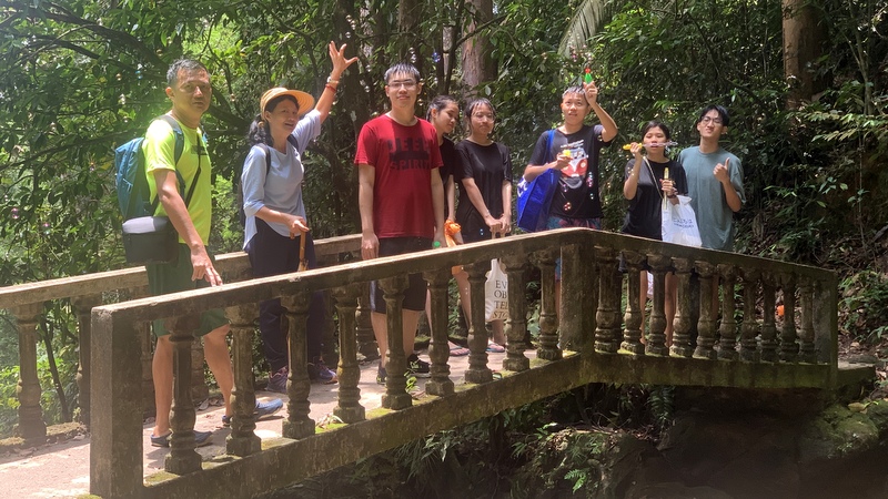
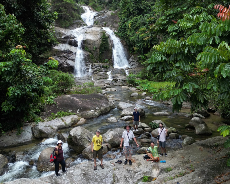
For a long time there has been a plan to visit a waterfall with Aric’s family, but it was not easy to find a suitable date. As 10 October was a holiday, we decided to make a trip to the Kanching waterfall between Selayang and Rawang. When we arrived at the carpark, it became clear that we would not be the only visitors, it was full, we had to drive a bit further to an additional parking. Here we are ready to go, notice the many bags with food for the picnic 😉
There are 7 waterfalls (and 2 more far upstream). Here are the first and the second fall.
The third fall, the Kapor fall, is the most popular waterfall. Too crowded, so we walked further up.
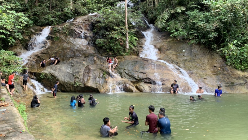
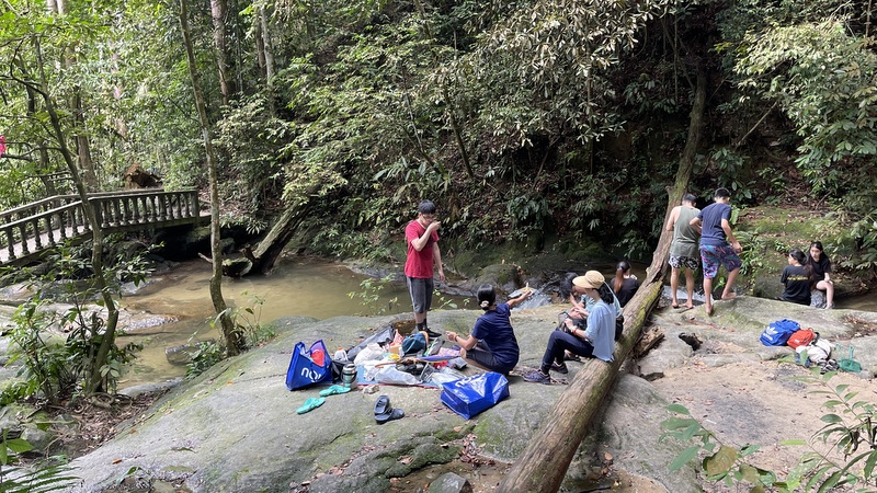
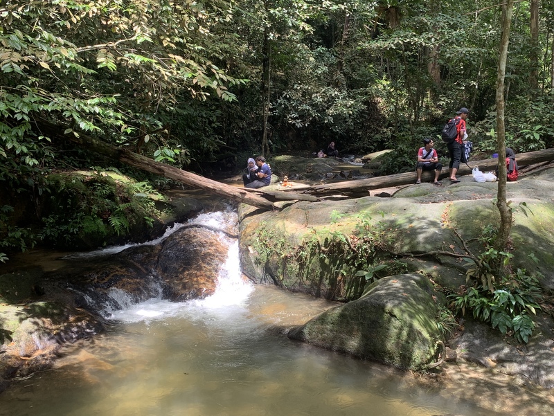
Where the cemented steps end, a trail continues, we expected that less people would hike that far. And that was the case, but there were still many people at my favorite fall no 5. I managed to take a picture of the fall without people!
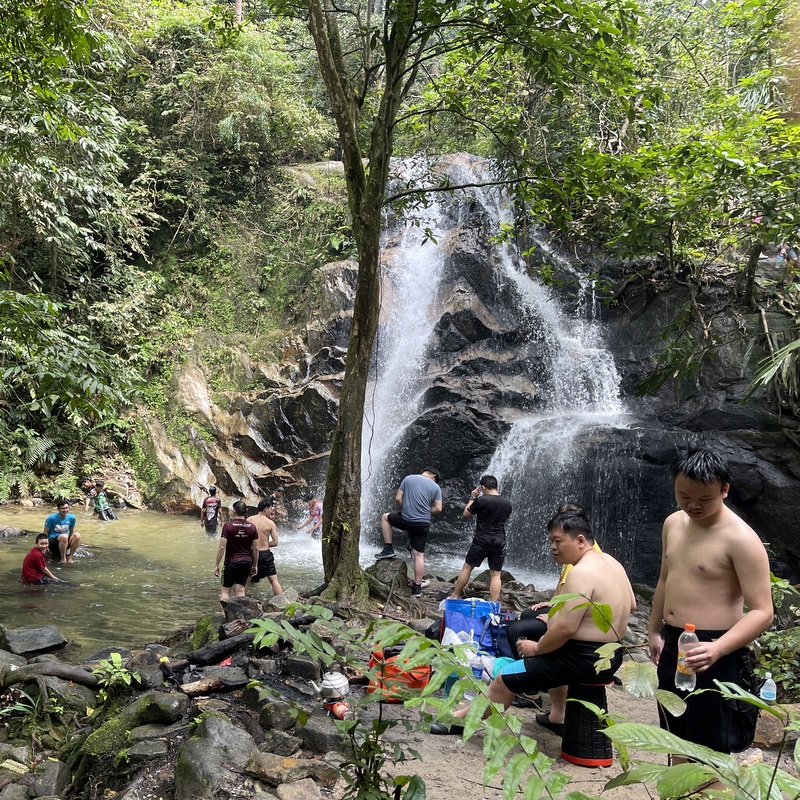
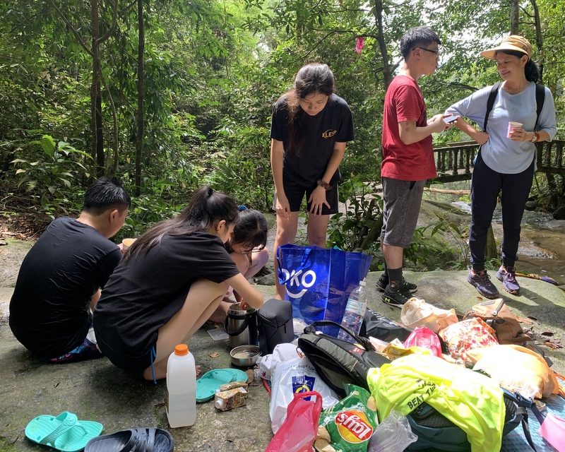
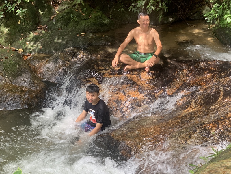
We found a suitable, more quiet place between fall 4 and 5, a big rock where we could enjoy our lunch.
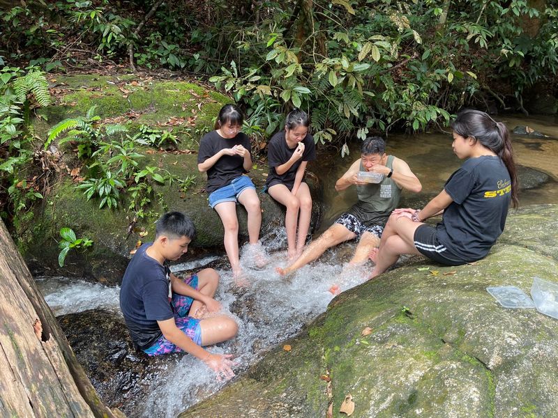
There was a small cascade next to our rock, a perfect place to enjoy the cooling water.
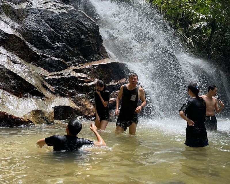
A few of us went for a while to fall no 5 to take a shower.
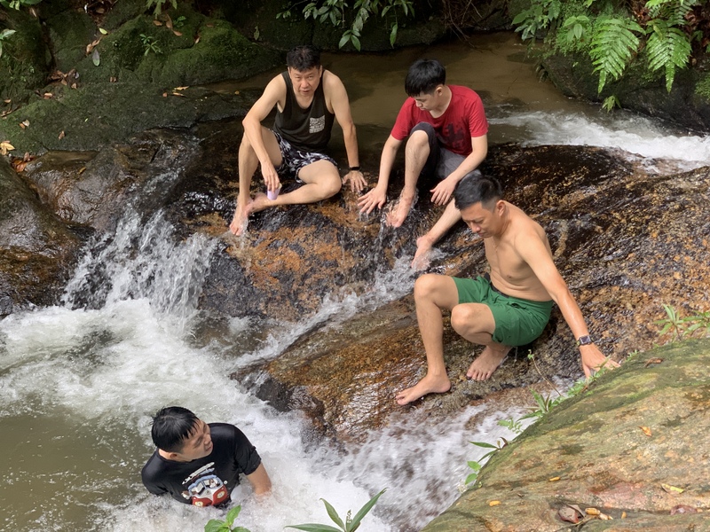
During my waterfall hikes I always liked to leave a stone marker at the waterfall. Here there was no need to do that because another visitor had already built two ones. In the right picture Zhi Le is blowing bubbles..
Ready to walk back.
Two views from the bridge. Left the rock where we had our picnic ( of course we left no rubbish) and the small cascade . Right looking down to fall number 4.
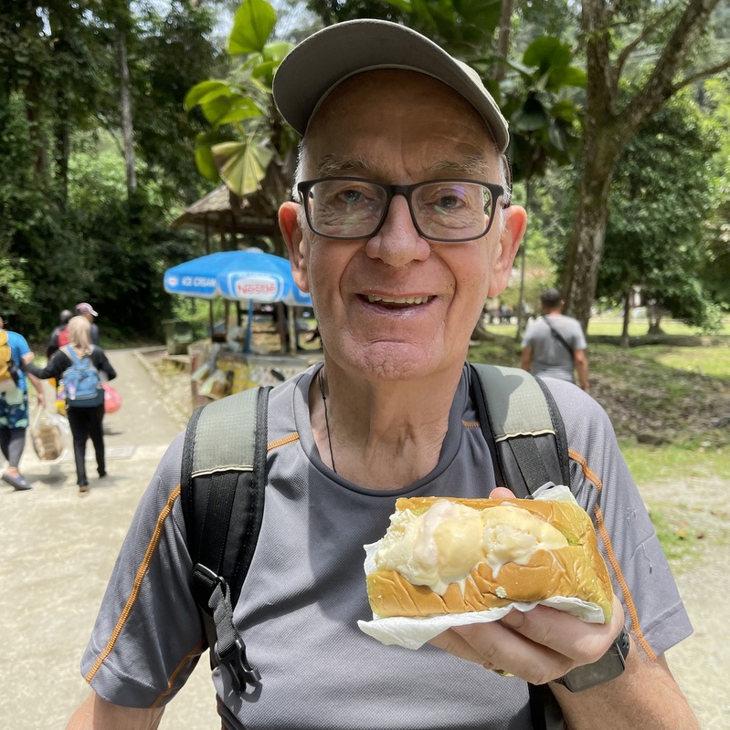
The Kapor fall was even more crowded now. Near the entrance we met an ice cream seller, I could not resist the temptation to have a roti ice cream 😉
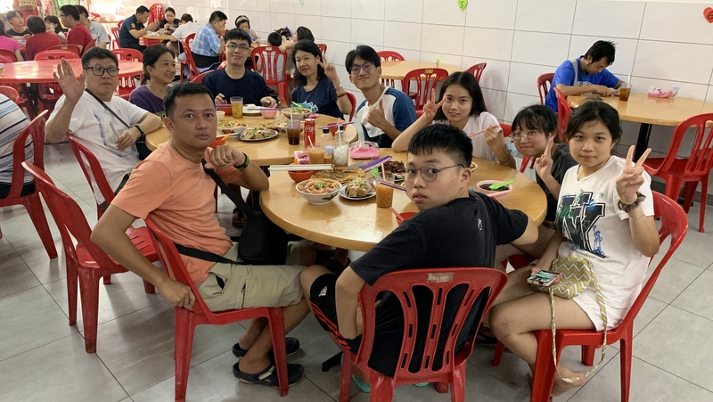
We were still hungry and decided to go to Restoran Tom Yam Serendah, where we had enjoyed nice food several times in the past. Then it was a small basic restaurant near the main road, but now it had moved to a new location, very clean but less atmosphere.
The food was ok, although the tom yam not as nice as before. Still cheap, RM 180 for 11 pax!
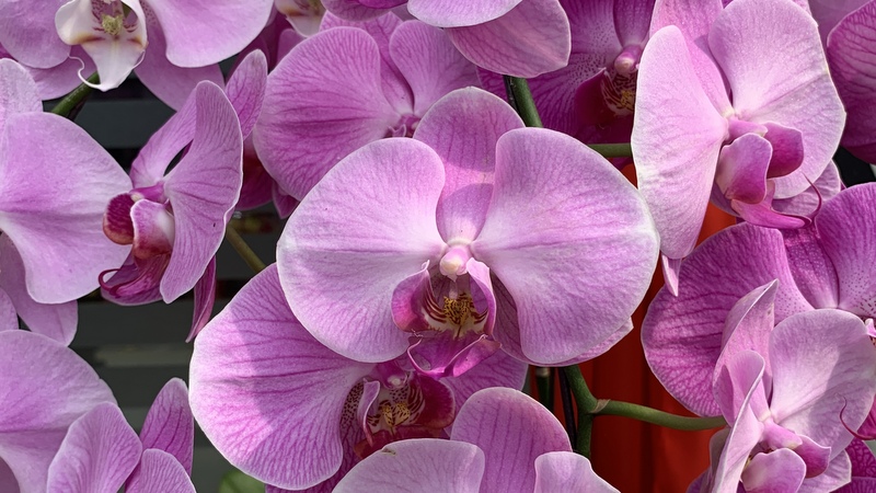
After our lunch we were in the mood for coffee, we decided to visit the World of Phalaenopsis , which not only has orchids, but also a nice café. However, here there was again a massive crowd, so we only walked around and bought an orchid to take home.
Driving back we looked for a kopi tiam, but we were not lucky. Finally we ended, almost home, in the DIB restaurant in Damansara Perdana. DIB stands for Deaf In Business, it is a relaxed, very friendly place, where we come regularly.
We had coffee, I was not yet hungry, had only a waffle with ice cream
it was a very nice outing, worth repeating (but preferably on a weekday)
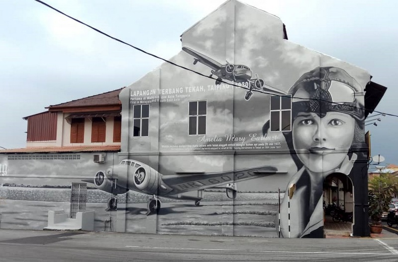
In September 2019 I published two blog posts about Amelia Earhart, the American aviator, who flew over present-day Malaysia from Bangkok to Singapore on 20 June 1937. A mural had been created in Taiping, honoring her landing on 20 June at the Taiping Aerodrome for a refueling stop.
Here is a bit more information about how the confusion started./
In 2007 a Wikipedia contributor, Andrew Kidman, starts a topic Taiping Airport. He adds content in the following years, for example on 1 February 2009 :
” … The airport also achieved fame through the famous American aviator, Amelia Mary Earhart in 1937, when she was doing her world flight and stopover at the Taiping Airport for refueling petrol. Amelia Earhart was doing her flight route from Thailand to Singapore, her permission to land at Taiping Airport was allowed on 7 June 1937 by the then Resident-General of Malaya….”
The second sentence is correct, the first one is his own conclusion and erroneous. His last edit of Taping Airport was in April 2009, he is not active anymore, I have tried to contact him, without success.
Yes, Amelia Earhart received a letter on 7 June that she was permitted to land at the Taiping Areodrome. Does that make Taiping at least a bit special? To make clear that this was mot the case, we must keep in mind that in 1937 Malaysia did not exist, it was British Malaya, consisting of the Straits Settlements , the Federated Malay States and the Unfederated Malay States, Crossing the airspace of British Malaya, Amelia needed several authorizations. In my second blog copies of these letters are shown. Each gives authorization for a specific period (‘in or about June’) and mentions the airports where she is permitted to land. Here is the list, with date of the authorization letter and the airports. Kedah and Johore were unfederated states and had to give authorization separately.
15 June Straits Settlements (Penang, Singapore)
.7 June FMS (Taiping)
17 June Kedah (Alor Star)
17 June Johore (Batu Pahat)
Taiping was just one of the five airports where she was allowed to land. But she did not , as is clear from the book Last Flight. In her report she mentions a few times Alor Star (We checked over Alor Star airport but did not stop, and headed for Singapore)
Amelia Earhart never landed in Taiping and had no intention to do so
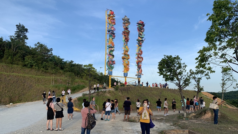
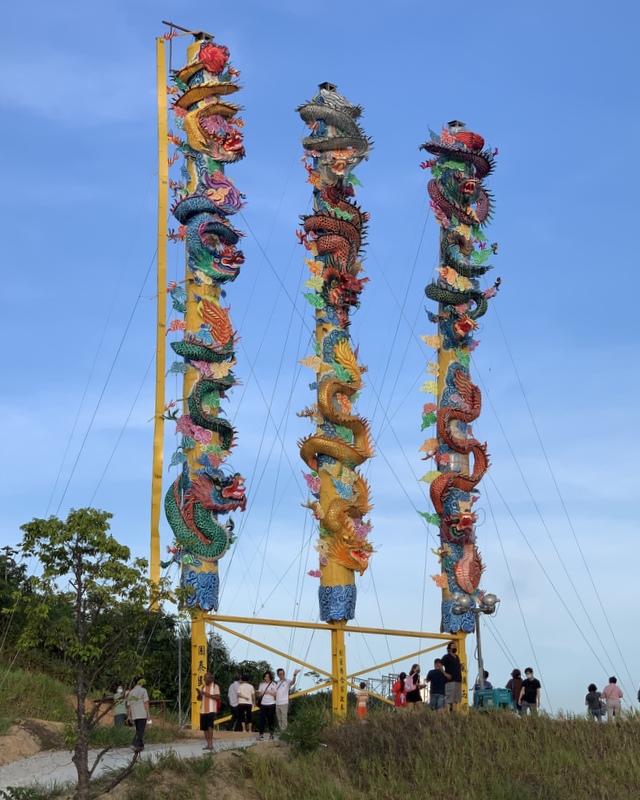
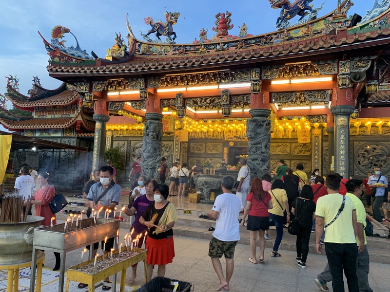
After Aric had heard that a temple near Kuala Pilah had built three giant joss sticks for an upcoming festival., he suggested that we should go there and have a look. Kuala Pilah, in Negeri Sembilan is quite far from KL and it took us almost two hours to reach the temple. The temple is located about 7 km sount of Kuala Pilah, along the road to Tampin. We were not the only visitors, there was a massive crowd. Well organised, we followed instructions to find a parking place.
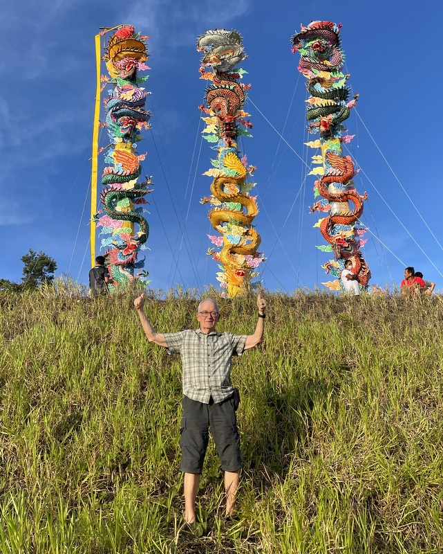
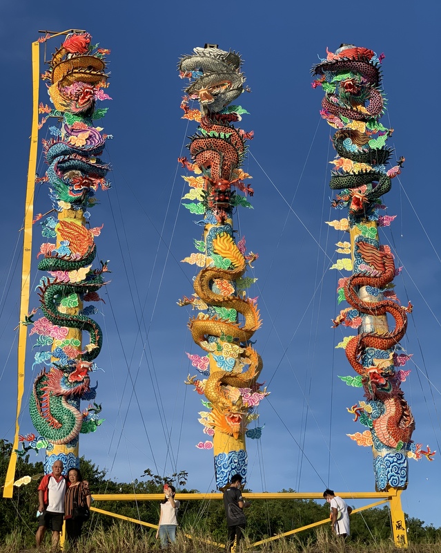
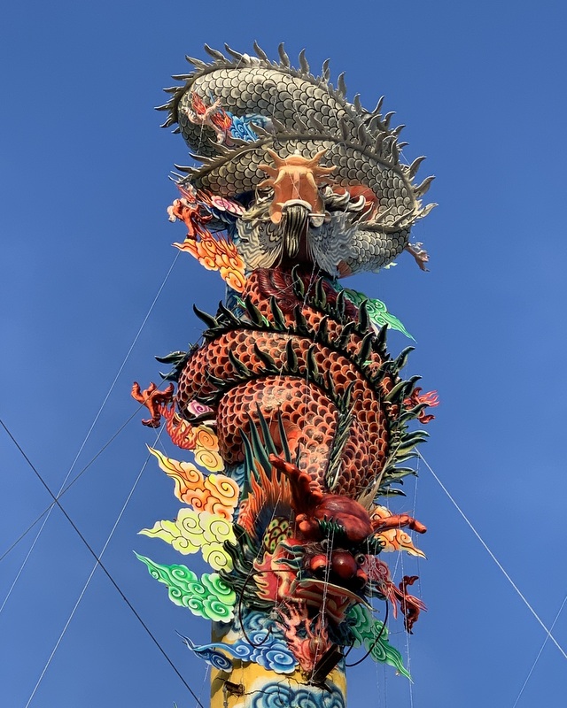
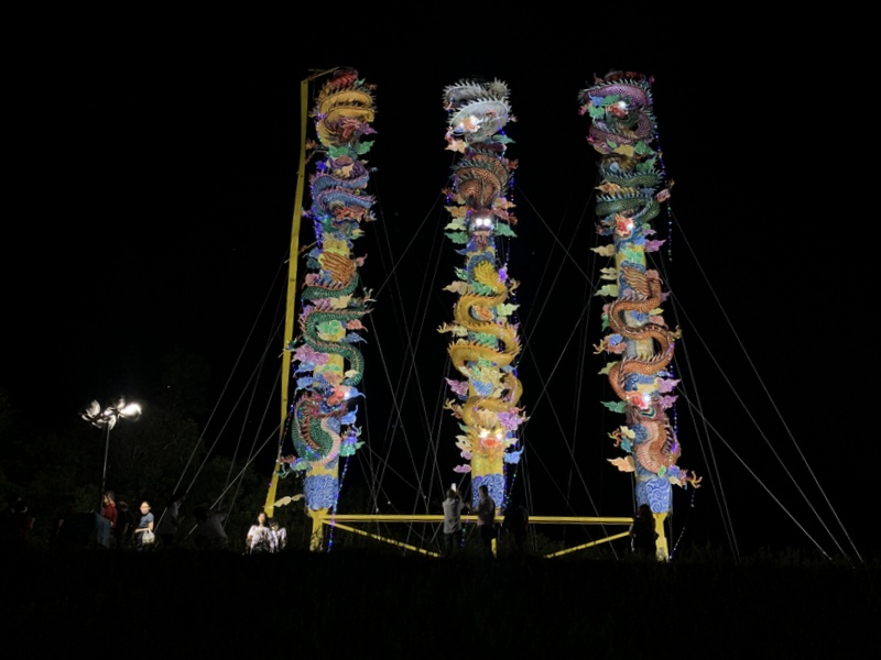
We started our visit with the giant joss sticks. And huge they are, almost 20 meter tall. Visible from far away.
.The yellow ribbon left is a tape measure. Starting from 0 m at the top until almost 20 m at the bottom.
Beautifully decorated with dragons. Here are details from the three sticks
Left the top part of the center joss stick. Notice the many supporting cables in the right picture.
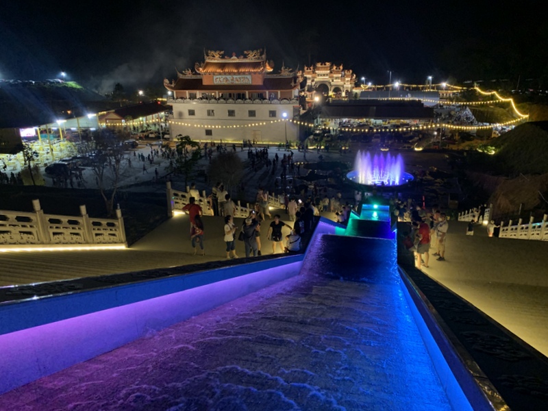
There is a lot more to see in this Si Thean Kong temple. It is a Taoist temple, dedicated to the Nine Emperor Gods. Originally it was located in the center of Kuala Pilah, but moved to this new location in 2015. Still not yet completely finished, there are plans to add a pagoda, but already quite spectacular.
The Nine Emperor Gods festival takes place in the beginning of the ninth lunar month, culminating on the ninth day. This year that will be on 4 October and that explains the huge crowd of devotees. On that day the crowd will be much larger. Usually the temple will be more quiet, see this YouTube video.
Here is a drone video of the temple complex, taken by Aric.
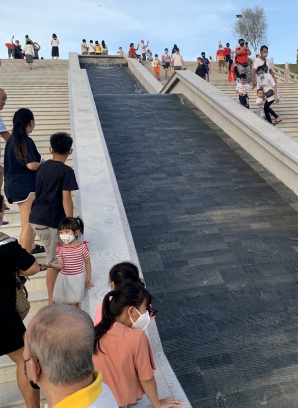
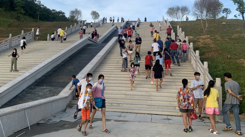
We walked down from the joss sticks to the main temple.
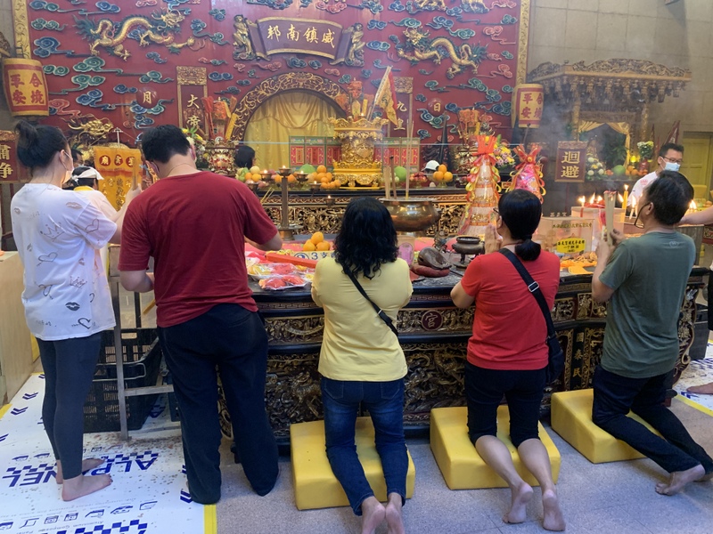
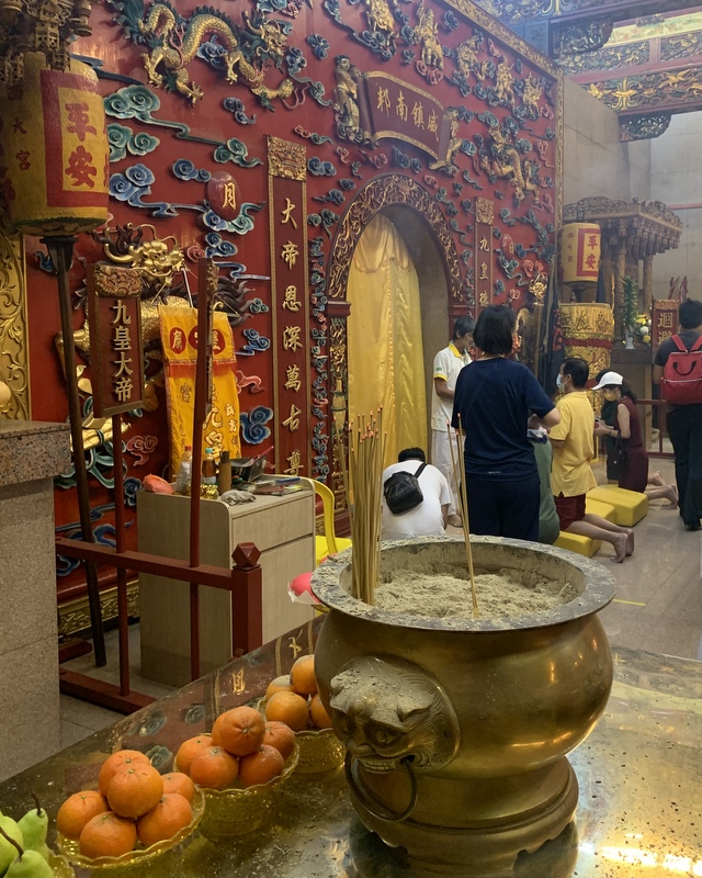
The main temple
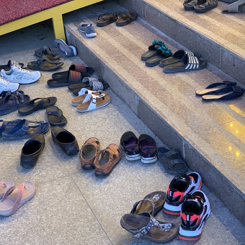
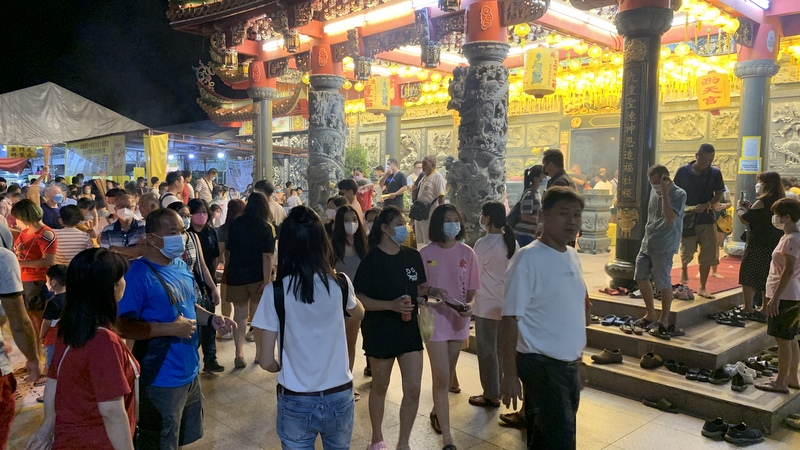
Inside the temple you have to take off your shoes. Better remember where you left them, with this crowd it might be not easy to find them back. You can give a donation for the ongoing construction.
After visiting the temple we walked around. Well organised. Here a view of the monumental entrance arch. Tables and chairs for the visitors to rest.
And eat! There was a hall were free food was served, I had a plate of mee goreng , while Aric was busy droning. The right picture shows a contraption, where a waterspout would rise in the air when you blew in the horn. Not related to the Nine Emperor Gods, just fun for young and old.
I took a short video of the horn blowing.
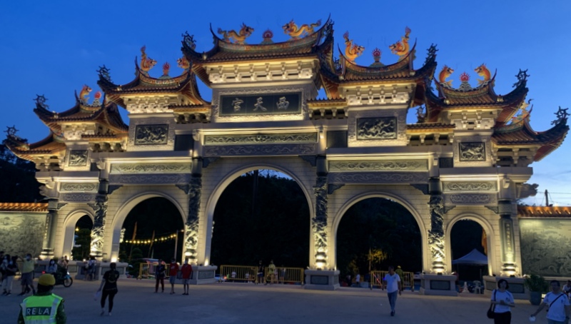
Here is the monumental stone arch, the biggest in Malaysia and already in the Malaysia book of records.
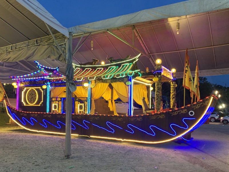
View from the roadside. At the main event on 4 October, there will be a big procession, where the “boat” in the right picture will take part.
We made another round, climbing up to the joss sticks and down again to the crowd
Aric took another video of the temple complex.
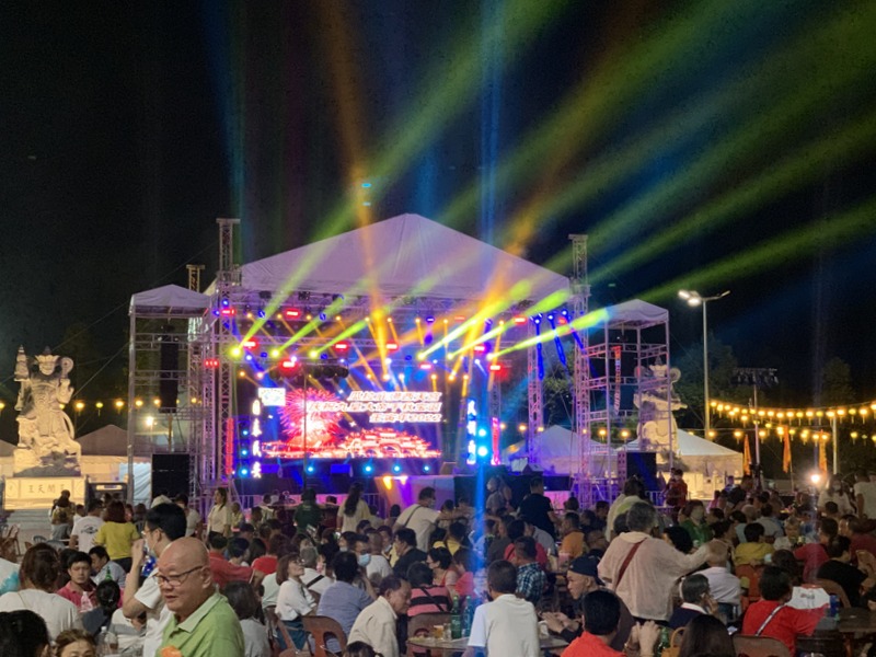
The crowd had grown a lot
There was entertainment, left a traditional Chinese opera, right a modern light show.
There were also many food stalls, but with very long queues, so we gave up, walked back to our car and had a late dinner at a Malay stall in Kuala Pilah.
This temple will become a major tourist attraction in Negeri Sembilan and even in Malaysia. Many of my friends are not yet aware of this place.
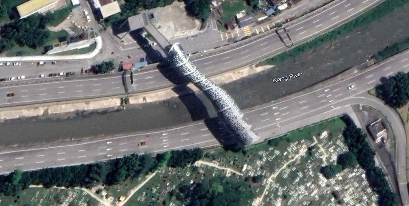
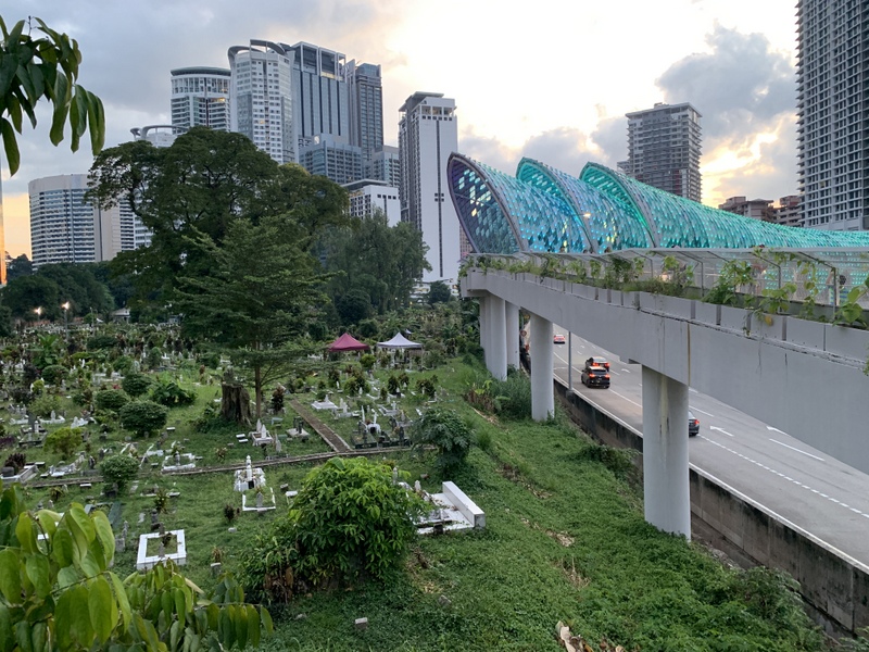
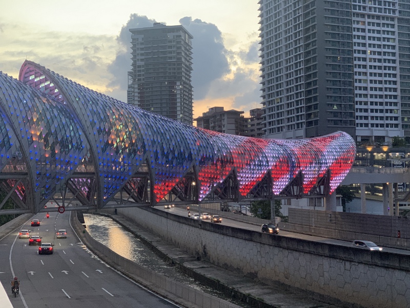
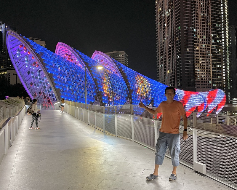
The Saloma Bridge is a pedestrian bridge crossing the Klang river and the AKLEH highway. It connects KLCC to Kampong Baru and was opened in 2020. Here is a Google Earth screenshot.
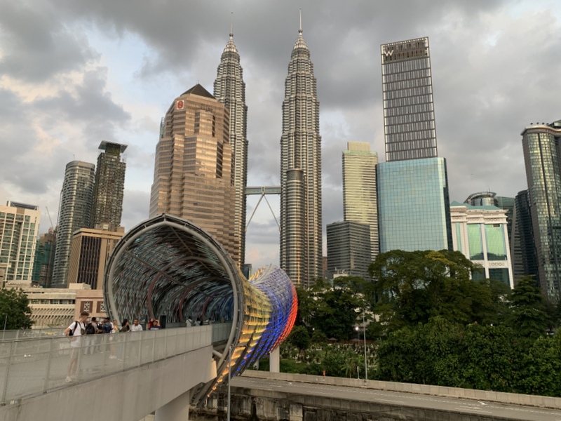
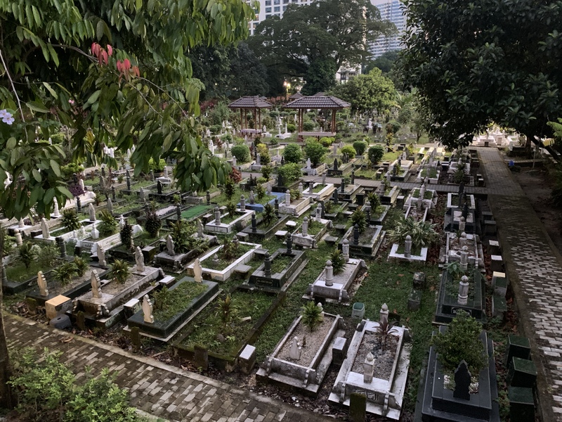
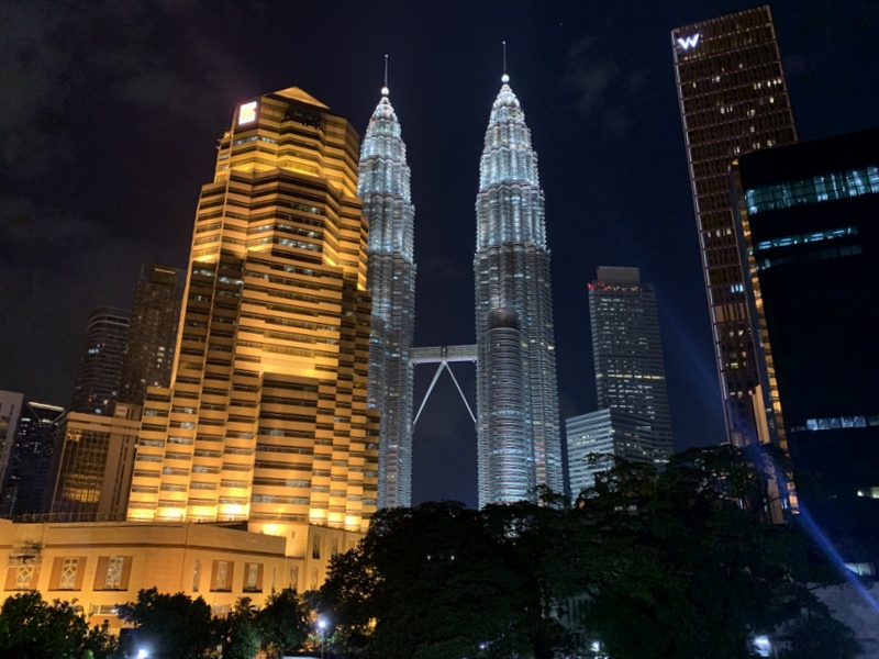
The bridge is walking distance from the Kampong Baru LRT station. The left picture shows the bridge from the Kg Baru with the Twin Towers in the background. The right picture is from the KLCC side, the bridge ends at an extensive Muslim cemetery, an elevated walkway leads you around it
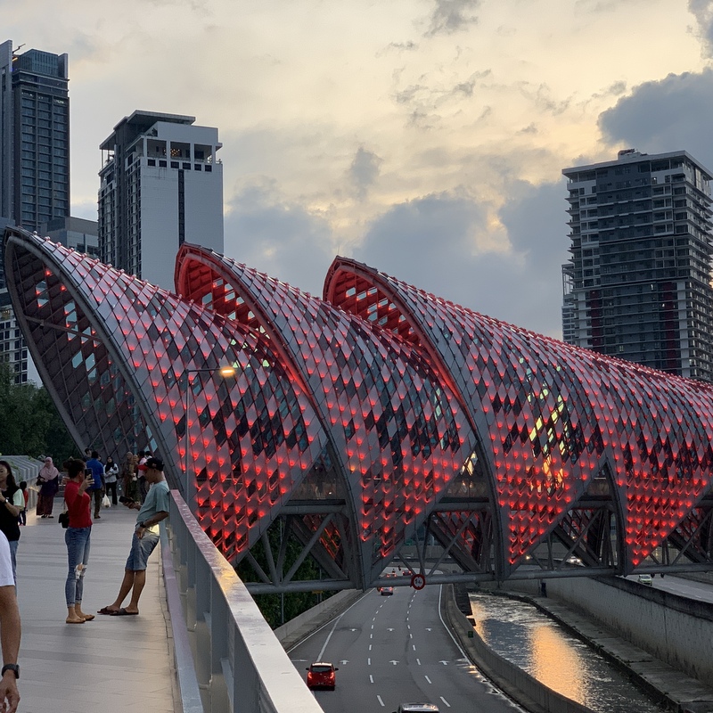
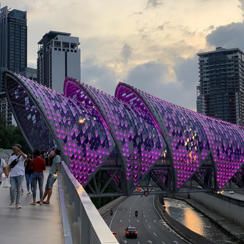
The bridge is brightly lit, it has become a tourist attraction, especially in the evening. The colors change all the time. No wonder that all visitors take many photos.
Here is a video of the bridge with the changing colors.
More photos. THe red color is the most brilliant, The light patterns on the bridge change all the time, sometimes showing the Malaysian flag.
Here is a video with the flag. Notice how the flag is waving 😉
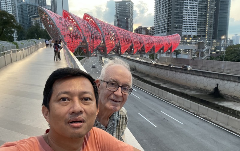
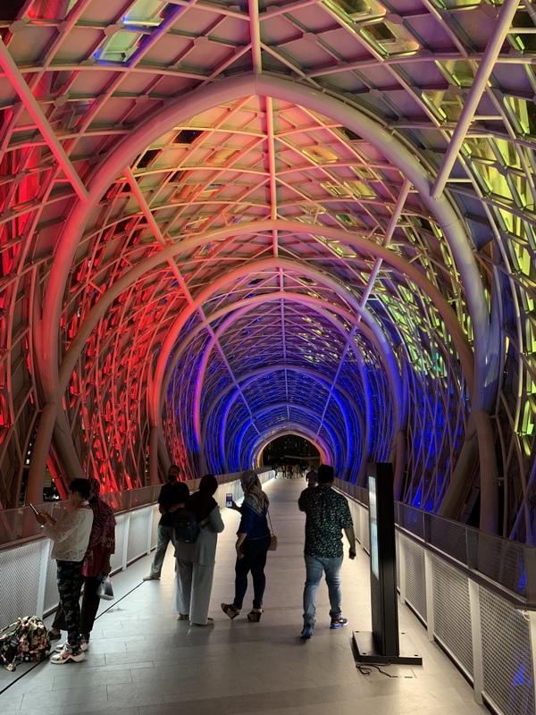
Walking in the “tunnel” of the bridge is also interesting.
After a last picture we crossed over to the Kg Baru side, where we had dinner in a Malay stall. Nice food, chicken, sotong and veggie plus drinks RM 32,
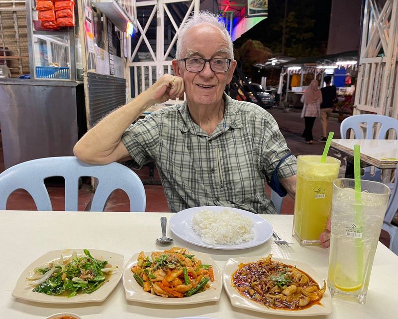
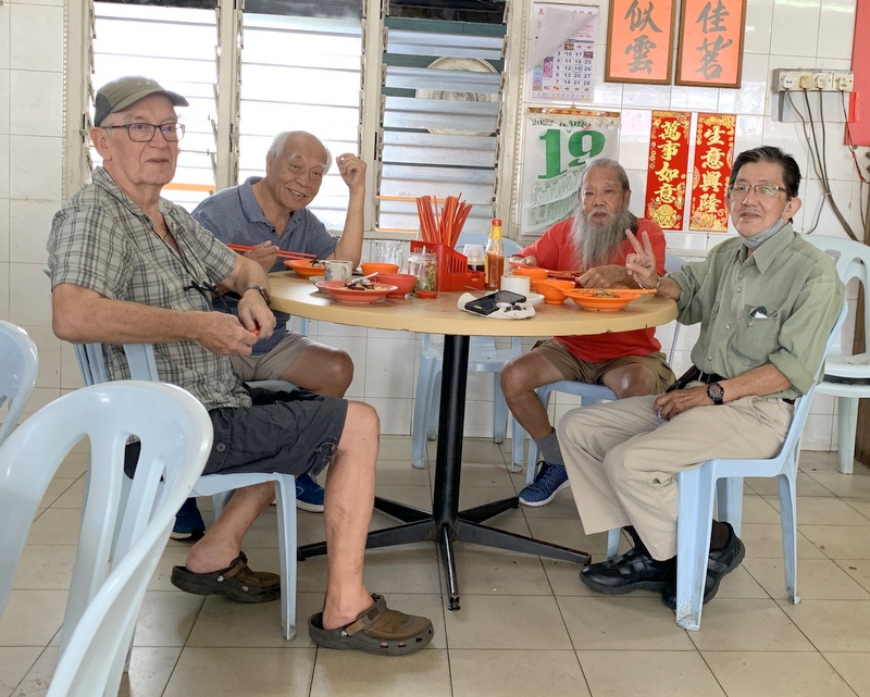
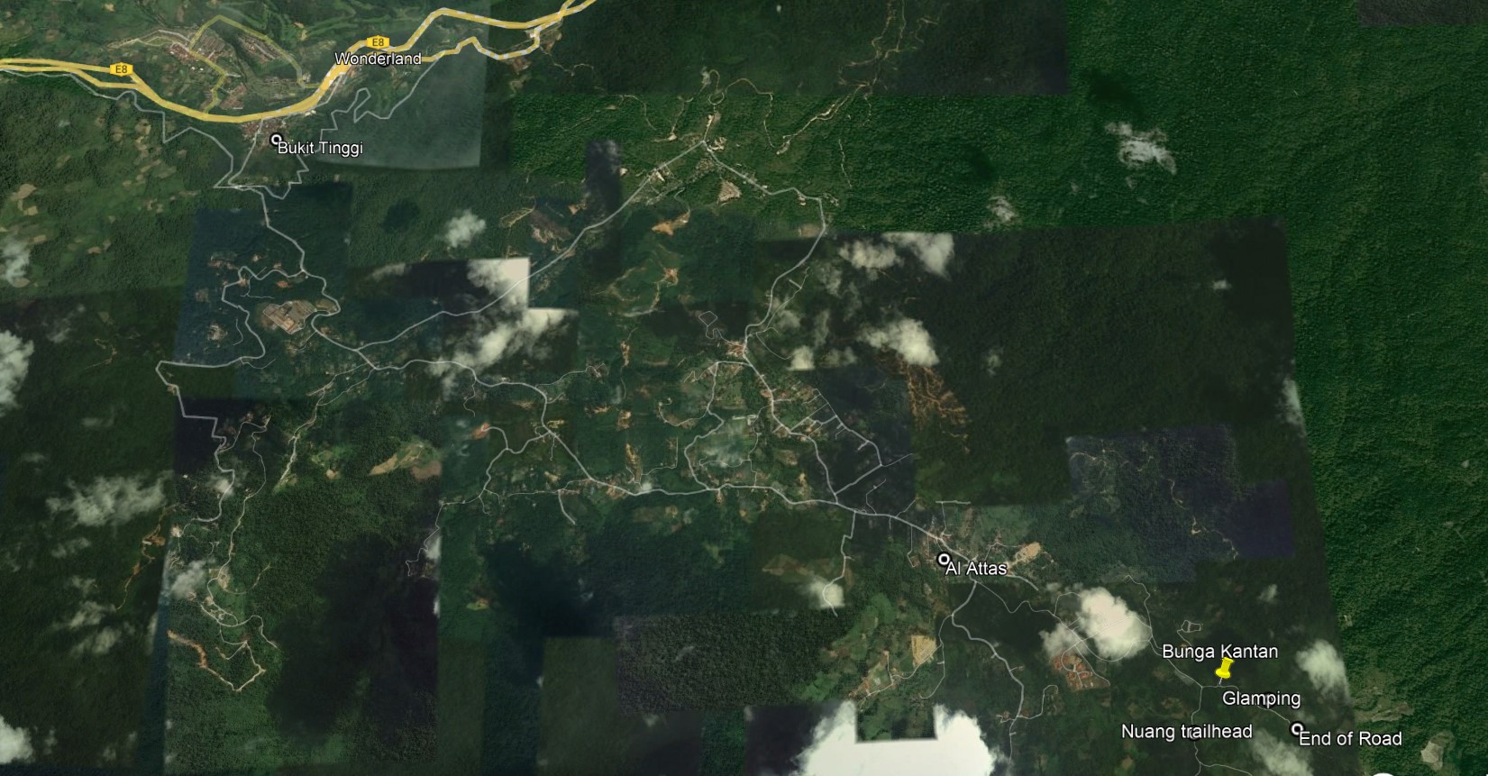
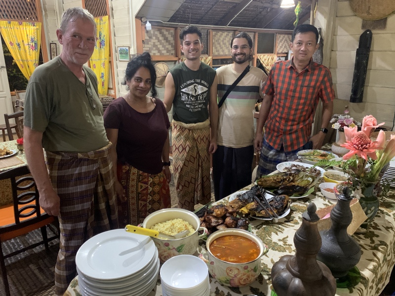
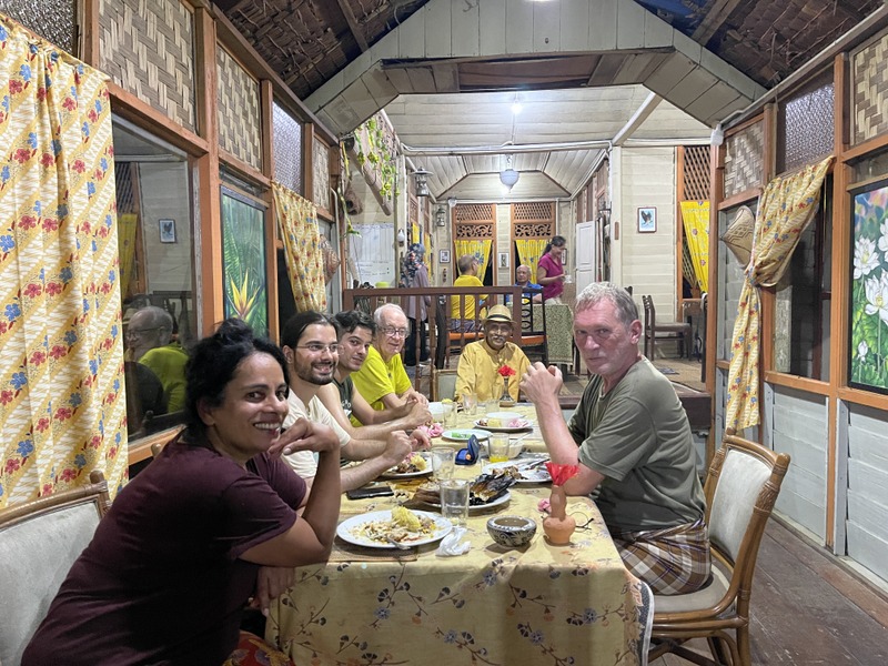
The last trip of the Gang of Four (Khong, Stephen, George and Jan) was in January: The Gang of Four in Kampar. High time for a new outing. Khong suggested Janda Baik with a visit to the garden of Al Attas and of course nice food,
We started with a late breakfast of wantan mee and coffee in Bukit Tinggi, a charming village beside the highway.
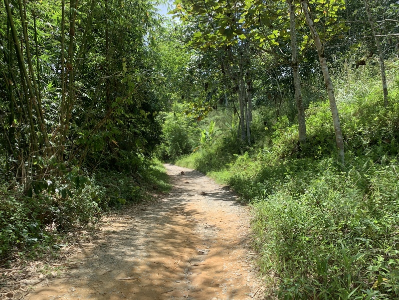
Khong knows the region well and drove us deep inside the Janda Baik region, until the end of the road
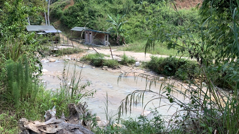
IIt was a long time ago that I had visited Janda Baik and I was a bit shocked about the “development” that had taken place. Everywhere resorts and campsites. A funny kind of campsites, meant for town people who are afraid of nature 😉 I love camping, see my blog Waterfall Camping, but this kind of “glamping” is not my cup of tea.
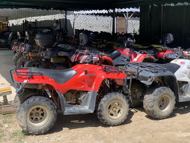
And of course there are places where you can rent ATV’s.
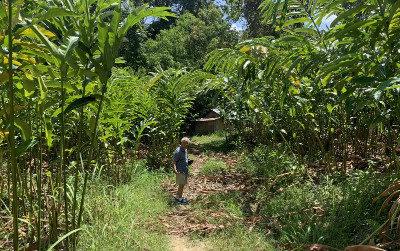
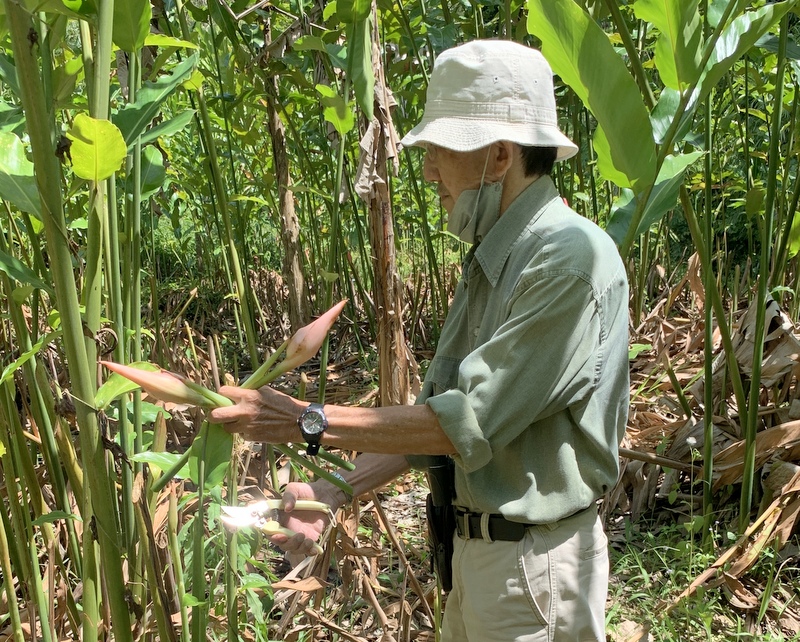
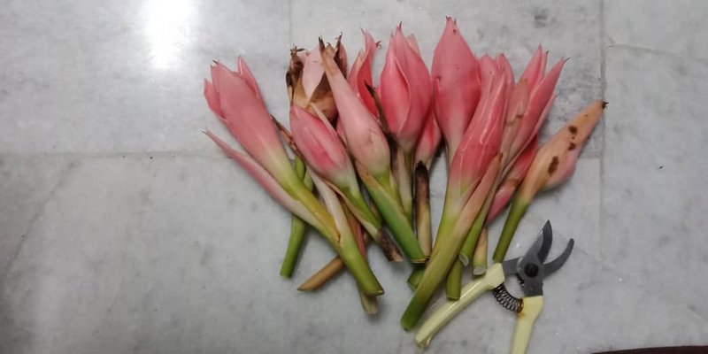
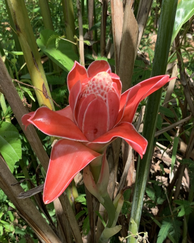
Our next stop was at a ‘forest’ of wild ginger. George was interested to harvest some bunga kantan, buds of the torch ginger, used for the preparation of assam laksa and tom yam.
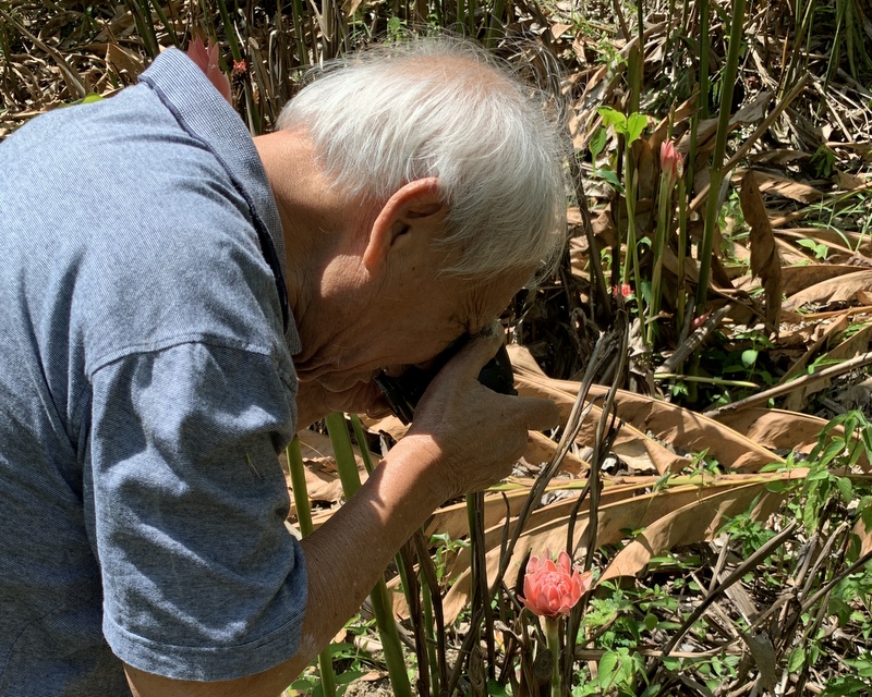
Here George is in action cutting the flowers, while Khong is practicing his new hobby, close-up photography.
George’s harvest of bunga kantan
I was taking pictures too.. The right pictures looks like a bird 😉
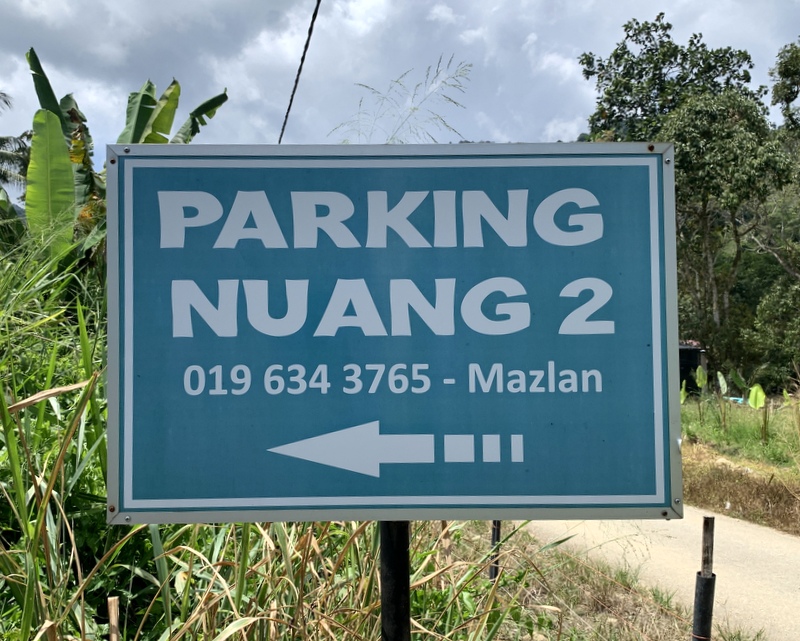
Nearby is a parking for people who are going to climb Gunung Nuang, the second-highest mountain of Selangor at 1493 m. Nowadays the ascent from Janda Baik is getting more popular than the traditional one from Pangsun. In the past I have hiked part of this trail until the Cemperoh waterfall. It was free and easy then, now you need permits. Here is an interesting and detailed comparison of the two ascents: Janda Baik versus Pangsun.
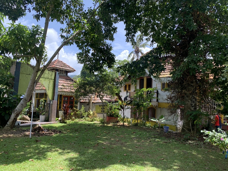
Final destination was the house and gardens of Al Attas. I had visited this place with Khong a long time ago> At that time we admired the garden and the numerous flowers and plants in it. For this blog I searched for more information about the owner, Prof(?) Syed Hussein Alattas, better known as Pak Habib. Quite a character, founder of the University of Life He was not at home, but Eddie, his caretaker said we were welcome to walk around the gardens.
Here are some pictures of the house and the gardens. According to Khong, the house looks like it is from a Disney movie.
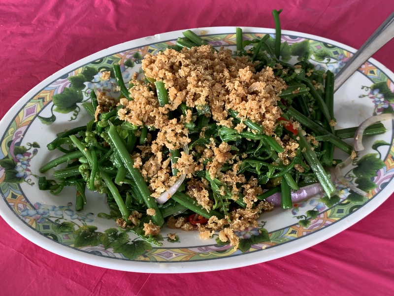
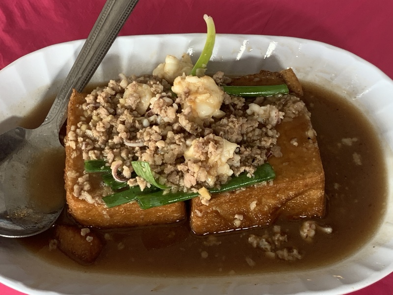
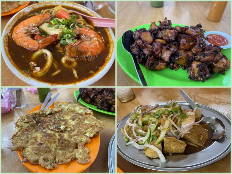
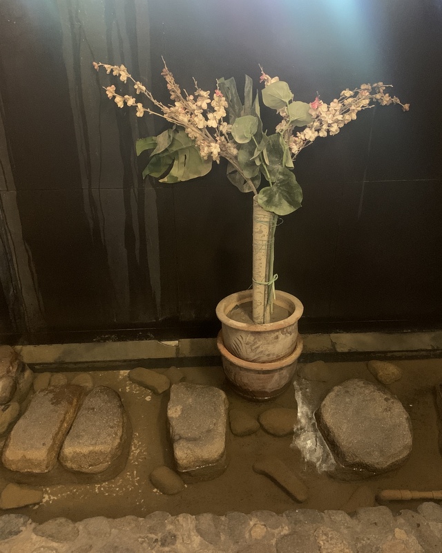
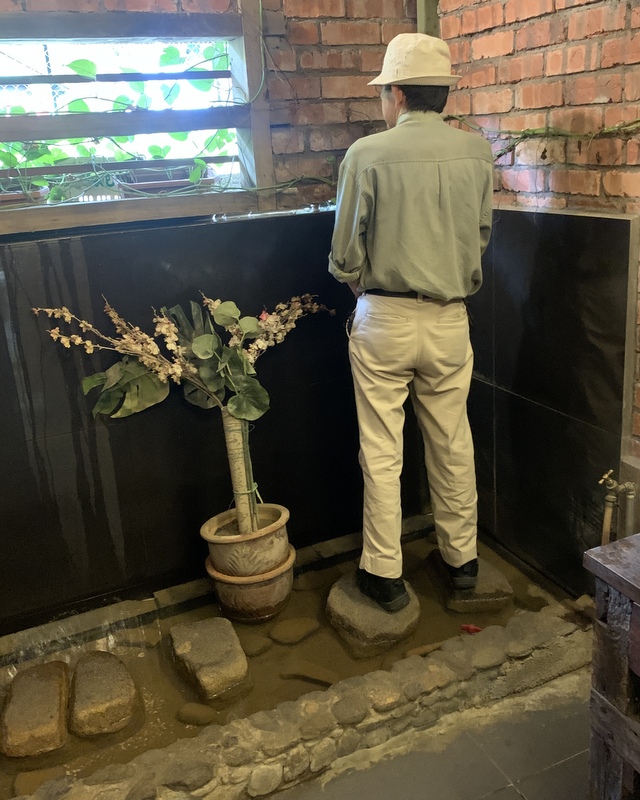
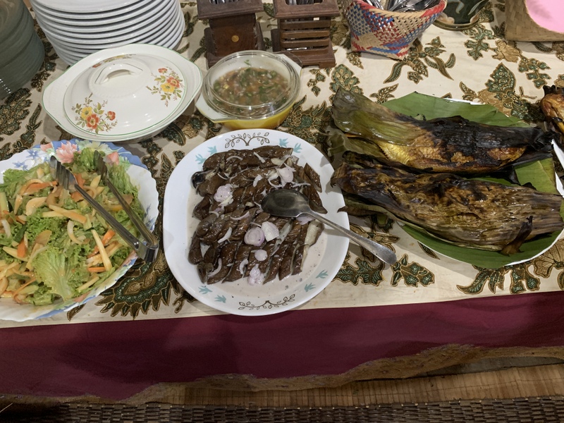
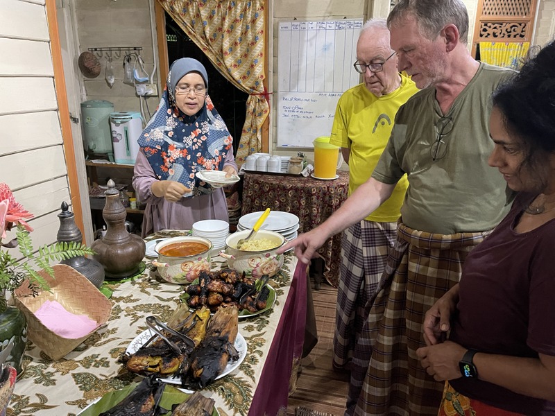
Here is the food we had. From top left, clockwise: .kangkung in prawn sauce, BBQ pork ribs, deep-fried squid with salted egg, yam basket with stir-fried cuttlefish and steamed lala in giner/garlic sauce..
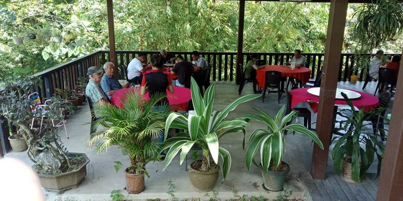
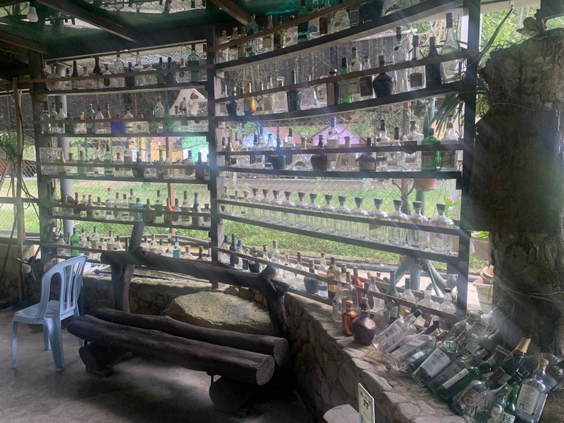
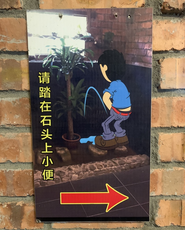
Te location of the restaurant is idyllic, next to the river. Food was good, price reasonable. I liked the wall decoration with empty bottles. And I had to take pictures of the men’s toilet 😉
It was a nice trip. Here is a Google Earth map of the region. Top left the highway, with the village of Bukit Tinggi.
Twenty years ago I started my own website. Although now in hibernation, this Stuif Site is still online. It has a Science -> Earth category, here is a screenshot of that page. I was quite interested in plate tectonics and continental drift and was planning to write more webpages about it. This never happened, the Earth page remained a “stub”.
But finally I have now decided to write a blog.
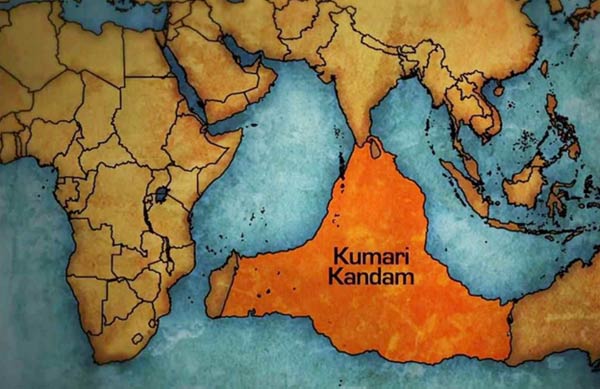
Recently I came across an article The Lost Continent of Kumari Kandam in which I found this map: I had never heard about Kumari Kandam and had to check Wikipedia: Kumari Kandam, “a mythical continent, believed to be lost with an ancient Tamil civilization”
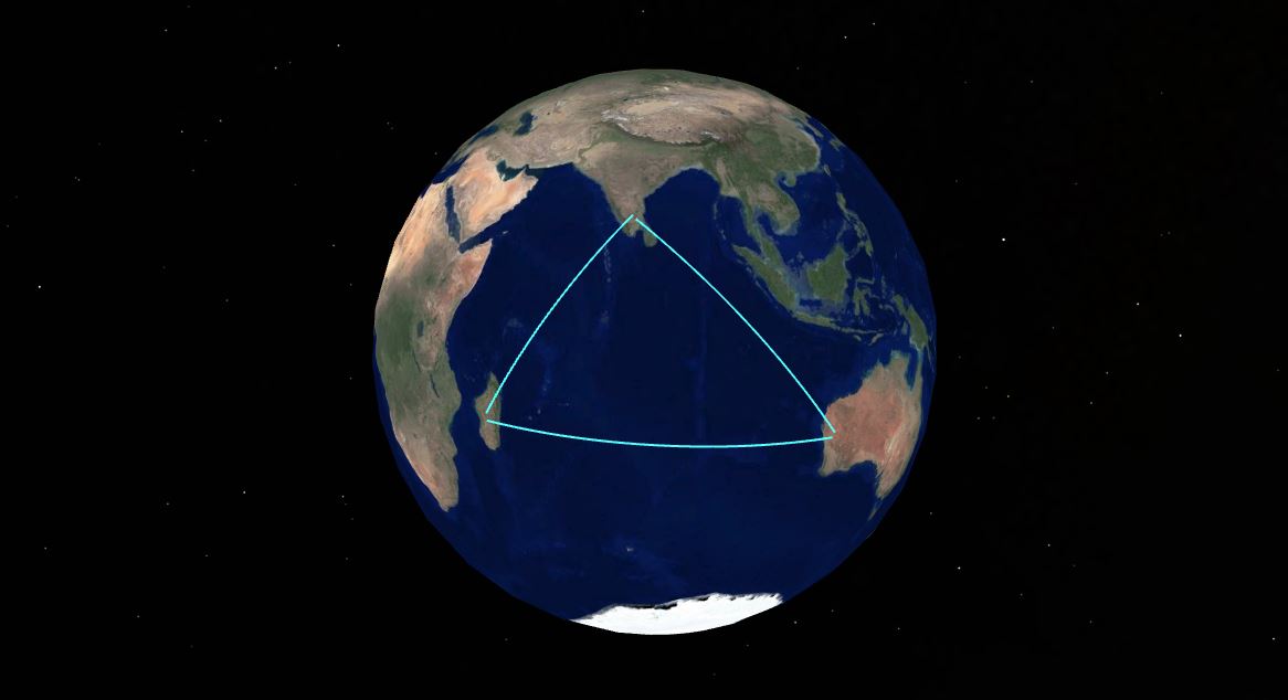
Apparently some Tamil revivalists still think that this continent really existed and actually was the cradle of civilisation, not Mesopotamia . The continent was submerged after the last Ice Age, when sea levels rose, forcing the Tamil people to migrate to other parts of the world. And yes, the sea levels rose after the last Ice Age, more than 120 meters. But have a look at the Google Earth nap of the Indian Ocean, where I have outlined Kumari Kandam. Mean sea depth is ~ 4 km!
So the Kumari Kandam continent never existed. A few months ago I have written a separate blog about this myth: Kumari Kandam & Lemuria .In that post I announced a post about continental drift and plate tectonics. Here it is.
THE STRUCTURE OF EARTH
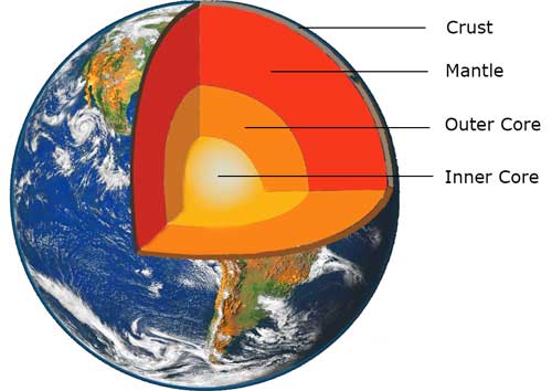
When Earth was formed, 4.55 billion year ago, it was in a completely molten state. The heavier elements sank to the center, the lighter elements rose to the surface. Because of cooling soon a crust developed. Here are two images of present Earth , showing its structure. Basically there are three main layers, the Crust, the Mantle and the Core.
The Core consists mainly of iron and nickel. In the Outer Core they are liquid (high temperature) and are the source of Earth’s magnetic field. The Inner Core is solid, the temperature is even higher, (about 6000 °C) but the pressure is gigantic.
The mantle is basically solid, but the upper mantle is already so hot, that it behaves as a fluid on a timescale of many millions of years. This upper part is called the Asthenosphere. .
The right image gives more details about the size of the various layers. The crust of Earth is very thin, especially under the oceans (~6-7 km). The continental crust is much thicker , 30-70 km and less dense than the oceanic crust. Compare the Earth crust with the shell of a chicken egg, or the skin of an apple
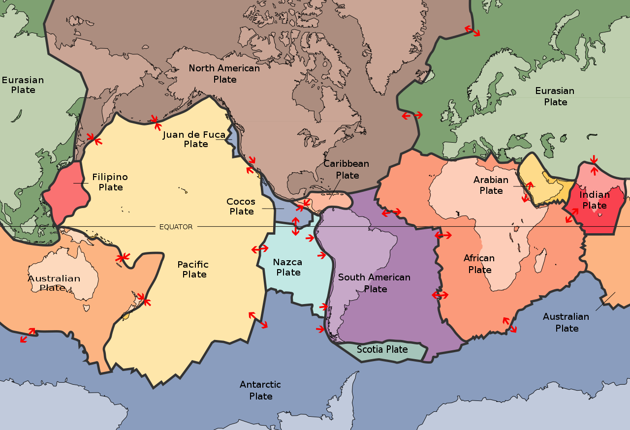
The crust of Earth is not one whole, it is broken in many separate parts, called tectonic plates. Below you see the main tectonic plates at present. They “float” on the mantle, very slowly, about a few cm/year. Red arrows indicate the direction in which they move.
A few comments on this map
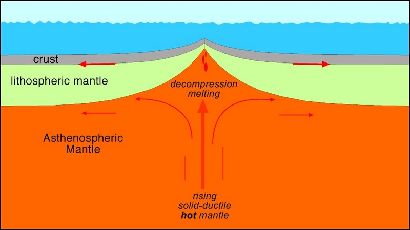
In the Atlantic Ocean the Eurasian plate and the North America plate move in opposite directions, creating a gap, that is filled by magma from the underlying mantle. They are called Mid-ocean ridges.
The Eurasian plate and the Indian plate collide, resulting in the Himalayas.
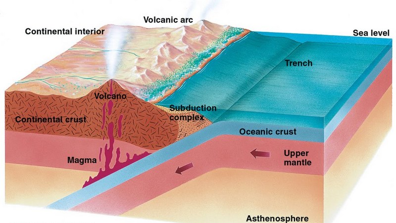
The Australian plate and the Pacific plate also collide, but here they create a Subduction zone. Because oceanic crust is denser than continental crust. the oceanic crust will go down under the continental crust and merge again with the mantel.
Two images as an illustration: a mid-ocean ridge (left) and a subduction zone (right)
These examples show that plates can change in time, they can also merge or split. In the past Earth has looked different, and in the future it will also look different.
THE PALEOMAP PROJECT
A paleomap is a map of Earth in the past, using information about tectonic plates. The American geologist Christopher Scotese started the Paleomap Project in the 1990s and is still actively working on it. Here are a few of his maps
This is a map of Earth, about 200 million year ago. In that period most of of the landmasses were connected and formed a supercontinent, named Pangaea. In the lower part, called Gondwana, you can already see the shapes of present-day Africa, South-America, Antarctica and Australia
Millions of years later, Pangaea has broken apart. Dinosaurs are roaming the earth
Earth starts to look a bit more familiar South-America and Africa have split, with the southern Atlantic Ocean separating them. Eurasia begins to take shape. Australia is still connected to Antarctica. Note that India has split from Africa.
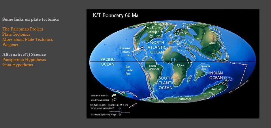
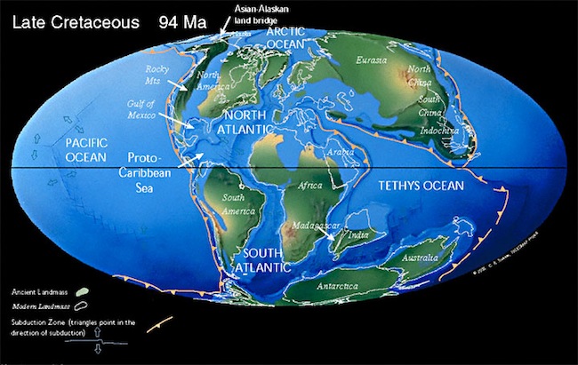
Earth 66 million year ago. The impact of the Chicxulub meteor in Mexico causes the extinction of the dinosaurs and the rise of mammals. India is on a collision course with Asia and Australia has split from Antarctica.
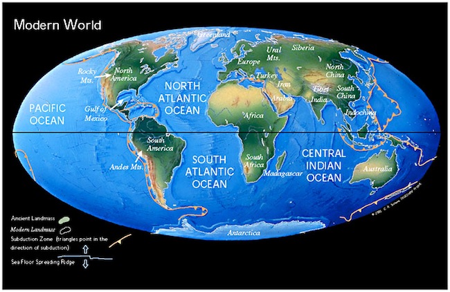
Present Earth..
More maps can be found here. The oldest map shows Earth 513 million years ago
These are static images, it would be nice to follow the development in time through animations The Paleomap Project homepage has many animations , but they do not work anymore, because they are using Java applets, which most browsers don’t accept nowadays. The site has not been updated since 2003 and I assumed that the project had been stopped. But searching information for this blog, I discovered that I was wrong, Scotese is still very active! But nowadays he and his coworkers create YouTube videos. Here is one of them. Time runs backwards, the video starts with the modern Earth and goes back to 750 million year ago.
It is also possible to predict how Earth will look like in the future. Of course such a prediction is less accurate because you have to extrapolate , using current plate movements.. Scotese’s prediction is that in the future another supercontinent will form, which he has called Pangaea Proxima. Here is the video. Notice that Australia will merge with Asia and l Antarctica.with India. The Mediterranean Sea will disappear.
Scotese’s YouTube Video Channel contains more than 70 videos about aspects of plate tectonics and continental drift. I will mention one more here, about the Story of the Malay Peninsula. (There doesn’t exist a Story of the Netherlands because God created the world, but the Dutch created The Netherlands 😉 )Notice how during the Ice Ages the sea-level was so low that the islands of the Malay archipelago were connected. This was called Sundaland. Topic for another post.
A few concluding remarks
Before Pangaea there have been several more supercontinents. Click here for a list.
When plate tectonics started on Earth, is still a matter of dispute. Possibly 3 billion year ago.
It can be argued that plate tectonics has been essential for the development of life. Watch this fascinating video The World before Plate Tectonics.
From 8 until 25 August 2022 my brother Otto and his family visited us in Malaysia. A report of what we did, can be found here. Part of our program was a 8D7N trip to a few of our favorite “haunts” and here is a report about this trip.
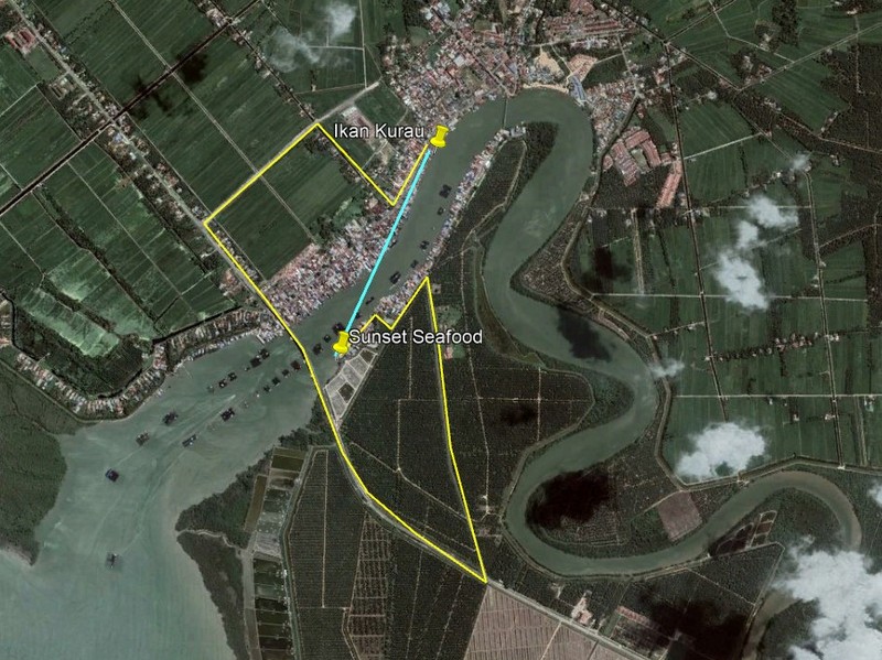
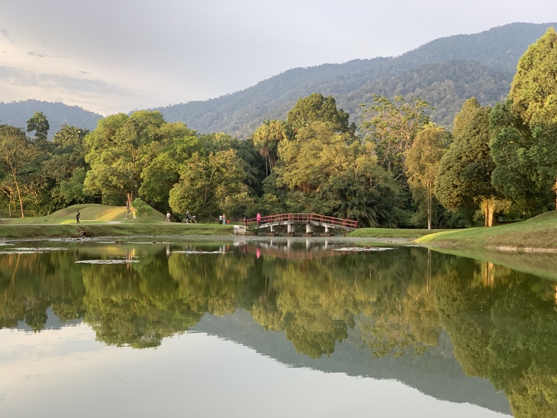
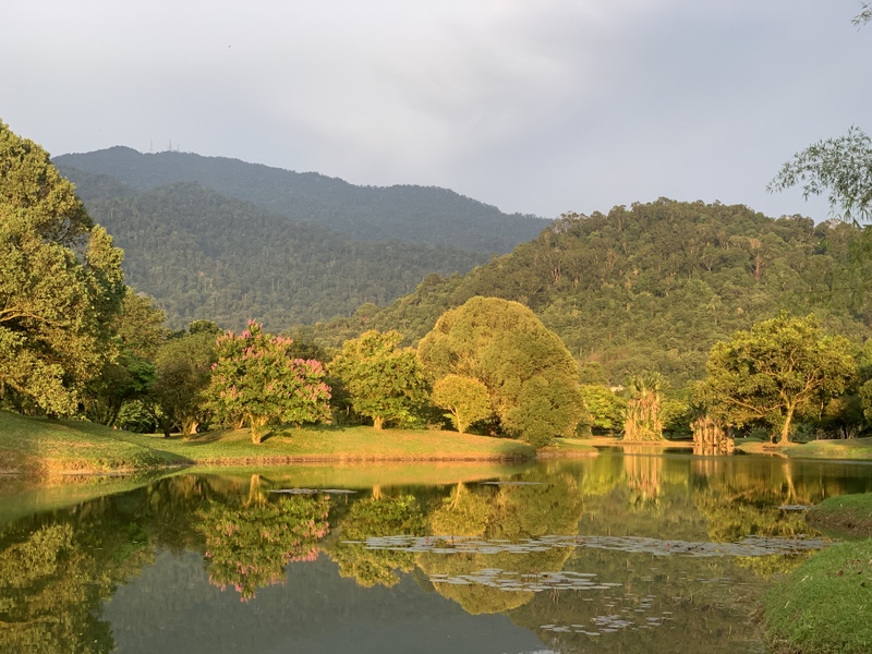
We decided to limit ourselves to the West Coast of (Peninsular) Malaysia. Below is the route we followed. Our first destination was the Suka Suka Lake Retreat, next we stayed two nights in Georgetown. One night in Kuala Kurau and in Taiping, finally two nights in the Cameron Highlands.
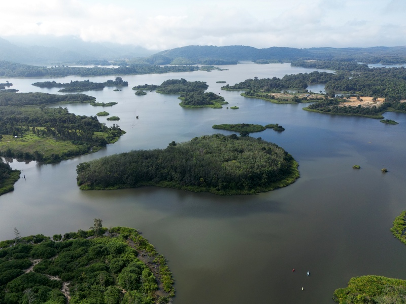
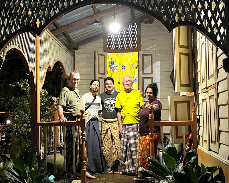
It is a three hour drive from our condo to Suka Suka, we travelled in two cars. .Using the highway we stopped only for some snacks at the Tapah R&R. The Suka Suja lake retreat is located on the bords of the Chenderoh reservoir, one of the oldest in Malaysia. Left a drone picture of the reservoir, right Suka Suka, marked with an X.
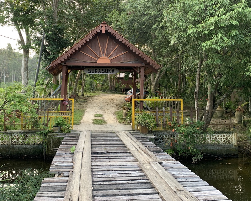
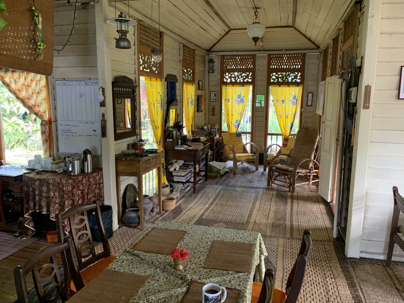
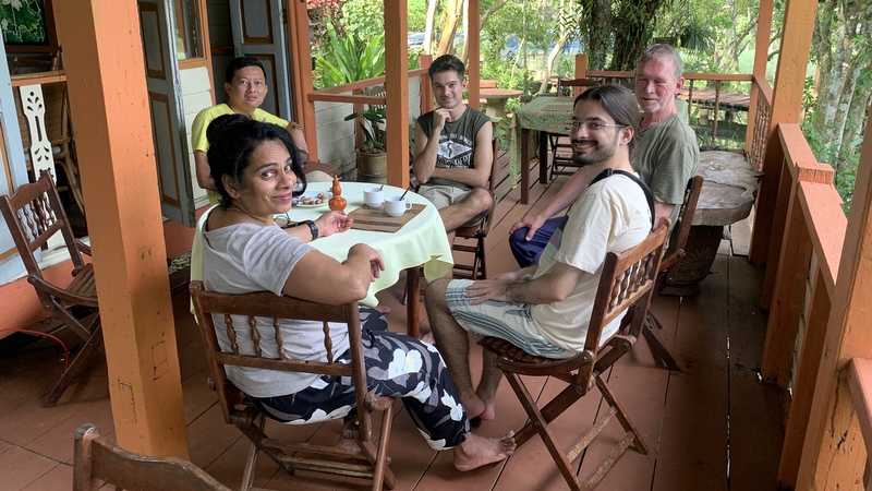
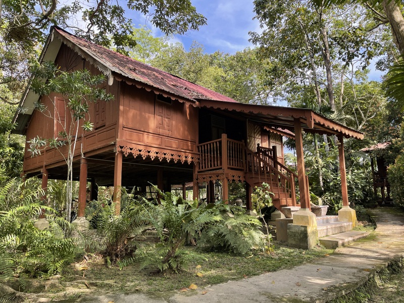
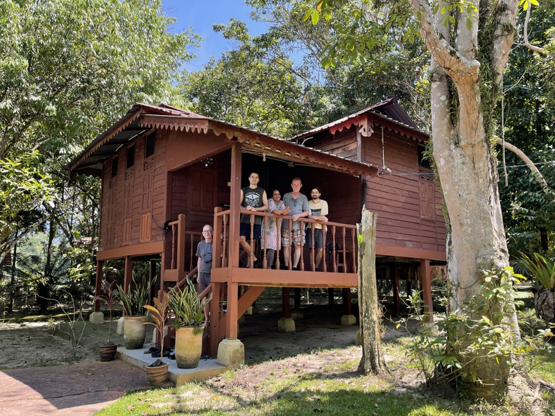
When you enter the resort, it feels like going back in time. Traditional Malay houses, built on pillars. Here the main building with some pictures of the interior..
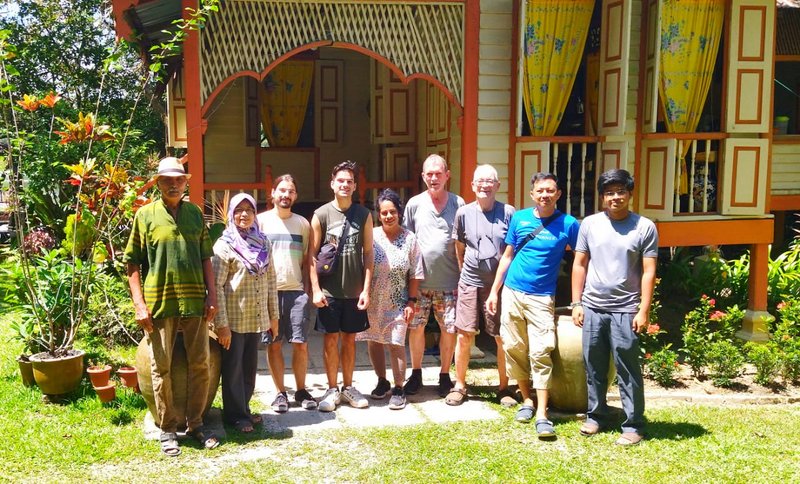
The resort is managed by a family, Aziz, his wife Asiah and their son Azam. I have stayed in the resort many times and they have become friends. Very friendly and hospitable. We were welcomed with a drink and some fried chempedak.
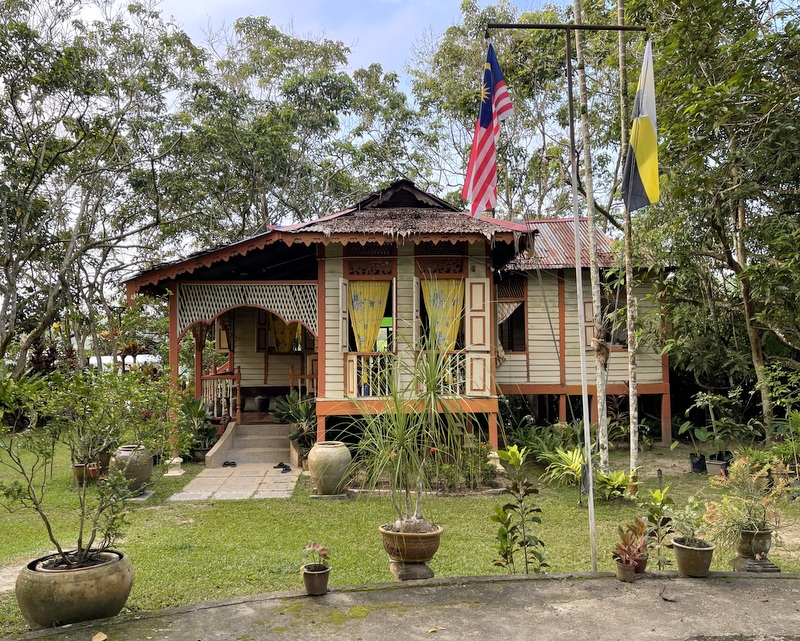
Aziz has bought old Malay houses from various locations in the country, taken them apart and rebuilt them in his resort. Original design, he only added modern bathrooms. Here are the two houses where we stayed.
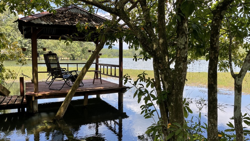
Suka Suka is a place to relax, for example in one of the gazebo’s
But of course you can also explore the resort.
Staying there is not cheap, but meals are included and Asiah is a very good cook, eager to explain the various Malay dishes she prepares. She lent us sarongs and asked us to wear them during dinner. Actually we should have eaten, sitting on the floor, but looking at the seniors among us, she suggested that we could sit on chairs 😉
After the dinner she explained to my nephews how to play congkak, a traditional Malay game. Here are the rules, if you are interested. Of course a photo had to be taken with all of us wearing our sarongs.
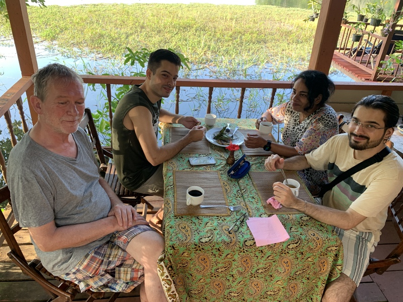
The next morning Asiah prepared breakfast for us.
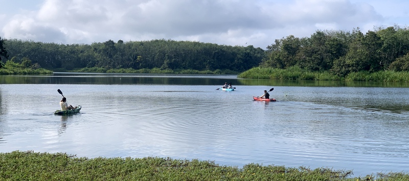
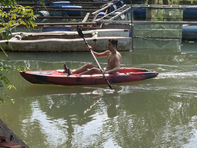
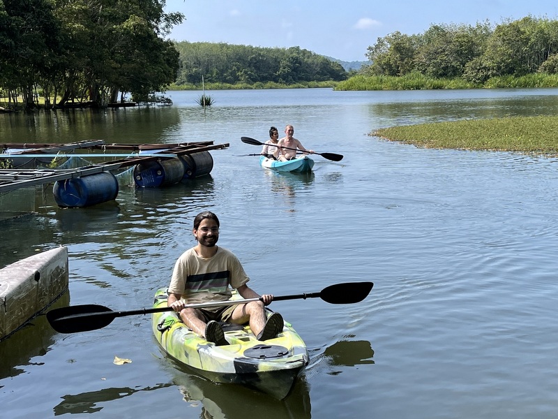
The resort has kayaks which can be used by the guests. Aric and I had done that during an earlier visit and we nearly got lost, orientation is not easy with all those small islands. So we left the exercise to Otto and Nina, and to the twins. They found their way back without problems
Then it was time to say goodbye and continue our trip. Azam used a tripod to take this nice farewell picture.
Our next destination was Georgetown in Penang, in 2008 declared a World Heritage Site, because of its historical past. You could spend weeks to explore everything, but we stayed only two nights.
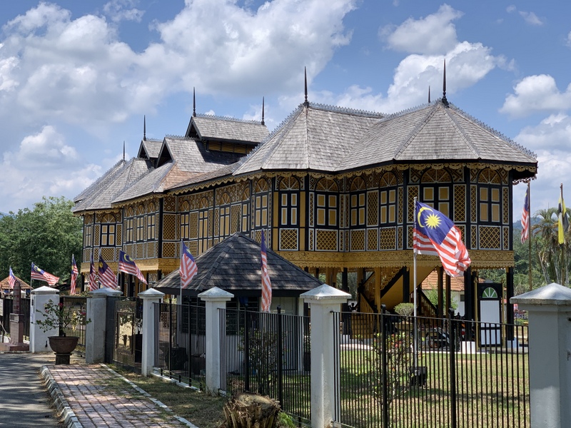
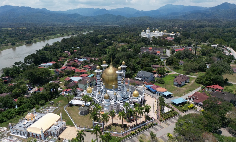
On our way, we passed Kuala Kangsar, the Royal town of the Perak state. Two landmarks, the impressive Ubudiah mosque, a masterpiece by colonial architect A.B. Hubback, completed in 1917 And the Istana Kenangan, the former Royal Palace.
Aric did some droning, here is an aerial view of the mosque. with the present Royal palace in the background and the Royal mausoleum in the left foreground
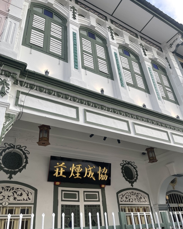
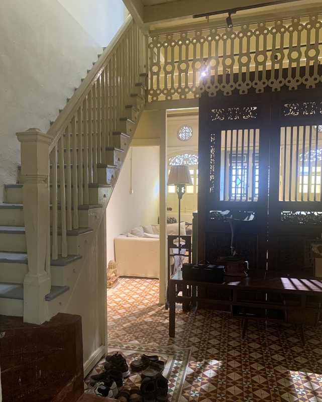
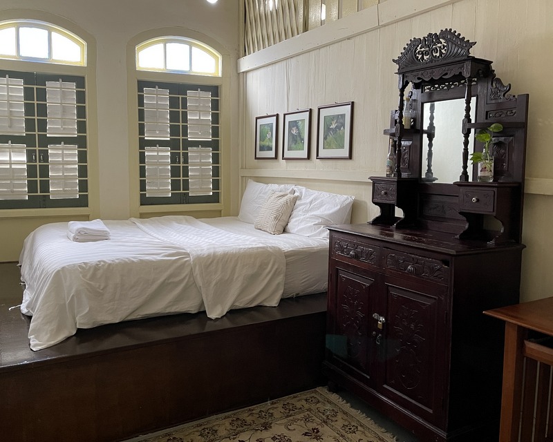
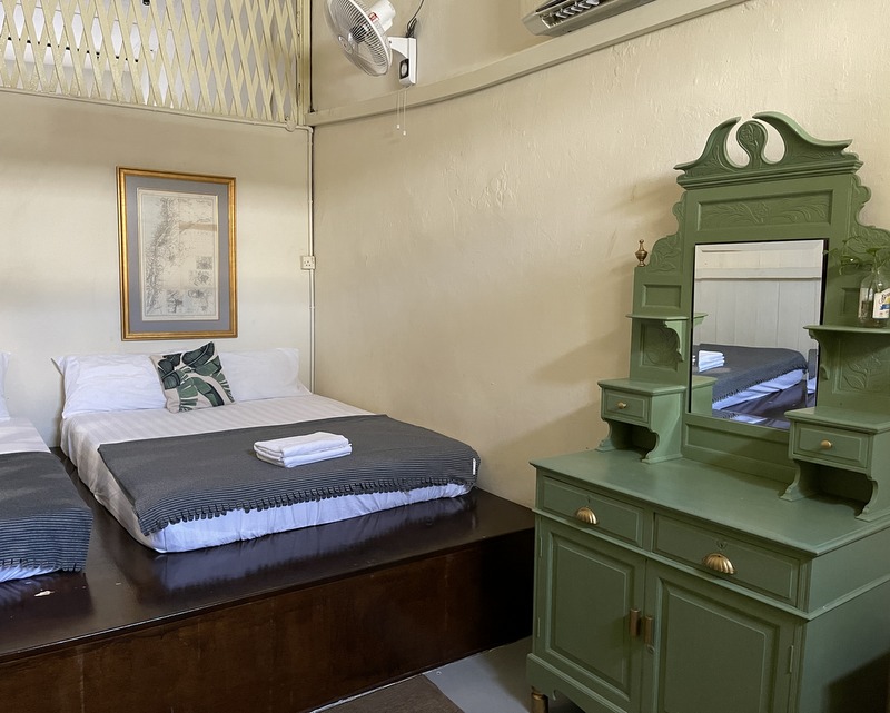
We had some snacks in an R&R and arrived in the afternoon at the Airbnb booked by Aric. Located in the historical center of Georgetown, it was a nice house in Peranakan style. Left the façade, right the (very) steep stairs, leading to the bedrooms. Notice the traditional screen shielding the ground floor rooms from the entrance
Left the screen as seen from the entrance, and two pictures of the bedrooms. The house was well furnished and comfortable.
Having some refreshments before going out.
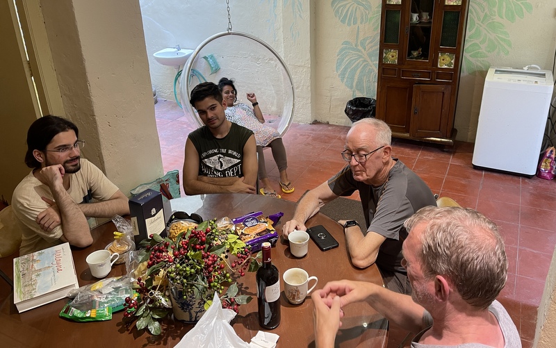
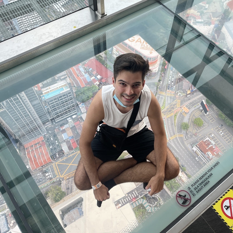
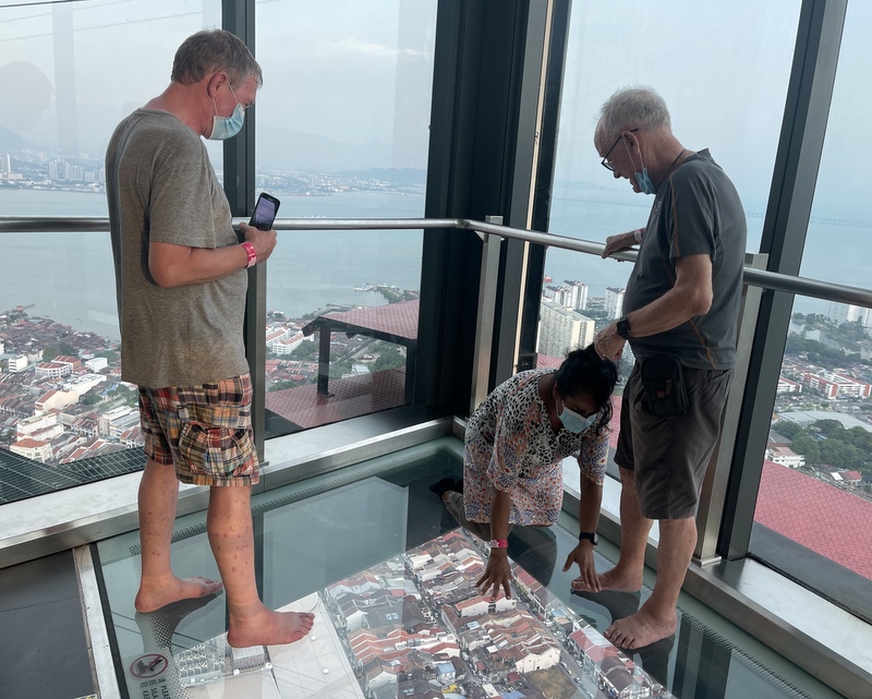
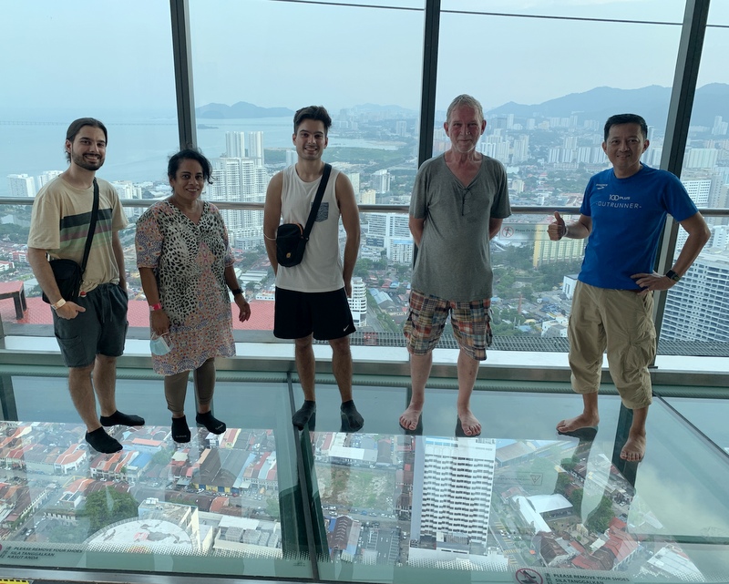
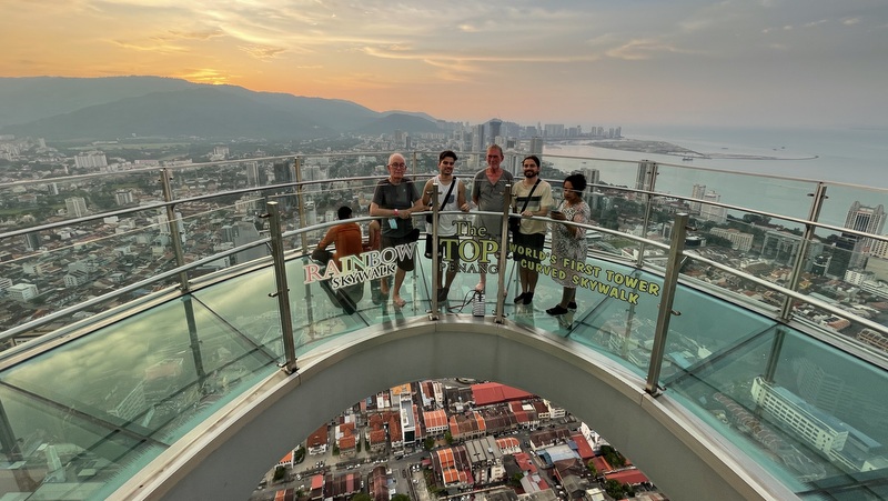
During our last stay in Penang, Aric and I had visited the top floors of the Komtar tower, where you can look down 250 meter, through a glass floor. We liked it so much that we wanted to show it to our guests. Here are Xander and Aswin, sitting relaxed on the (very) transparent glass.
Nina had said that she would scream, but she did not. Bravo ;-). I took a photo of our group.
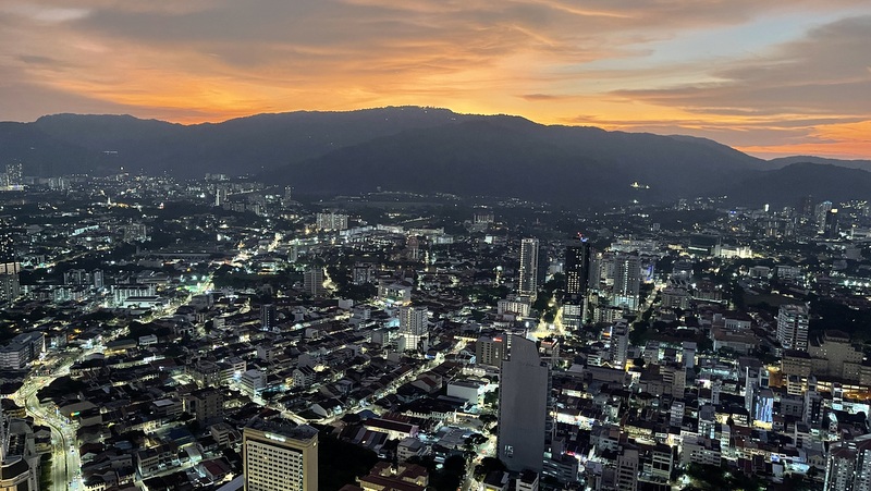
The top floor has a skywalk. Here Aric took a picture of us. I found this a lot less scary. We stayed until after sunset, to take some night pictures.
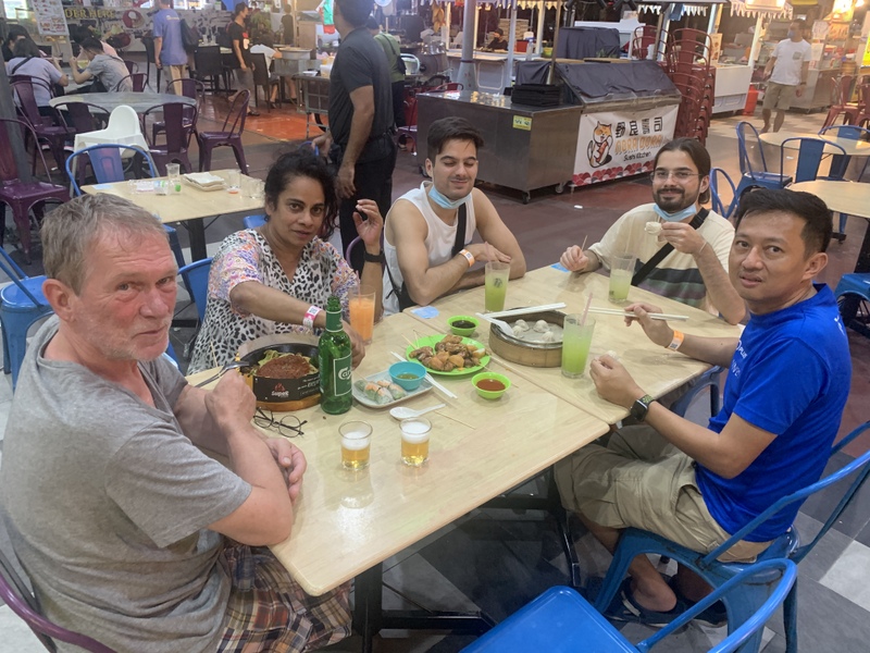
Dinner at the New World food court. Aric ordered a selection of dished. Without him we should have been at a loss what to order. From top left clockwise: popiah, lobak, vegetarian spaghetti and dumplings.
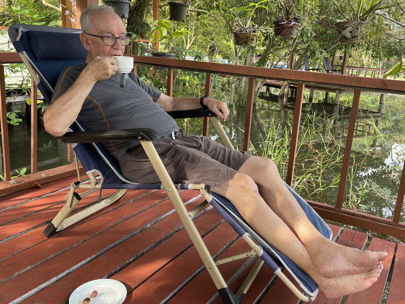
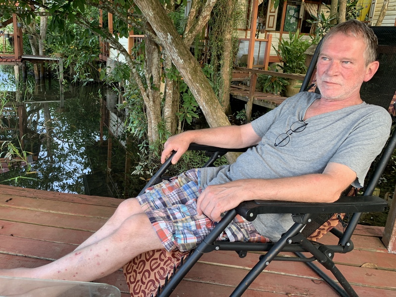
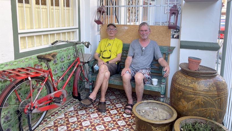
The next morning. Two brothers having a relaxed cup of coffee in the front yard of their temporary home.
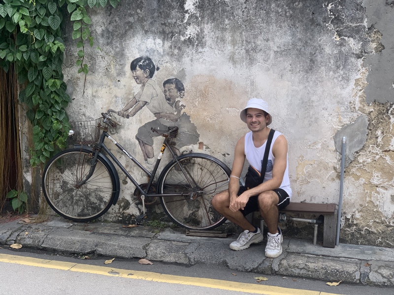
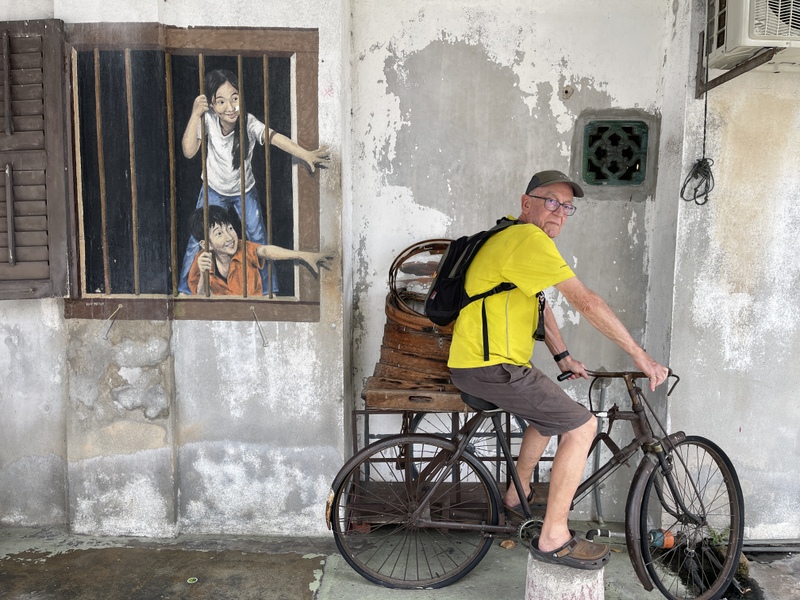
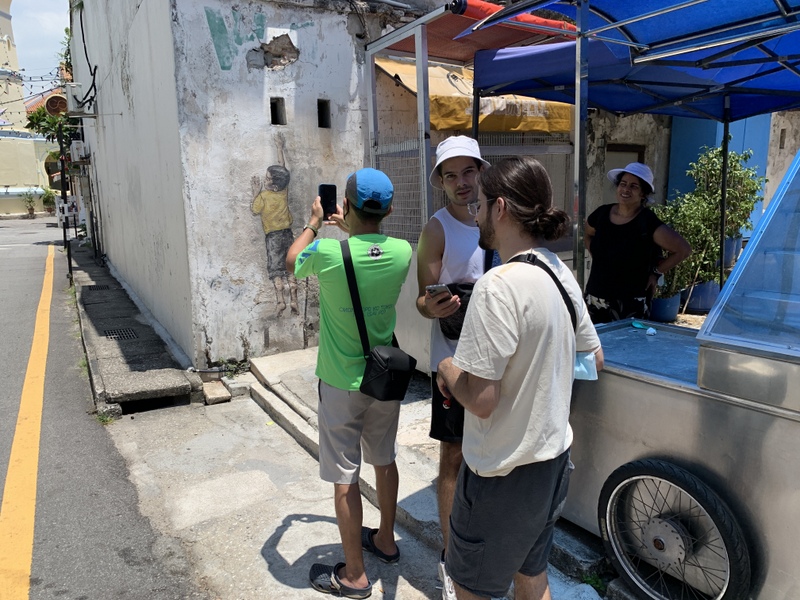
We did a lot of walking that day. First we had a look at some of the famous Zacharevic murals. If you are interested, I wrote several blogs about Penang Mural Art. A lot of copycatting, I am not sure about the top right one, and the lower right is definitely not Zacharevic.
Then we walked to the clan jetties, another landmark of Penang. We selected the Tan Jetty and were a bit disappointed that we could not proceed until the end, from where you have a fantastic view of the harbor front. I could only take a shot through an opening in the gate.
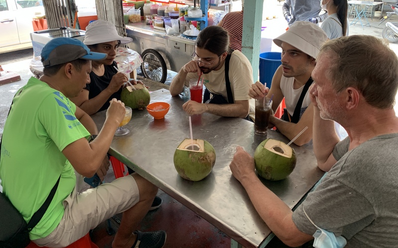
We had a refreshing coconut there
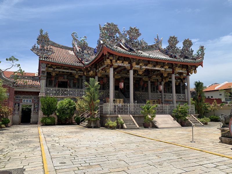
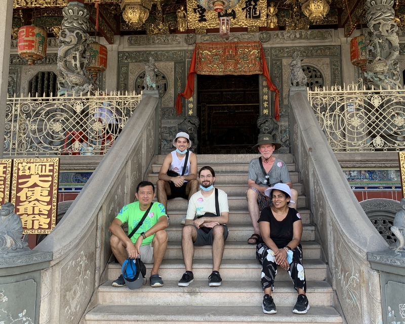
On our way back we passed the famous Khoo Kongsi, the most impressive clan house of Georgetown. We entered and walked around. I have visited this place so many times, I did not take many photos.
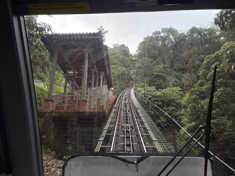
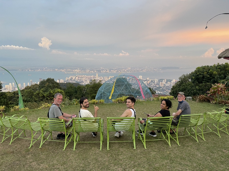
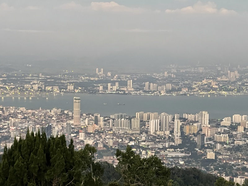
After some rest in our Airbnb, we discussed what to do the rest of the day. We decided to take the cable car up Penang Hill and walk around a bit there, having a drink at the Bellevue hotel. This colonial style hotel is owned by a friend of mine and has a spectacular view of Georgetown and Butterworth on the mainland. We stayed until after sunset before taking the cable car down.
o
The next morning we first had breakfast in the famous Toh Soon cafe. We had tried the day before but found it was closed. Now it was open with a long queue of people waiting. It is famous for its coffee and its toast. I had my favorite eggs on toast.
oo
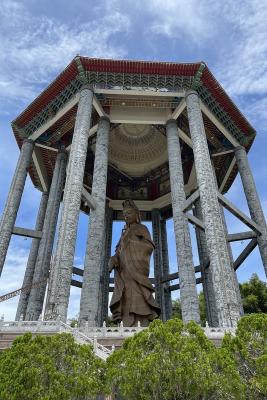
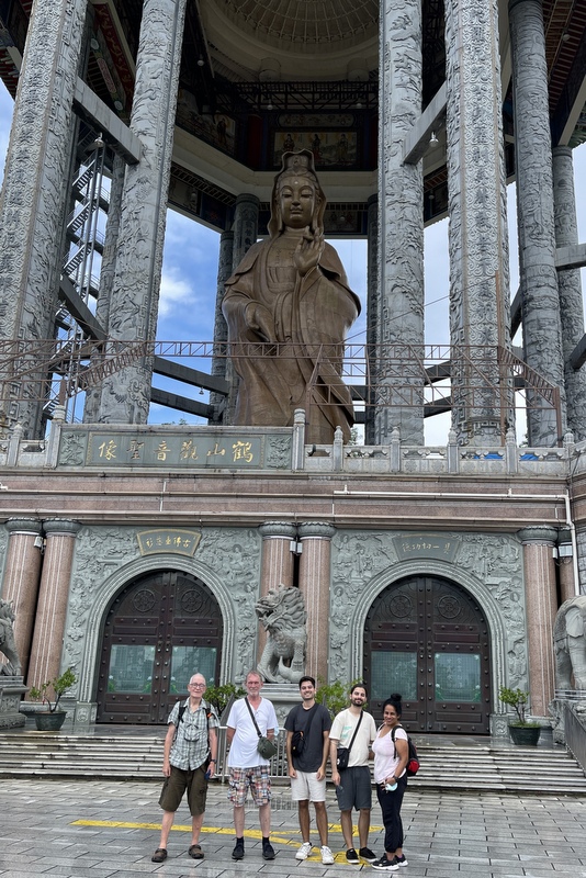
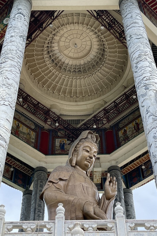
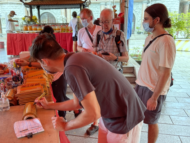
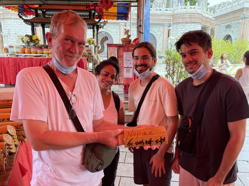
A trip to Penang is not complete without a visit to the Kek Lok Si temple in Air Hitam. The Buddhist temple is dominated by the huge statue of Guan Yin, the goddess of mercy.. You can only take a photo of the whole building when you are far away 😉
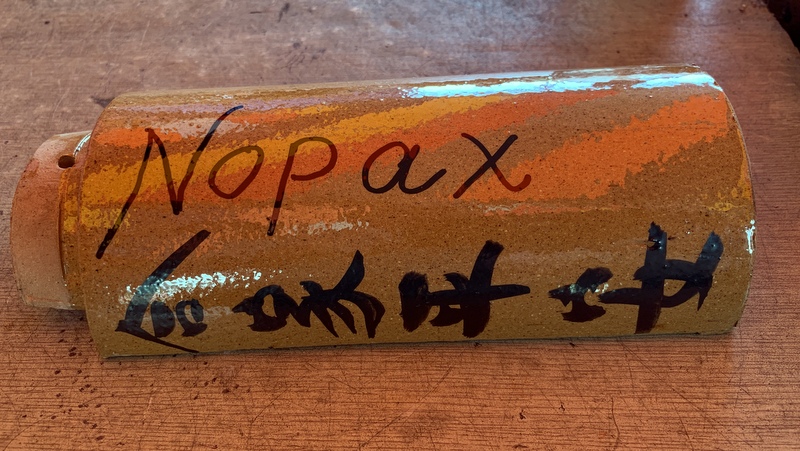
The construction is not yet complete, you can donate roof tiles. The family bought a tile and wrote NOPAX on it (Nina, Otto, Pascal, Aswin and Xander)
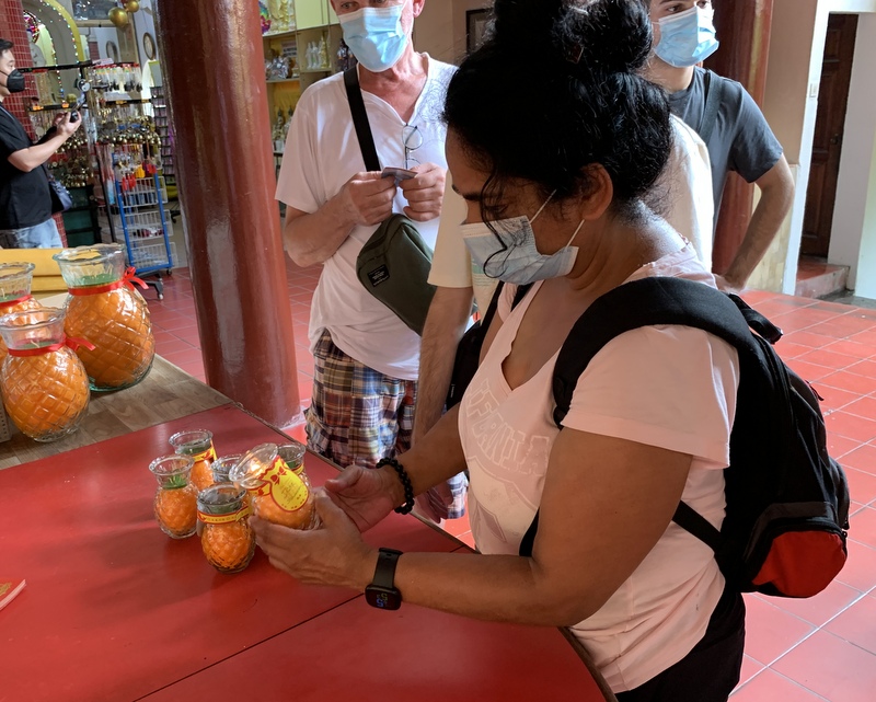
Nina also bought a candle.
There are many temples in the complex. This is the main one.
You can climb the beautiful pagoda, but I had done that already in the past. So I waited at the bottom while the others climbed up.
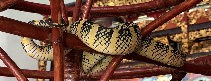
Before crossing over to the mainland, we visited another temple, the snake temple. Inside(!) the temple and outside in the trees many Wagler’s pit vipers live. When you don’t disturb them, they are harmless (although venomous). During our visit there were only a few snakes inside the temple, sleeping. But many in the trees of the courtyard.
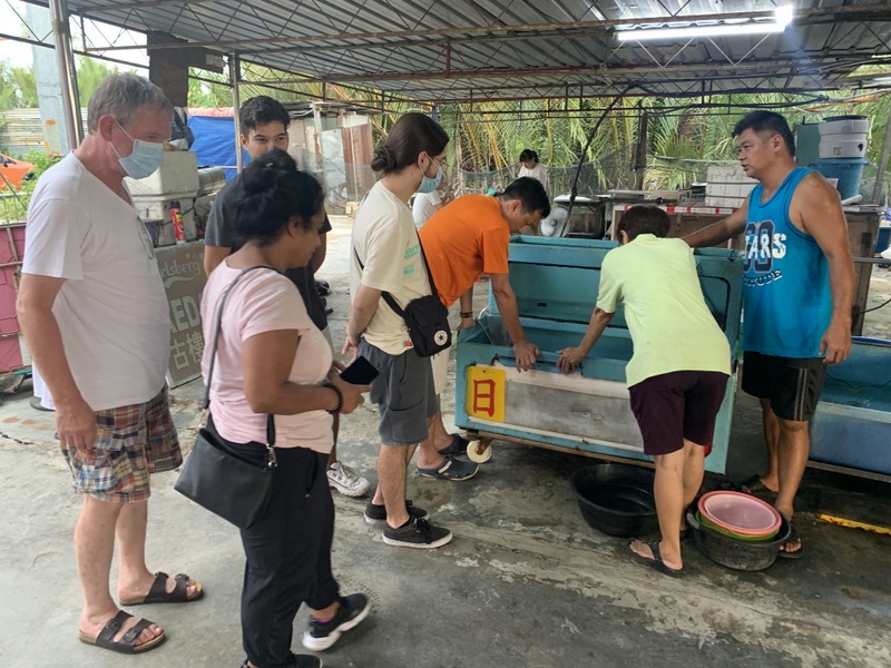
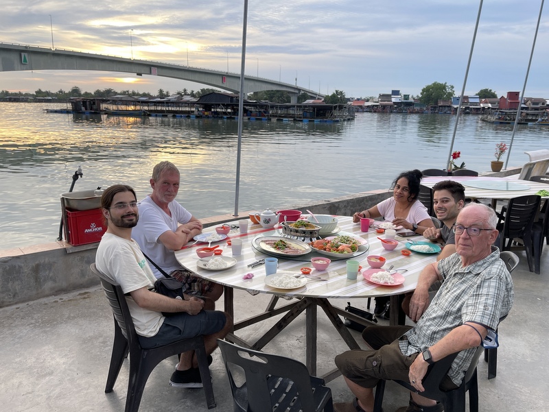
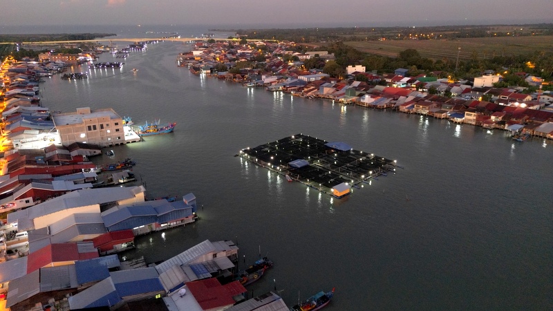
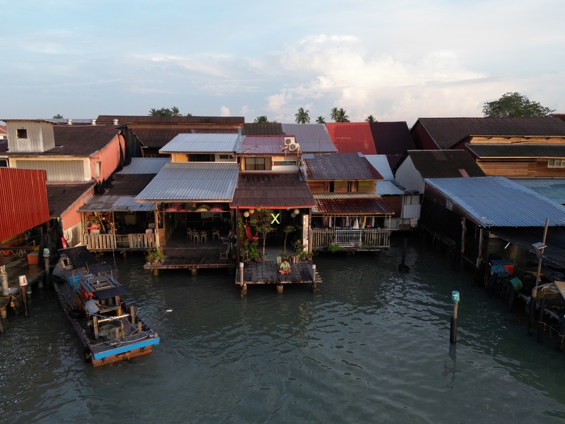
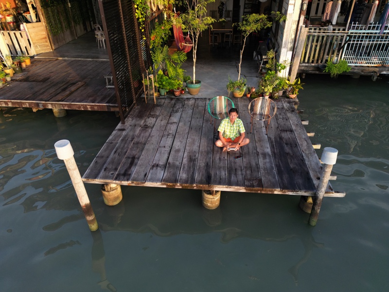
After a simple lunch opposite the snake temple, we crossed the bridge and drove to Kuala Kurau, a fishing village at the mouth (= kuala) of the Kurau river. Years ago we had discovered in this village a nice homestay, located right on the river with a terrace from where we could observe the many activities on the river.
The owner of the homestay, a young man, studied and worked in the UK, but came back to his hometown, missing the rural life. Nicely renovated house.
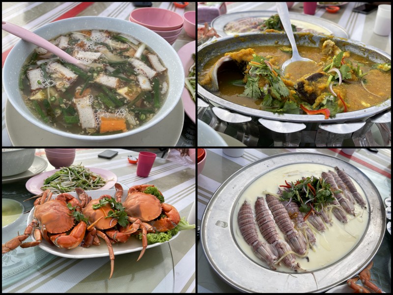
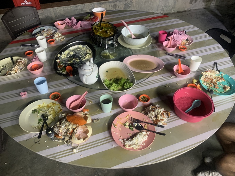
For dinner the owner suggested a restaurant from where we could enjoy the sunset. In this kind of seafood restaurant you start with looking at the fish tanks to select what you like to eat, Can not be more fresh. The food picture, from top left clockwise: seaweed soup, stingray, mantis shrimps and crab. The bottom right picture shows how people here leave the table after a nice dinner 😉
The restaurant was about1 km from our homestay, as the crow flies, but to reach it by car we had to take a long detour. Crossing the Kurau river we saw the numerous fish farms in the river.
Back in our homestay it was time to relax.
The next morning Aric woke up early to take drone pictures of the river and our homestay (marked with a yellow x). Notice another fish farm in the river.
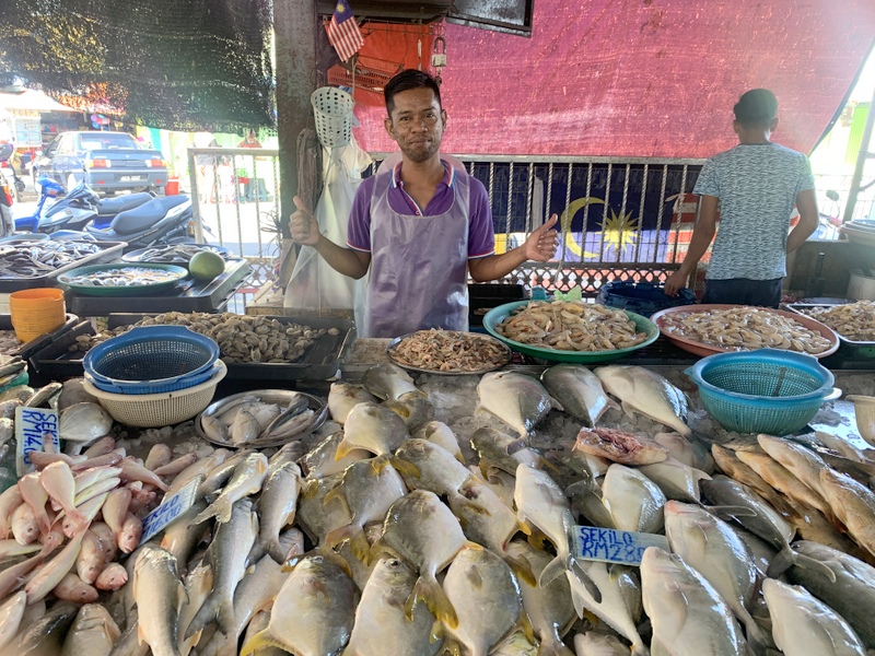
We had breakfast in the village and walked around. Of course there was a fish market.
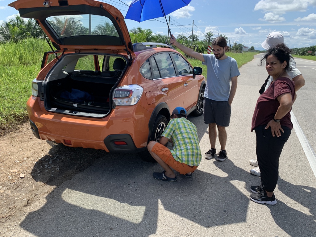
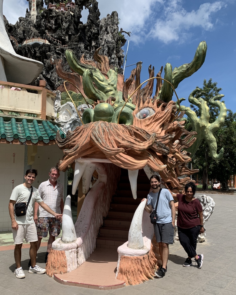
On our way to the Hua Seng Kong Temple near Kuala Gula, Aric got a flat tyre, which he changed superfast . The temple is located in the middle of nowhere, surrounded by plantations. We were the only visitors.
This Buddhist temple has strong Mahayana and Taoist influences. It has a rustic atmosphere, no exquisite art here. Left the family at one of the entrances. When you kneel on the metal plate, as Nina does, the statue starts pouring holy(?) water.
Very interesting is the depiction of “Hell”, where people are punished for the sins they have committed in their life. A small scale version of the famous Haw Par villa in Singapore.
Here Xander and Aswin are waiting for their judgment. After the punishment everybody gets a cup with the tea of forgetfulness, so they have no memories after being reborn.
It was not far to Taiping where we had lunch in the Old Railway Station. Finally we had Assam Laksa, Aric’s favorite food. He has a special Assam Laksa website. Try to find his verdict about this assam laksa (hint: there are three assam laksa entries for Taiping)
We had booked rooms in the modern Flemington hotel, next to the Taiping :Lake Gardens. After some rest we walked around, we were lucky, Taiping is named the rain town of Malaysia, it rains often in the afternoon, but we had nice weather,
At sunset we watched the colony of egrets, roosting every night at the Lake Gardens. Thousands of them. We also had a look at the rain trees that in recent years have fallen down on the road. The town council took the smart decision to leave them there and make part of the road pedestrian: the Raintree Walk. Now a tourist attraction.
Dinner in the Double Tap, a modern fusion-style restaurant near the Lake Gardens. I had spaghetti with smoked duck, curry leaves and salted egg! Very eatable.
A special feature of Flemington is the infinity swimming pool on the top floor. I had told my family to bring swimwear, they did, but I was actually the only one using the pool haha. We had a buffet breakfast the next morning.
Here is the Raintree Walk during daytime. During evenings and weekends teher can be a happy crowd.
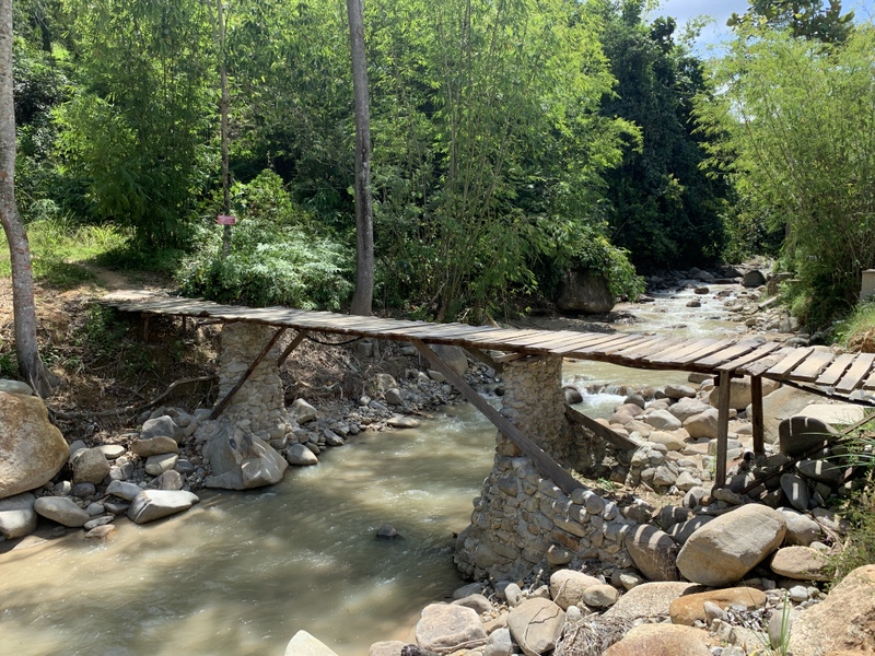
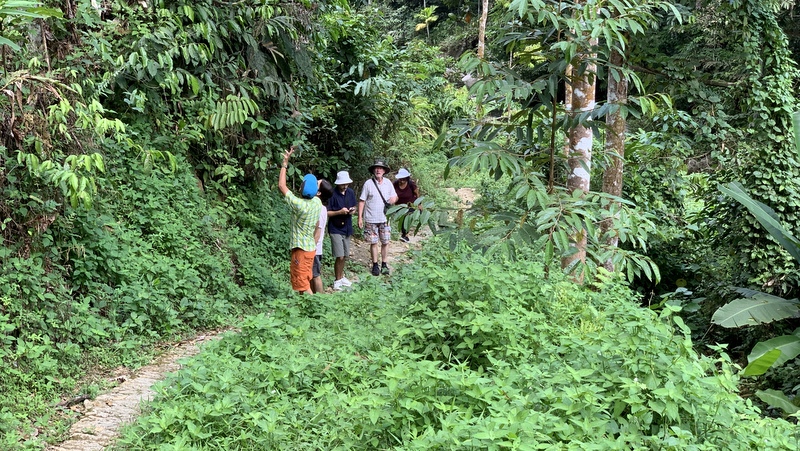
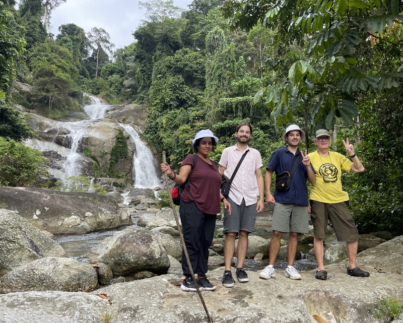
As the “godfather of Malaysian waterfalls”, of course I had to bring my family to a waterfall North of Taiping there is a nice waterfall, not yet discovered by the general public, although easily accessible on a clear trail
The Air Hitam waterfall is an attractive one, from where I took the photo, you can still continue to the bottom of the falls, but that is more tough going. Aric took a drone picture of us.
We could not stay long, because we had a (late) checkout before 1 pm. We had lunch in the Lighthouse restaurant in Matang. The famous Teochew fish porridge (Aric is Teochew himself).
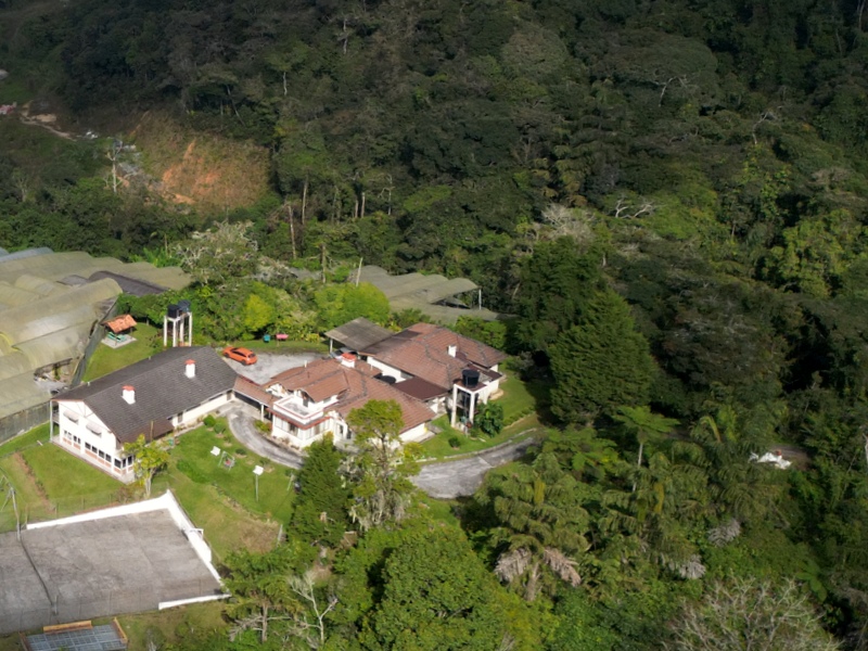
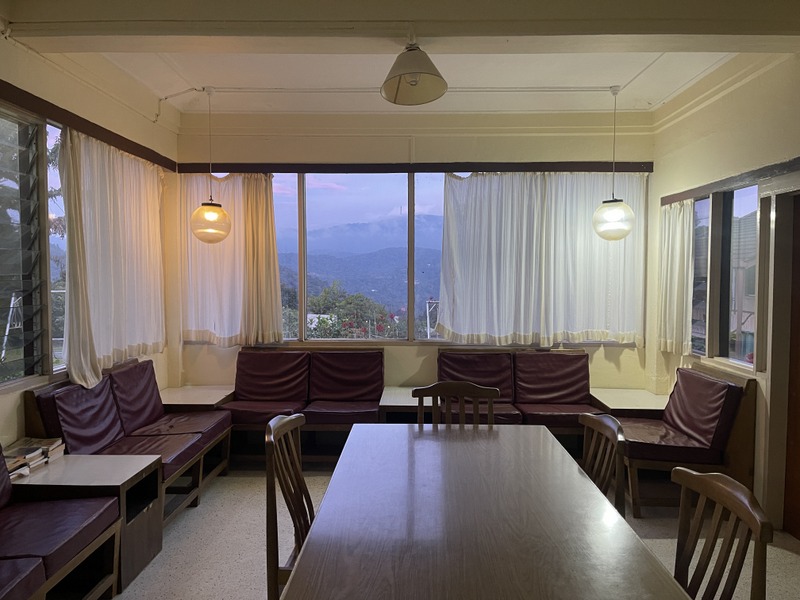
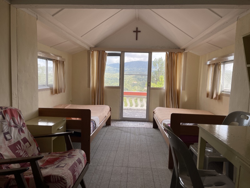
Our last stay was in the Cameron Highlands, two nights in the Lutheran Mission Bungalow. A lot of the Cameron Highlands has lost its charm because of agricultural (over)development, but this bungalow is still relatively unspoilt. Left a drone picture, the ugly gray plastic roofs are approaching. Right the bungalow, built in the 1950s as a retreat for Lutheran missionaries.
default
How I discovered this bungalow (12 years ago) is too complicated to tell here. Read my blog What Happened to Jim Thompson. I have been there many times and booked three rooms in the main bungalow this time.
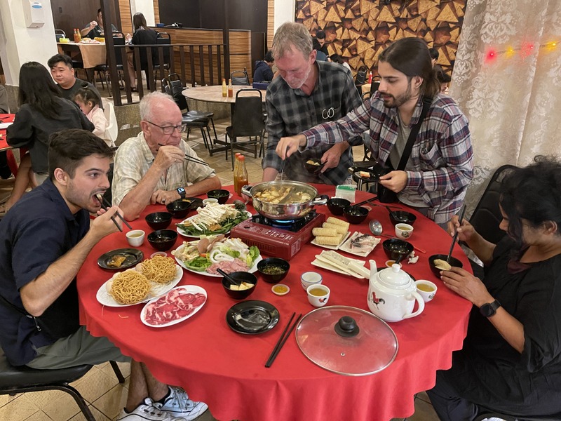
For our dinner we went to the Jin Jin Steamboat restaurant in Brinchang. Steamboat is popular in Malaysia and specially in the Cameron Highlands. You get a bowl with hot broth and plates with meat, fish, veggies, mee etc. You prepare your own food. Although it was a weekday, it was very busy, we had to wait for a table. But it was worth it.
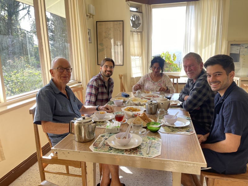
Traditional breakfast the next morning..
The view from the garden is still very nice. and there are lots of flowers.
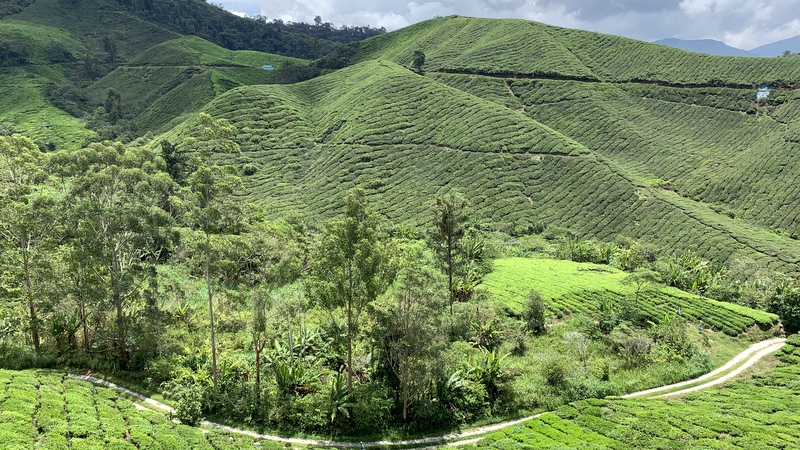
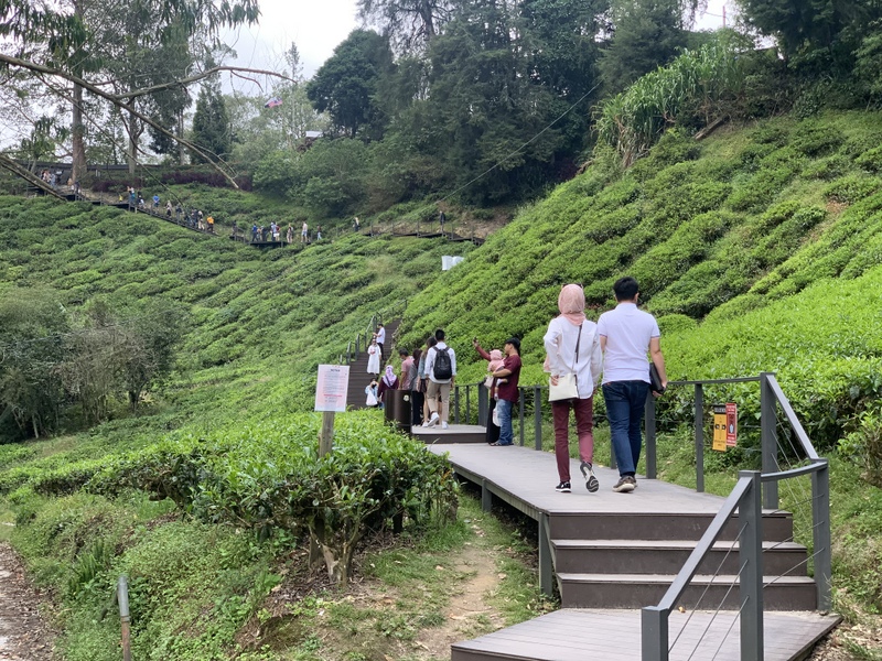
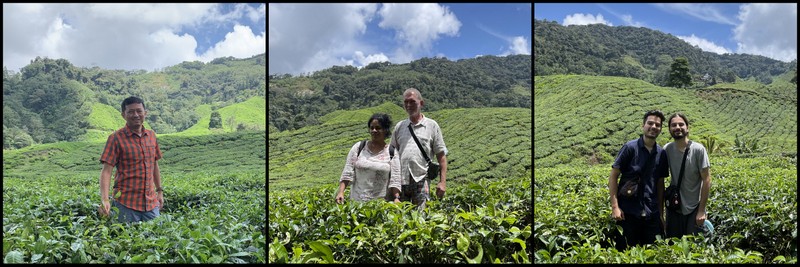
One of the attractions of the Cameron Highlands are the tea plantations.
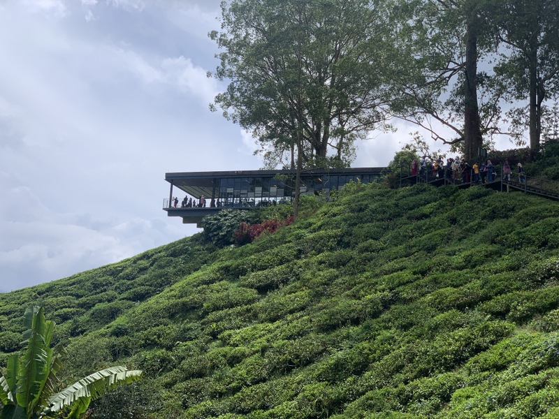
We visited the BOH Tea Centre Sungai Palas and we were not the only ones. The tea house has a spectacular location, overlooking the tea fields.
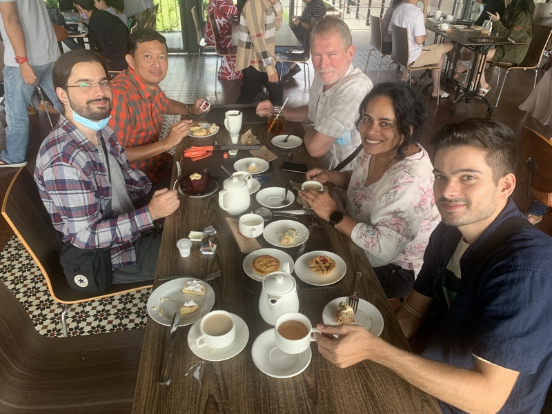
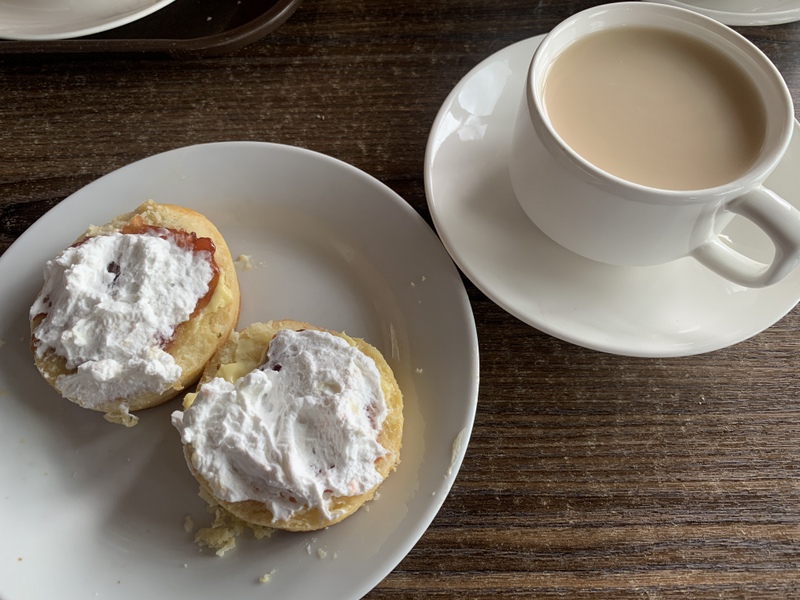
Of course we had BOH tea and cakes. I had scones
‘
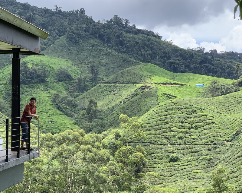
Pity that the tea factory, where they process the tea leaves, was closed for renovation. Of course we took many pictures of the tea fields.
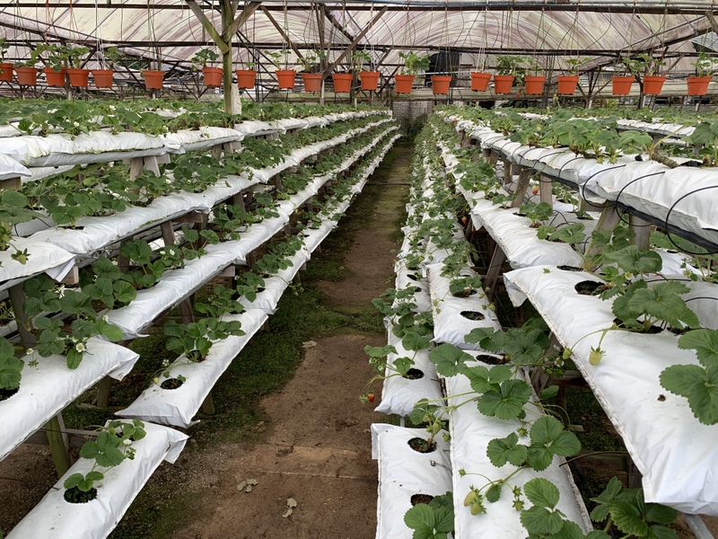
Another attraction of the Cameron’s are the strawberries, strawberry farms everywhere (with the ugly gray plastic roofs) When you buy Cameron strawberries in the supermarket, they are very sour, but the ones we bought here, were surprisingly sweet.
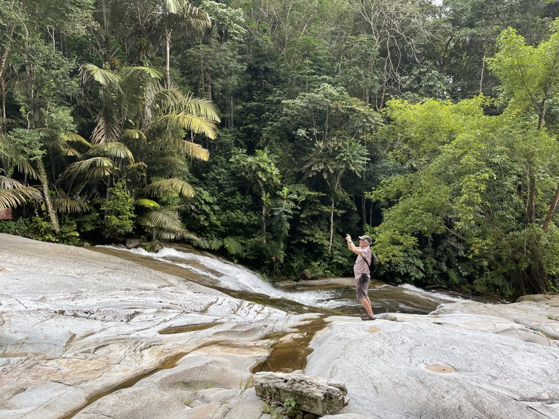
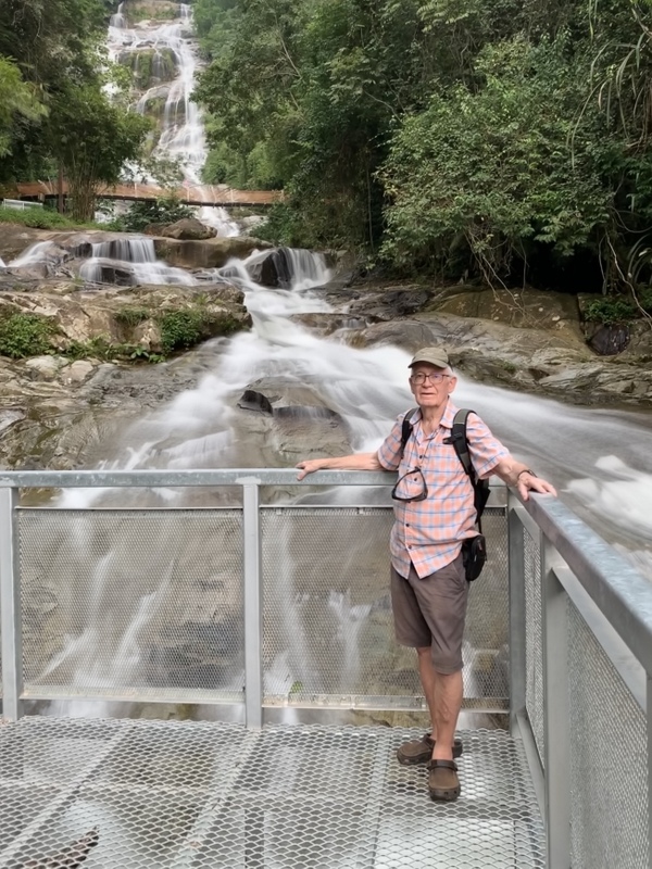
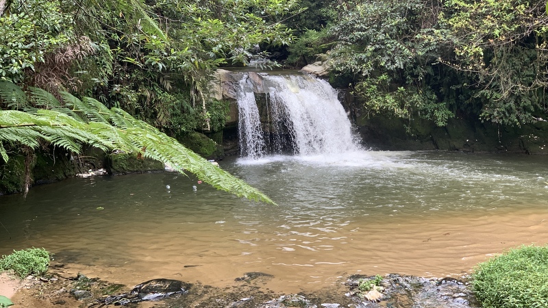
In the afternoon we hiked to another waterfall, the Parit fall. On the way back it started to rain a bit. We have been very lucky with the weather during the whole trip.
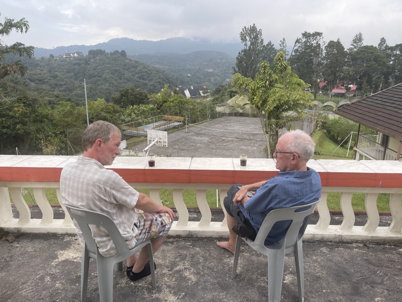
Back in the bungalow Otto and I enjoyed a glass of whisky on the balcony. You have to book for dinner and breakfast in advance. The food was not bad, colonial style: fish and chips for Nina and chicken chop for the others.
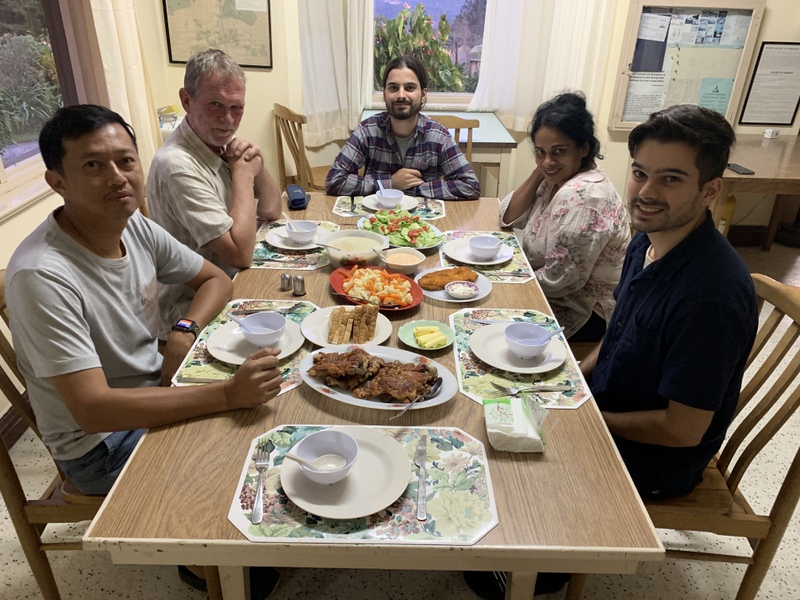
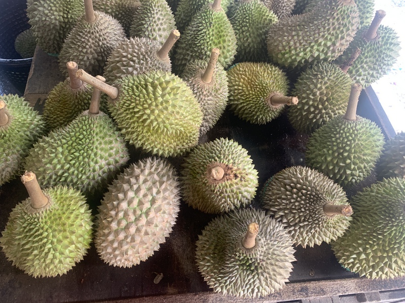
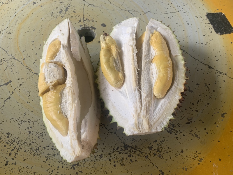
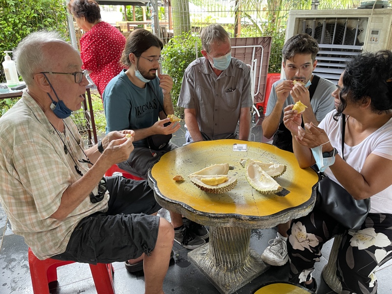
The next day we took another route from the CH back to KL. Passing through Raub, a famous place for durians, we stopped at a stall and Aric bought one. For RM 132 , yes durians can be very expensive. But we just had to let our guests taste the “King of Fruits”
I am addicted to durians, judge for yourself what the others though about it.
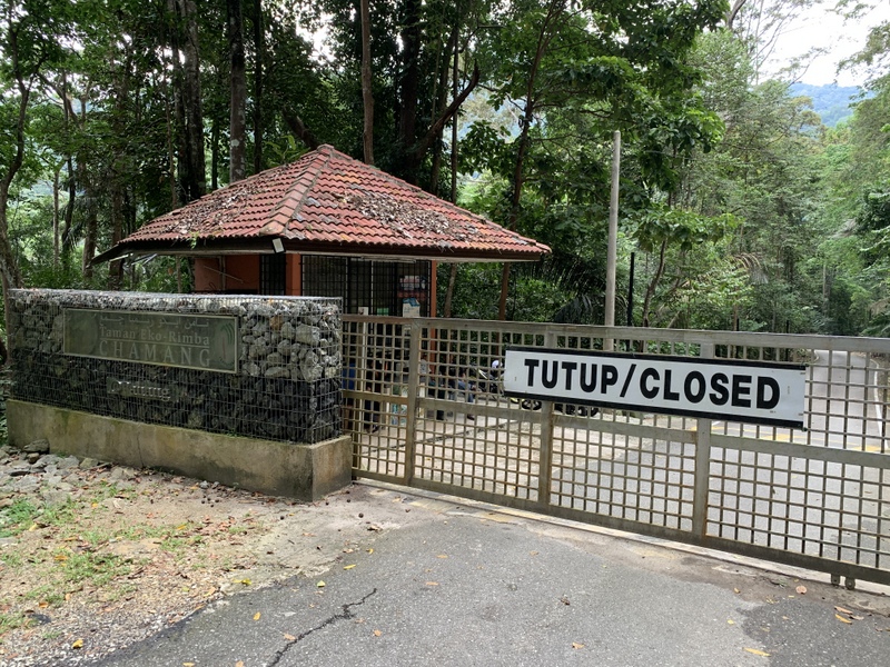
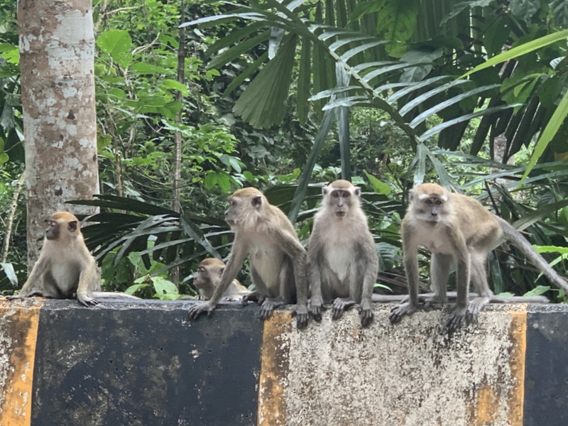
Our last stop was at the Chamang waterfall, until recently always open without paying tickets, but now closed. It is called development :-(. But at least we saw a nice group of long-tailed macaques along the road.
We did a lot during our 8 days trip ;-). and came back quite exhausted.