In January 2003 Aric and I went camping at the Gombak river and during our hike I noticed a sign to the Pisang waterfall. Back home I searched the Internet and found a webpage about this Pisang waterfall, maintained by a guy named Khong. I decided to write to him and immediately got an enthusiastic reply. We met and soon became friends. He had published many waterfall pages, but recently had become more interested in birdwatching. We decided that I would manage and develop further a website Waterfalls of Malaysia (WoM)
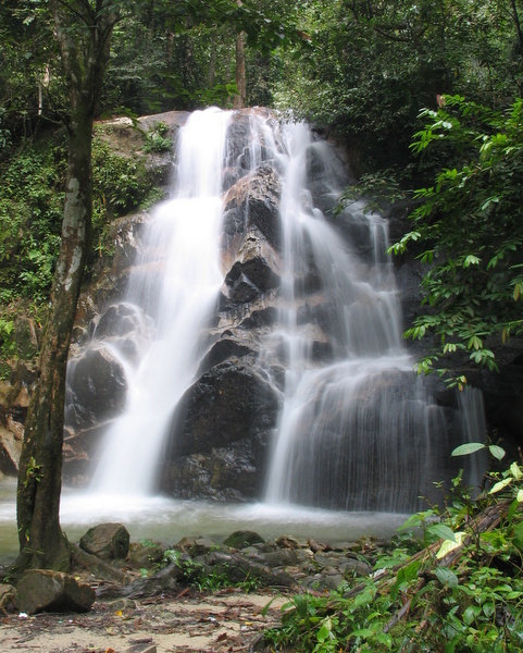
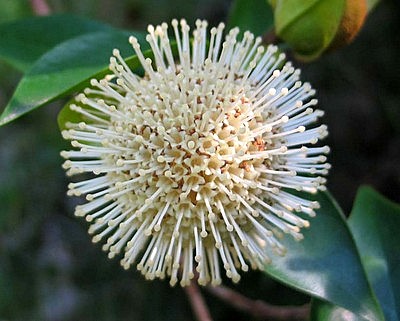
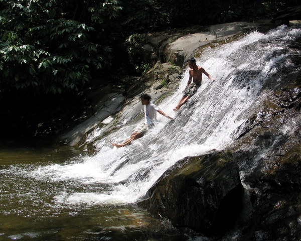
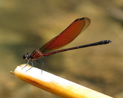
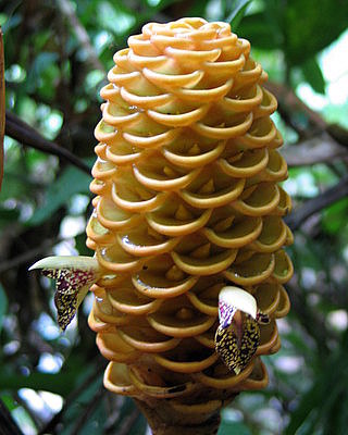
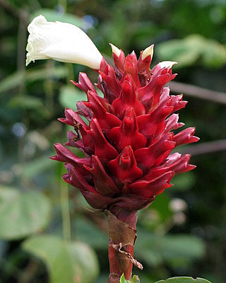
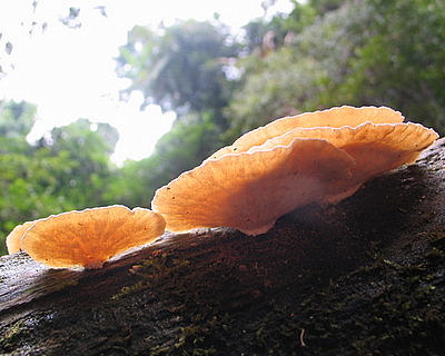
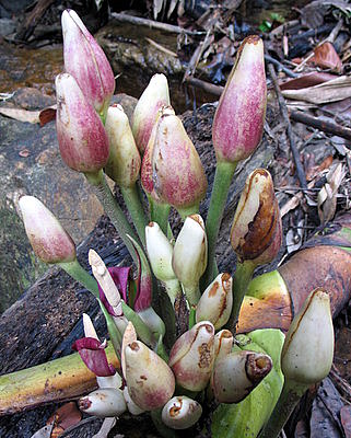
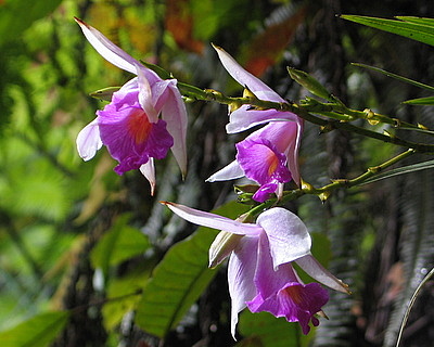
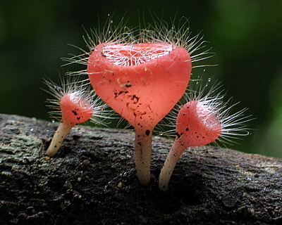
That was the start of what became my waterfall addiction…:-). I have collected in this blog many of the waterfalls I have visited from March 2003 until March 2006, more than a decade ago. The pictures of fauna and flora have been taken during these trips. Clicking on a link will bring you to the corresponding waterfall page of WoM.
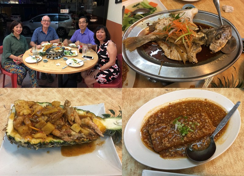
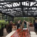
“Do you have a plan for your next Taiping visit”, a friend asked me. “Not really”, I replied, “I just like to visit my second hometown, meet friends, enjoy the food, see what is new (and what is still ruined)”.
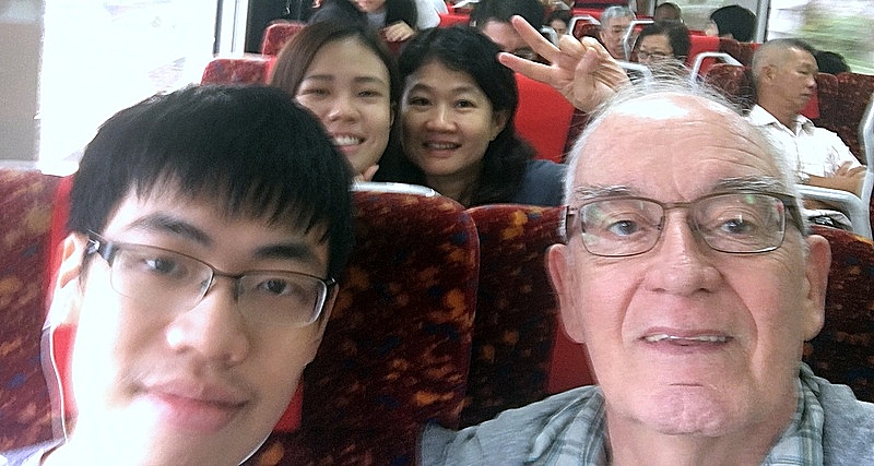
I booked three nights in my favourite Furama Hotel and went by train to Taiping. Aric and his family traveled to Thailand, using the same train, an opportunity to practice my selfie (wefie) skills.
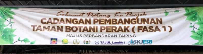
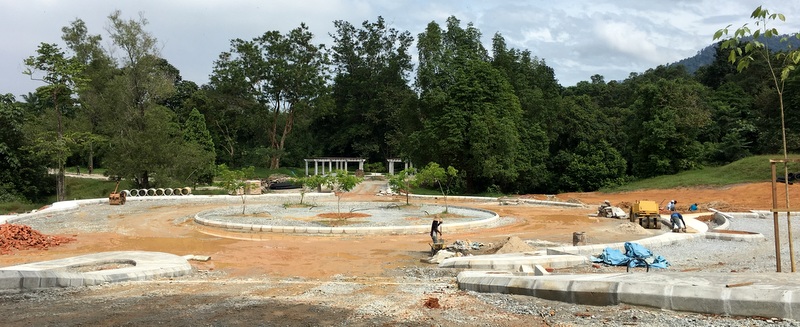
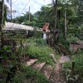
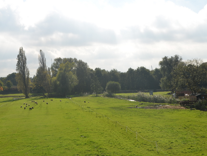
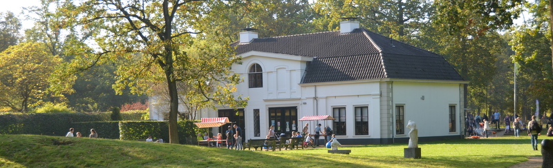
At the Taiping station my THS (Taiping Heritage Society) friend Tung Lay Chun was waiting for me. She had arranged a (preview) visit to the new Telegraph Museum, but first she showed me the work going on at the future Botanical Garden of Taiping. A botanical garden in Taiping? It was the first time I heard about it
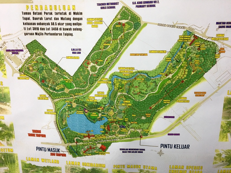
In this Google Earth map I have sketched, with a red contour, the location of the proposed Botanical Garden. The green markers indicate existing buildings and points of interest. As you see, it is a huge project, compare it with the size of the Lake Gardens
The banner suggests that the Taiping Town Council (MPT) is responsible for the project and I was told that funding is by the Federal Government. RM 10 million for the first phase!
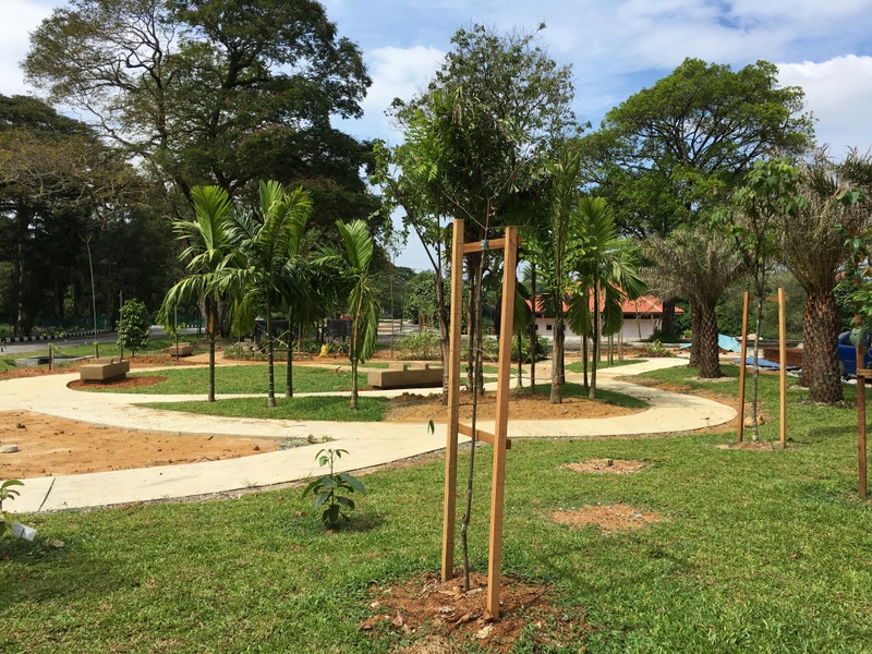
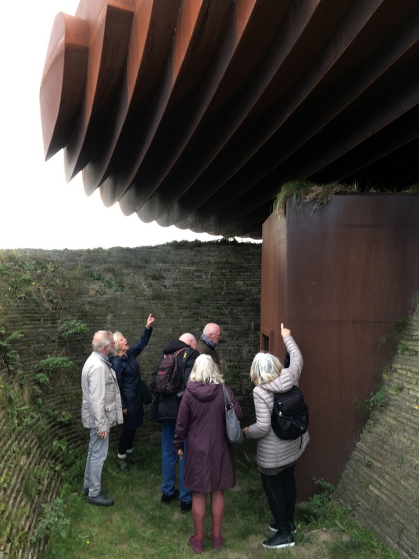
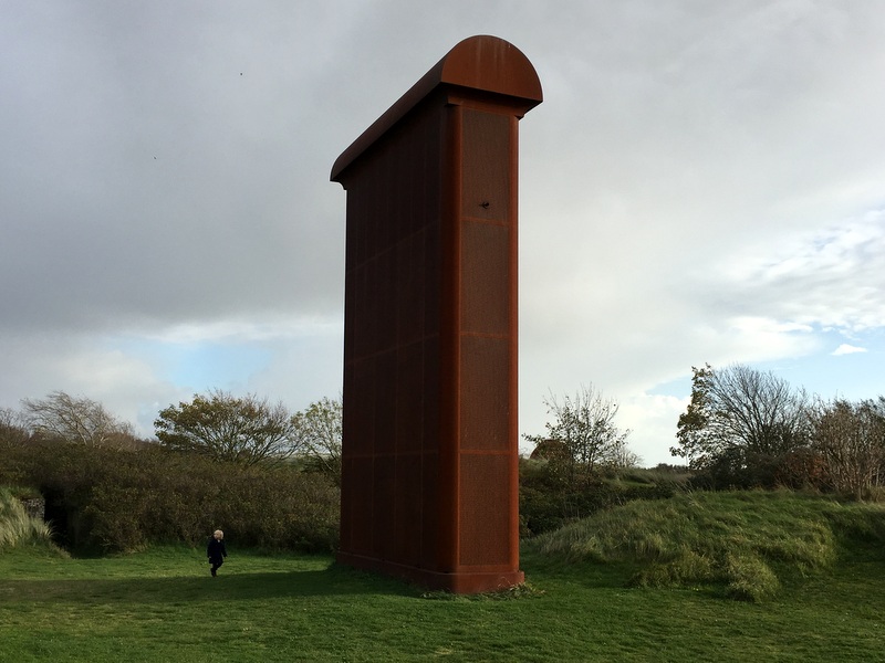
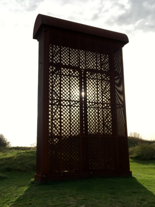
Here is a plan of the garden. The supervisor, a nice Malay lady, explained a bit about the garden
According to a signboard, the first phase should be completed in November 2018, but when I look at the present situation, I wonder whether that is feasible. Here are some pictures.
A large parking lot, they must expect many visitors
To be honest, I have my reservations about the project. Penang has its famous Botanical Gardens (1884), Taiping its equally famous Zoo (1961), the oldest in Malaysia. Why create another botanical garden in Taiping? Will Penang follow with another Zoo? A friend said that it may be better to have a Botanical Garden there than buildings and condos and of course I agree, but the money could also be used to upgrade/beautify/renovate Maxwell Hill and its heritage bungalows.
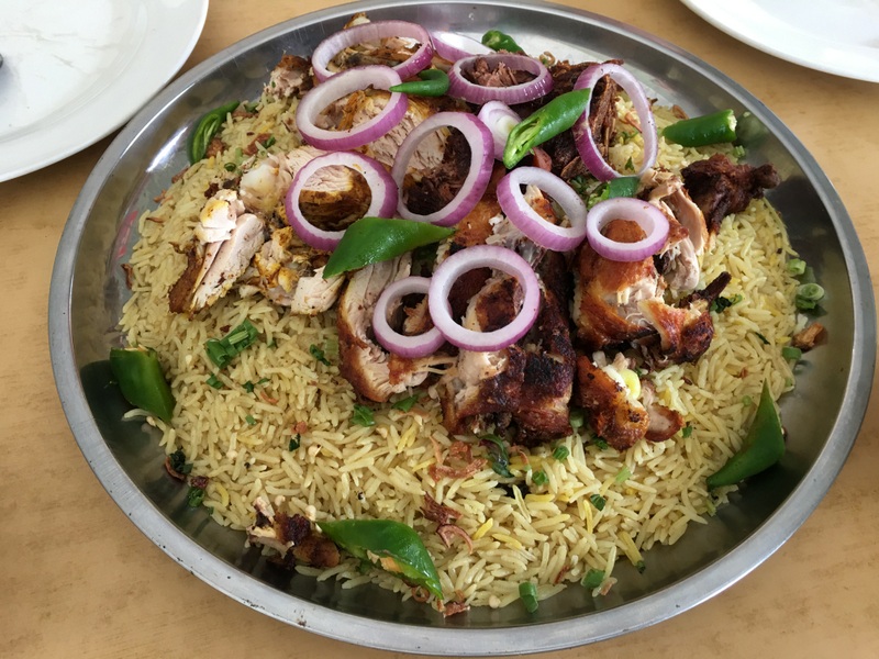
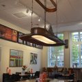
After this visit it was time for lunch. Nasi Arab, delicious!
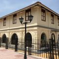
The Telegraph Museum is not yet open to the public, but the friendly supervisor Athira didn’t mind showing us around. Most of the exhibits are already there, but they are still working on the explanatory notes.
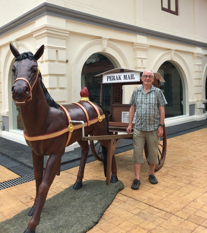
It is apt that Taiping has been chosen as the location for a telegraph museum, as the first telegraph line was opened in 1874 between the Deputy Resident in Taiping and the Residency in Kuala Kangsar. The building, housing the museum, was built in 1884 by the department of Posts and Telegraph and has been beautifully renovated. In the beginning it was also the post office.
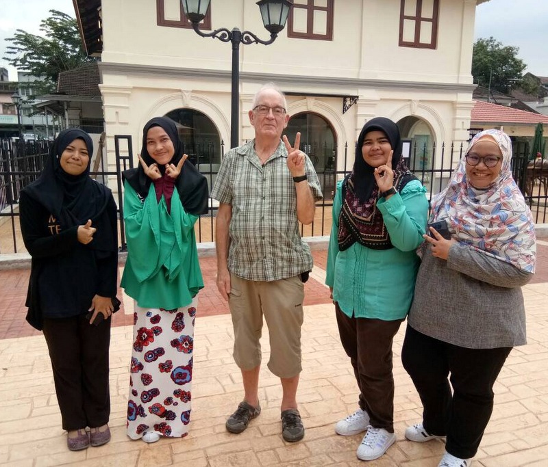
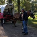
Here I am standing in front of the museum, in the left picture with a mail coach and in the right one with Athira (in black) and three interns, who are helping her.
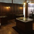
We had a look of the interior, with some machinery, digital displays, you could practice Morse code etc. It will become an interesting museum when everything is finished.
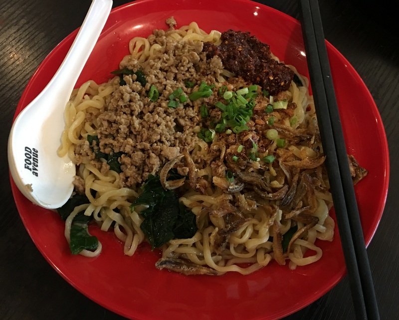
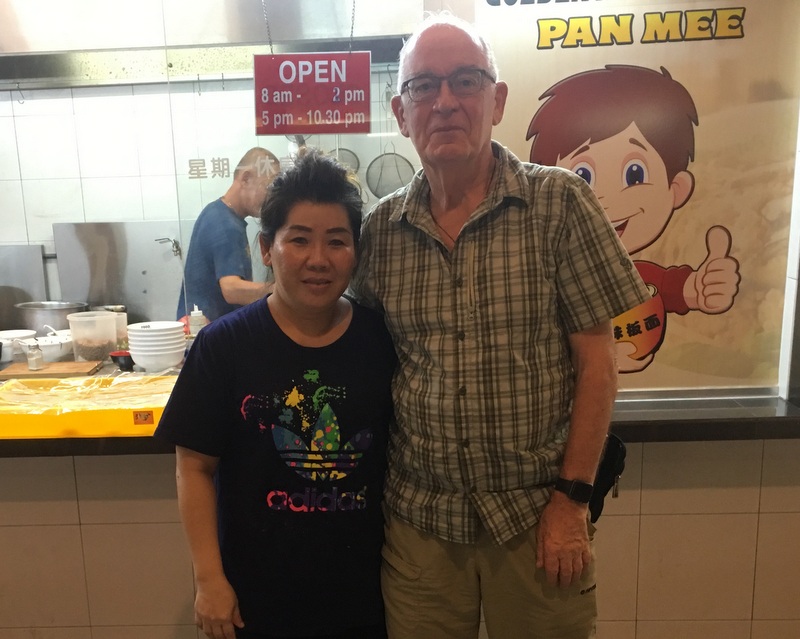
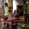
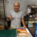
That evening I had dinner with Lay Chun’s husband in a food court near the Beverly hotel, chilli pan mee. Good food, nice company! The friendly owner of the stall was happy to be in the picture with me…:-)
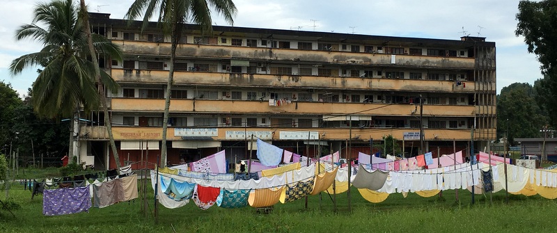
The next morning, on my way to breakfast, I passed the row of dobi (laundry) shops, which use the field in front to hang and dry the laundry. Often very colorful and photogenic.
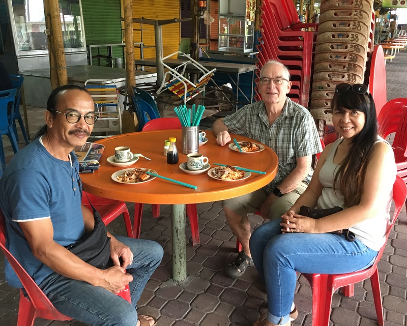
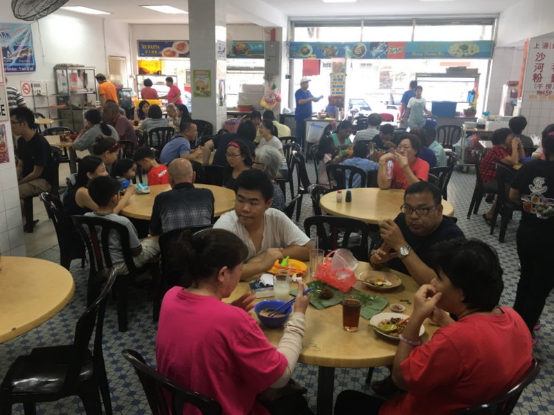
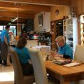
I had asked Suet Fun and Peter, the tenants of the Nest bungalow, to join me for breakfast at the Chee Cheong Fun stall in the Taiping hawker center.
After my visit in September I had whatsapped on and off with Tong, the owner of the stall. The CCF was delicious and it turned out that Peter and Suet had met Tong before. Taiping is an even smaller world than Malaysia…:-)
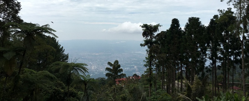
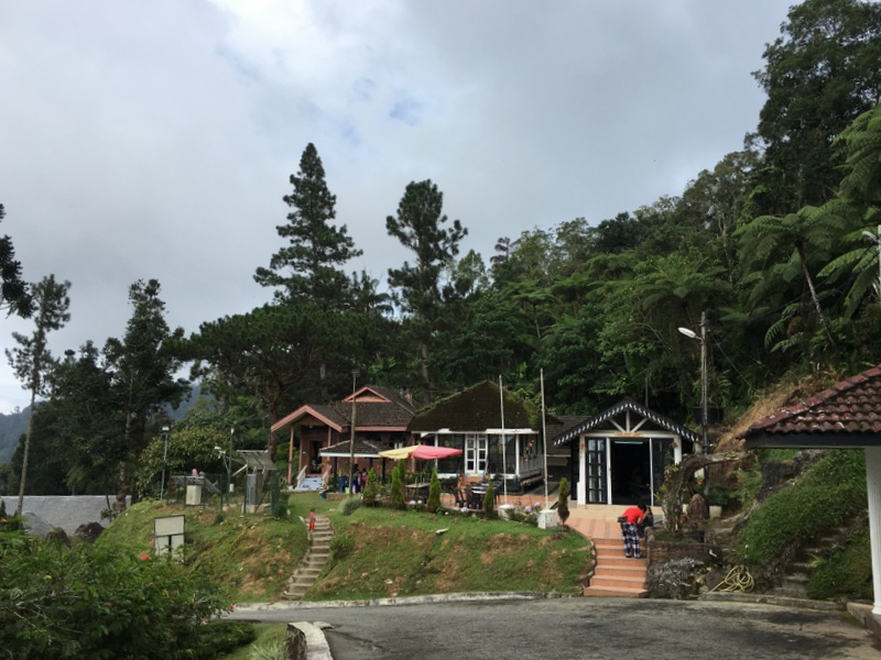
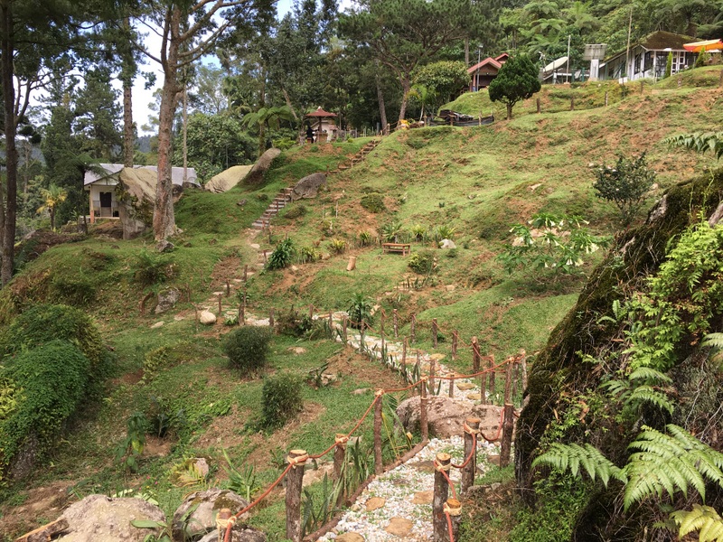
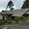
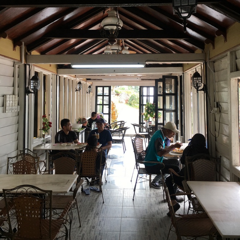
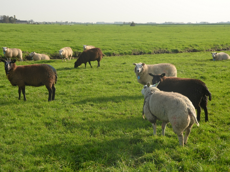
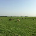
I had no specific plan for the rest of the day, so when Wan Amril called me and told me that he was going to his cafeteria at the 6th Mile on Maxwell Hill, I asked him if I could join him. The 6th mile is the end point of the jeep service. Beside the cafetaria, there are a few bungalows. As it was school holidays and also weekend, there were quite a few visitors, good business for the cafeteria.
It was a nice day, the view was quite good, deep down you could see Taiping town and far away the coastline of the Straits. Pleasant atmosphere
While Amril was busy I walked around a bit and took pictures..Left a view of the 6th Mile “village” and right a walking path, recently constructed.
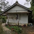
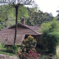
Here a few pictures of one of the bungalows in the 6th mile village. According to Amril the original name was the Doll. Now it is being renovated by his mother, the wife of the OBJ.
The Doll bungalow
Romantic
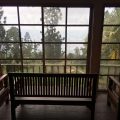
A room with a view
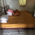
Basic accommodation
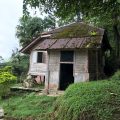
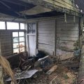
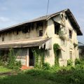
A few other bungalows at the 6th mile are probably beyond repair.
Rumah Delima
Abandoned
Another small bungalow
Destroyed by a landslide
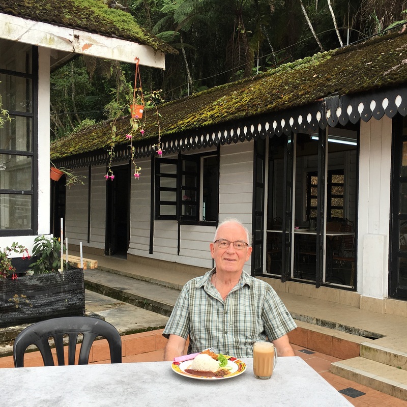
I had my lunch at the cafeteria
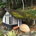
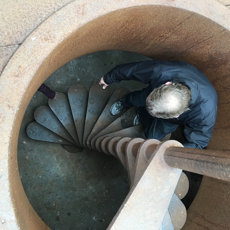
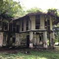
There was time enough to walk the ~1 km uphill to Speedy’s bungalow, where I celebrated my 60th birthday, 13 years ago. Guna was the caretaker then. Later there has been a failed attempt to create a biodiversity center here. Now it is closed, such a pity.
Speedy’s still looks good
But it is closed
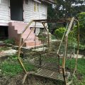
In colonial times this was a tennis court
The failed biodiversity project
It was a nice and refreshing afternoon. Maxwell Hill deserves to become a more popular tourist attraction in Taiping.
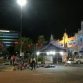
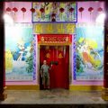
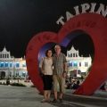
That evening I had dinner with my friend May, as usual in Siang Malam. Later we walked to the Cross Street Bazaar and the District Office, we had a look at the Ho Hsien Ku temple and we had our picture taken in front of the I Love Taiping sign. Coffee in a nearby stall was the end of a rewarding day.
Cross street Bazaar
Ho Hsien Ku temple
We love Taiping
Coffee
Where to have breakfast the next morning? I was in the mood for half-boiled eggs and toast and decided to go to the Lian Thong shop in Jalan Kota, but it was closed on a Sunday. So I ended up in Prima, also not bad.
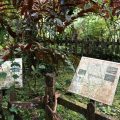
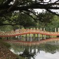
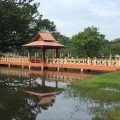
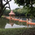
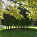
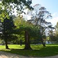
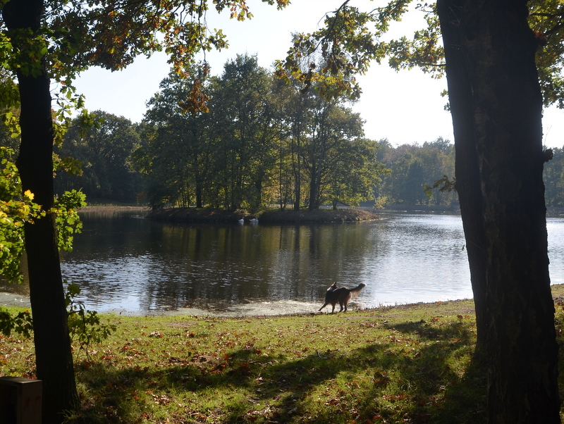
Time for a walk in the Lake Gardens. On my way I passed two historical landmarks, the Government Offices (now District Office) and the Chartered Bank (now Public Library). See my blog Taiping, old and new .
it is always a pleasure to walk around in the Lake Gardens
During my last visit in September I had met a gentleman at the Ansari cendol stall, see my report Taiping September 2017 . Because of our shared interest in Taiping Heritage we had kept in touch and when he heard that I was visiting Taiping again, he suggested that I should visit his sister, Mrs Kim Long, who is living in Barrack Road and who I had met for a short while in September.
After my walk I called her and I was welcome. It was a fascinating meeting with a very vital elderly lady, a treasure trove of memories about Taiping and its past. Looking forward to meet her again
Barrack Road
Mrs Long’s house
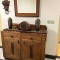
Beautiful interior
Vital Mrs Long
I could not resist the temptation to take a wefie with her.
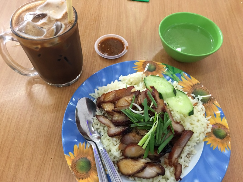
After my visit I had lunch in OK and cendol in Ansari. I had tasty char siew rice in nearby restaurant OK, only later I read in a review that their speciality is soup noodles. Next time!
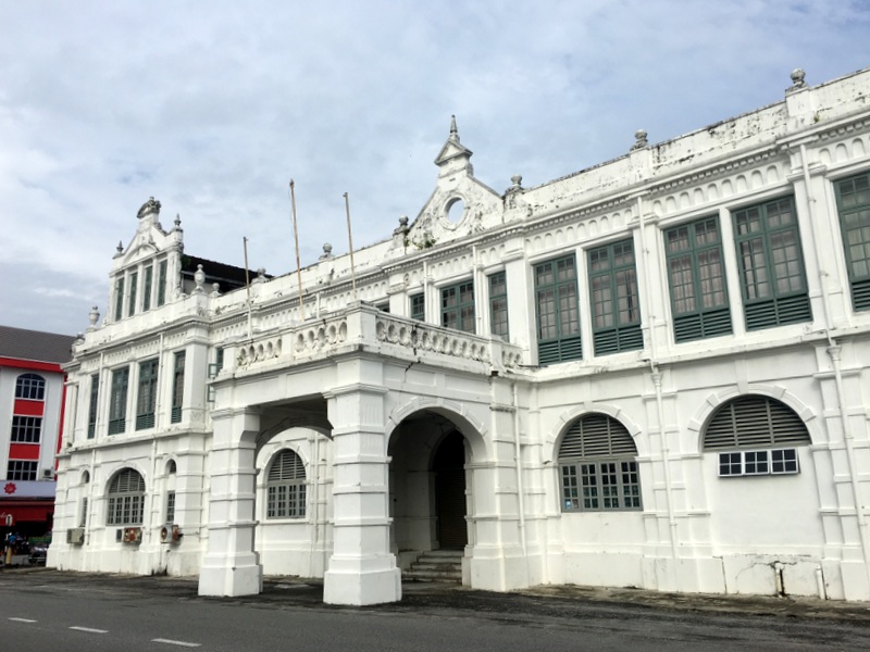
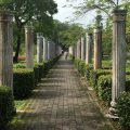
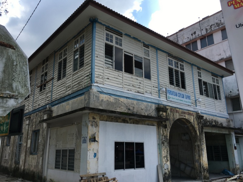
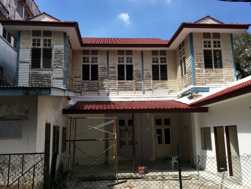
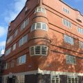
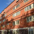
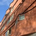
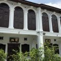
After my lunch I had a look at the building of the Ceylonese Association, nearby at Station Road. Built in 1901, it is now being restored! Left the front facade, right the back.
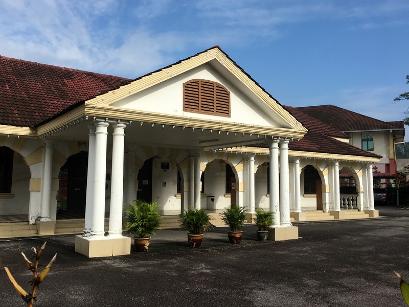
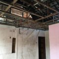
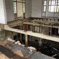
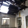
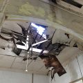
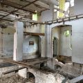
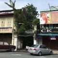
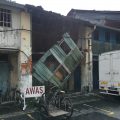
Also at Station Road, opposite the iconic buildings of the King Edwards VII school, are what I have called the Shame of Taiping, the former Rest House and the former PWD department (originally the Railway headquarters) . I wrote that report more than four years ago and not much has changed.
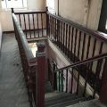
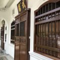
The Rest House has been cleaned up inside and fenced off, but it is still easy to enter. This time I even ventured up the first floor.
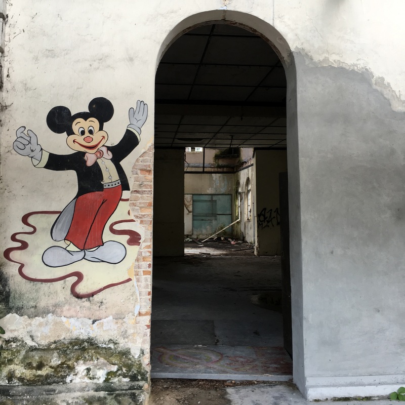
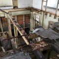
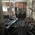
The PWD building, opposite the former First Galleria (another failed project) is actually quite attractive.
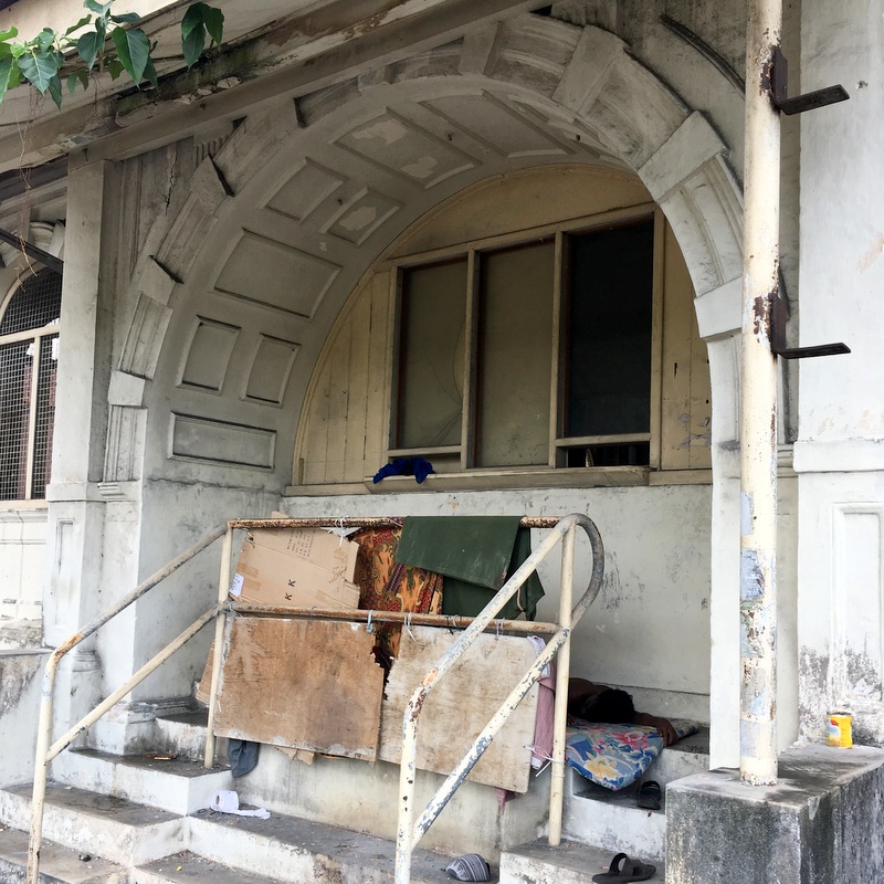
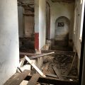
It has been cleaned inside and fenced off, but you can still enter it through the adjacent building (i anybody knows its original function, please let me know. To remove all the trees and rubbish, one entrance was widened and later repaired (left picture), but it is wide open and from there you can enter the PWD building. Before the cleaning operation, squatters were living inside this building, now there was only one, using the former ticket counter (?) as a makeshift house (right picture). He was sleeping, I didn’t disturb him. A sad situation.
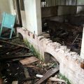
The reason that squatters don’t live inside the building anymore, can be seen in the picture gallery below. Most of the flooring has disappeared! Has this been done by the owner (MPT?) or has there been illegal looting, as the wooden floor boards are valuable according to my friend Yeap.
Will be continued during my next visit. Taiping Bandar Warisan!
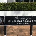
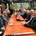
That evening I had invited friends for dinner at the New Bee Guan restaurant, Jalan Maharajalela, around the corner from my hotel. Food was not really special but the company was pleasant
The next morning I had dim sum for breakfast with Yeap, the president of the Taiping Heritage Society. We talked about heritage and that it would be nice if Ipoh, Taiping and the Kinta valley could get Unesco World Heritage status, with tin mining as central theme.
I had booked a train ticket for the afternoon, time enough to walk around a bit and take some more pictures
Birch was murdered in 1875 by Maharajalela!
Another picture of the colorful dobi shops
The Silver Jubilee jetty (1935)
The famous raintrees of Taiping
One of my friends wondered why I didn’t move to Taiping permanently…:-). There are many reasons why I will stay in PJ, but I hope to revisit Taiping many more times.
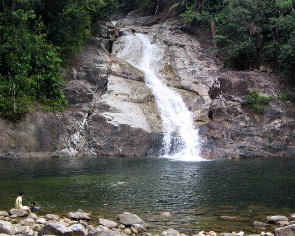
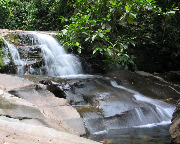
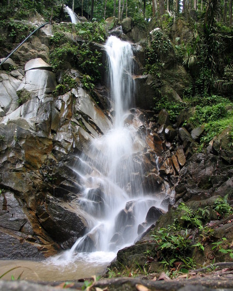
Here is a nostalgic report about two waterfall trips, made with my friend George Tan, in 2009 and 2011. During a recent visit to Taiping I talked with Jenny, a mutual friend, about these trips, she thought it had been irresponsible for two senior citizens to venture so deep into the jungle on their own. And although everything went well, in retrospect I think she was right.
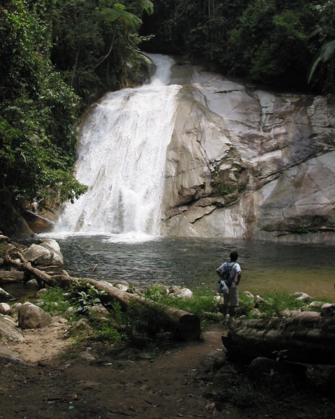
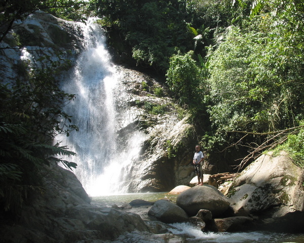
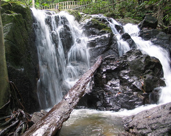
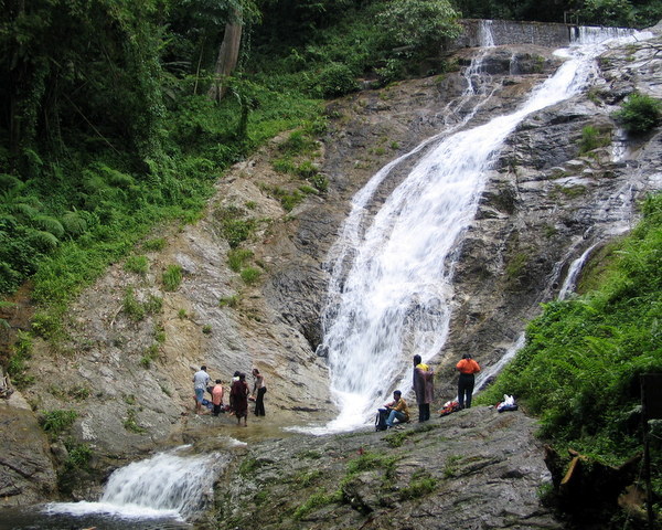
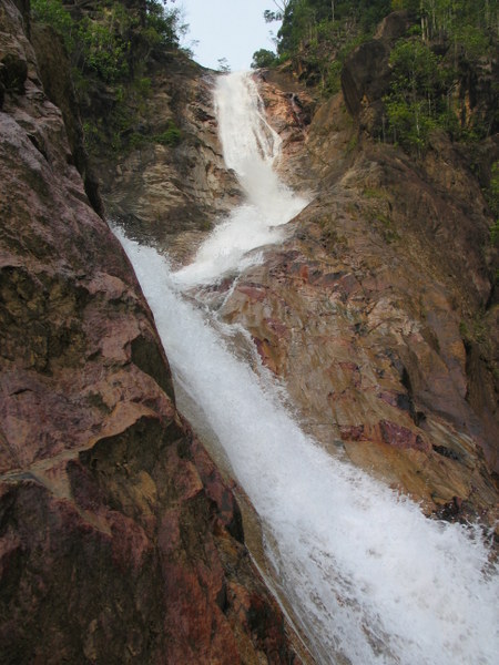
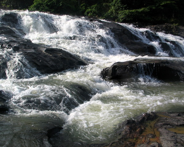
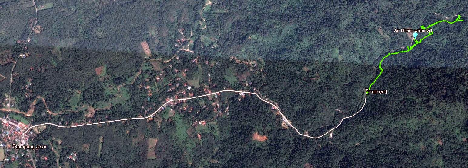
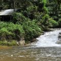
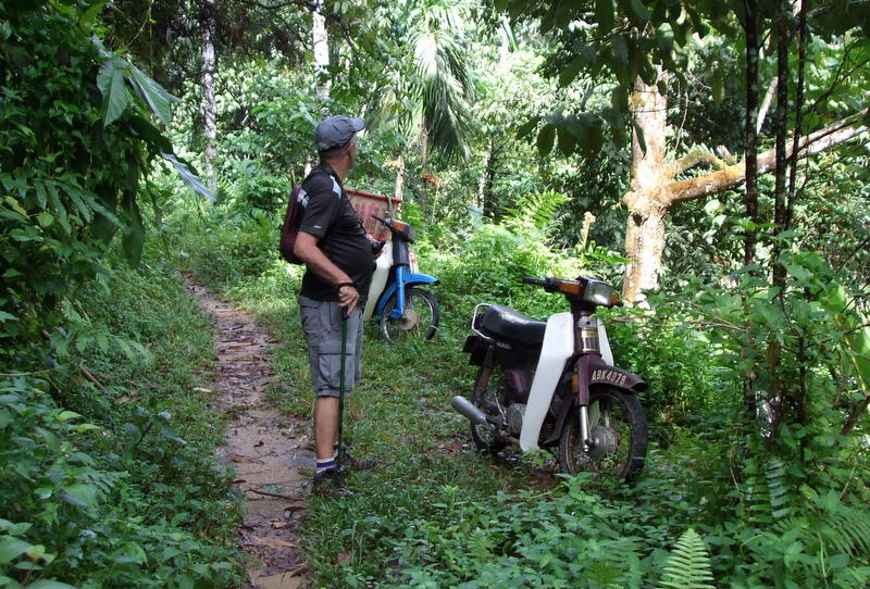
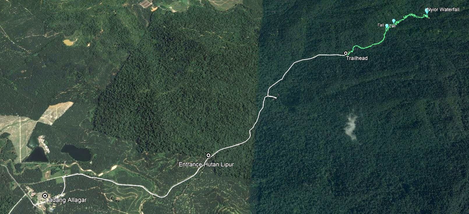
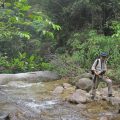
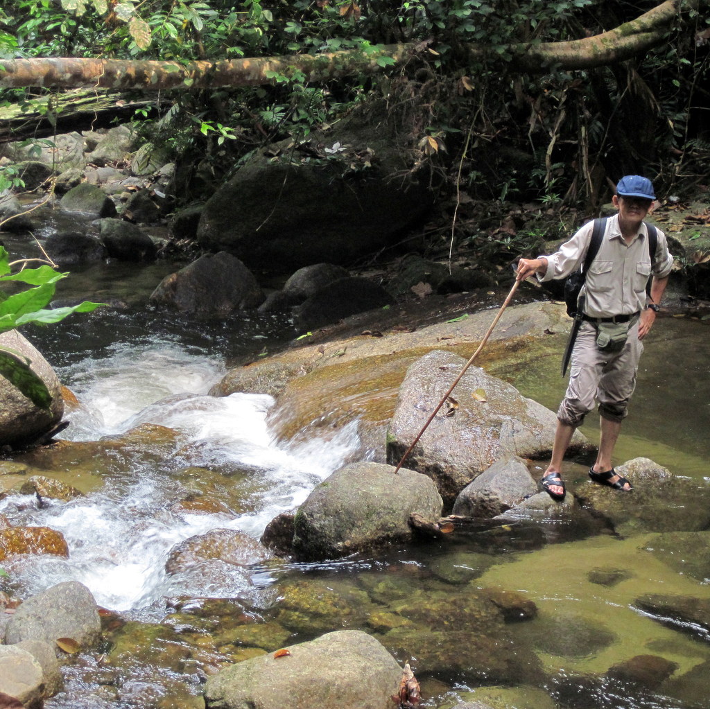
The first trip took place in 2009 when I was 65 year old and George 63. My waterfall friends had told me about a waterfall, north of Taiping in the Batu Kurau region. From Kampung Jelai a small road leads to a water catchment area, where we parked the car and started walking. Here is the Google Earth map (click to enlarge)
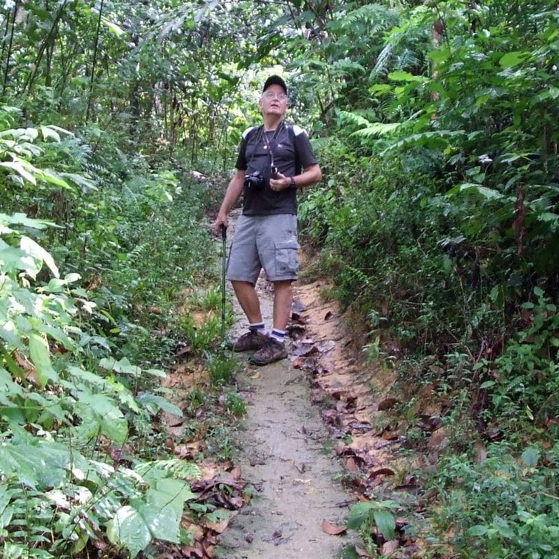
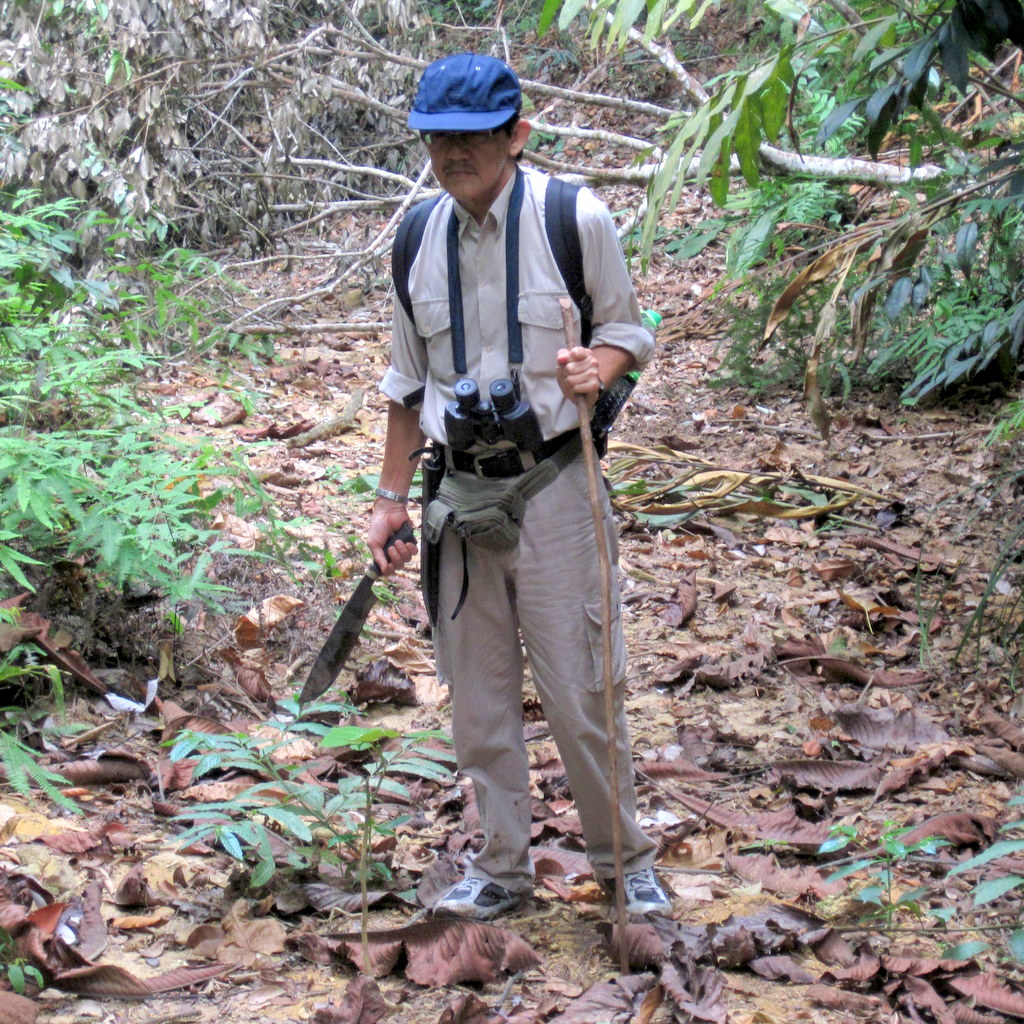
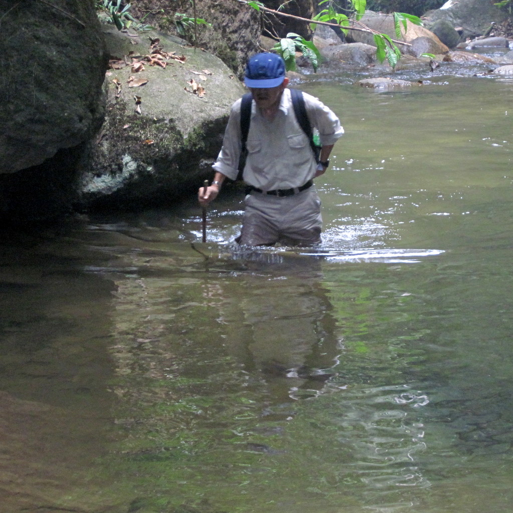
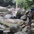
We followed a clear trail high above the river, but to reach the waterfall we had to scramble down a steep slope. A parang came in handy and George knew how to use it.
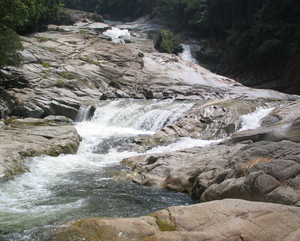
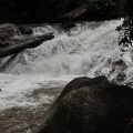
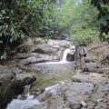
Not surprisingly this was leech country. There are several cascades and smaller waterfalls, we did quite a bit of esploration
Leech country
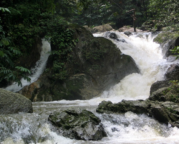
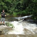
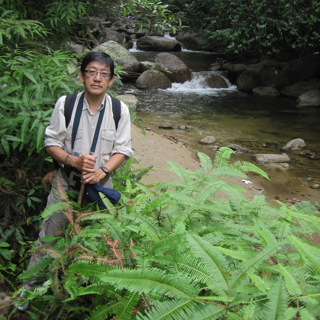
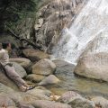
We reach the river
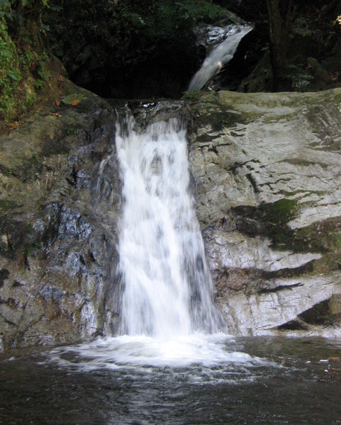
The first waterfall
Lots of water
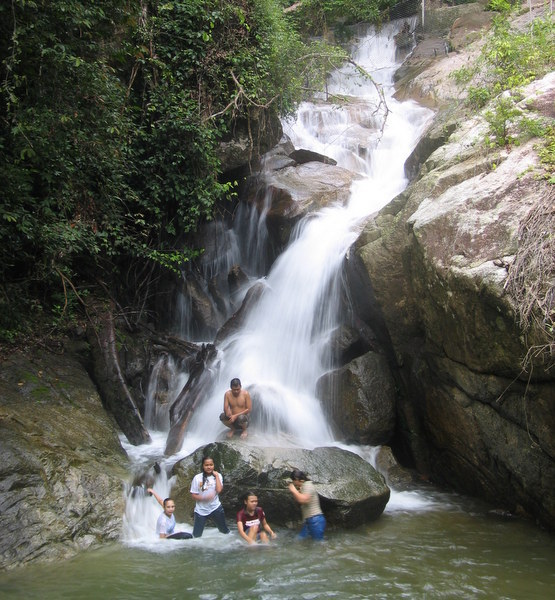
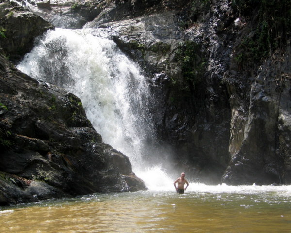
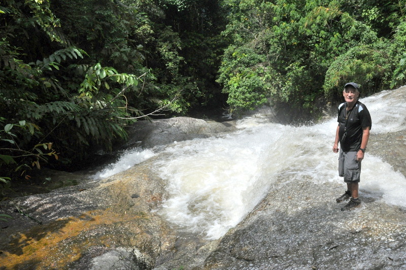
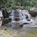
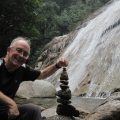
Here we are, two senior citizens in the jungle.
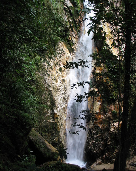
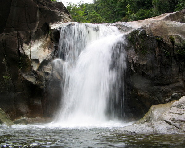
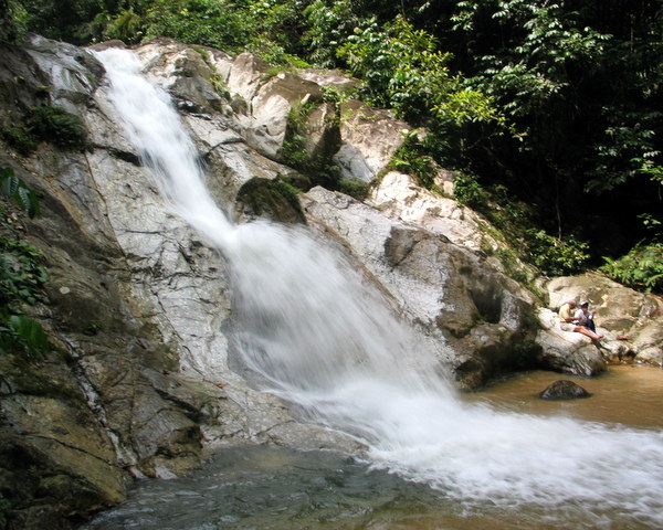
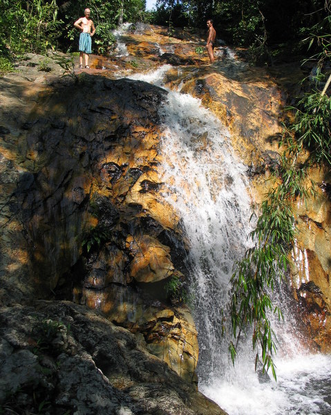
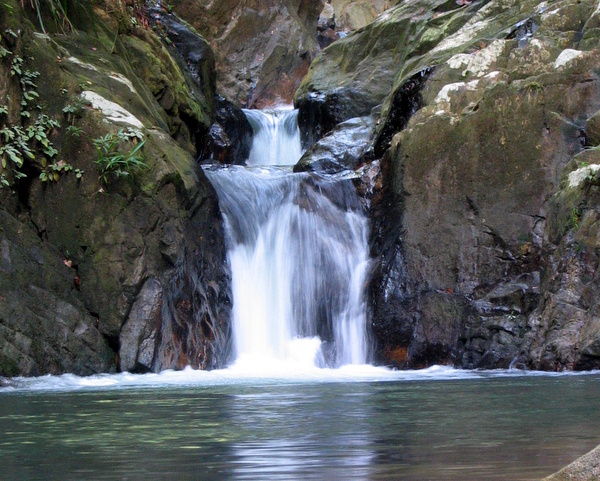
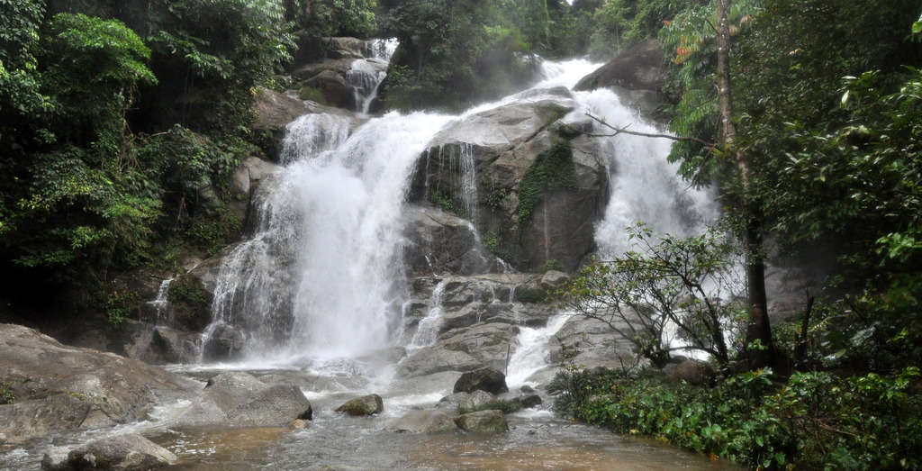
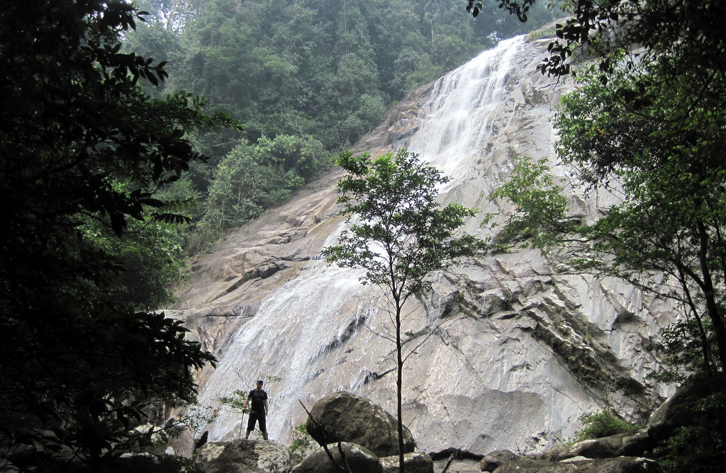
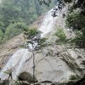
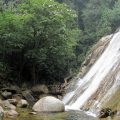
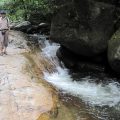
And this is the impressive Air Hitam waterfall
The hike took us about three hours, during which we did not meet a single soul, although we saw signs of life along the trail, a shelter here, a motorbike there. But ok, when something would have happened during our scrambling down, we would have had a problem.
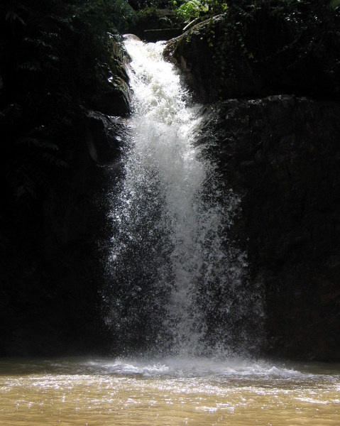
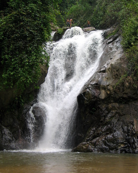
The situation has changed, after I published the Air Hitam waterfall on my website. I have revisited the fall several times and there is now a clear trail leading down directly to the main fall. Fortunately the fall is still relatively unknown and pristine.
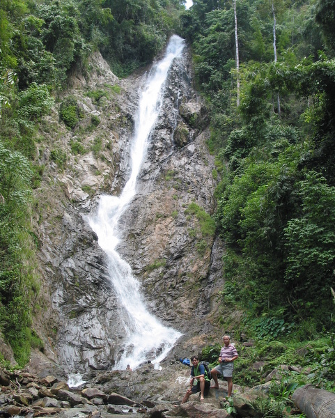
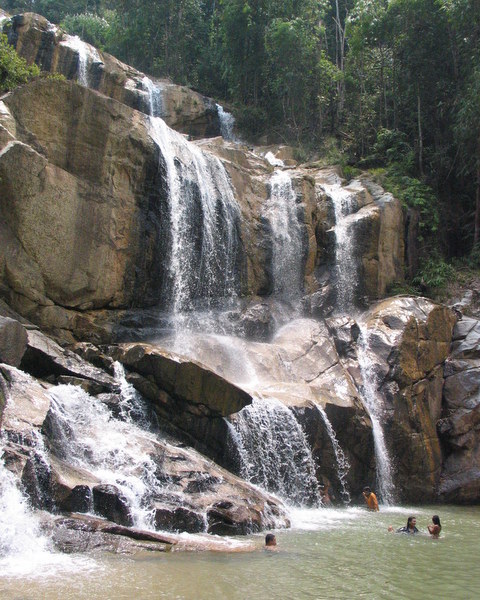
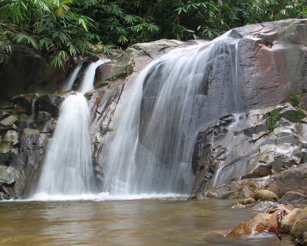
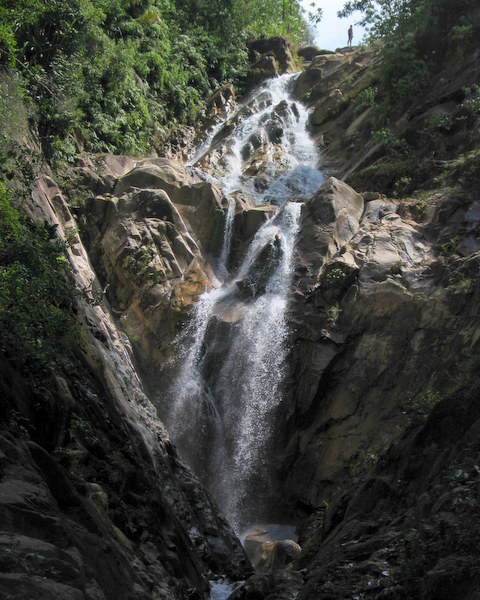
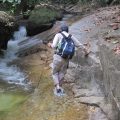
Two year later we went to the Nyior waterfall in the Bubu mountain range. A much more serious adventure.
Ladang Allagar is a plantation between Terong and Beruas. Crossing the plantation you enter a Forest Reserve. The road ends at a water catchment, where the trail starts.
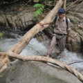
At first there is still a trail but soon you reach the river and from there you have to river trek
River trekking is fun, but not always easy. You have to be careful with slippery rocks
And you will get wet…:-)
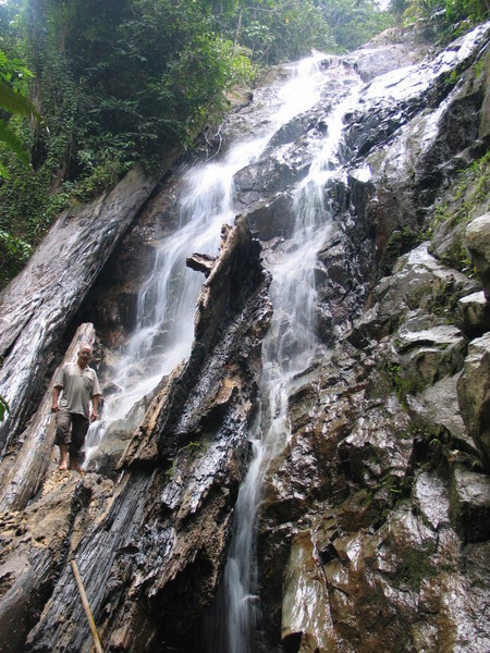
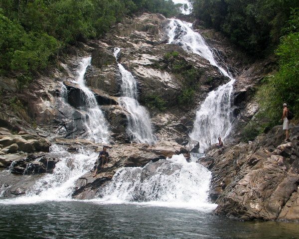
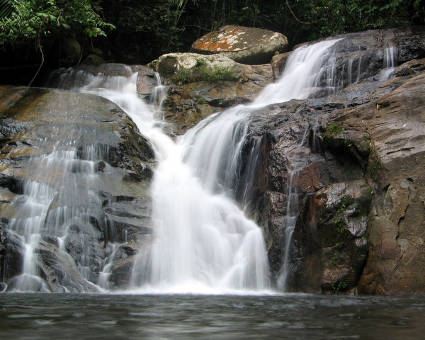
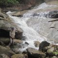
Finally we reached the main Nyior waterfall. Far from civilisation, worth the effort
We stayed at the fall about one hour, enjoying ourselves. Pity there was no pool.
George was here!
Tiny human, tall fall
Relaxing
Leaving my signature
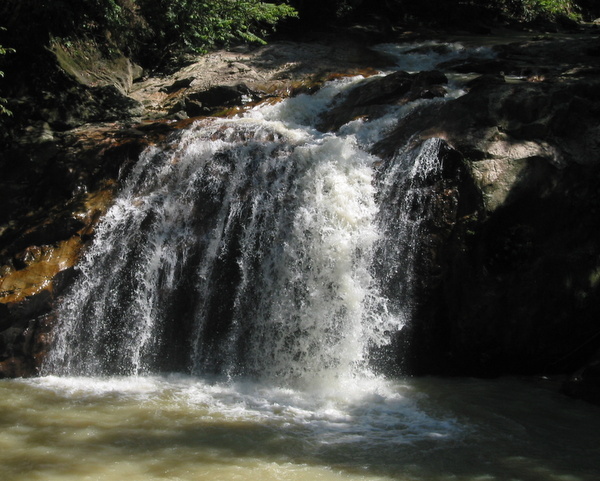
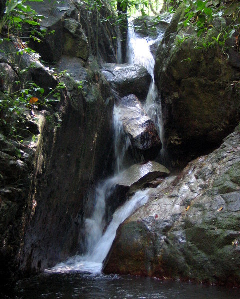
Walking back the same way, we had a look at a few smaller falls
Altogether the hike took us almost 5 hours, it was not a difficult one, again we met nobody but this time there were also no signs of human activity. If one of us would have had an accident, we would have been in serious trouble.
That was six years ago. For George this trip was a reason to say, enough is enough, no more remote waterfall hikes. And I decided only to go to remote waterfalls in the company of 2, preferably 3, strong, (young) men… 🙂
So, yes, it was a bit irresponsible what we did 🙁 🙁
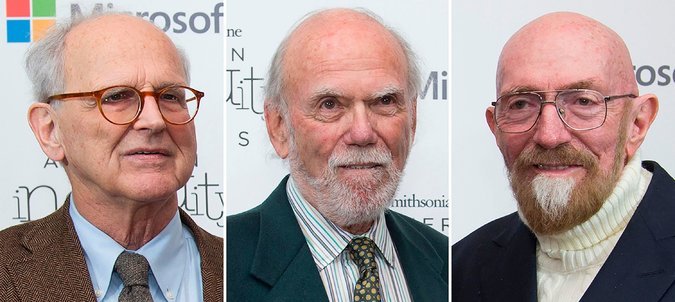
Last month the Nobel Prize for Physics has been awarded to three American physicists for their ” decisive contributions to the LIGO detector and the observation of gravitational waves”
All are retired professors and quite old, not unusual for Nobel Prize winners…:-; More unusual is that this Nobel Prize has been awarded for the observation of gravitational waves in September 2015, only two years ago! The time between a discovery and the Nobel Prize is often 10-20 years and tends to increase
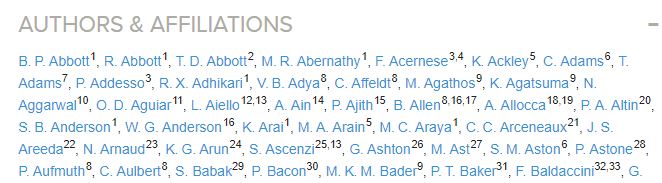
In this case the physics community was pretty sure that the Nobel Prize would go to LIGO, the Laser Interferometer Gravitational-Wave Observatory, where the gravitational waves were observed. Problem is that a Nobel Prize (with the exception of the Peace Prize) can not be awarded to an organisation but only to a maximum of three individuals (and never posthumously). And the article in Physical Review Letters, where the discovery was published in February 2016, has more than 1000(!) authors. Here is the beginning of the author list
In this blog I will explain why these three people were selected. But first I must tell a bit more about gravitational waves, and why physicists are so excited that they have been observed.
Motion takes place in 3-dimensional space as a function of time. Both space and time are absolute concepts, independent of each other.
Newtonian mechanics works extremely well, but there is one disturbing fact, the speed of light c in vacuum turns out to be always the same, no matter how fast the light source is moving itself. Einstein “solved” the problem in 1905 by accepting the constancy of c as a fact, which resulted in his Theory of Special Relativity (TSR)
But it came at a price! Space and time are no longer absolute and independent in this theory, together the three dimensions of space and the single dimension of time form a 4-dimensional continuum, called spacetime .
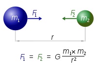
Gravitation doesn’t play a role in the TSR, but in 1916 Einstein publishes his Theory of General Relativity (TGR). In this theory gravitation is described as a curvature of spacetime. A massive object like the Sun curves the spacetime in its surroundings and a planet like Earth just “follows” this curvature.
A consequence of this theory is that even light would follow this curved spacetime and will be deflected when it passes close to the Sun. This prediction was successfully confirmed only a few years later. During a solar eclipse the stars near the Sun became visible and their position was shifted in complete agreement with the TGR. It was front page news and made Einstein world famous.
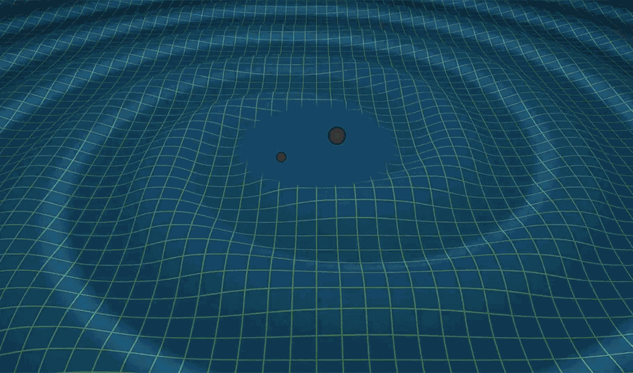
Another prediction of the TGR was that (accelerated) motion of massive objects could produce waves and ripples in this fabric of spacetime. Mind you, in spacetime itself ! However, these waves and ripples were estimated to be very small, maybe only measurable if those objects were extremely massive.
For example, two black holes or neutron stars, orbiting each other.
Here is an artist impression of the gravitational waves caused by two orbiting black holes. I have hesitated to include this image, because I find it very confusing, suggesting that the cells of the spacetime fabric are moving up and down, whereas the cells themselves are changing shape, stretching and contracting. But the image comes from LIGO, so who am I…:-)?
After this long(?) introduction it is time to go back to LIGO and the three Nobel Prize winners.
LIGO has a long and complicated history, starting in the 1960! Here are some important dates. The names of the three Nobel Prize winners in blue. __________________________________________________________________
In 1968, almost 50 (!) years ago, Kip Thorne (Caltech) did calculations about the gravitational waves of black holes. Which, by the way, had not yet been discovered at that time, but their existence followed from the TGR! He came to the conclusion that detection should be possible. Also in the 1960s, Rainer Weis (MIT) proposed to use interferometry to detect the incredibly small variations in the fabric of spacetime. See below for more about interferometry.
In 1980, under pressure of the American National Science Foundation (NSF) , MIT and Caltech joined forces in the LIGO project. But progress was slow and funding not easy.
In 1994, Barry Barish (Caltech) was appointed director of the project. He was a good organiser, proposed to build the LIGO detector in two phases. This proposal was approved by NSF and got a budget of USD 395 million, the largest project in NSF history!
In 2002, the first phase of LIGO became operational, but no gravitational waves were detected.
In 2004, funding and groundwork started for the second phase, “Enhanced LIGO”, four times more sensitive than the first phase.
In September 2015, after a 5 year overhaul of USD 200 million was completed, Enhanced Ligo started operating.
Within days, on 14 September at 9:50:45 UTC, Enhanced LIGO detected gravitational waves for the first time in history. __________________________________________________________________
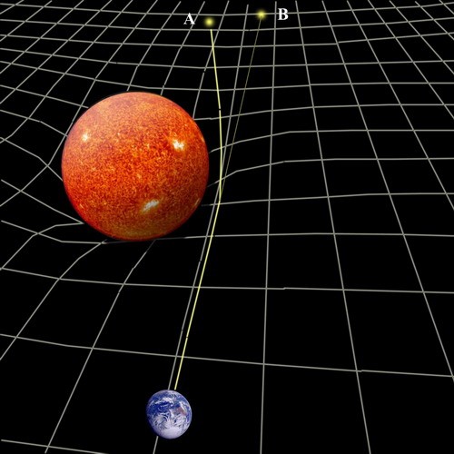
So, what is an interferometer? Here is a sketch of the LIGO interferometer
And who could better explain how it works than Rainer Weis himself?
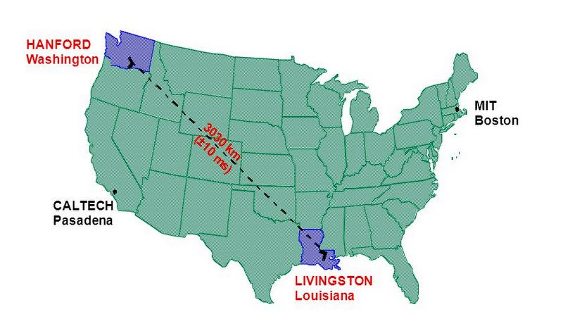
What may not be fully clear from the video is the huge scale of this LIGO project.
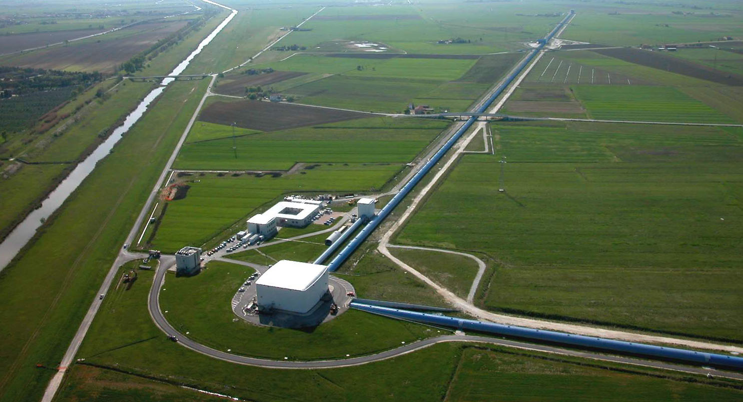
Two “identical” interferometers have been built in the US, about 3000 km apart
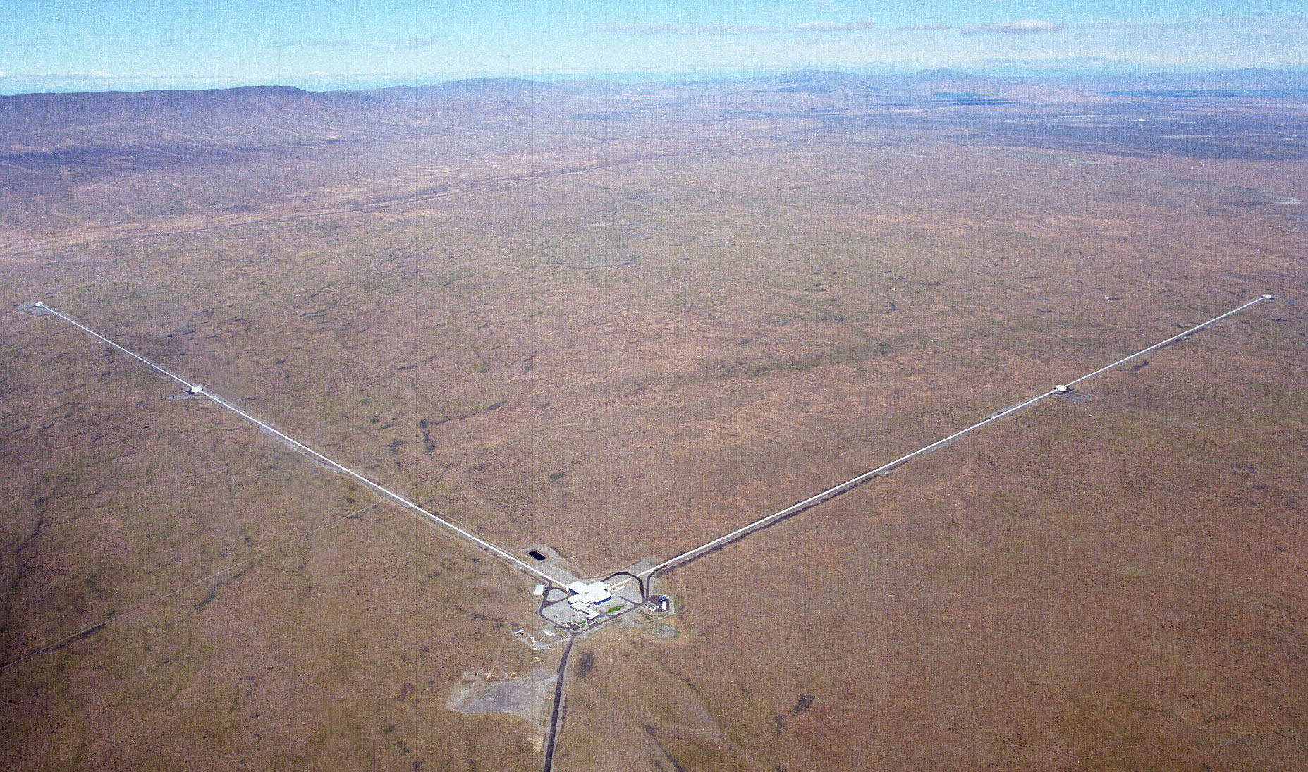
Here is an aerial view of the Hanford interferometer, each of the arms is 4 km long!
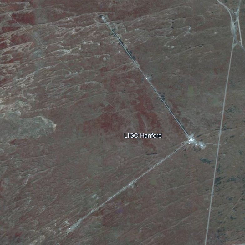
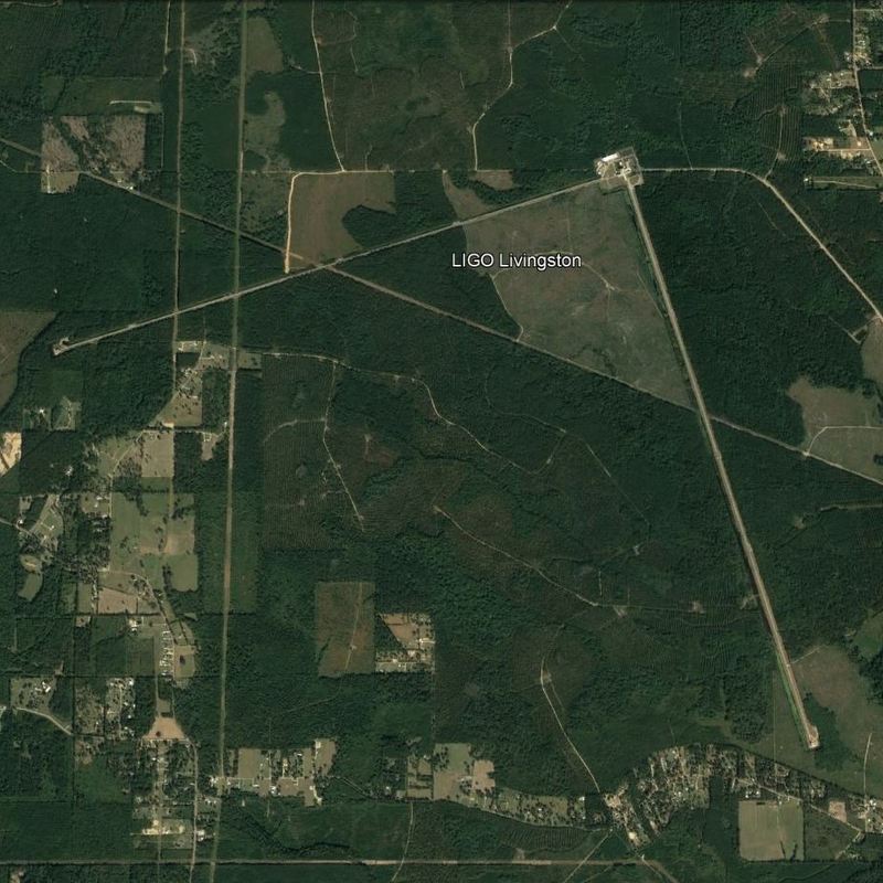
Both interferometers can be seen easily on Google Earth. Left Hanford, right Livingston.
As Weis explained, gravitational waves cause small differences in the length of the arms. Very, very small. In the order of 10-19 m, that is about 1/10.000 part of the size of a proton. Read that again and again, I still find it difficult to believe..:-)
The sensitivity must be about 1/10.000 part of the size of a proton.
New technology had to be developed to reach this sensitivity. Ultra-high vacuum, very precise mirrors, extremely stable lasers. Noise reduction (thru seismic vibrations, a passing truck, etc) is the main problem. That is also the main reason that two interferometers were built. Accidental noise should be different in both detectors, but a gravitational wave should reach both (with a slight time difference, because of the distance between the two detectors).
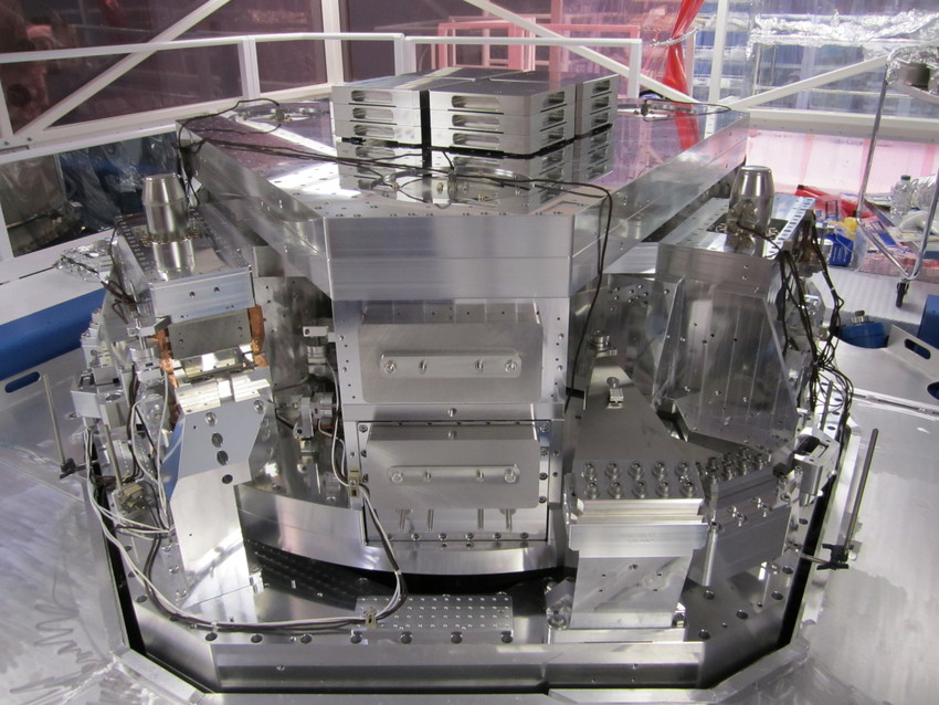
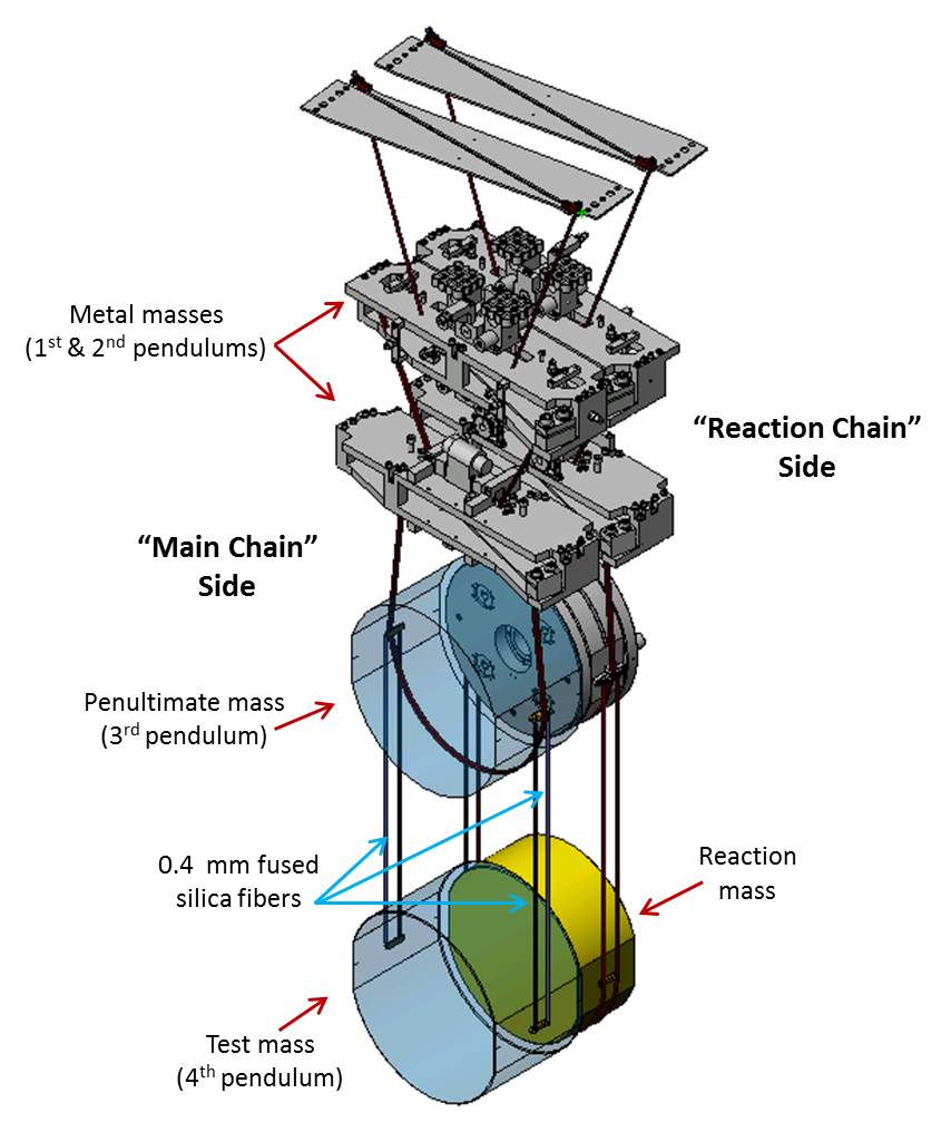
Critical is the suspension of the mirrors. They must be absolutely stable. Here two images of the damping and suspension systems. Click here for details
What kind of signal do we actually expect? Let’s concentrate on orbiting back holes (it is called a binary), like Thorne did. As shown in the earlier image, they produce gravitational waves, but those are way too small to be detected. However, the binary will loose energy sending out these waves, as a result over time the two black holes will get closer and closer. Until they come so close that they will merge into one larger black hole, a cataclysmic process that may take less than a second! It is during this phase that the gravitational waves are much stronger and might be detectable.
Here is a computer simulation of the merger of two black holes. The simualtion has been SLOWED down about 100 times, in reality the merger occurs in a split second. The “moving” background stars are a result of the extreme distortion of spacetime.
Click here to see the gravitational waves, sent out during the merger.
You will notice that before merging the two black holes spin faster and faster, distorting the fabric of spacetime more and more. It is a bit similar to a bird chirp: increasing frequency and loudness. After they merge into one, no more gravitational waves.
So, what happened on 14 September 2015? The two interferometers were to start the first research run on 18 September and were already in fully operational “engineering mode”, when at 9:50:45 UTC both detected the typical “chirp” signal. For testing purposes sometimes “fake” signals were injected, to test the alertness of the system and the scientists. It took a few hours before it became clear that this was a real signal and not a test!
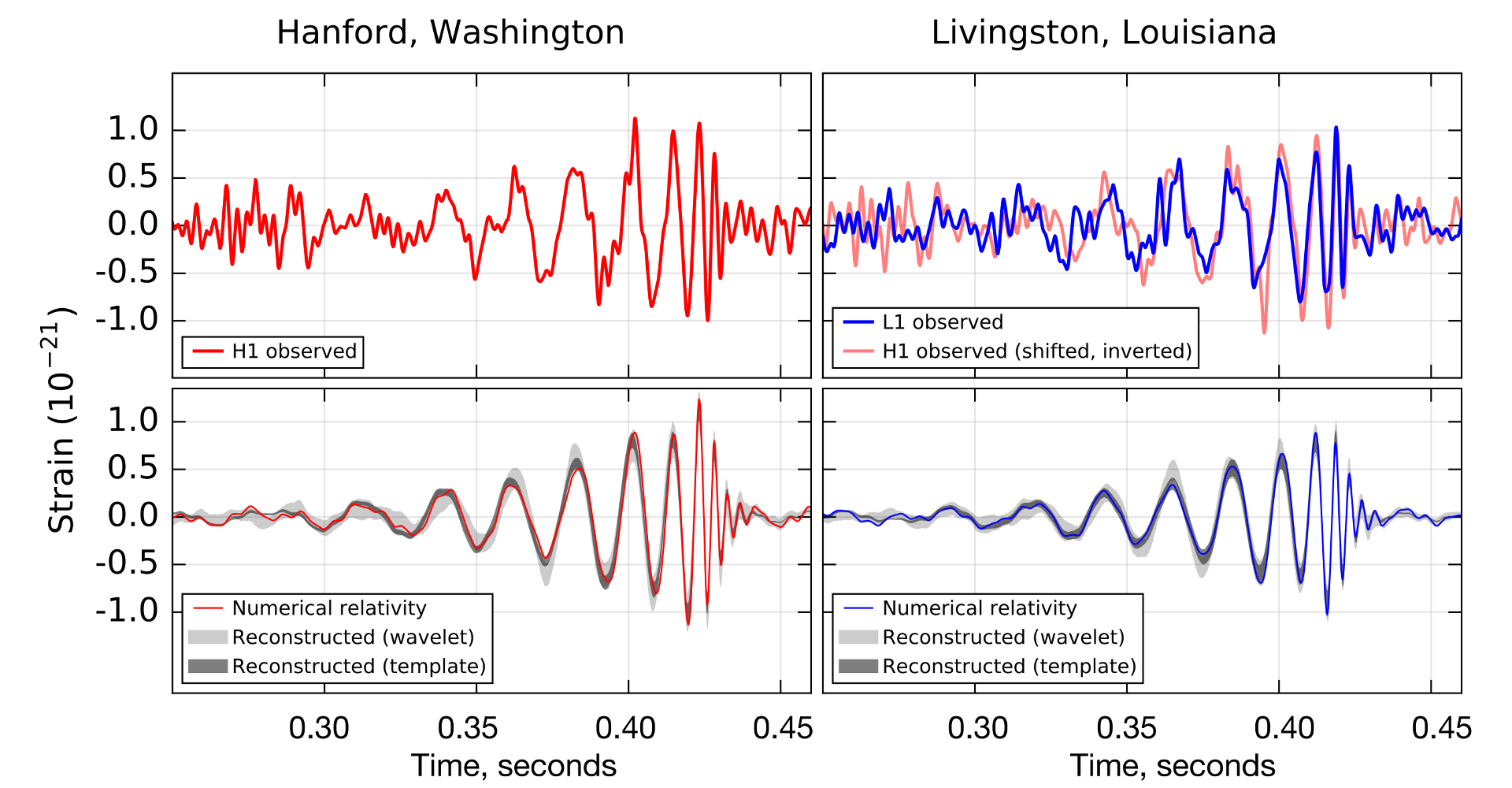
Here is the “Nobel Prize winning” signal. The red graph is from Hanford, the blue one from Livingston (the Hanford signal is also shown, inverted and shifted in time) Notice the time scale, the whole merger takes place in a few tenths of a second!
The lower two graphs show a fit to the data, using Numerical Relativity. It is surprising how much information can be extracted from these two graphs. Here is a (partial) result
Two black holes, with a mass of 35 and 30 M☉. (solar mass) , at a distance of about 1.4 billion lightyear away from Earth, merged into a single black hole of 62 M☉. .
The mass difference of 3 M☉ , was radiated during the merger as gravitational waves. That is an awful lot of energy! The estimated peak emission rate was greater than the combined power of all light radiated by all the stars in the observable universe! If you don’t believe me, click here.
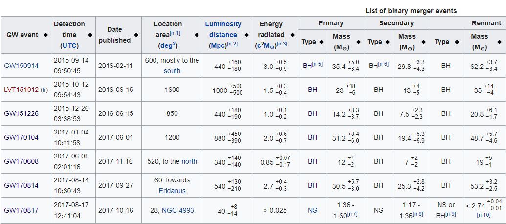
This first event has been named GW150914. GW stands for Gravitational Wave and is followed by the detection date 14-9-2015. In the past two years more gravitational waves have been detected, here is a list
If you look at the location, you see that in the first five events the location of the binary is not well-defined. The reason is that you need more detectors to determine the location accurately, two is not enough.
The sixth event, GW170814 was not only detected by LIGO, but also by Virgo , the European counterpart of LIGO. This interferometer is located near Pisa in Italy. Same setup as LIGO, slightly smaller arms (3 km)
Virgo was also designed in two phases. The first phase did not detect gravitational waves. In 2106 Advanced Virgo became operational and is now cooperating with LIGO. Another interferometer will be built in India: INDIGO .
The last event, detected until now, GW170817 (about three months ago), is an interesting one, because it is not a merger of black holes! For the first time a merger of two orbiting neutron stars has been observed. The masses of the two stars are comparable with the Sun and the binary is closer to Earth, although still a respectable 130 million lightyear! It is not sure if the merger resulted in a neutron star or a black hole. But anyway, a merger of neutron stars should result in visible light coming from the debris after the merger.
Because of the detection with three interferometers, it was possible to narrow the region of space where the gravitational waves came from. The location predicted by LIGO/Virgo was still large, about 150 times the area of a full moon. Within hours after detection, alerts were sent to astronomers all over the world and a massive search started.
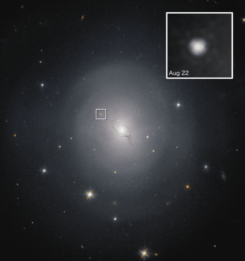
A few hours later the Swope telescope in Chili reported they had found the source in galaxy NGC 4993 , 140 million lightyear away. This was soon confirmed by other observatories.
Here is an image of this elliptical galaxy. The inset shows the light coming from the merger, getting weaker and weaker, as expected.
More interesting discoveries can be expected in the future, this is just the beginning.
When you want to learn more about this fascinating new field of astronomy, you should read the book Ripples in Spacetime, written by Govert Schilling
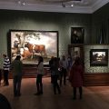
In my last blog post I visited the MORE museum in Gorssel , where MORE stands for MOdern REalism. In this post I visit more museums in Den Haag, where more stands for two…:-). I went there with my soulmate Inez, who suggested to visit the Gemeentemuseum and the Mauritshuis
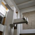
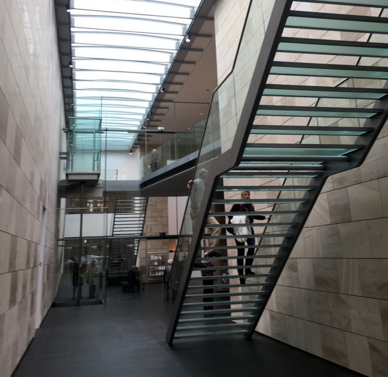
The Gemeentemuseum is a masterpiece of the Dutch architect Berlage. Built in Art-Deco style, 1931-1935. It is a spectacular building, both from the outside and the inside
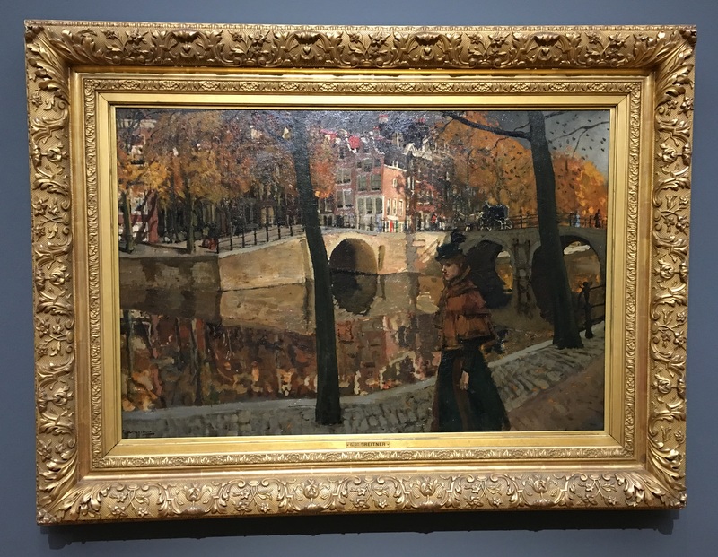
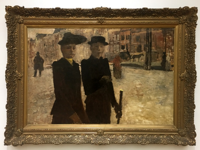
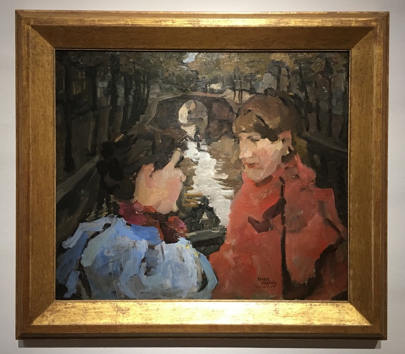
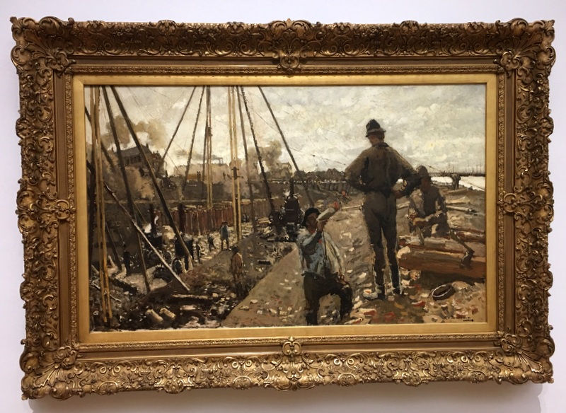
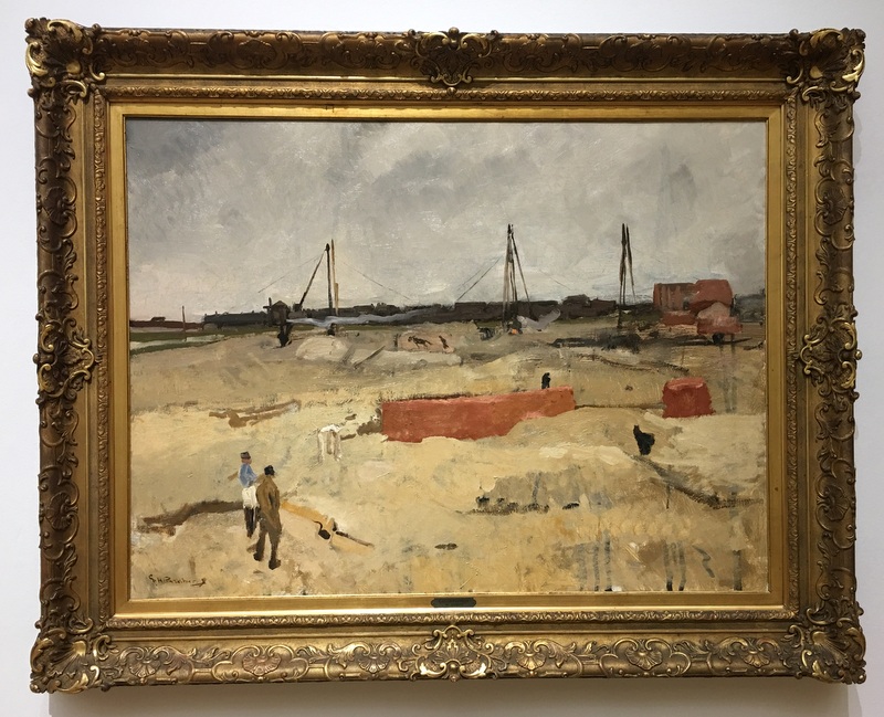
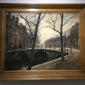
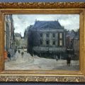
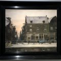
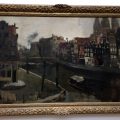
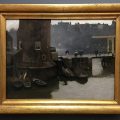
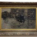
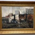
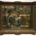
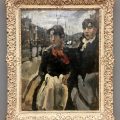
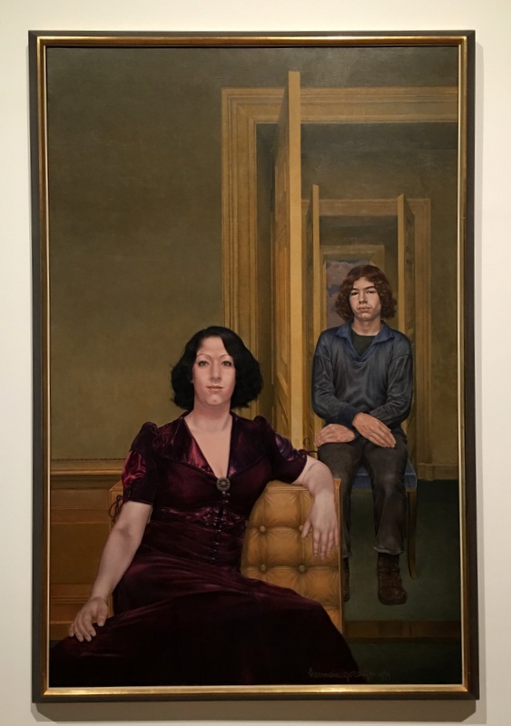
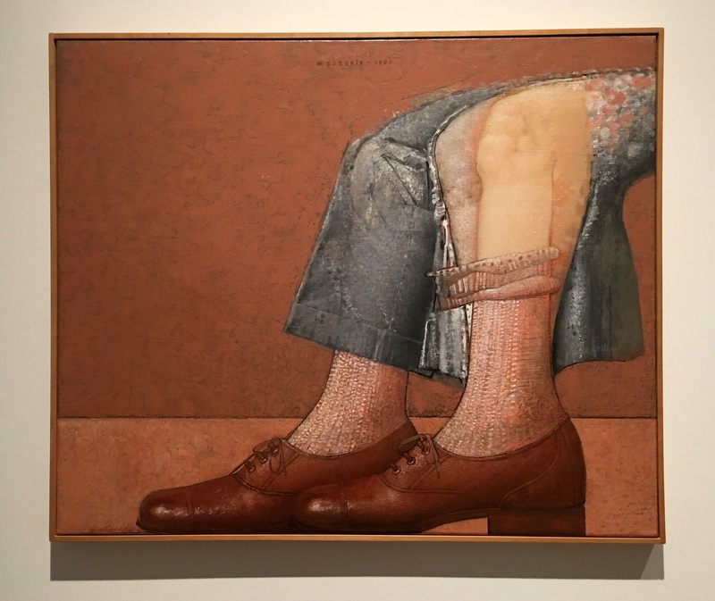
In the 1880’s a group of young artists no longer painted the countryside, like the Hague School, but became interested in city life. George Hendrik Breitner, Isaac Israels, Willem Witsen and others explored the city, especially Amsterdam, so they are sometimes called the Amsterdam impressionists
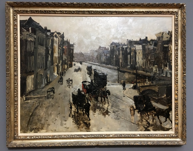
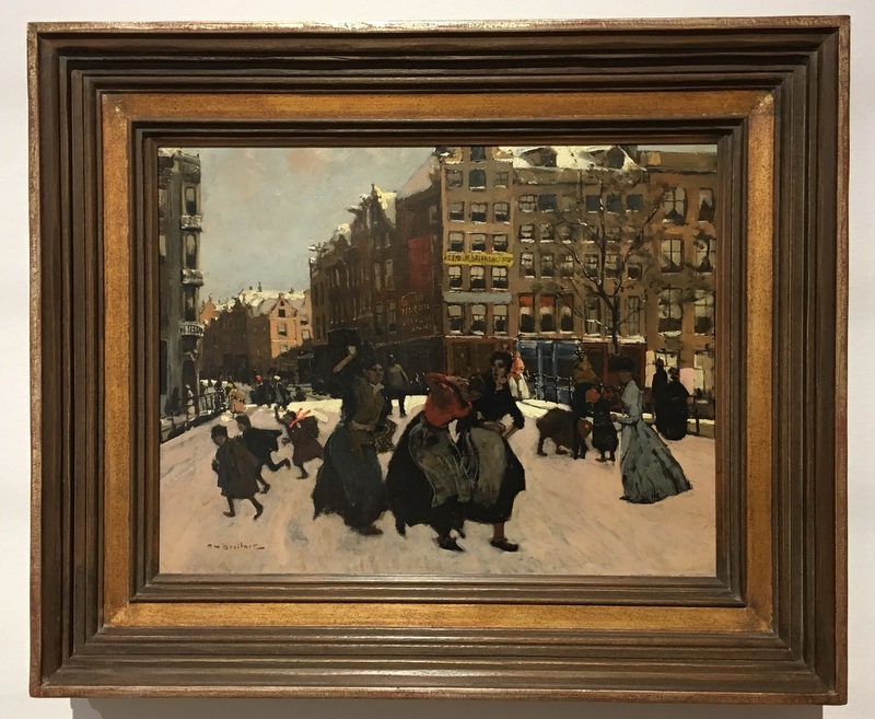
Here are a few examples of their style. They painted the everyday life of the city, street action, fashion ladies, entertainment, labourers, construction sites.
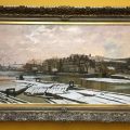
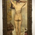
And more paintings
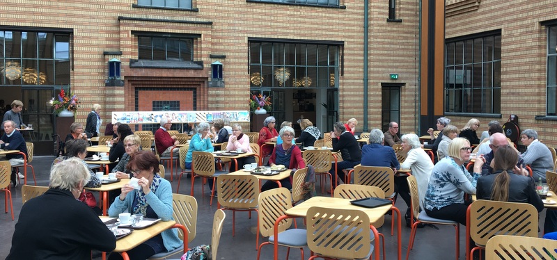
We had our lunch in the museum restaurant
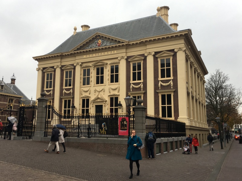
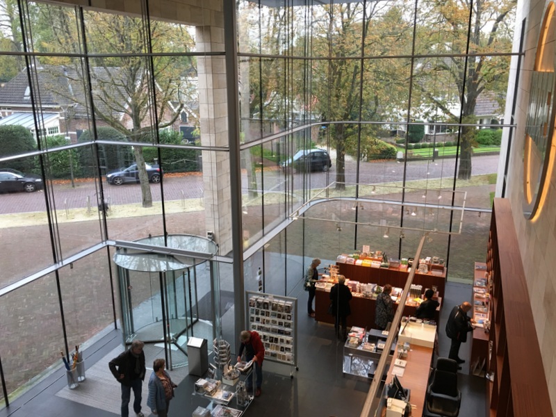
There is a lot more to see in the Gemeentemuseum, for example the world-famous collection of Mondriaan paintings, but we left that for another visit and went to the Mauritshuis. This magnificent building was built as a home between 1636 and 1641 by Jacobus van Campen (his masterpiece was the Townhall of Amsterdam)
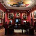
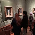
It now houses the Royal Cabinet of Paintings which consists of 841 objects, mostly Dutch Golden Age paintings
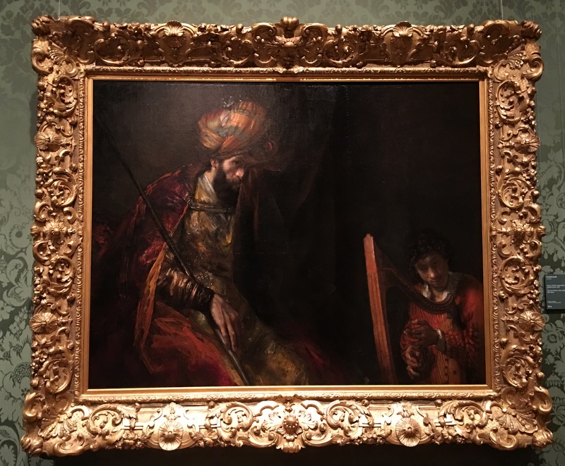
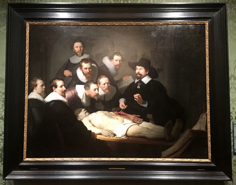
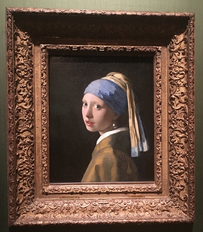
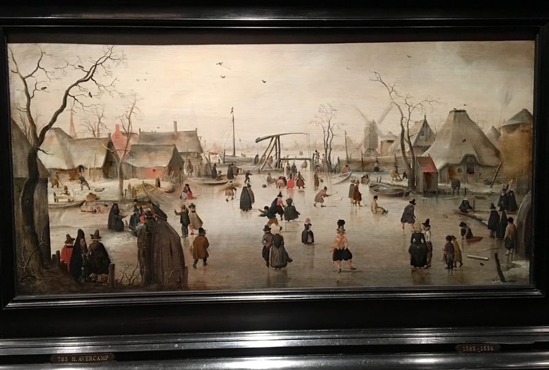
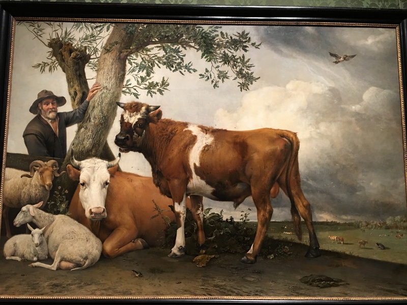
A visit to this museum is really a joy of recognition. Rembrandt, Vermeer, Avercamp, the famous bull of Paulus Potter…:-)
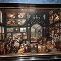
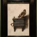
Here are more paintings
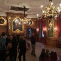
In 2007 the museum announced that it needed to expand. The architect Hans van Heeswijk designed the expansion, the project started in 2010 and the museum was reopened in 2014. This is the same architect who designed the MORE museum in Gorssel!
Here a few pictures of the expansion. Nice combination of new and old
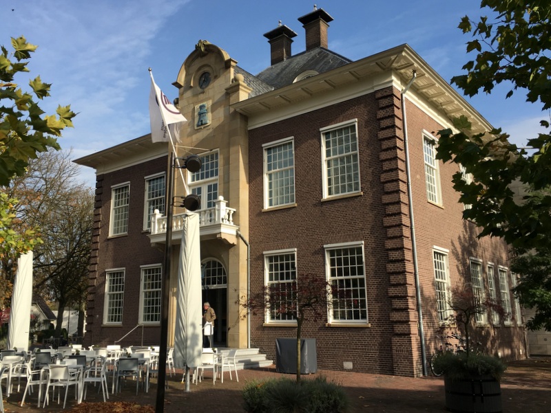
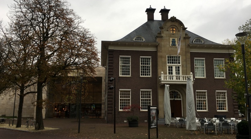
Five years ago, in 2012, business tycoon and art collector Hans Melchers bought more than 1200 artworks from the bankrupt DSB bank. He owned already a large number of paintings by Carel Willink and wanted to create a museum for his collection. He found a suitable location in Gorssel, a village south of Deventer in the province of Gelderland. The MORE museum was opened in 2015 and is now the largest museum for Dutch Modern Realism.
When I am back in the Netherlands, I always try to meet Nellie, my friend of more than 55 (!) years. We both like art and this time we decided to visit this new museum. She traveled from Friesland where she is living, I took the train from Amsterdam, we met in Deventer, took the bus to Gorssel, and started with coffee in a nice cafe opposite the museum
In the train
Meeting in Deventer
A nice cafe
Friendly people
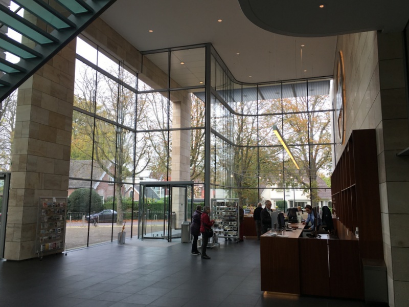
The museum is housed in the former town hall of Gorssel and a new extension. A very successful combination of old and new.
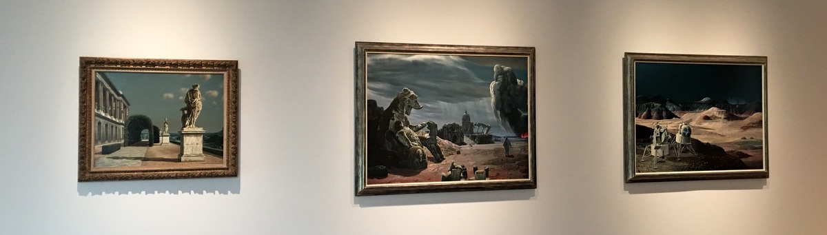
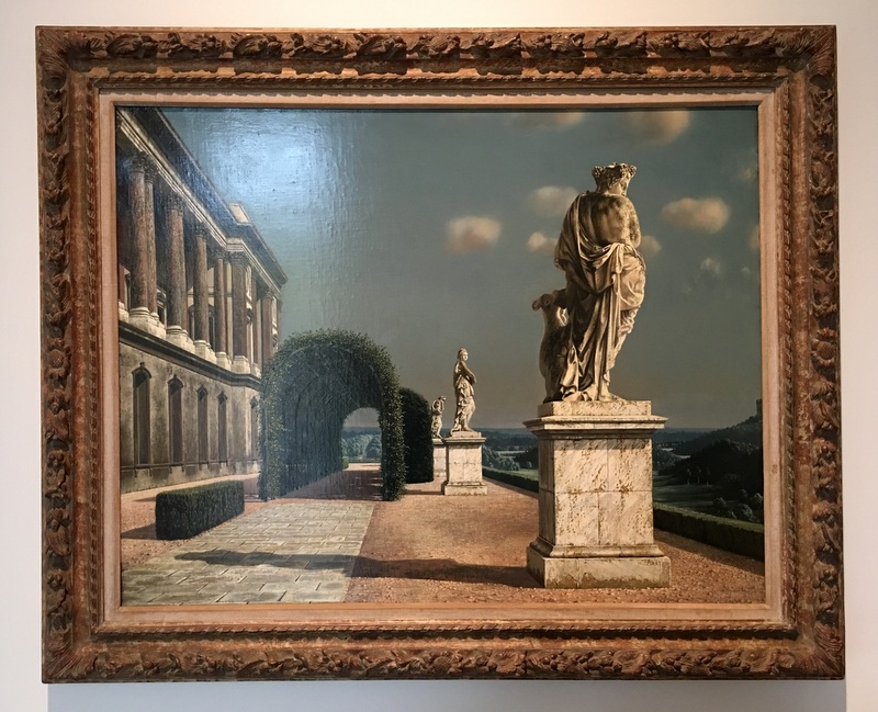
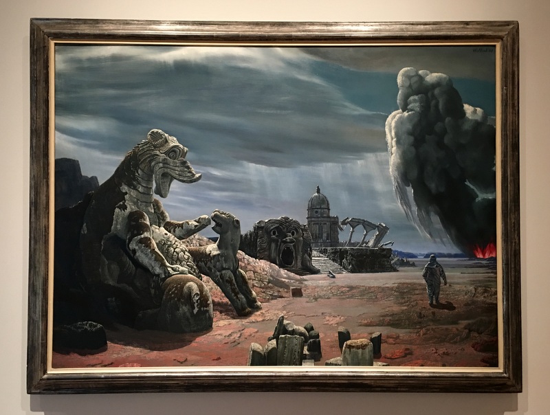
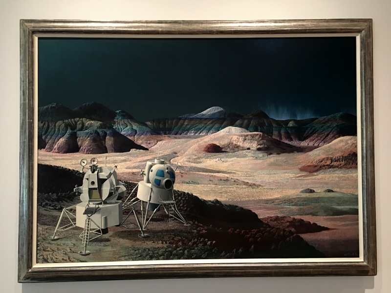
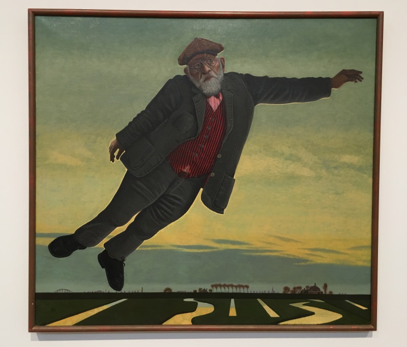
A few months ago Melchers opened a second museum in nearby Ruurlo, specially dedicated to Carel Willink, the most famous Dutch “magic realist” painter. We decided to keep this museum for a next visit, fortunately quite a few of Willink’s masterpieces were still on view in this museum.
Towards the Future (1965) and Landing on Mars (1969)
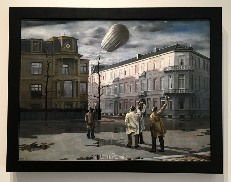
Willink’s Imaginary Realism is easily recognisable, it was a surprise for me to see that he has been experimenting with other styles when he was young. This is also Willink, when he was 24 year old!
The Silver Wedding (1924)
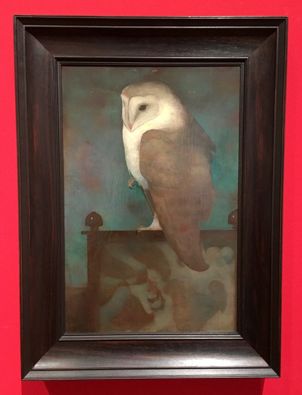
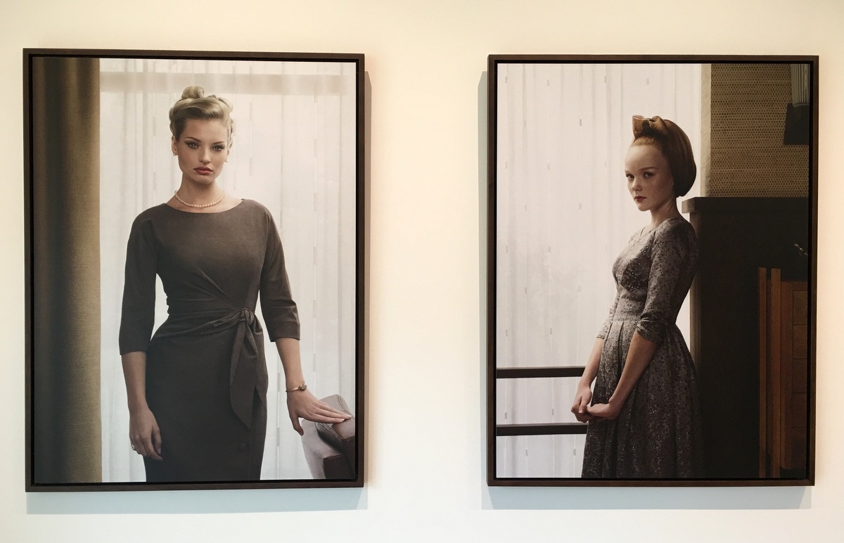
The ground floor of the museum houses (part of) the permanent collection. Well-designed exhibition halls
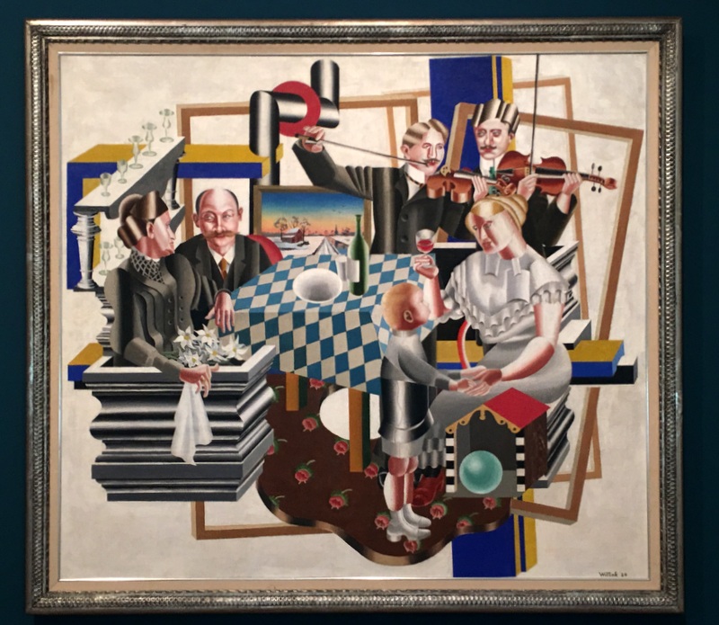
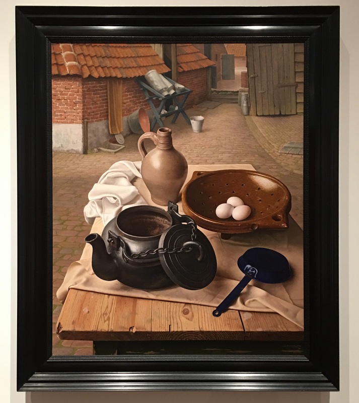
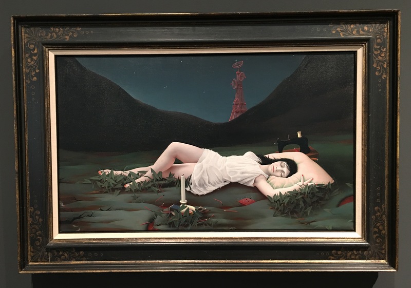
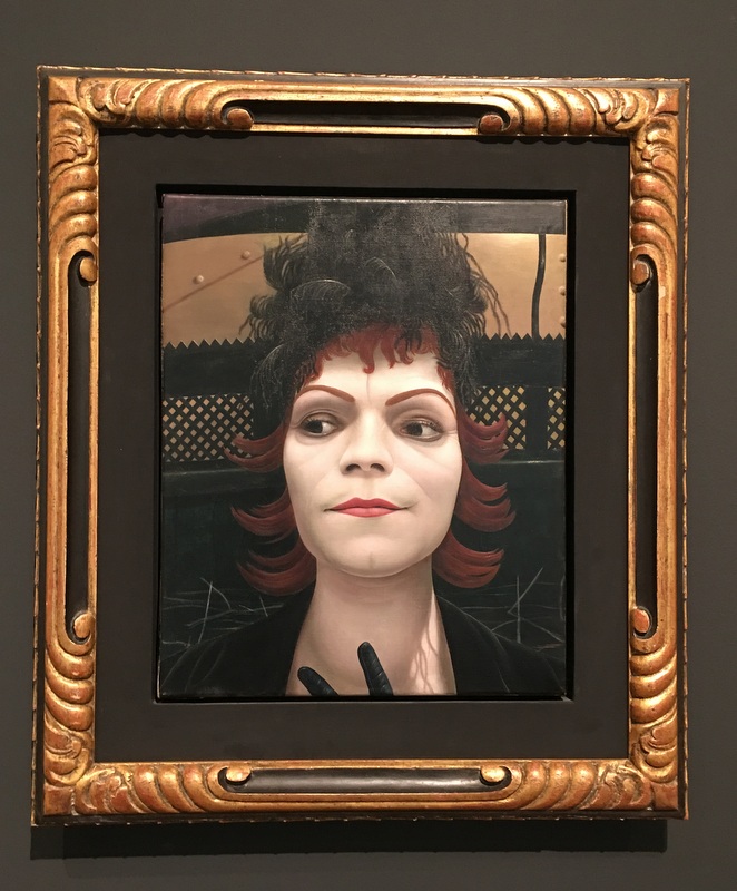
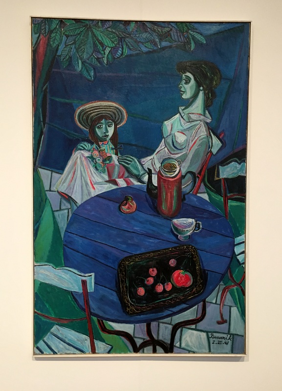
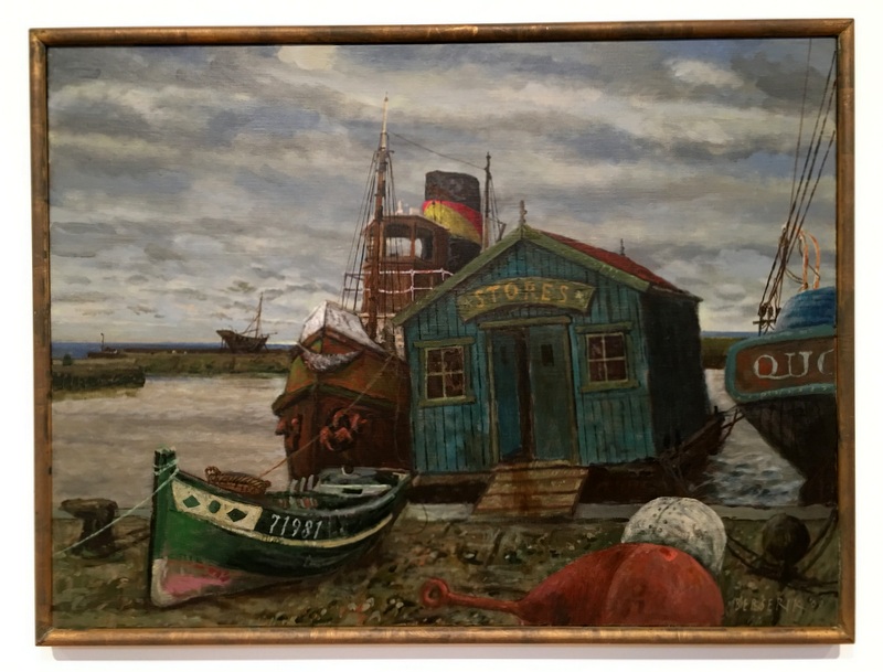
Here are a few examples of Dutch “modern realist” artists. Still-lifes are a popular genre. Click on the links for Wikipedia info.
When we left, the weather had become clouded, I could not really take pictures from the outside. I have to come back, it is really a very interesting museum, worth a second visit.
When I decided to come back to the Netherlands in October, I knew the weather could be unpredictable, hesitating between autumn and winter. In old times October was called theaarselmaand (hesitation month)
So it was an unexpected, but very pleasant surprise that my first weekend was warm and sunny, even breaking records!
Here is a report about three summer days in October. Click on a picture to enlarge it
Saturday 14 October
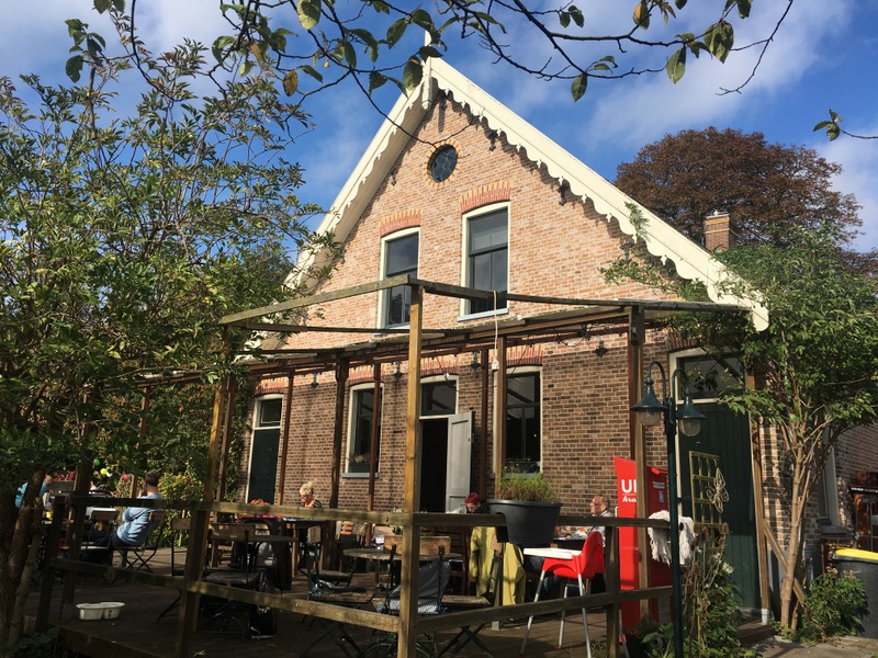
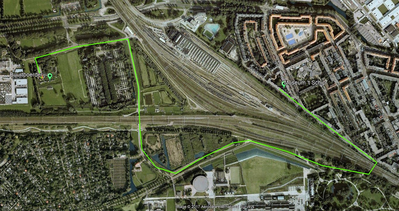
With my brother Ruud I visited the Spaardammerbuurt, famous for its Amsterdamse School architecture. First we had coffee and cake in the Buurtboerderij Ons Genoegen. This “farm within the city” dates back to 1880, was almost demolished around 2001, but just in time saved by a group of concerned citizens. More about this interesting story can be read here (in Dutch). It is amazing that such a rural enclave exists, sandwiched between two railway lines.
We walked from the Buurtboerderij to Het Schip following this route. Not the shortest one, but worthwhile, you don’t realise that you are surrounded by development
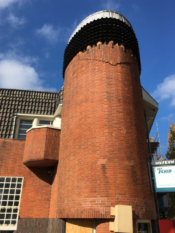
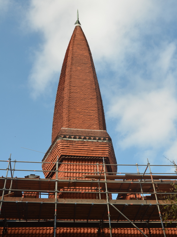
When we arrived in the Spaarndammerbuurt, we were a bit disappointed to see that Het Schip, the famous creation of architect de Klerk, was being renovated, so I took only a few pictures. You can find more in an earlier blog Amsterdam Architecture
During my last visit the Schip museum was closed, fortunately it was was open now. It is housed in a former school building and worth visiting.
Museum Cafe
Former school building
We ended our trip at the Central Station. Beautiful weather and the forecast for the next day was even better…:-)
Sunday 15 October
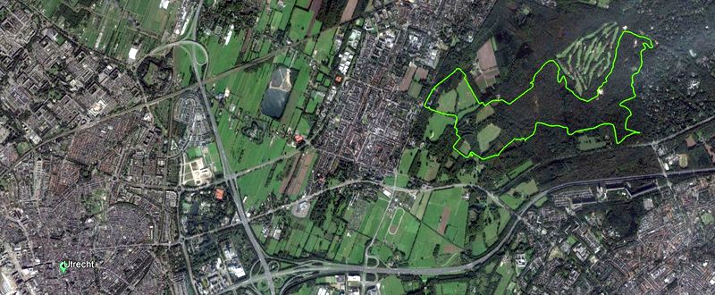
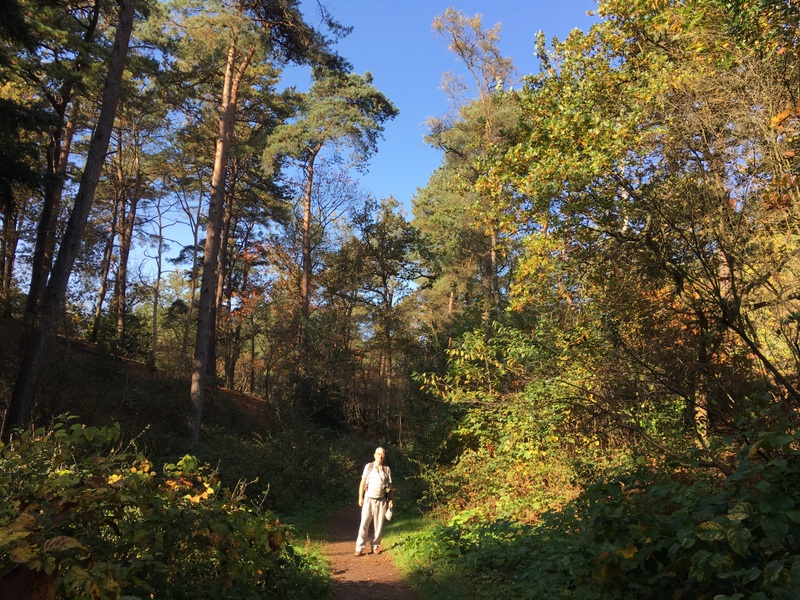
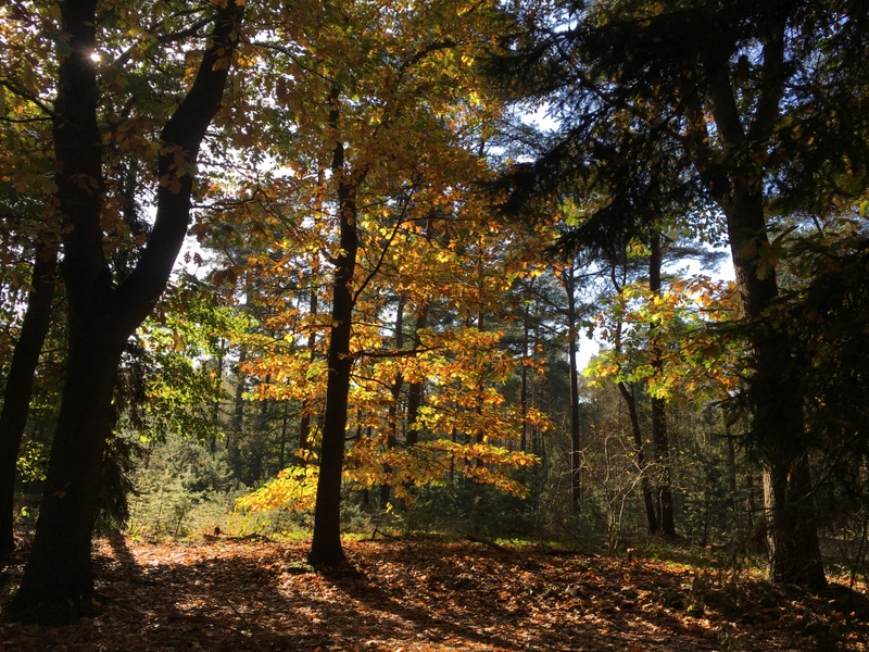
The second day I went with my friend Yolanda to the Utrecht Hill Ridge, a forested ridge of low sandhills, created 150.000 years ago as a moraine during one of the glacial periods. We followed a marked hiking trail of 12 km, indicated on the Google Earth map below.
It was a pleasant, easy walk.
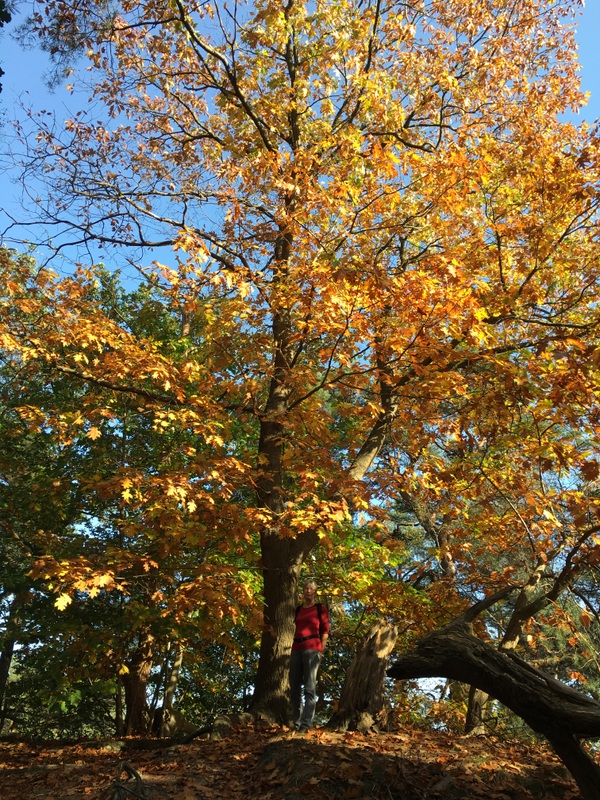
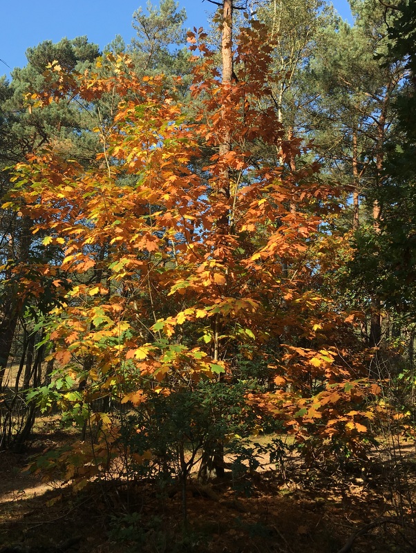
Our hike took us to the Beerschoten and Houdringe estates and to the Pan forest. Stately lanes, beech and oak forest
Many trees had beautiful autumn colours.
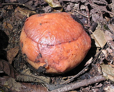
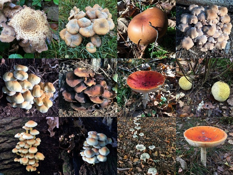
Mushrooms all over the place.
Hard to imagine that in winter this nice lake will become a skating rink.
The former coach house of the Beerschoten Estate now houses an information center
It was a Sunday and with the sunny weather there were many visitors. There is also a sculpture garden
Monday 16 October
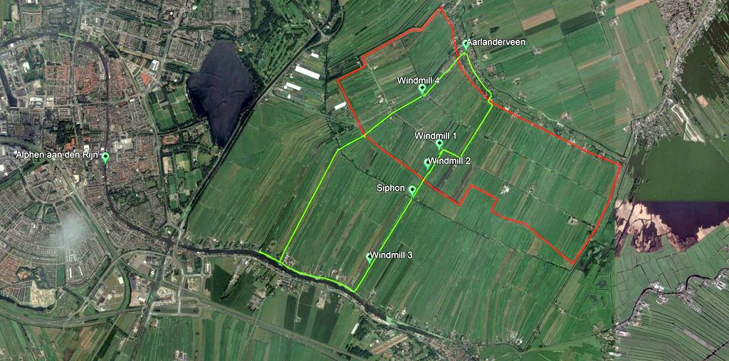
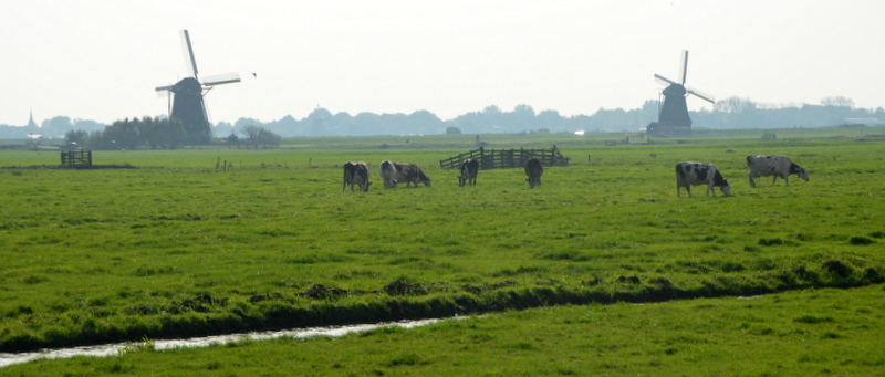
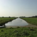
The third day I walked on my own in the region of Alphen, my birthplace. A polder walk of about 10 km. Green in the map below. Also indicated (in red) is one of the numerous Dutch polders . A polder is is a low-lying tract of land enclosed by dikes. This polder was created around 1785. Because they are low-lying, the rainwater must be pumped out by windmills into a river, in this case the river RIjn.
I took a bus to Aarlanderveen, where I started my walk. Nowadays Aarlanderveen has no shops and only one cafe. The cafe was officially closed, but the friendly owner was willing to serve coffee with apple pie. A good start of the day.
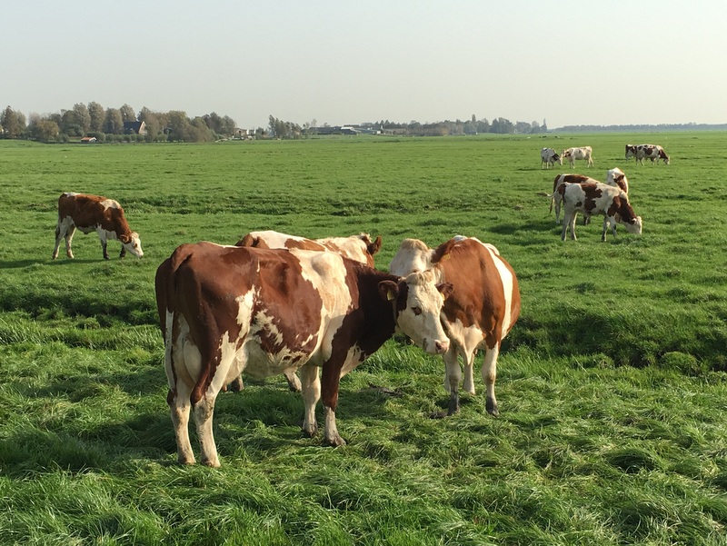
The landscape can not be more Dutch…:-) Meadows, cattle, windmills.
You walk on narrow trails through the meadows, sometimes crossing fences
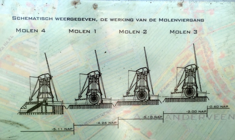
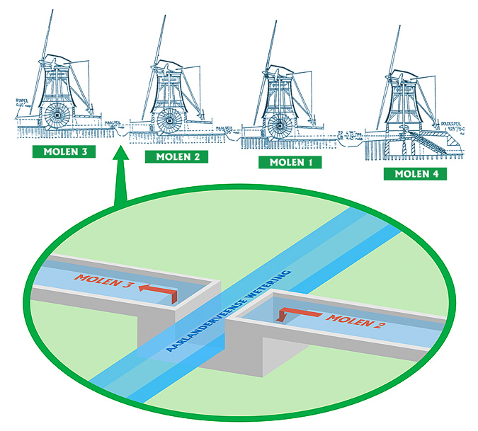
The polder marked in red needs 4 windmills, because in its deepest point it lies about 5 meter below sea level and one windmill can “lift” the water only about 1.5 meter. So they have to work together, like in the sketch below. The Dutch word for it is a Molen-viergang and it is the only viergang in the world that is still operating.
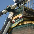
Mill no 4 uses an Archimedes’ screw, the other three have scoop wheels.
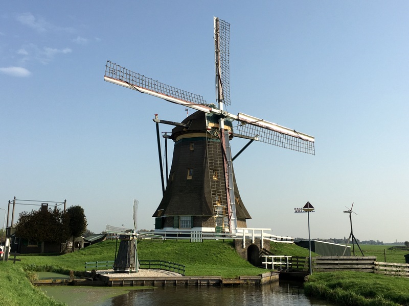
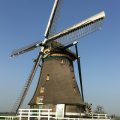
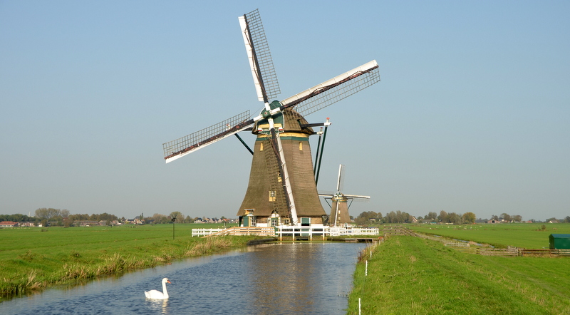
Here is windmill no 4, the Putmolen, built in 1801. later than the other three, because one more mill was needed to drain the lowest part of the polder. That explains the odd numbering..:-)
.
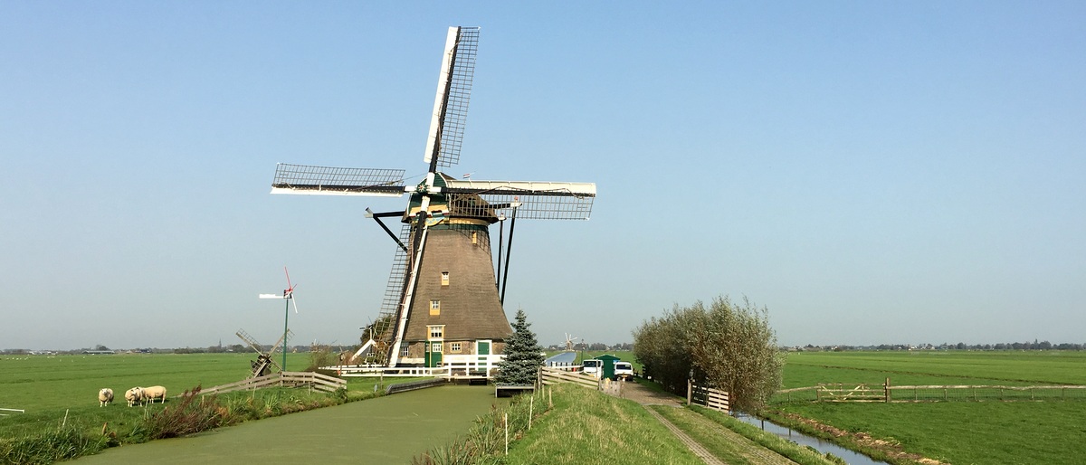
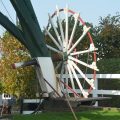
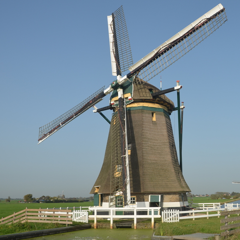
Here is Mill no 1, when you click on the image to enlarge it, you can see no 2 and 3 in the background. This windmill discharges the water in the Rijn river.
Some details of this windmill. The right picture shows part of the scoop wheel.
Windmill 2 and 3
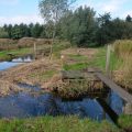
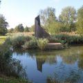
On the GE map you see that there is an (older) polder between the “red one”and the Rijn river. The easiest way to remove the water from the new polder would be to discharge it in this old polder, which had its own windmills.But understandably the owners of the old polder refused this, so for the new polder a separate drainage channel had to be created to the Rijn. Such a drainage channel is called a “wetering” in Dutch.
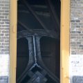
The problem is that the wetering of the new polder has to cross the wetering of the old polder. The left picture shows the location where this happens. The yellow line marks the wetering of the old polder, the red line is the wetering of the “red” polder. It passes UNDER the old wetering via a siphon (a duiker in Dutch). The right image shows how it works. This siphon was built in 1786. Amazing. I have marked the location of this siphon on the GE map
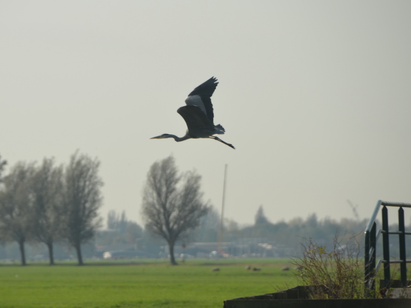
Not many birds in this time of the year. I noticed a heron and a cormorant. And of course many swans..:-)
A few more pictures.
Millers often build miniature mills, just for fun
Crossing a drain. Cattle can not pass.
A swan
Back in Aarlanderveen
It was a very interesting hike. A very informative website about the Molen-viergang (in Dutch can be found here.
It has become a tradition that we organise a reunion with my siblings and their partners during my visits to the Netherlands. This time my sister was the host and she had planned a visit to a museum in Den Helder, about 20 km north of where she lives.
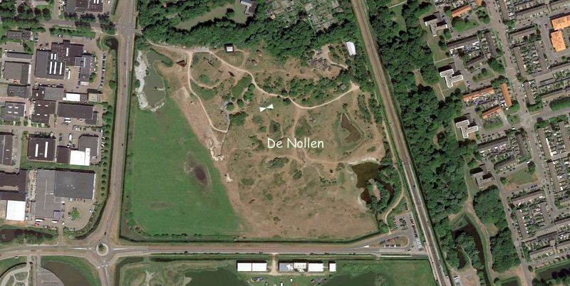
A museum? In Den Helder? Some of us were slightly skeptical, but it turned out to be a fascinating visit of De Nollen , the life work of a Dutch artist, Ruud van de Wint (1942-2006).
A nol is the Dutch word for a sand hill, a dune. In this Google Earth image you can still see these sand dunes. Once this was an island! From 1980 until his untimely death, van de Wint has been transforming this wasteland into a Land Art park.
Here is a view of the Nollen. Van de Wint not only put his artworks here, he also did a lot of landscaping.
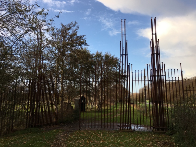
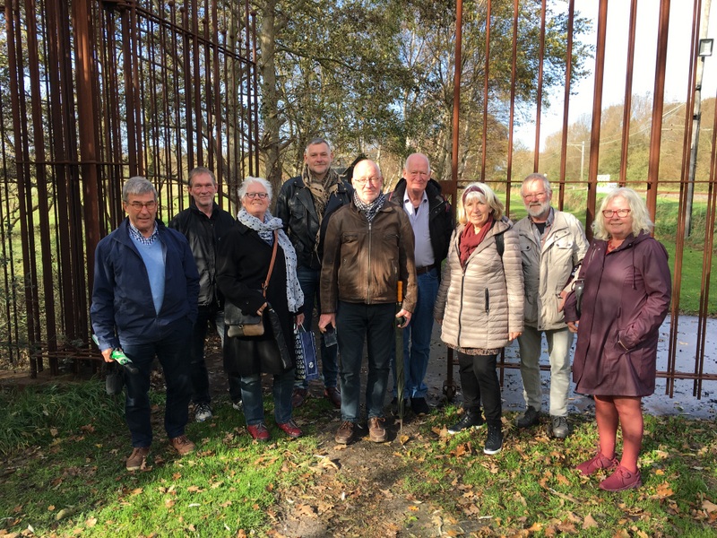
A monumental gate forms the entrance of the park, a good location for a family picture..:-)
After paying an entrance fee, you can walk around in the park on your own, but to enter the structures, you need a guide. We had an enthusiastic and knowledgeable guide, a friend of my sister.
She took us on a 2-hour walk through the park. It was stormy autumn weather with an occasional shower, but we were lucky, during a rainy spell we were inside a structure…:-)
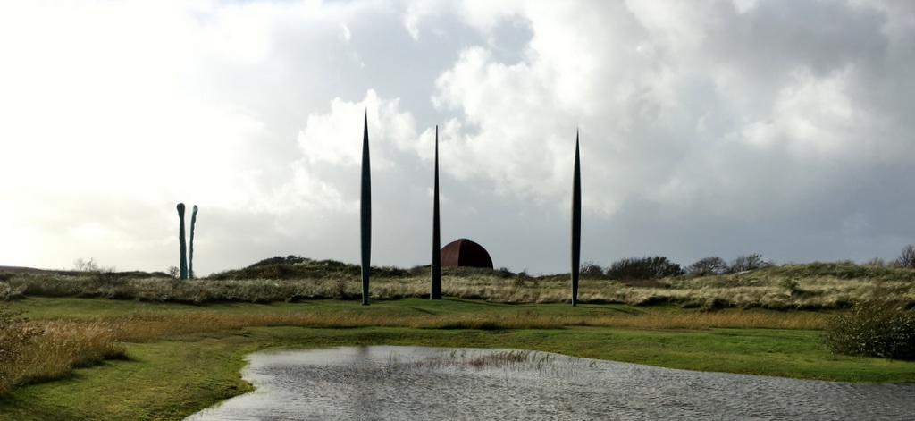
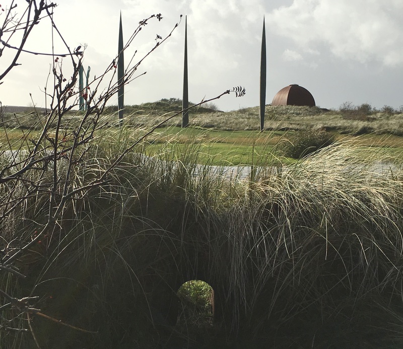
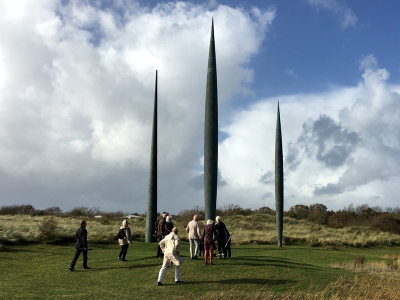
Visible from far away are three needle-like structures.
Notice the small “tunnel” in the foreground.
Created by the artist, so you could have a view of the needles, looking through this peeping hole.
Stormy weather, nice cloudscapes…:-)
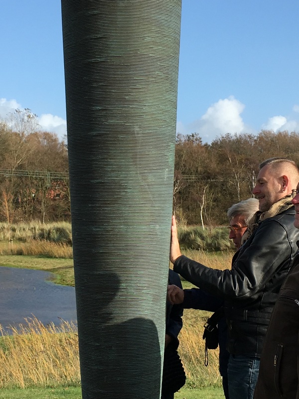
The needles look solid, but on closer inspection it turns out that they have been made of wound copper wire!
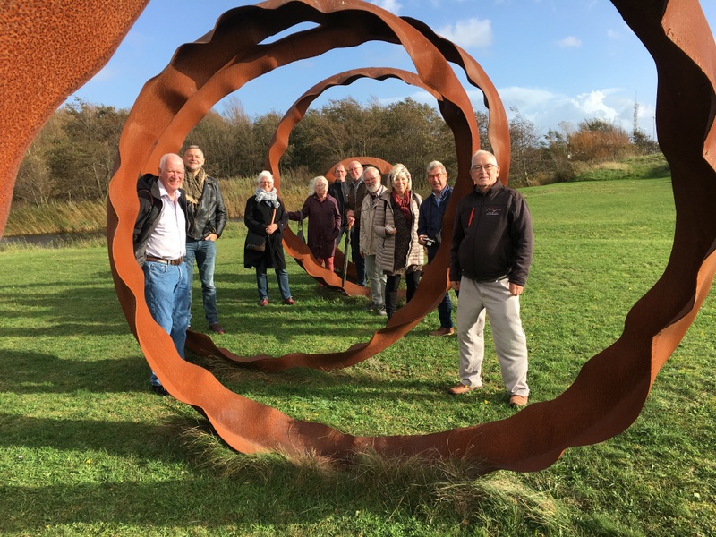
This structure which looks like an orange peel, was very suitable for a group picture, taken by our guide.
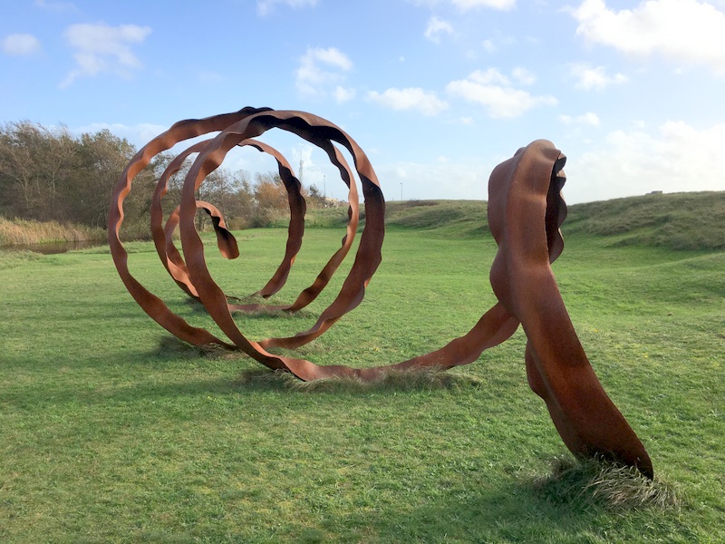
These green structures were slowly moving in the wind, but very sturdy.
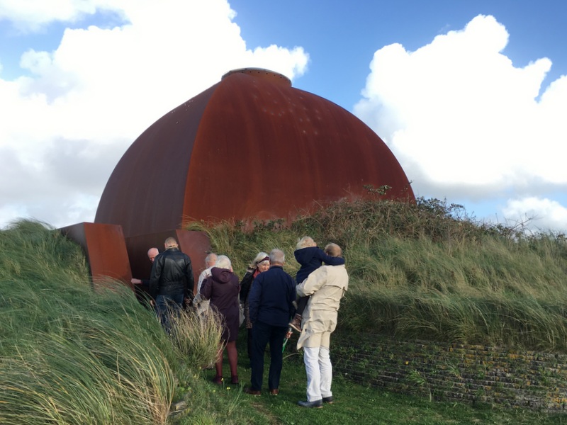
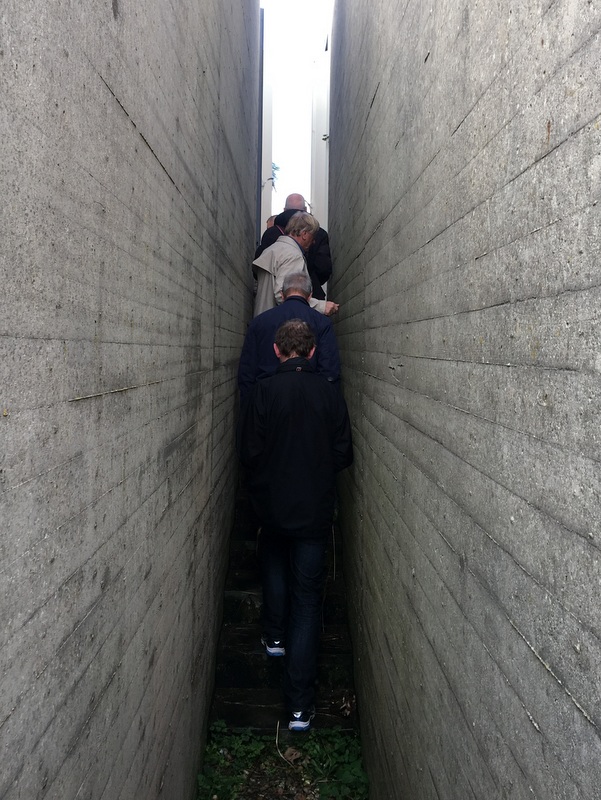
The Nollen terrain contains many bunkers, some of them dating back to Napoleonic times, others to WWII. Some of them have been transformed in artworks, like this dome structure with an oculus at the top of the dome.
The interior of the dome has been painted and is lit by the light falling through the oculus. Fascinating
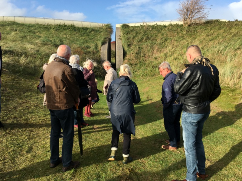
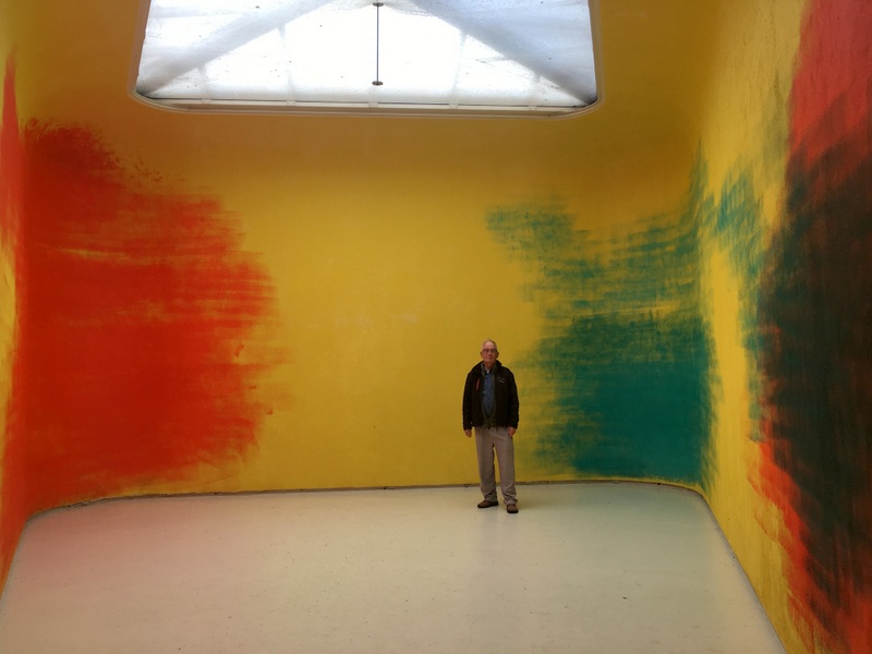
Here is another spectacular structure. On the Google Earth image a whitish lemniscate-like shape can be seen. This artwork is not based on a bunker but has been built by the artist. In the left picture we are walking to this construction. A narrow passage leads to the two entrances.We visited one of the halves
Here I am standing in one half of the lemniscate. No windows, the light enters through a transparent roof. Beautiful, it made me think of Mark Rothko
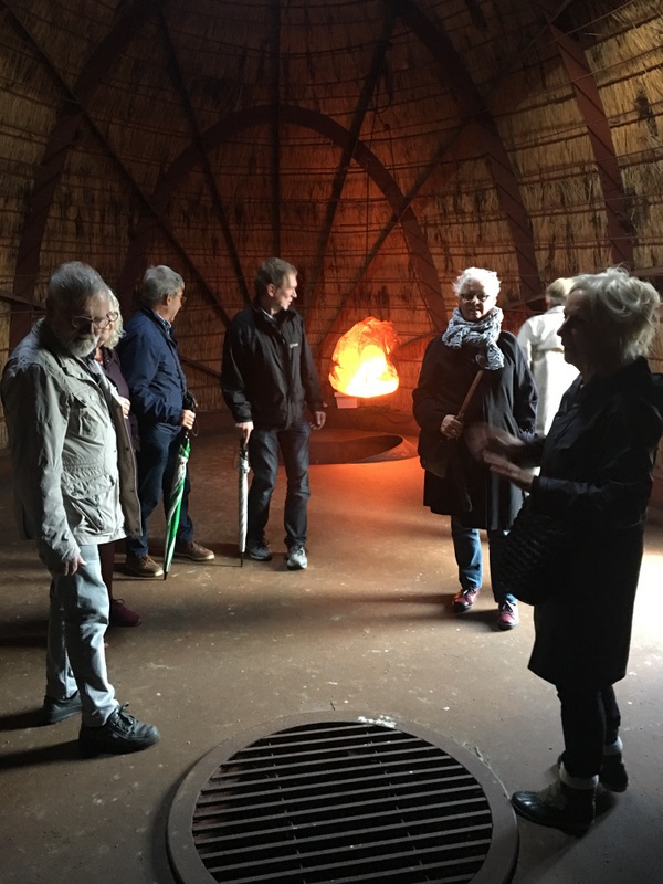
Another structure. Two thatched domes, which can be entered through tunnels and spiral staircases
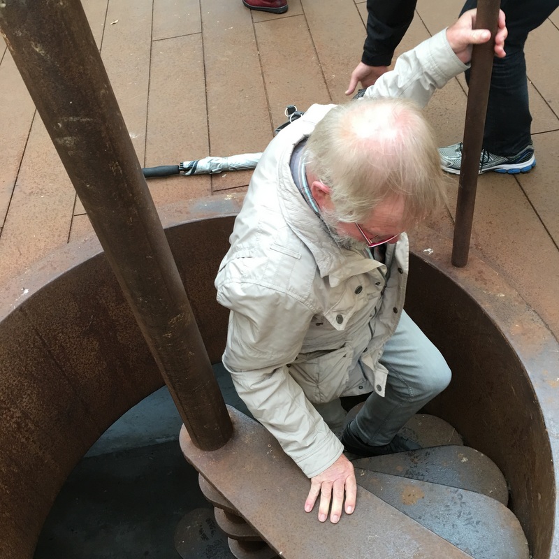
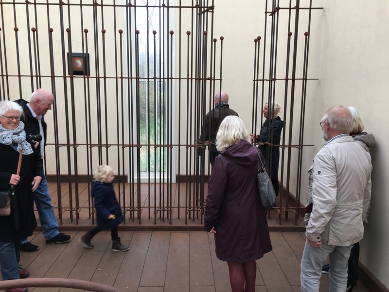
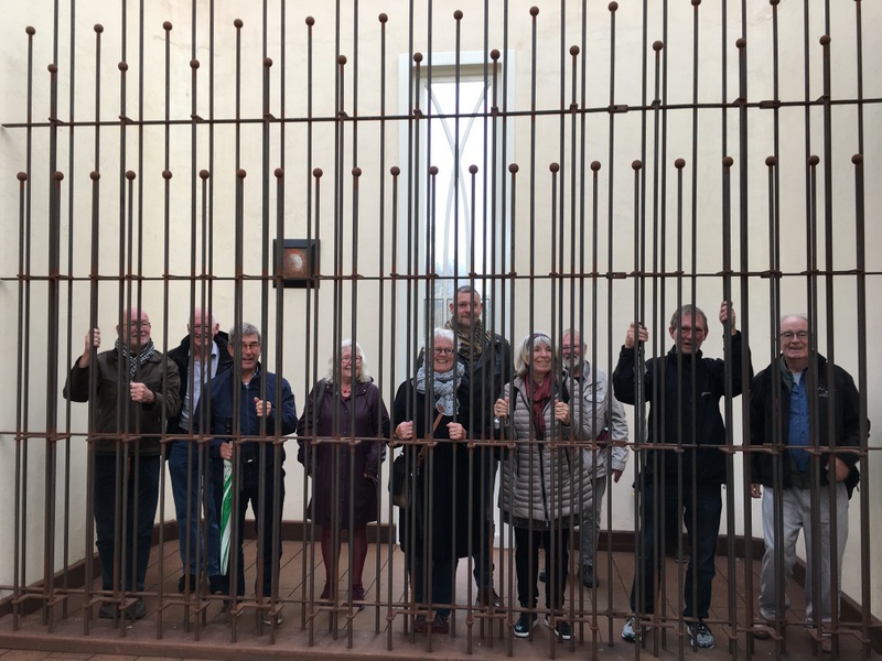
Here is the last structure we entered, constructed in corten steel and accessible through tunnels and again a spiral staircase.
The interior looks like a cathedral, with one single (tiny) painting behind a monumental grille.
The painting looks not accessible, but…
It can be opened 🙂
The grille was of course another good location for a family picture “in prison”
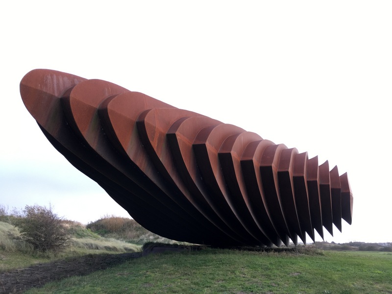
The most impressive work of art was this structure in corten steel.
It can actually rotate on a pivot! Unbelievable..:-)
You need quite a few people to bring it in motion. Fascinating.
On our way back to the entrance we passed another artwork of the artist
Back in the entrance hall we had a look at scale versions of his artworks. Van de Wint has been a prolific artist. An exhibition hall for his paintings is under construction. And we had coffee and cake, another family picture…:-)
It was a very rewarding excursion, advisable to anyone who is interested in art!
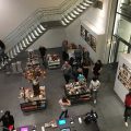
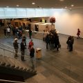
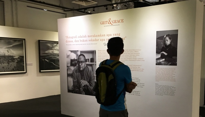
Grit & Grace is the title of a photography exhibition, running at the moment in the former OCBC building near Central Market in Kuala Lumpur. The photographer is S.C. Shekar and the subtitle of the exhibition is “The Grandeur of Monochrome Malaysia”
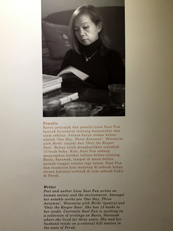
Under the same title he has published a 330-page photobook (5 kg, RM 800!) with black and white photos, covering all aspects of Malaysia. The text accompanying the photos has been written by our friend Suet Fun and that was one more reason to visit the exhibition.
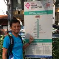
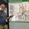
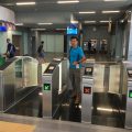
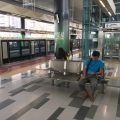
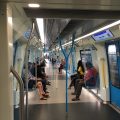
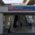
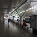
We decided to use public transport ..:-) The new MRT line connects the Curve shopping center with Central Market (near the OCBC building) and feeder bus 809 took us from near our condo to the MRT station. In less than 45 minutes we arrived at Central Market!
At the bus stop
In the 809 bus
At the MRT station
Using Touch and Go
The Mutiara station
In the train
Arriving Central Market
Within 45 minutes
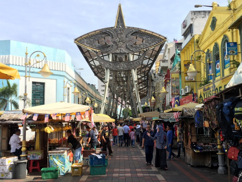
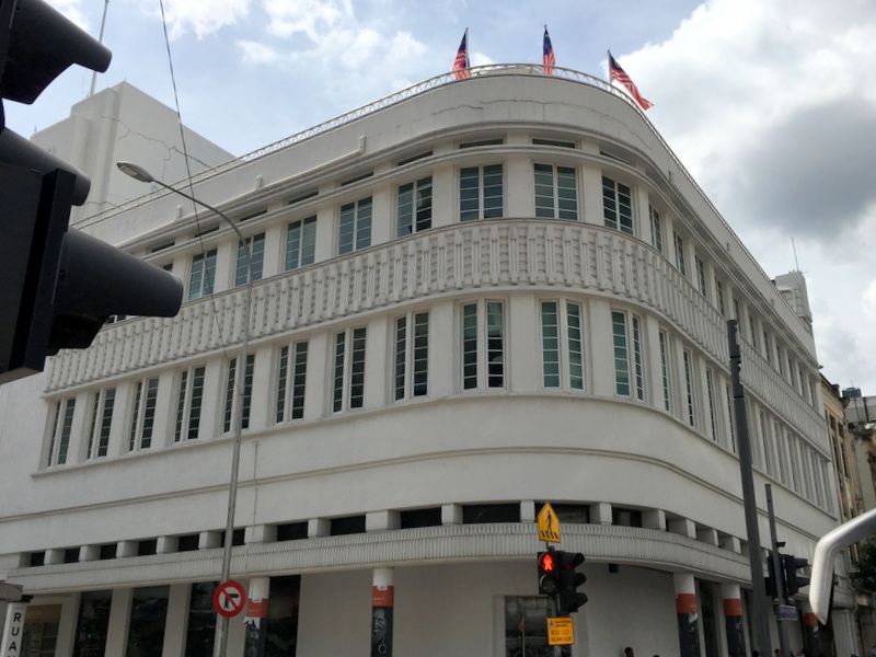
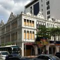
From the MRT station it is a short walk to the OCBC building. Beside Central Market a kind of up-market copy of Petaling Street has been created, full of tourists even on this Sunday morning. A big contrast with the austere beauty of the OCBC building (Art Deco, 1937, designed by Coltman) at the end of this gaudy street.
The exhibition is open daily from 10 am until 8 pm (until 16 October) and admission is free.
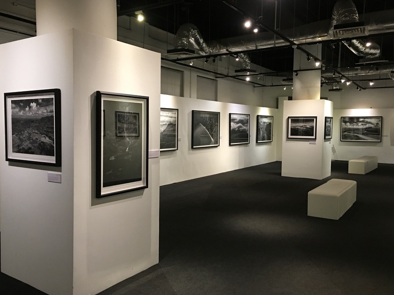
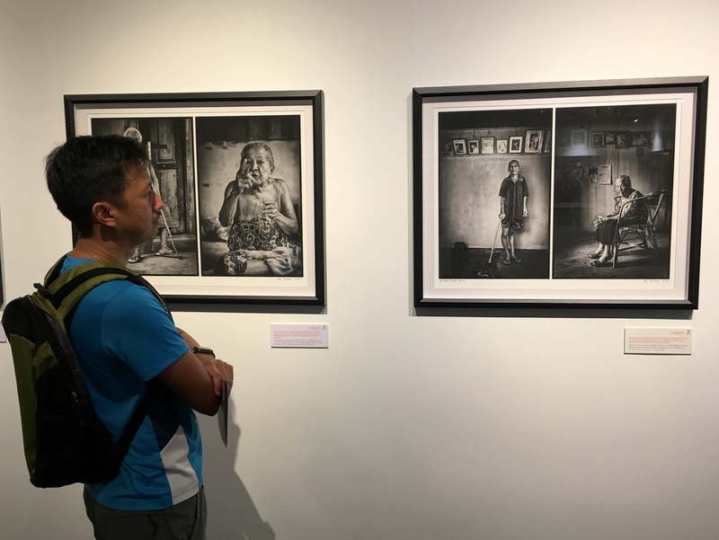
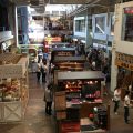
A selection of 50 photographs is shown in the exhibition. They are impressive and show many aspects of Malaysia, landscapes, people, culture.
It was pleasantly quiet on this Sunday morning.
Many of the nature photographs show aerial views. We were wondering if they were taken by a drone, but at the reception they told us that a helicopter was used.
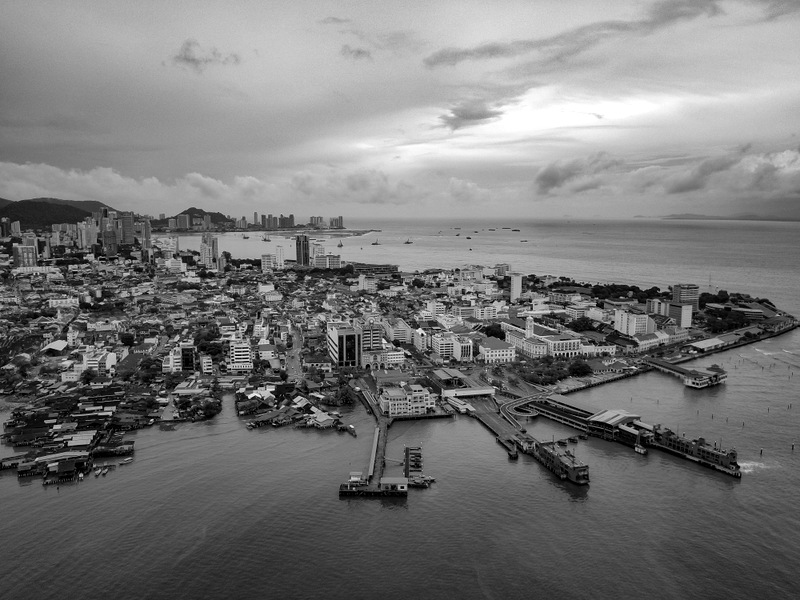
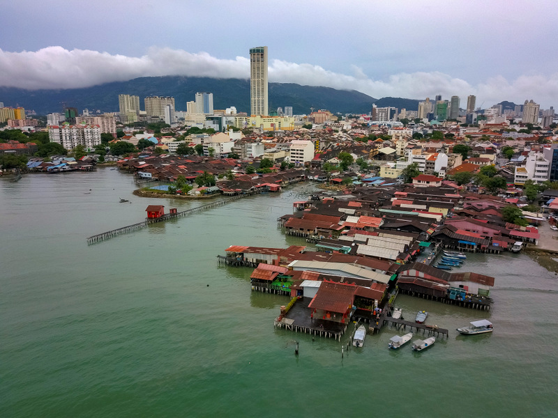
This is a view from Georgetown
Here is a drone picture of the same region, recently taken by Aric. To remain in style, I have made it black and white..:-)
It is a very attractive exhibition, showing the power of monochrome photography in the hands of a gifted photographer. If you have a chance, visit the exhibition.
The exhibition will also go on a roadshow to different regions of the country in the first half of 2018.
On our way back to the MRT station, I could not resist the temptation to take a few pictures :-). See my report KL Heritage for more.
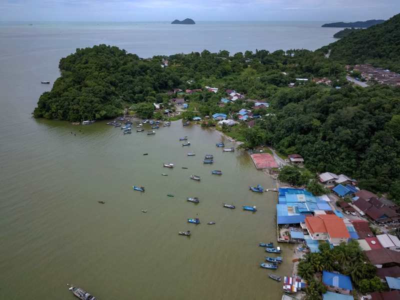
Earlier this year we bought a drone. What to do with a drone…:-)? Aric came with a plan: take drone videos of all the fishing villages in Peninsular Malaysia and combine them into a documentary. An ambitious project..:-)
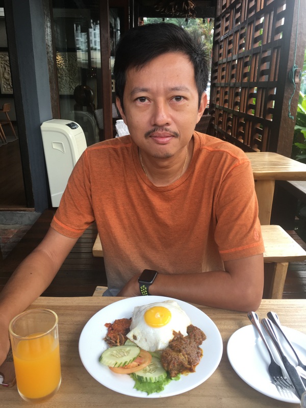
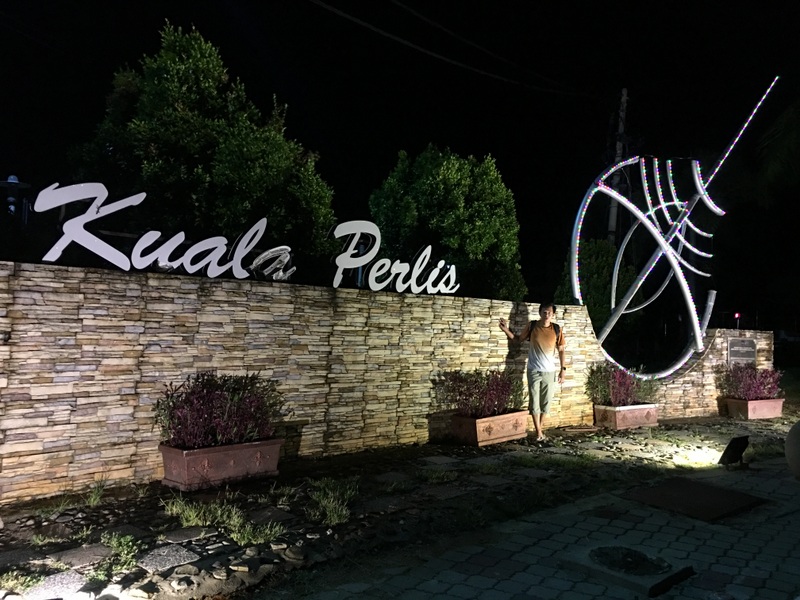
The plan was to start in Kuala Perlis, near the Thai border. Quite far from KL, about 500 km, we decided to drive first to Ipoh, stay overnight in the Ipoh Bali hotel and meet a friend for dinner.
We had stayed before in the Ipoh Bali hotel and liked the place. Your own private balcony, where you can feed the koi fish, a nice breakfast, pleasant atmosphere.
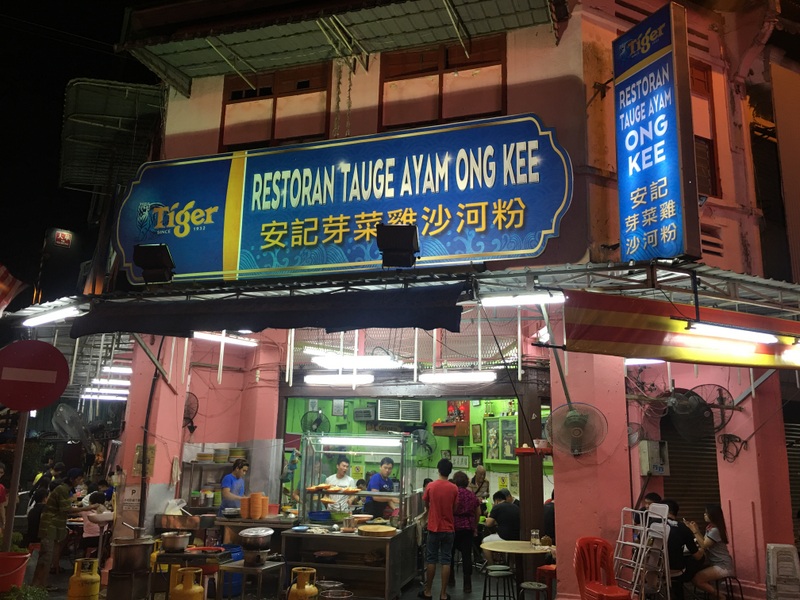
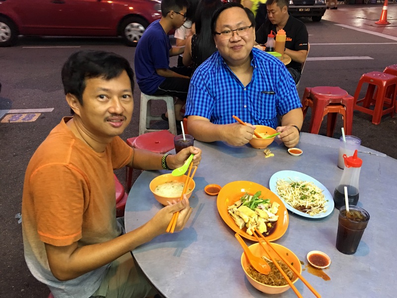
In the evening we met our friend and had dinner with him. Of course the Ipoh specialty, chicken hor fun with taugeh…:-) The restaurant he had in mind was closed, so we went to Ong Kee , also very good and less touristy than Lou Wong, opposite the street
The next morning we left early, still 300 km to go. We had left KL with nice weather, but now the skies became dark, and soon heavy rain started, which did not stop. No way you can drone when it is raining. Was the monsoon starting already? Only the next day we read in the news that the downpour was related to the typhoon Doksuri, that had hit VIetnam!
We arrived in Kuala Perlis for a lunch with Assam Laksa. Malay style, not bad.
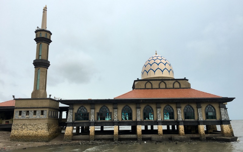
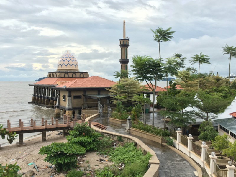
Here is the quite attractive mosque of Kuala Perlis.
Our plan was to start taking drone videos here, then slowly go down south, visit a few more fishing villages and stay overnight, halfway to Penang. The heavy rain messed things up. We waited for quite a while, but the rain continued, with strong winds.
Finally, a bit disappointed, we decided to stay overnight in Kuala Perlis. A good decision because around 6 pm finally the rain stopped and the wind became less strong.
While Aric was starting his drone, I walked to the lookout tower, from where I had a nice view of the mosque.
Here is a drone view from the village. We were happy that we could at last have one drone result after our long drive…:-). Note the pedestrian bridge, crossing the Perlis river.
We walked to this bridge and found a large crowd there, watching longboat races. Very interesting, actually they were training for the Perlis Water festival in November
In February 2016 we had also made a Trip up North and we had enjoyed the food at the Hat Thien restaurant in Kuala Perlis so much that we went back there for our dinner. Good decision.
Hai Thien restaurant
Thai mango salad
Seafood otak otak
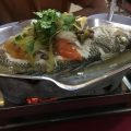
Siam steamed fish
After our dinner we walked back to our hotel. It was dry, no wind, we were optimistic about the weather the next day. Kuala Perlis is well known for its horseshoe crabs. Next visit we must try them.
We woke up the next day not by the sun shining in our room, but by rain pounding the windows. Bad luck. Useless to visit fishing villages…:-(
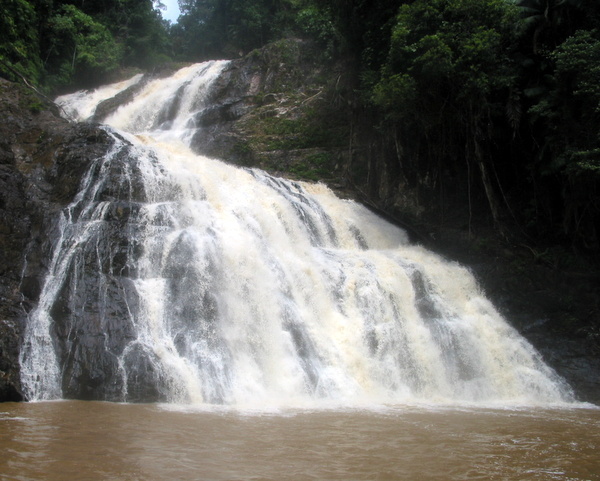
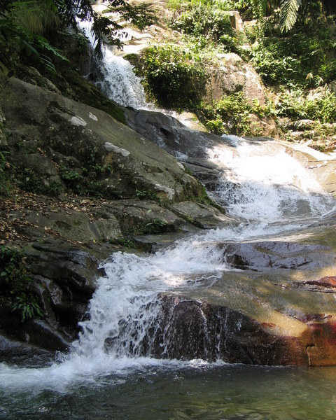
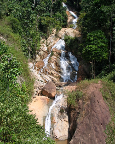
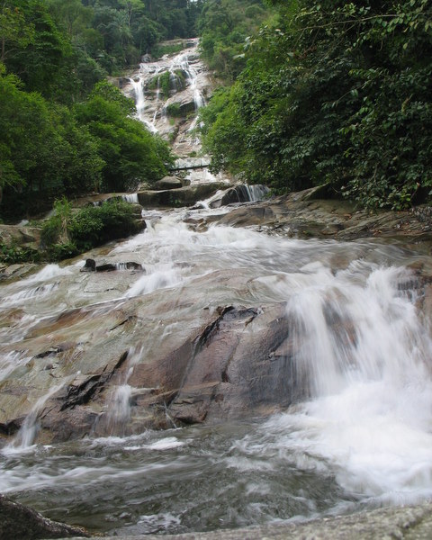
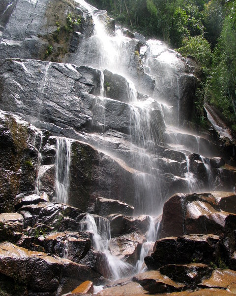
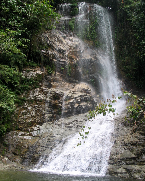
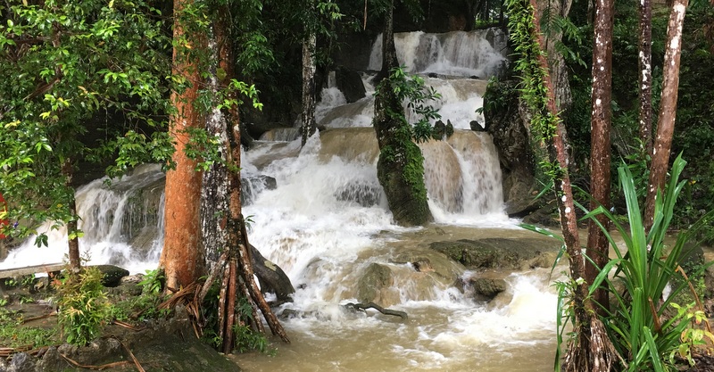
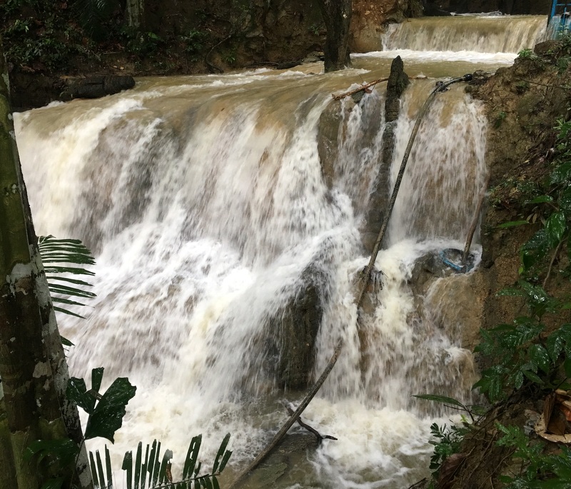
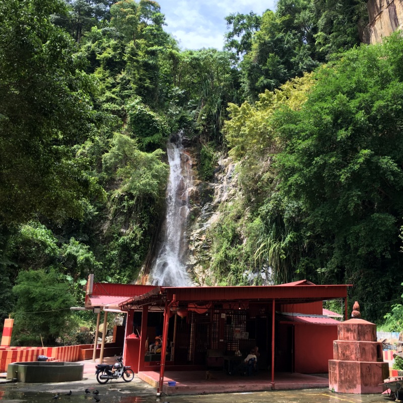
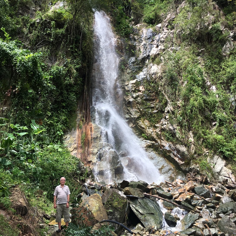
Instead we decided to have a look at the one and only waterfall in Perlis, north of Kangar. It had been one of the main targets of our 2016 trip up North. It is a seasonal waterfall and during that trip there was no water at all. We expected that it would be different now, and we were right. Quite impressive.
For comparison. The left picture shows the situation in 2106, nice flowstone but no water. The right picture has been taken from roughly the same angle. What a difference.
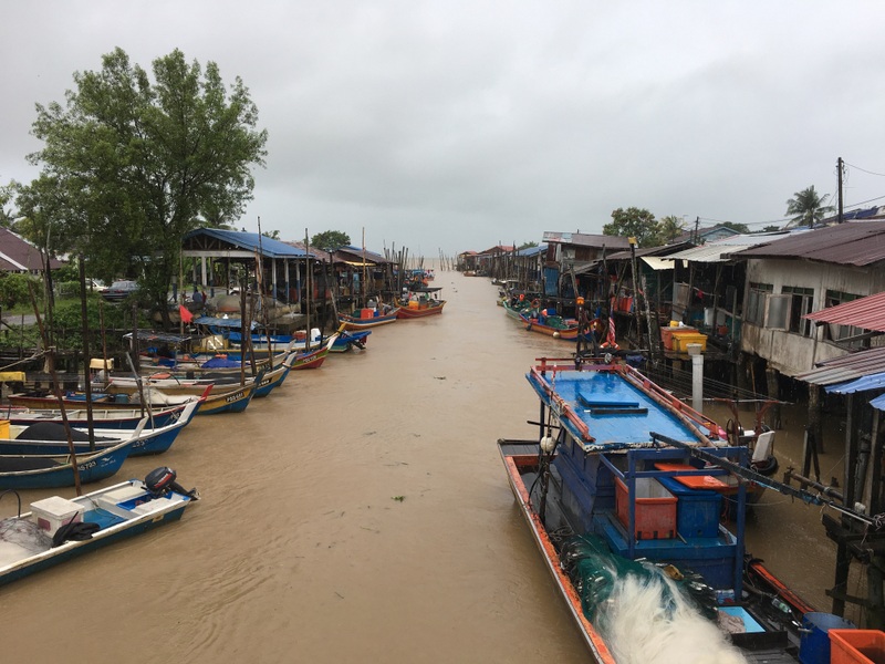
We decided to drive back to Penang. On our way we passed one of the fishing villages, Simpang Ampat, the rain did not stop. Scenic views of the paddy fields, but look at the dark clouds.
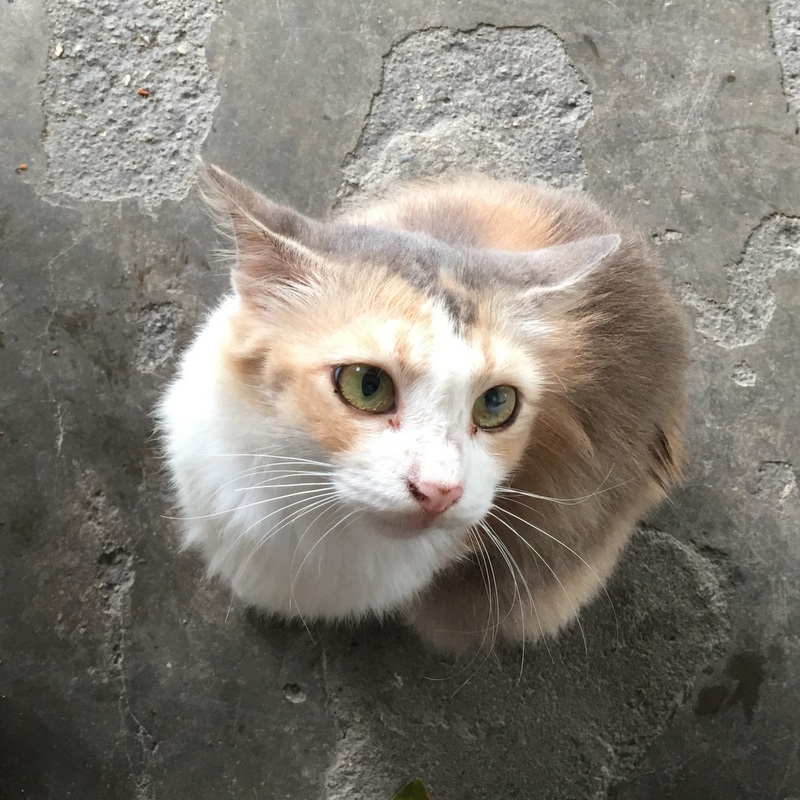
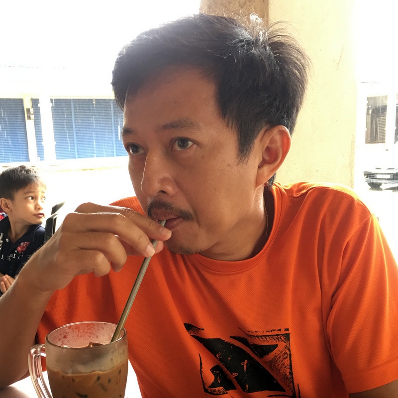
It is really a small village, finally we found the only coffee shop, where we had a drink and some food. The cat is hoping for some leftovers, Aric is hoping that the rain will stop
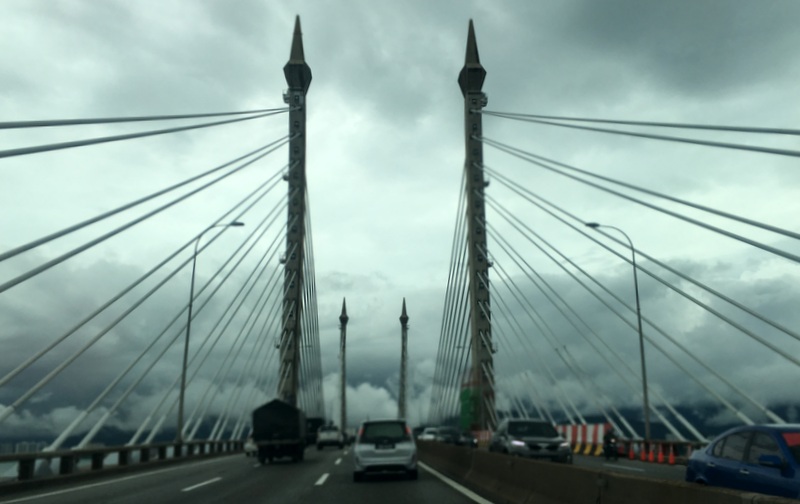
We knew that the situation in Penang that morning was chaotic, flooding, landslides, cars floating in the water, and when we crossed the bridge, the situation looked quite threatening.
We decided to try our luck and go to Balik Pulau for its famous assam laksa.
Balik Pulau is on the West side of Penang, you have to cross the hills on a winding road. There had been a few minor landslides, but the road was not blocked.
Still heavy rain in Balik Pulau, but the assam laksa was nice.
We expected a traffic jam on our way to our hotel in Georgetown, but actually there was not a lot of traffic, probably many Penangites had stayed at home that day.
We had booked accommodation in the Chulia Heritage hotel . The outside and the lobby look nice, a traditional Chinese hotel, but probably during renovation they have split the huge hotel rooms into smaller units. Still ok, though, and not expensive
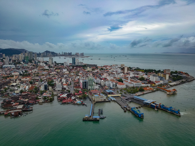
End of the afternoon the weather finally started improving. We walked to the clan jetties, passing the Kapitan Keling mosque (left). The Tan jetty (right) extends far out, a perfect location to drone.
In this picture you see theTan jetty (where we are standing, near the red temple) and the large Chew jetty.
Georgetown with the ferry terminals.
We had dinner that evening with a friend who is living in Penang, so he knows the good food places…:-)
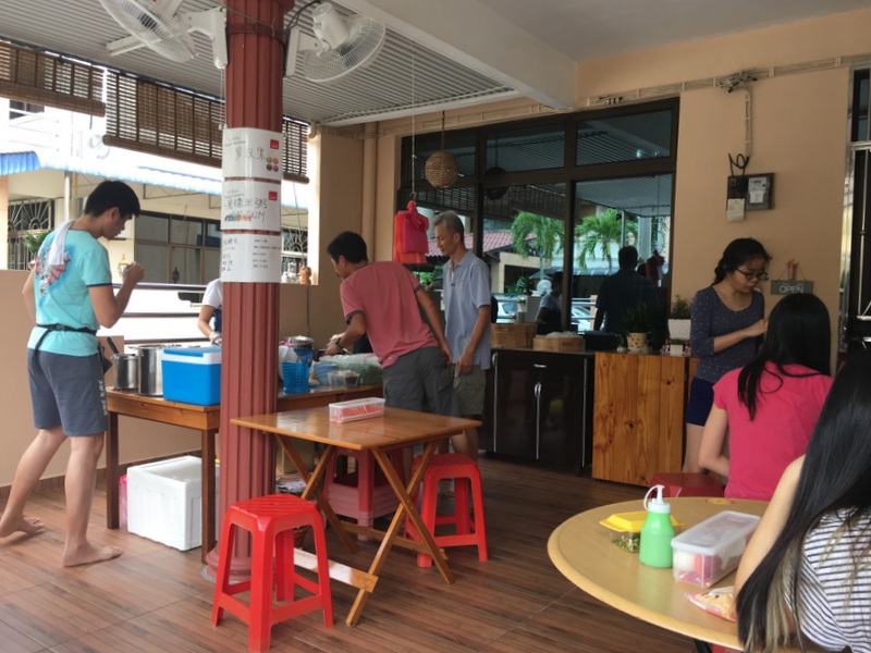
He suggested for breakfast the next morning Moh Teng Pheow a famous nyonya kuih stall, near to our hotel. It opens a bit late, at 10:30 am, but it was worth waiting. Popular place, friendly staff, nice food.
Our next destination was a fishing village, Teluk Kumbar, at the southern point of the island. On our way we visited another waterfall, suggested by my friend Siang Hui. Usually it is just a trickle of water, but he expected that it might now be more powerful after the heavy downpour. And he was right, as usual..:-).
In front of the waterfall there are two temples, an Indian and a Chinese one, next to each other. Unusual.
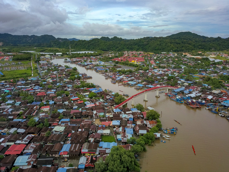
Here is the drone picture of Teluk Kumbar
Aric is collecting data about assam laksa shops in Malaysia and had discovered one in Bukit Mertajam, so leaving Penang we went to this shop for lunch. Only open during weekends and run by a family in their own home in a residential area.. Take off your shoes, before you enter! Nice assam laksa, friendly service
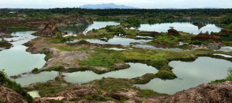
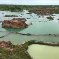
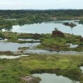
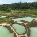
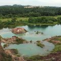
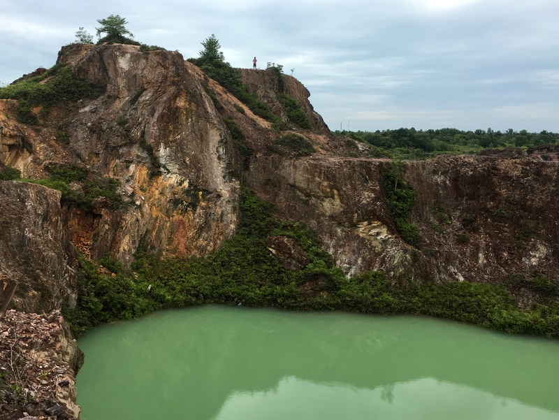
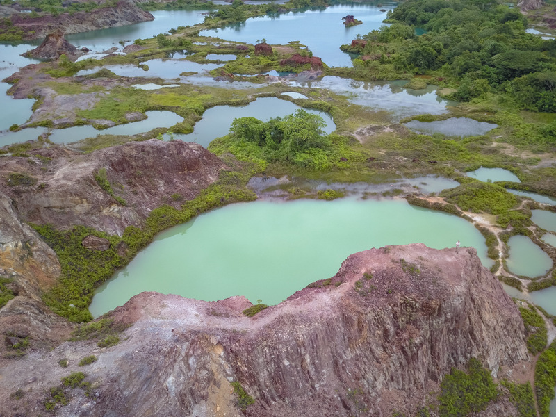
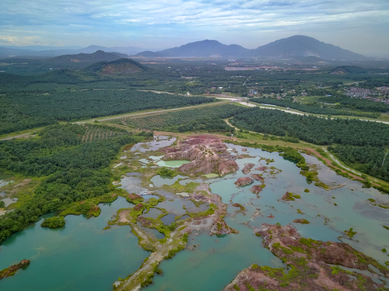
After our lunch we continued to Guar Petai, a.k.a. Frog Hill. We had visited this spectacular mining landscape in 2016 during our trip up North last year. Very suitable for droning, although even without a drone, you have a nice view from the hill in the middle of all the lakes
In the left picture you can see Aric on top of the hill, directing his drone. The right picture is taken by the drone, and when you enlarge the picture and look carefully, you may see me at the right, on the ridge…:-)
Here is one more drone shot, taken from a higher altitude.
Ater this Frog Hill we drove back to Taiping. I had booked two nights there, Aric went back to KL. My activities in Taiping this time were mainly related to heritage, which may be a bit too detailed for the average visitor of this blog. Therefore I decided to write a separate blog Taiping September 2017 , about how I spent these two days.
Taiping promotes itself proudly as Bandar Warisan (Heritage Town) and it is true that you can find many beautiful historical buildings there.
But there are also many ruined and run-down buildings, and during this visit I have concentrated on this darker side of my second hometown.
As I had no transport this time, I had booked a train ticket from Taiping to KL Sentral. Nowadays there is an efficient and fast ETS (Electric Train Service) between Gemas and the Thai border.
Food and beverages can be bought on board, tickets can be bought online. It took me only 3 hours and 20 minutes between Taiping and Sentral. Kudos for Malaysia!
Although we had to modify our plans, the 6D5N trip was very interesting and full of variety, as usual..:-)


