The River of Life again

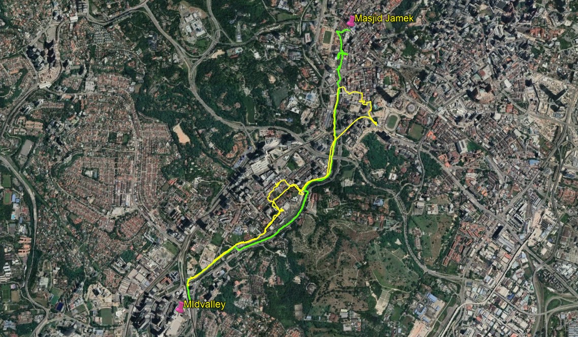
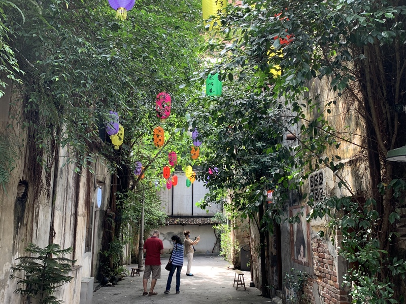
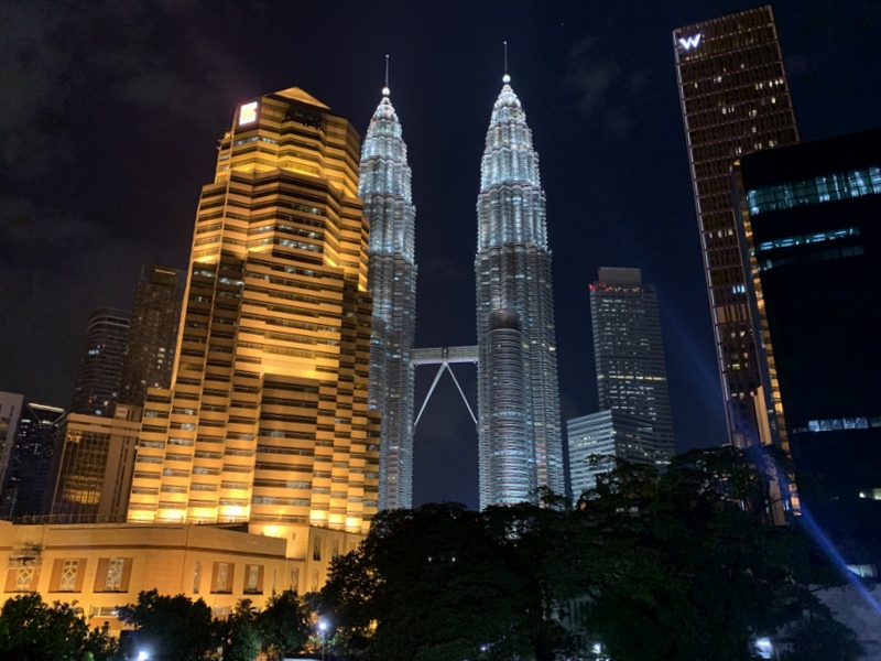
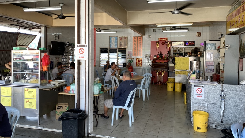
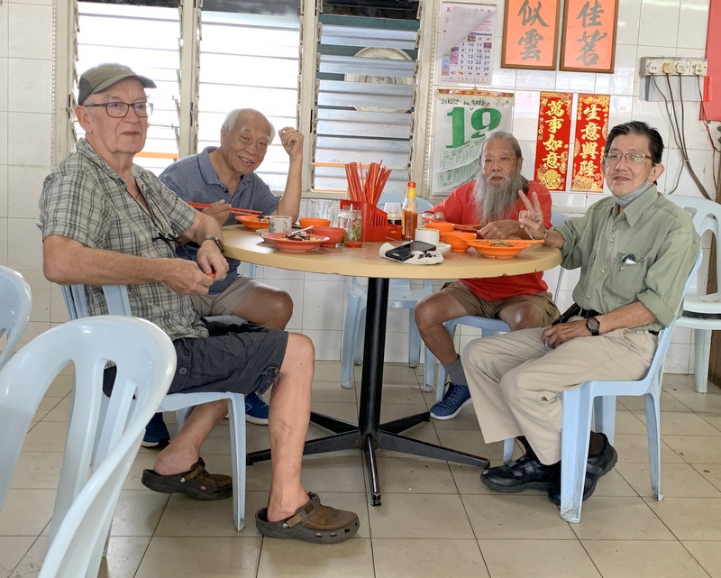
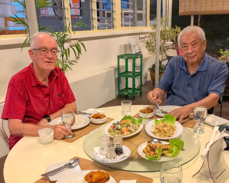
When we walked the River of Life route recently, we started at the trail head near the Midvalley Megamall and stopped at Chinatown, because we wanted to have a look at the murals there. Click here for a detailed report. So we skipped the part from Chinatown to Masjid Jamek, considered the be the most beautiful part of the route.

As there are LRT stations both at Masjid Jamek and near Midvalley (Abdullah Hukum) , I suggested to Paul that we could walk another time, one way, from Masjid Jamek and going back by train.

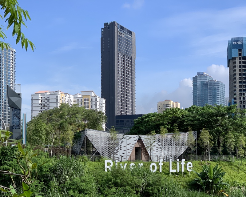
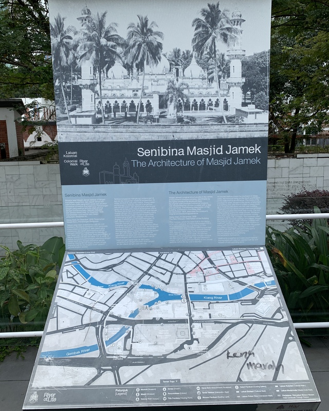
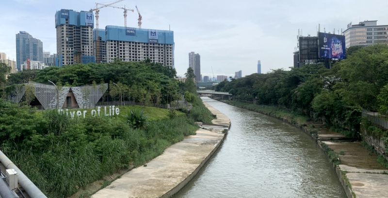
We met at the exit of the Masjid Jamek LRT station and started our walk from there. A clear signboard gives information about the River of Life project.

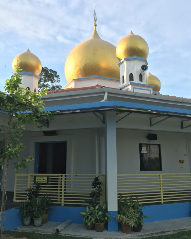
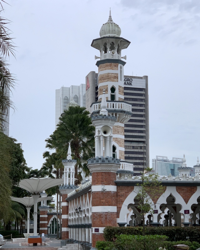
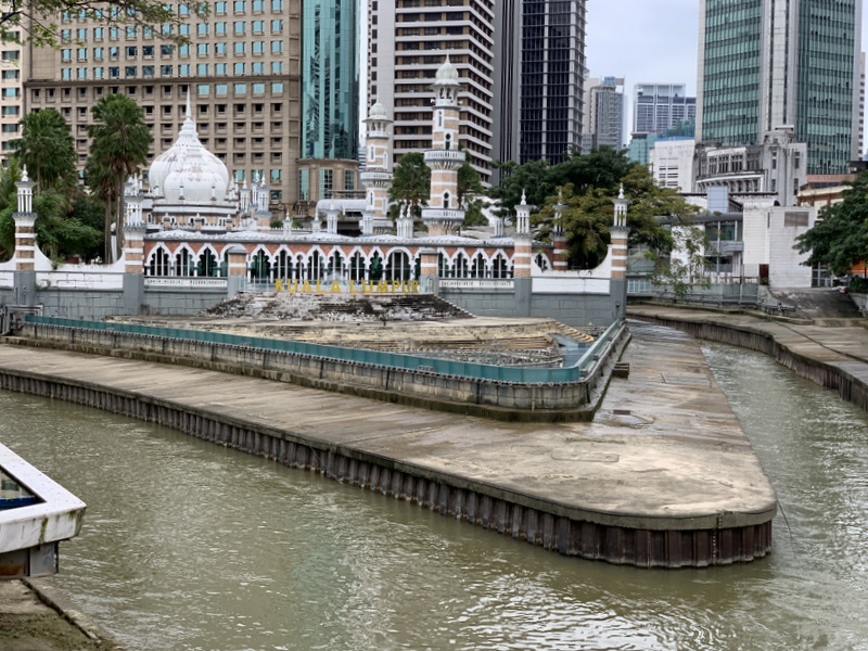
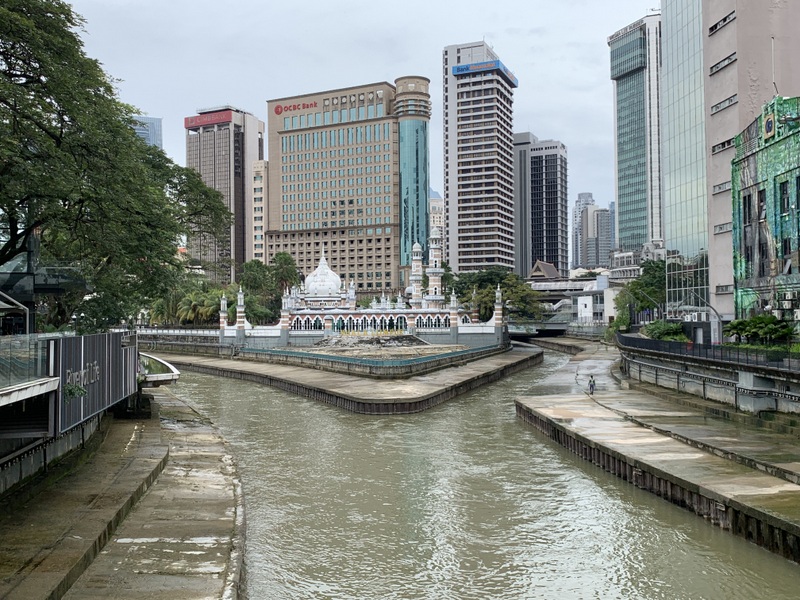
Our walk started in front of the Masjid Jamek, one of the masterworks of Arthur Benison Hubback, built in 1909. Non-Muslims can visit the mosque, but there is a dress code. Left an explanatory signboard, right the mosque as seen from the main entrance.

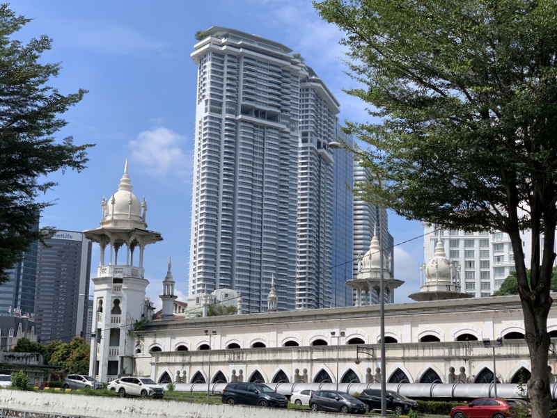
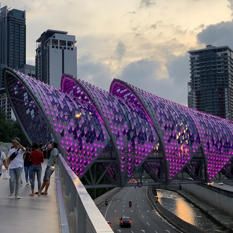
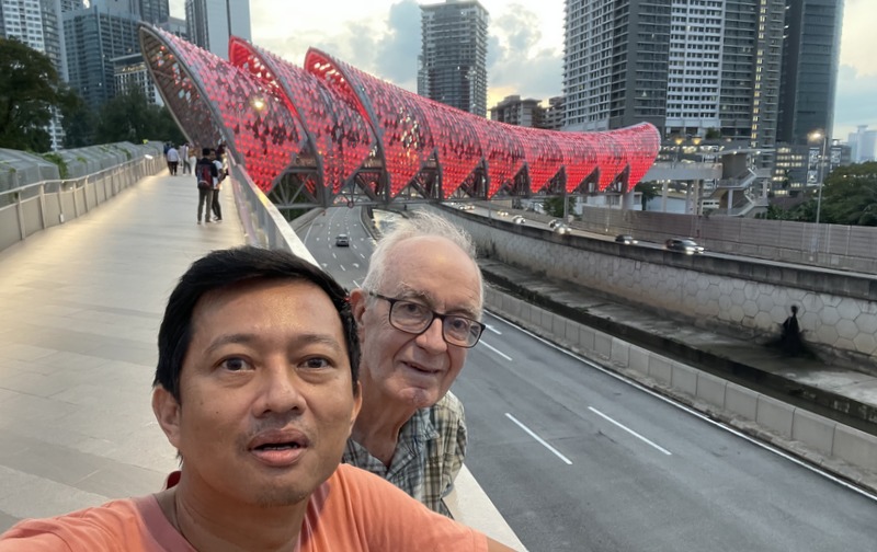
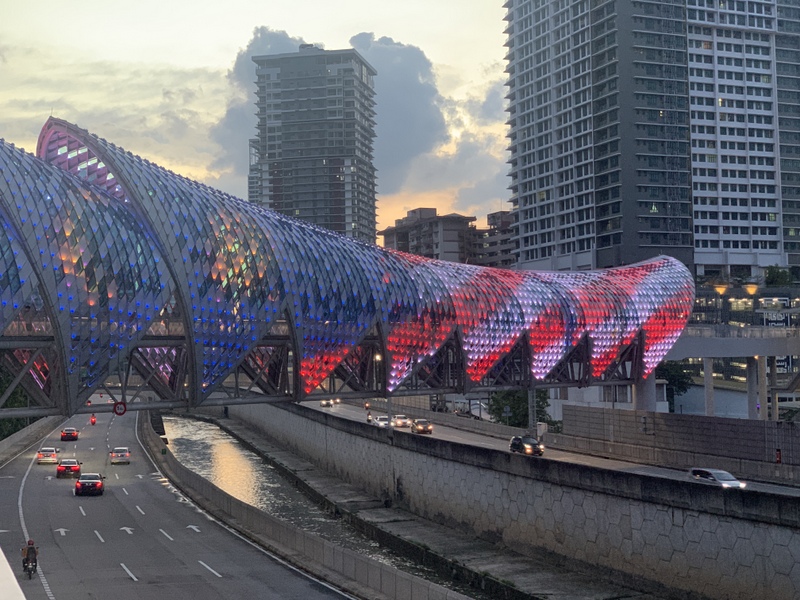
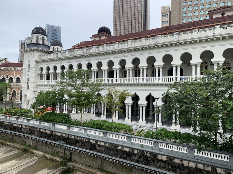
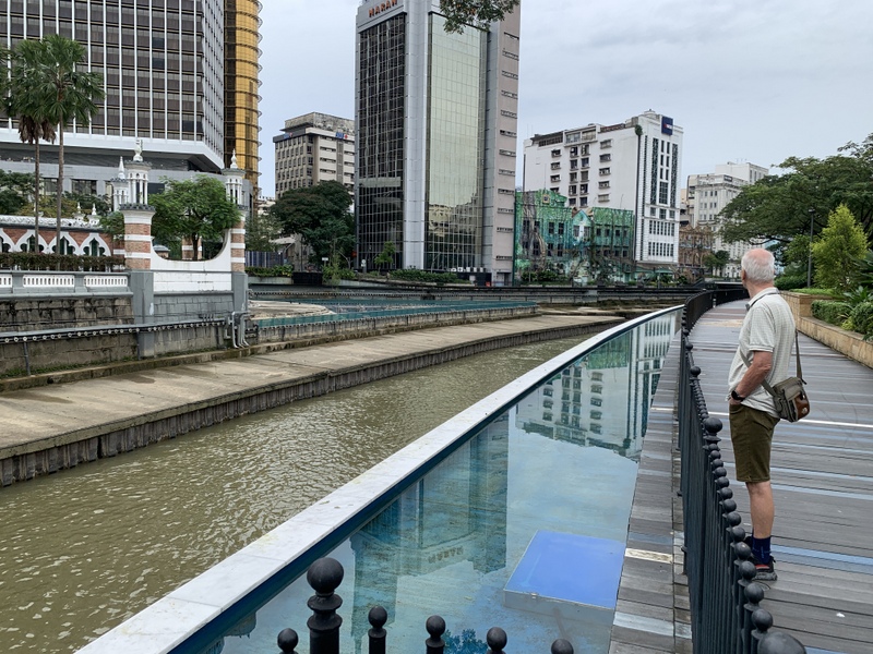
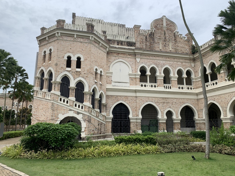
The route passes the magnificent (old) Supreme Court building, another creation of Hubback (1915). Not in use at the moment and the interior needs urgent repairs. The picture has been taken from the new pedestrian bridge crossing the Gombak river. In the right picture Paul is looking at the mosque, located at the confluence of the Gombak and Klang rivers.

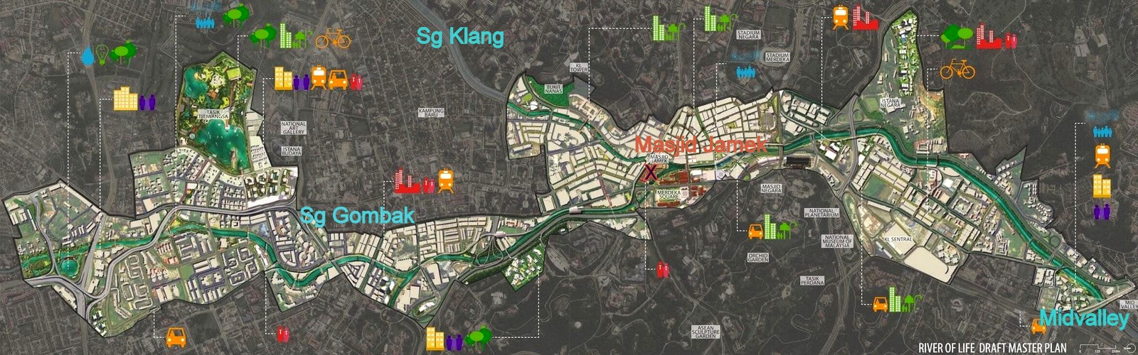
The next few hundred meters are for me the highlight of the River of Life project You pass the back of the former Government Office (1897). The front side, facing Dataran Merdeka, is probably the most photographed building of KL The tranquil , peaceful backside was an unexpected surprise for me

Continuing along the Gombak river, you have nice views of the Mosque and the confluence of the two rivers.

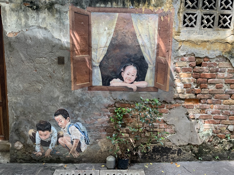
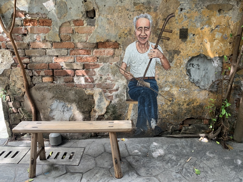
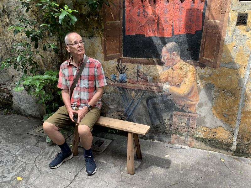
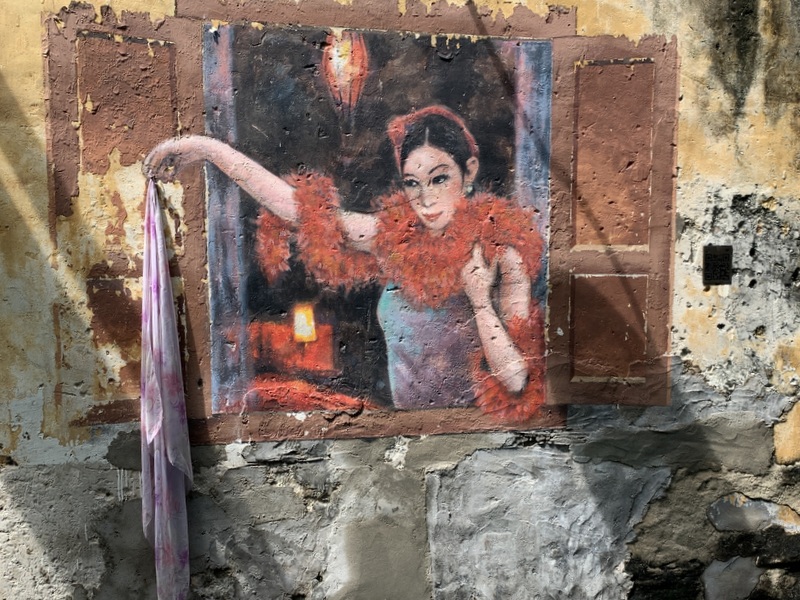
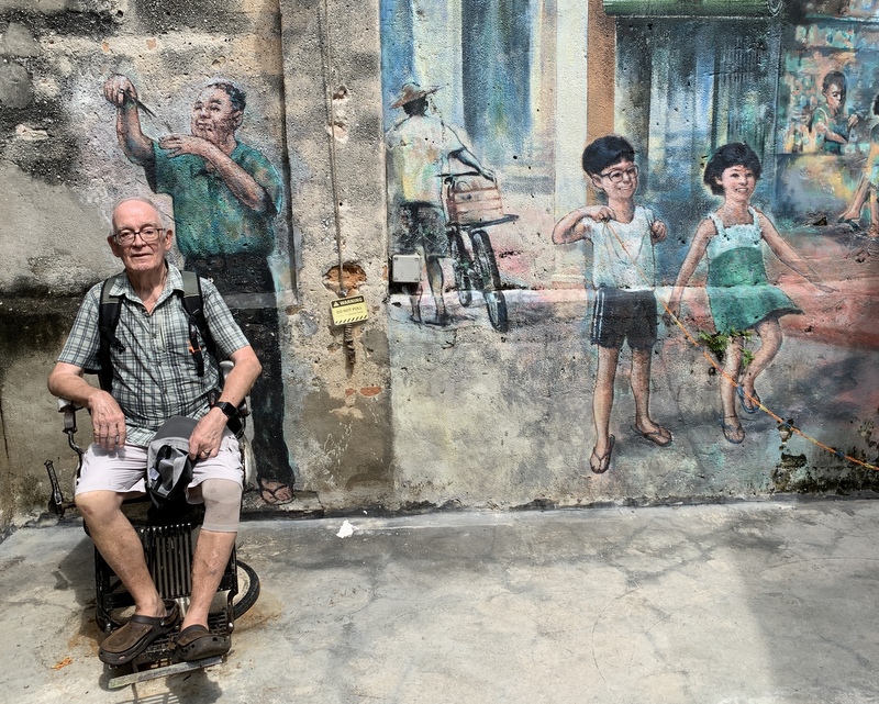
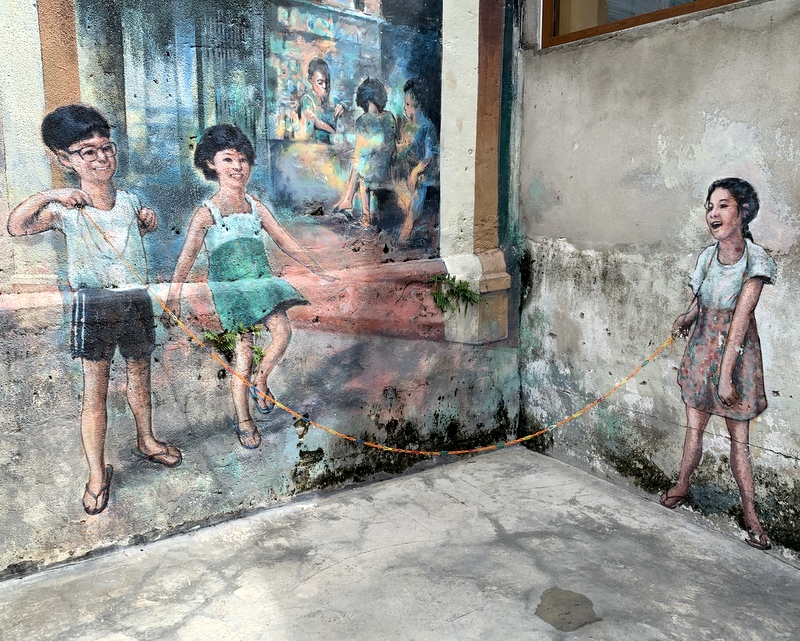
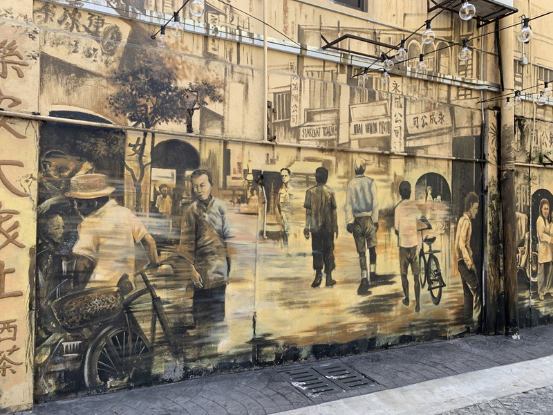
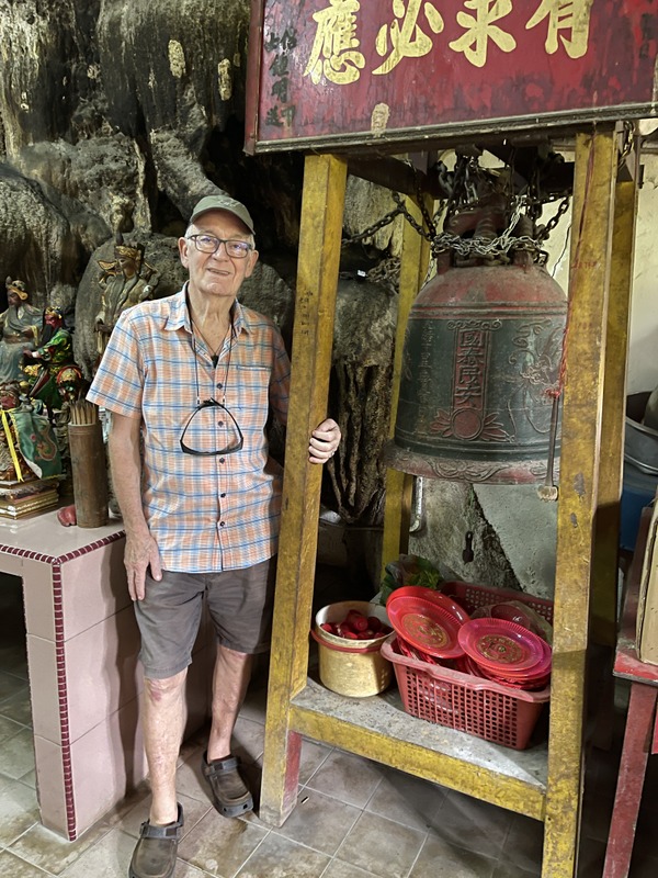
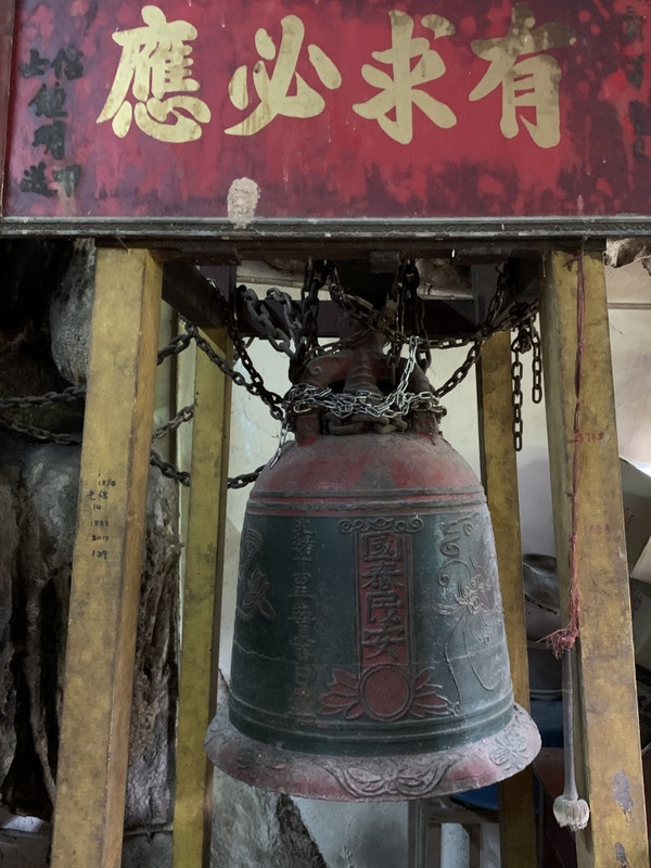
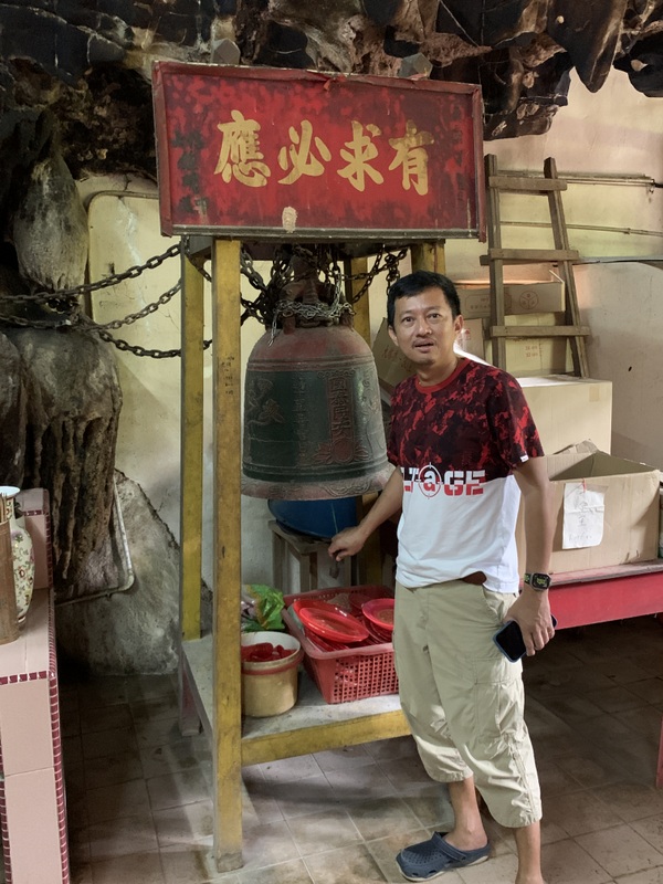
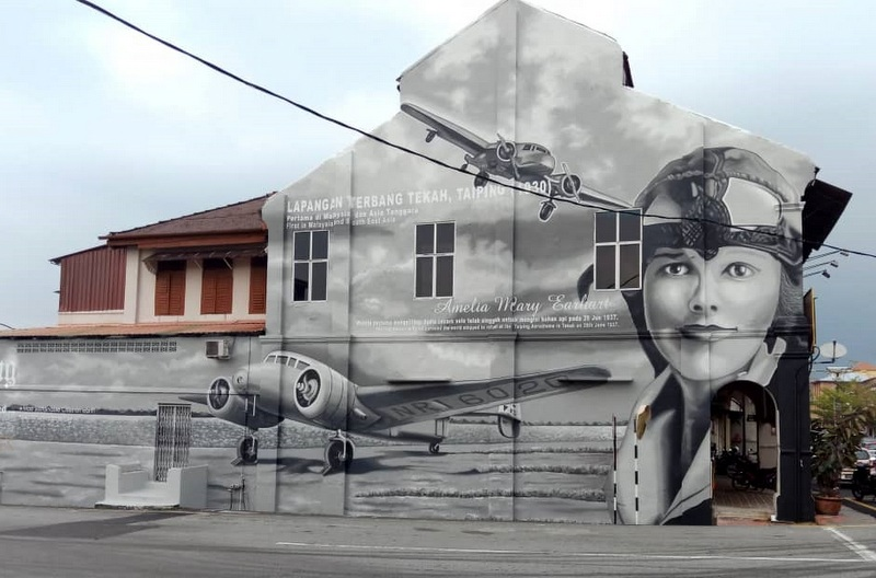
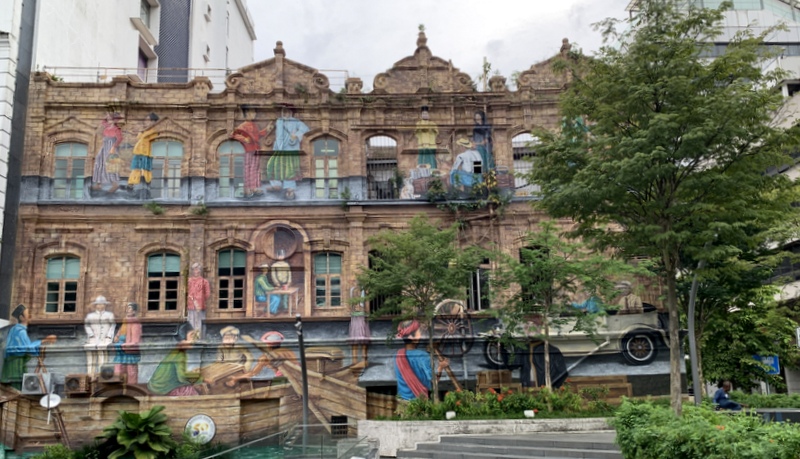
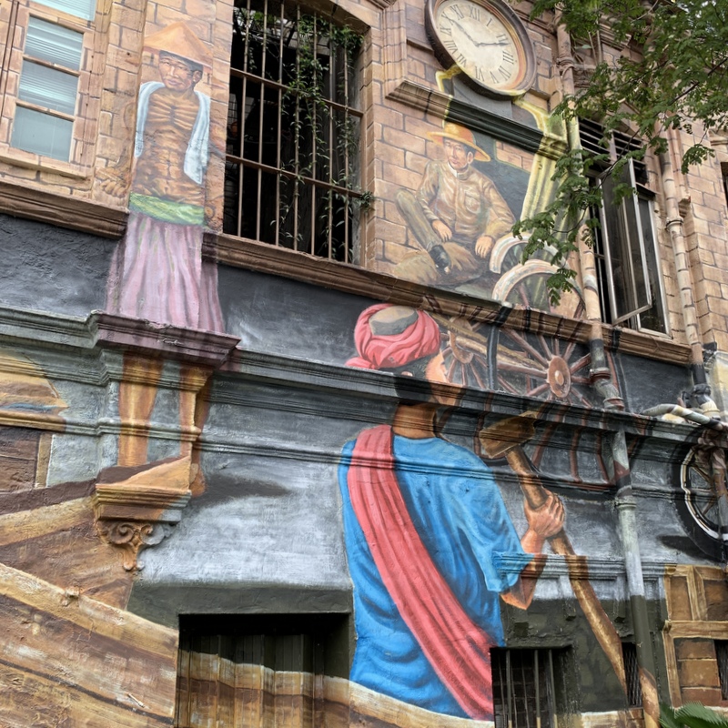
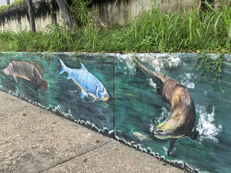
Before you reach the next bridge, there is interesting mural art. These three buildings are still in use, as can be concluded from the numerous aircon’s .

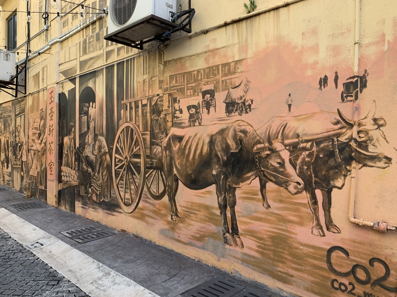
Almost next to it, this building looks vacated, not a good sign . The faรงade has been used to paint various sketches of Kuala Lumpur’s past

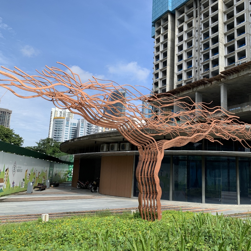
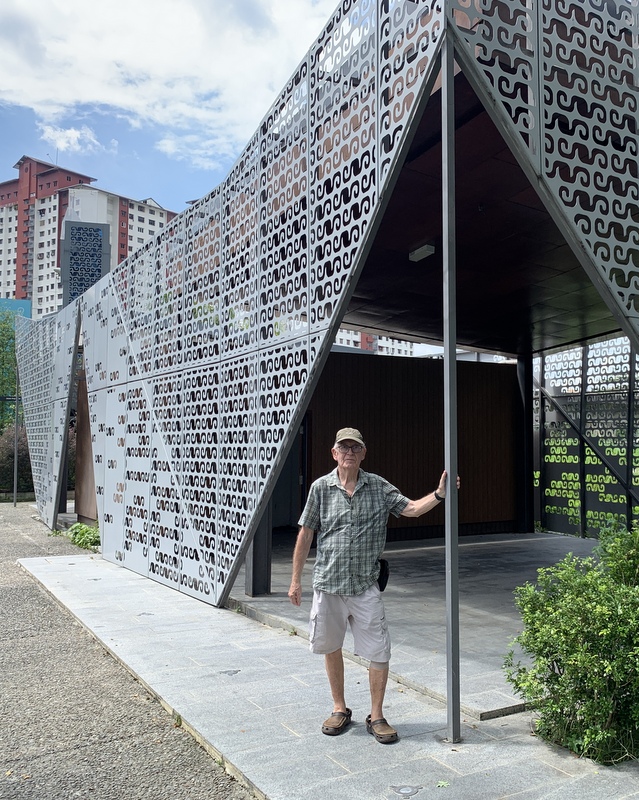
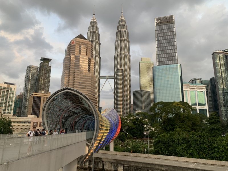
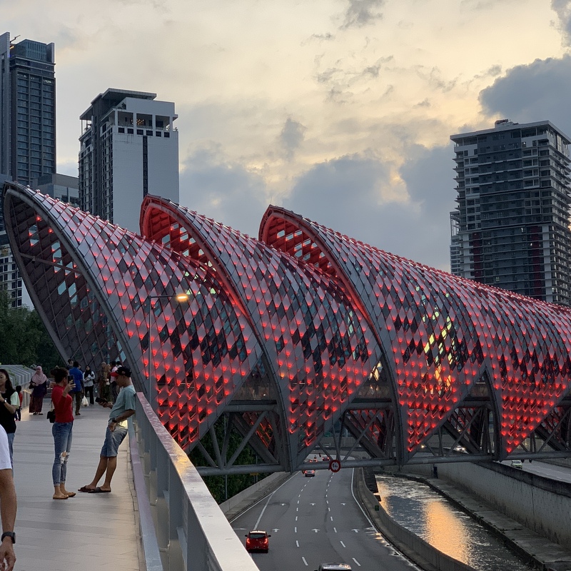
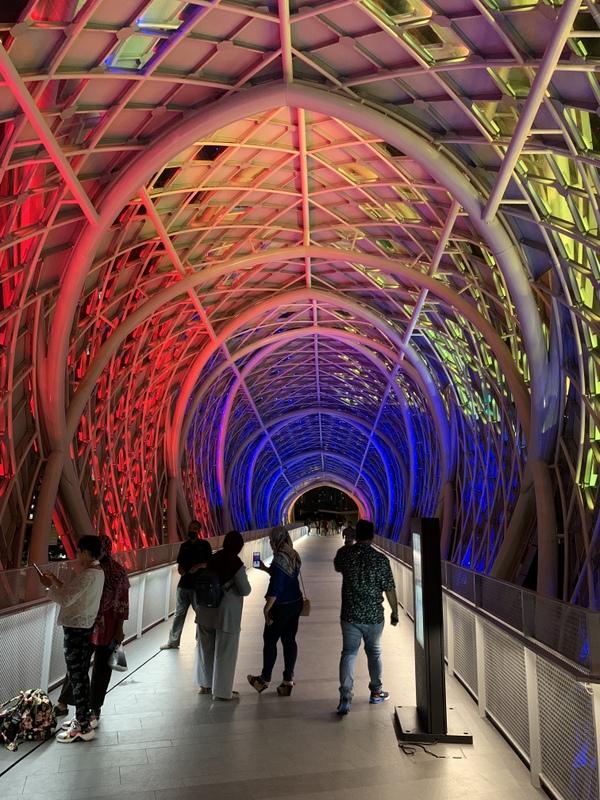
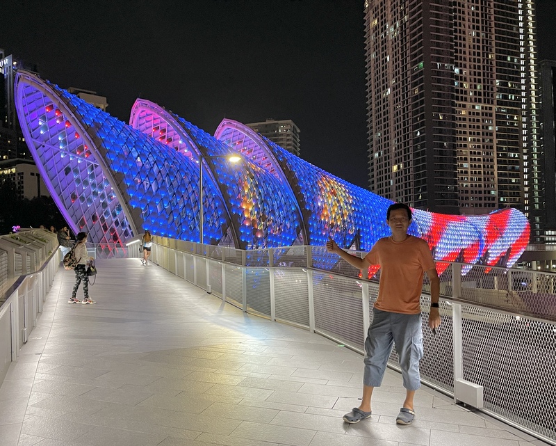
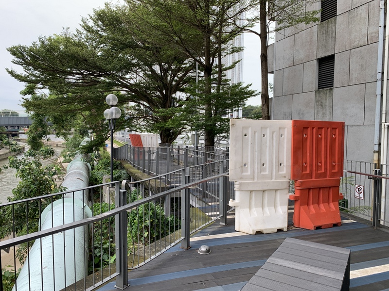
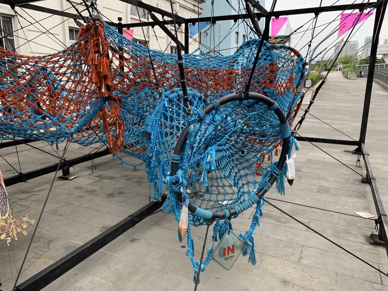
It looks like after the bridge you can continue at the same side of the river, but soon, the raod is blocked (left pic), so you have to cross the bridge here, where you can find a modern work of art. (right pic)

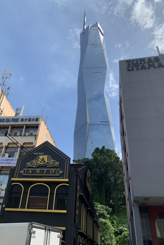
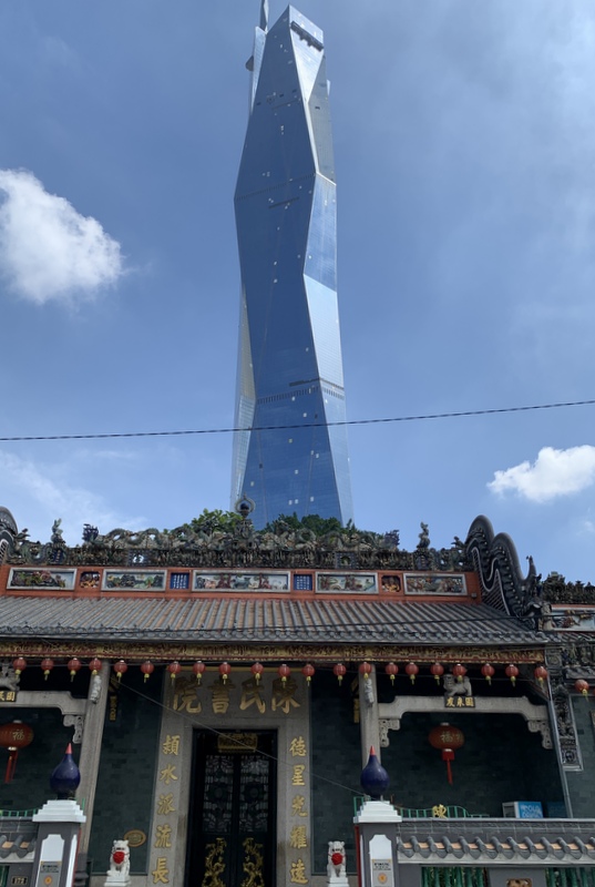
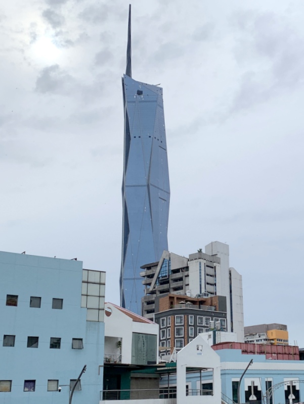
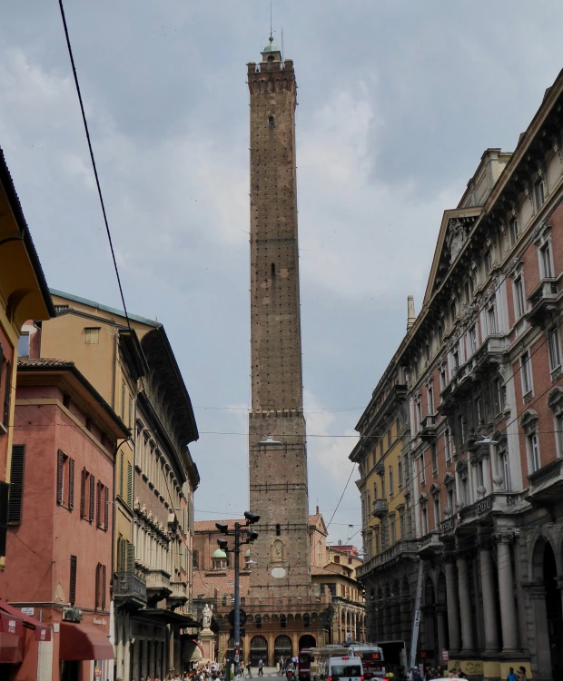
You will pass now the Central market (Art Deco , 1937). The left picture shows a part of its faรงade, with towering above it the new Merdeka 118 skyscraper, still under construction. It will become the second-tallest skyscraper in the world. I can’t resist the temptation to digress for a while. When I see a photo like this I immediately have the association with a phallic symbol and that these symbols have been constructed since time immemorial. The right pic shows the Asinelli tower in Bologna, built in 1107 ๐Ÿ˜‰ .

Left a detail of the Central Market and right one of my favourite buildings in KL, the Dayabumi building. Completed in 1984 and for one year the tallest skyscraper of Malaysia. For me it is a fine example of Islamic Architecture.

Passing the Dayabumi complex (left) we reach the Pasar Seni LRT station (right in the center), where we cross again the river.

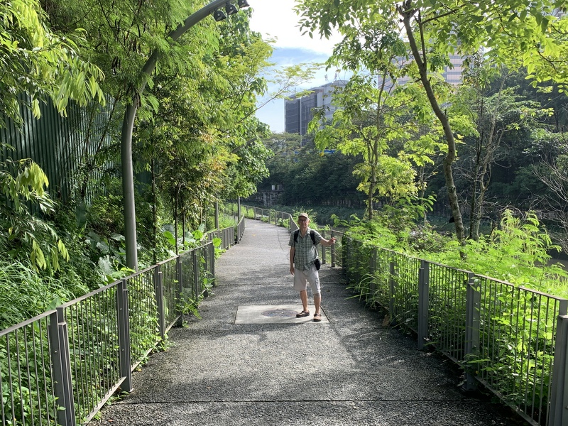
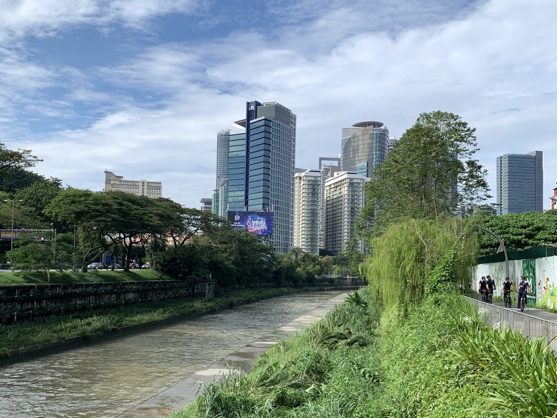
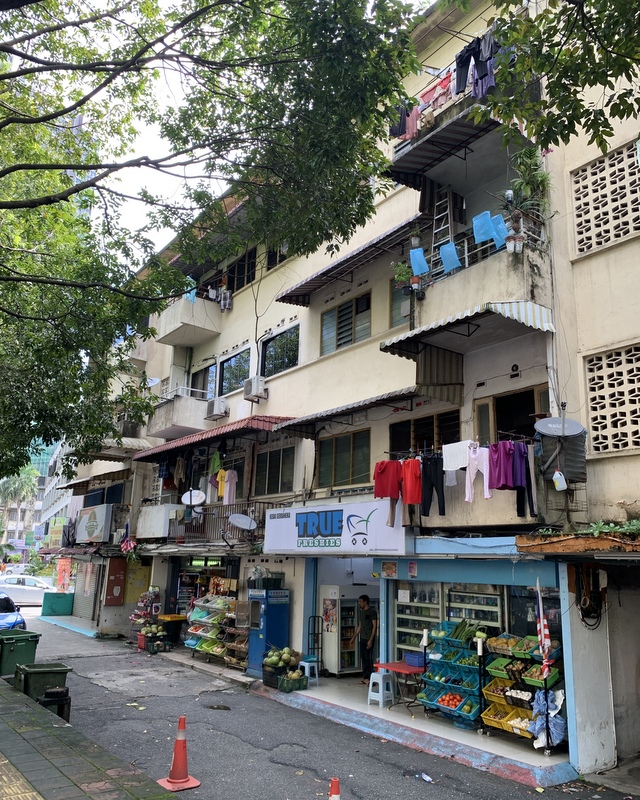
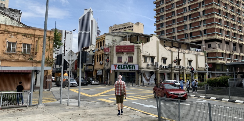
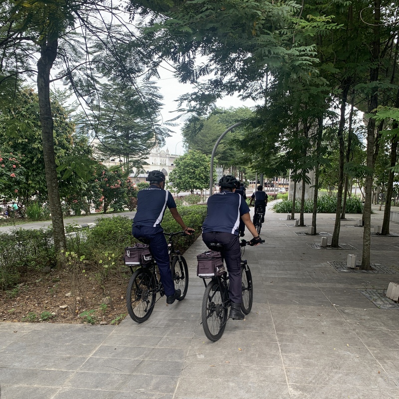
From there we followed the same route as during our first trip, so not many photos. It is basically a bicycle lane and we noticed a few cyclists.

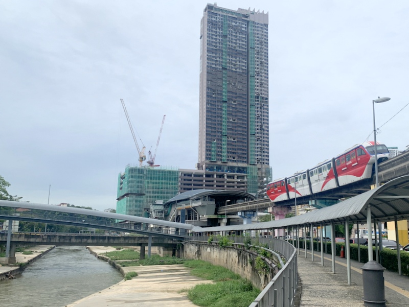
Mural art (left) and the Tun Sambanthan monorail station in Brickfields (right)

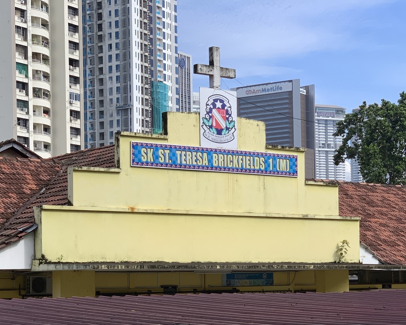
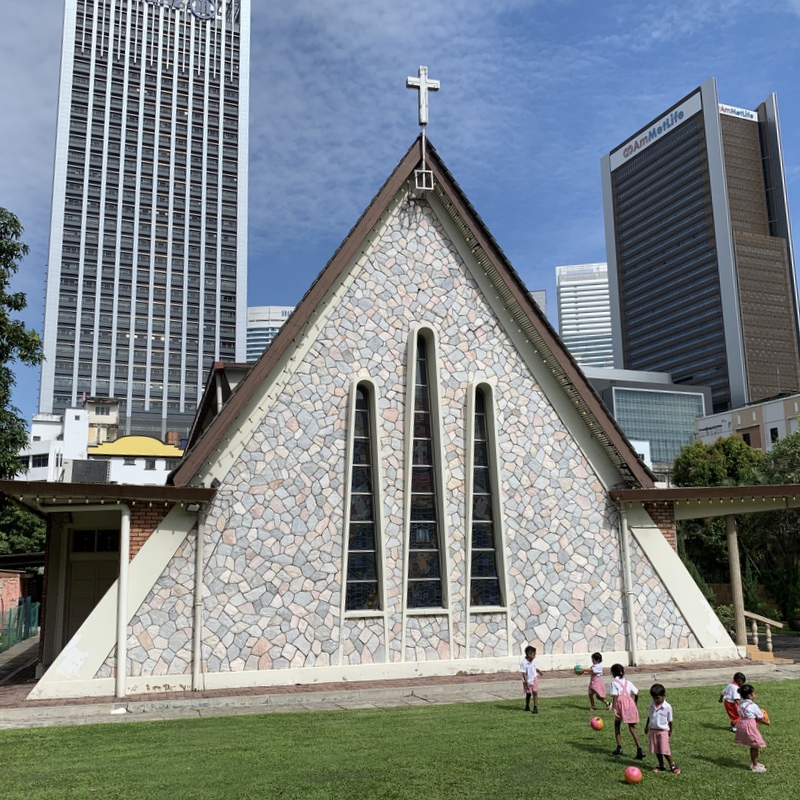
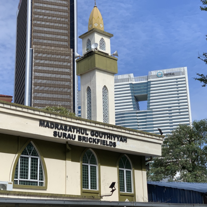
This time we decided to cross a bridge and continue at the other side of the river, so we didn’t walk through Brickfields. Distance is a bit shorter, but it is not interesting at all.

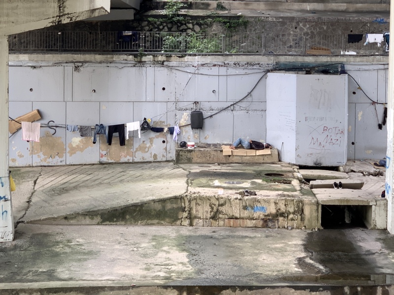
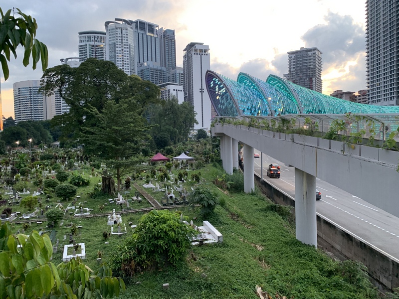
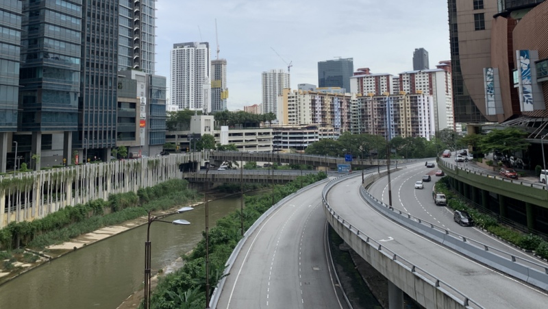
And there is one part where you have to walk a few meter away from busy, noisy highway traffic. Really to be avoided.

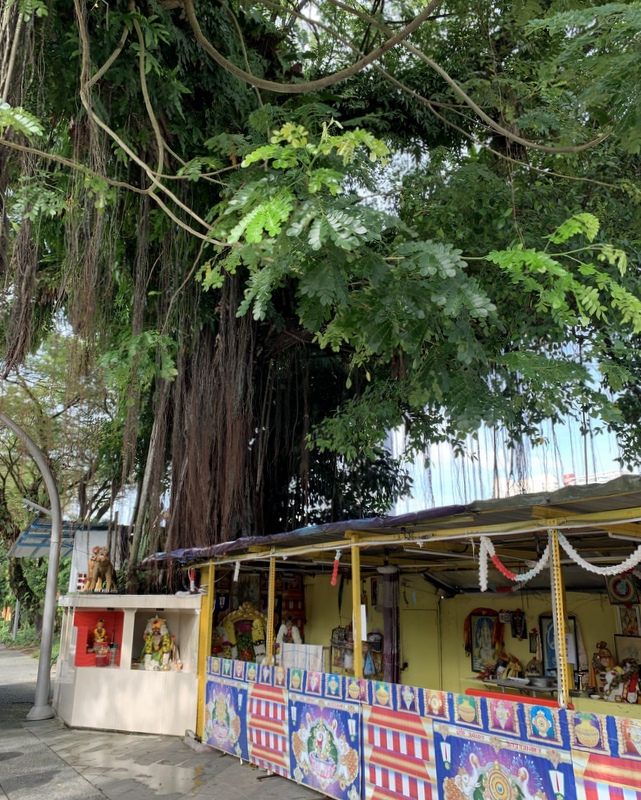
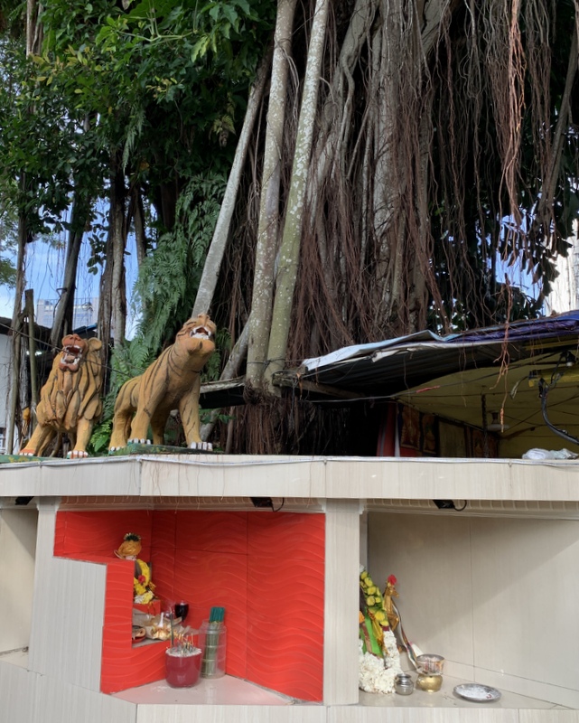
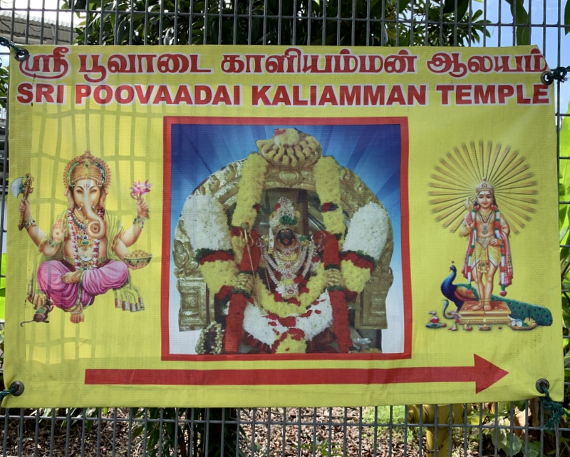
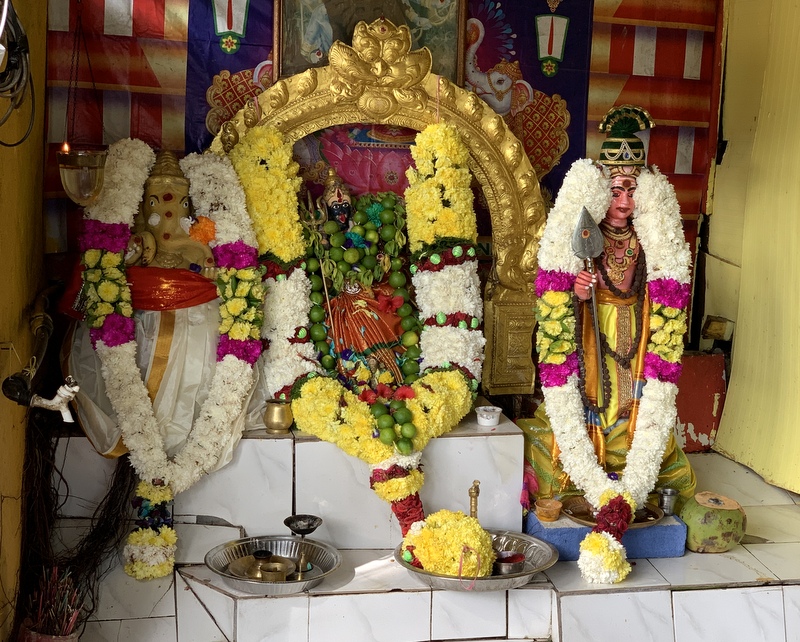
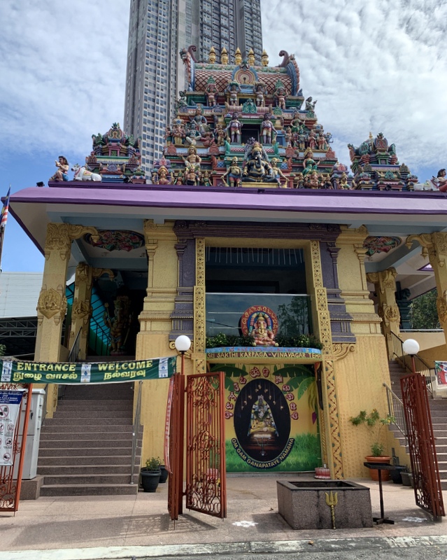
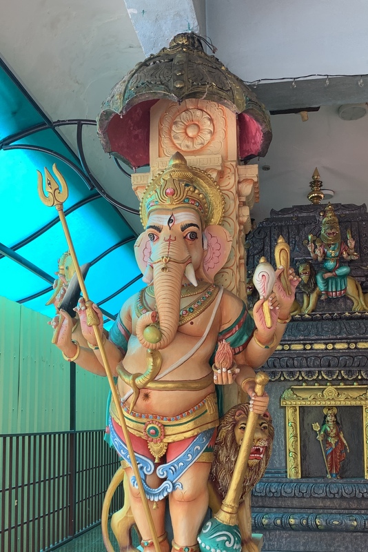
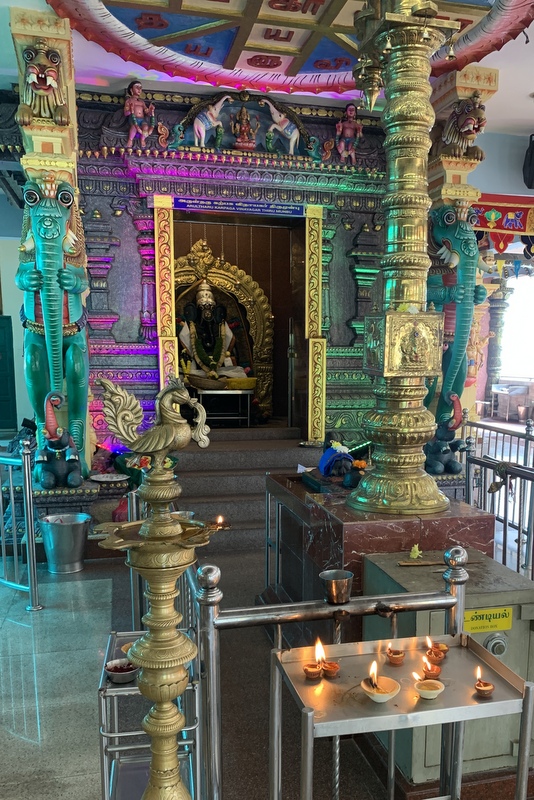
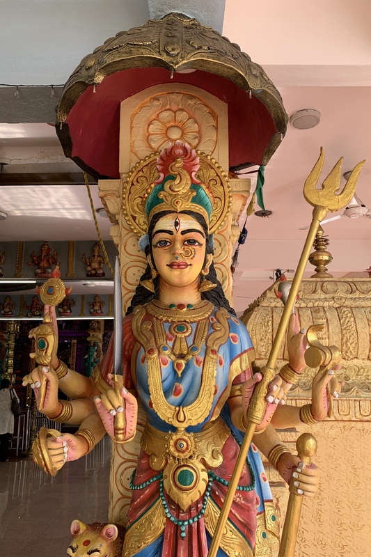
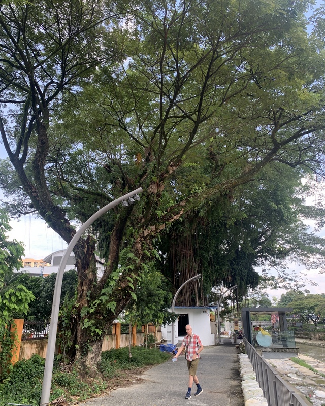
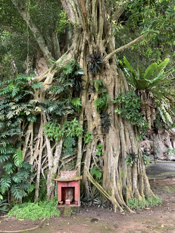
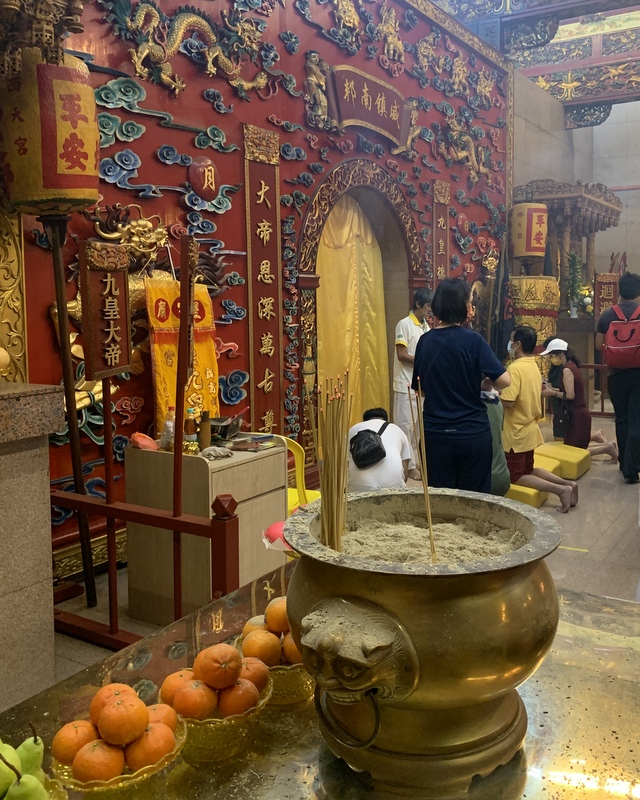
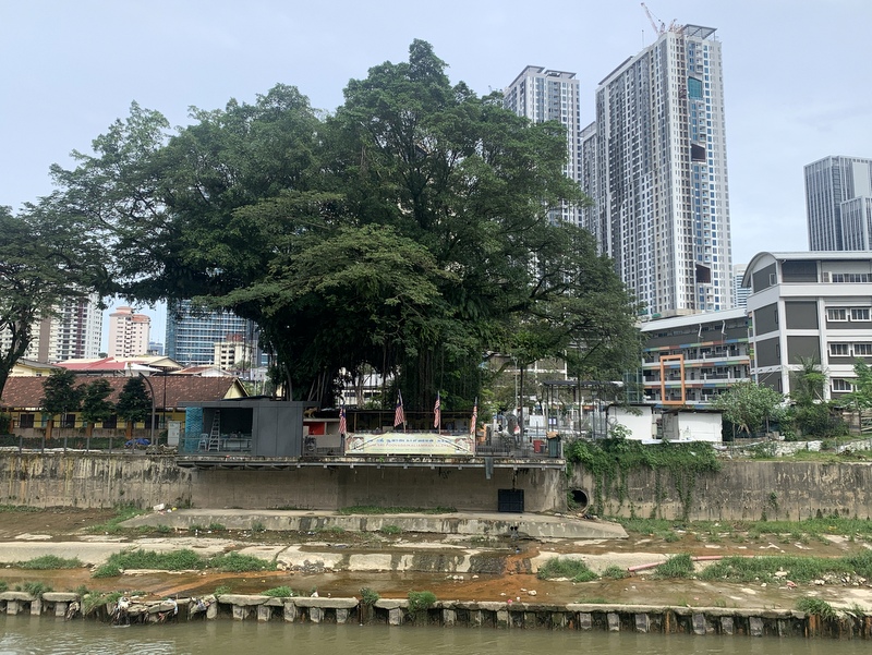
The Kalaimman temple is at the other side of the river. The majestic tree is now even more impressive

As soon as possible we crossed back to the other side of the river, and continued the trail until where we had started during our first trip. There was a sign near the building that it is the Southern Gallery. Completely empty, maybe there are plans to put some exhibits inside.

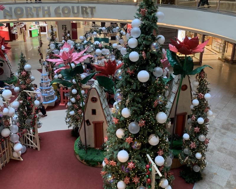
To reach the Abdullah Hukum LRT station we had to cross the Midvalley complex, where you can get easily get lost. Christmas atmosphere.

To reach the station we had to cross once more the Klang river.

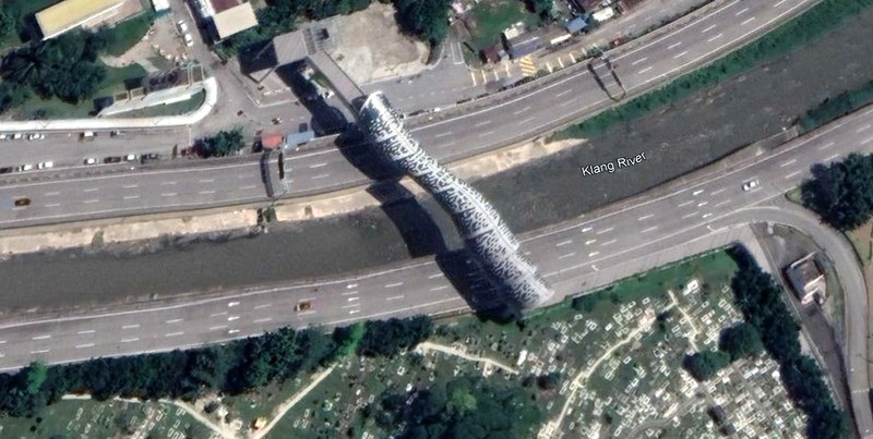
Here is a Google Earth map of our walk, in green. For comparison also the route of the first trip is shown (in yellow) . Notice the part where we walked at the other side of the river, avoiding Brickfields. To be avoided at all costs, Brickfields is much more interesting,

River of Life & KL Murals

The River of Life (ROL) project was launched in 2011 and aimed at reviving the Klang River and Gombak River within the city of Kuala Lumpur, transforming the banks into waterfront areas with economic , touristic and commercial value through river cleaning and beautification. An ambitious project, here is the masterplan. Click to enlarge. I have put a few markers,the Klang en Gombak rivers, the Friday Mosque , where their confluence is and to the right Midvalley where the City of Kuala Lumpur ends.

In 2017 the first phase of the project was officially opened, the region around the confluence of the two rivers and the historic city center. A pedestrian bridge has been built across the river from where you have a nice view of the Masjid Jamek, and the river banks are brightly lit at night. During the visit of my family in August we took pictures from the bridge. The Friday mosque in the centre, left the Gombak river, right the Klang river. Spectacular, but too blue in my opinion.

Probably it is because of this part of the project that in 2019 the River of Life has been listed in worldโ€™s top 10 Waterfront Districts. .

C4 (Center to Combat Corruption and Cronyism) is quite negative: River of Life โ€“ a vanity project that fails to measure up

Another part of the project is a biking/hiking trail along the Klang river between Masjid Jamek and the Midvalley megamall. My friend Paul had walked this trail and was willing to show it to me. He suggested to start at the Midvalley side,

The start of the trail is marked on Google, close to Midvalley, but we needed Waze to find it, at the end of a minor dead end road (left picture). A signboard River of Life made it clear that we had reached the correct spot. The building behing the signboard looked nice but was unused.

The first part of the trail is very pleasant. It is very wide as it is meant primarily as a bicycle route. The right picture , looking back at the Midvalley complex, shows a group of cyclists

Along the route descriptive panels give information about the history of the Klang river.

We passed building sites, still under construction. A nice sculpture with an unfinished building. A nice flower in front of a fence.

We could have crossed the white bridge in the background to the other side of the Klang river, but decided to follow the bicycle route.

Entering Brickfields. Beautiful trees. We passed the St Teresa school.

In the left picture above you can see a small white building. This is the Sri Poovaadai Kaliamman temple, built around a gigantic banyan tree. An interesting surprise.

After the temple it is not possible to walk along the river, but a blue bicycle ribbon leads you through Brickfields,

It is an interesting part of the walk, Brickfields is very Indian, We passed another temple, the popular Sri Sakthi Karpagar Vinayagar temple.

I walked around in the temple and took pictures.

Left the Tamil Methodist Church (1908), right a Muslim Surau & Mosque. Brickfields is multi-religious ๐Ÿ˜‰

After passing through Brickfields the route joins again the Klang river. In the center the Merdeka 118 building, 679 meter tall, the second-tallest skyscraper in the world.

Murals along the route, at the other side of the river, a homeless person has hung his laundry to dry, and is taking a nap.

We passed the iconic Old Railway Station, a creation of Hubback (1917) and reached the underground MRT Pasar Seni station

Here we decided to leave the last part of the route, to Masjid Jamek, for another walk and instead explored the KL murals in the region around Petaling street in Chinatown,

Lots of murals have been created during the last years, to liven up the neighborhood. Many different styles. Here is a collection, without comments

I like it when there are some 3D elements, like the barber chair and the kids jumping rope.

In another back lane the walls have been painted with scenes of KL’s past. It attracts tourists, but it is not really my favourite

A nice contrast, skyscrapers around Chinatown. Two times Merdeka 118 (why did they not come up with a more interesting name?) and in the center a photo of the attractive Wisma Tun Sambanthan (1988)

We had to go back to our car, near Midvalley but didn’t want to walk all the way. Therefore we walked to the Maharaja Lela station of the Monorail and took it back to Brickfields

We were hungry, but it was too late for Thosai or Roti Chennai. Finally we found a Chinese pork noodle stall. Good quality food and not expensive.

After lunch we walked back the last part. Passing again the temple. Notice how huge the tree is. The last picture is at the empty building, near my car.

Here is the route we followed, the Monorail part in orange. It was an interesting walk, we are planning to walk one more time and then include the part near Masjid Jamek.

A Nice Outing

On 22 October Free Malaysia Today had an article with the intriguing title Mysterious 135-year-old temple in Perakโ€™s jungles .Of course I was interested and wanted to have a look myself. But where was this temple located? The article mentioned Jeram and Jalan Chenderiang. Still a bit too vague. Fortunately my friend Siak Hong Law had visited the temple many years ago, he gave me the exact location. The temple is actually on Google Maps, named as ็Ÿณๅฑฑ่„šๅฏฟไป™ๅฒฉ่ง‚้Ÿณๅบ™, which Google translates as the Shouxianyan Guanyin Temple at the foot of Shishan

As the temple is still a two hours drive from PJ, Aric and I decided to make it a day trip, combine the temple with waterfalls and food. We started with breakfast in Tanjung Malim. The Thye Fah coffee shop is popular and well patronised.

Their special ice coffee has a frozen coffee heart on top. I had my half-boiled eggs, the buns with butter and kaya were really delicious. A good start of the day.

After our breakfast, we drove to Jeram and from there to the temple. In the left picture you see how to drive, first following the Chenderiang road until you turn left into a small road. I forgot to take a picture of the junction, so I took a screenshot of Google Street View. The description by the author of the FMT article of the temple as “hidden in the depths of a thick jungle.” and of the road as “you have to travel along a stretch of dirt road snaking through an oil palm plantation” shows that he has a rich imagination. The road is tarred, passing a few industrial sites, then following the peaceful Sg Dipang. No jungle at all.

After less than 2 km, this road ends at a clearing, next to a former tin mining lake. Peaceful surroundings.

The entrance of the temple

The temple complex is partly built inside a limestone cave. Overgrown with trees. It is a Taoist temple dedicated to Guan Yin, the Goddess of Mercy. According to the FMT article more than 135 year old.

Here is a collection of pictures, taken inside and outside the temple.

Left a statue of Guan Yin, right a statue of the White Guard, one of the Heibai Wuchang deities, escorting the souls of the deceased to the underworld.

The friendly caretaker told us that the temple bell was quite old and that attempts have been made to steal it. The bell is now tied with metal chains to its scaffolding.

Outside the temple there is an interesting Datuk Kong shrine.

Next to the temple there is a fascinating collection of idols, left there by devotees who had no place for them in their home and didn’t want to destroy them.

We walked around a bit, there are many small caves

It was a very rewarding visit.

Quite near the temple complex there are popular waterfalls, the Salu Falls. We had a look at the lower fall, easily accessible on a cemented path

It’s only a short walk and you can see and hear the fall from some distance already.

Here is the waterfall. There are more upper tiers, but they are more difficult to reach..

The Salu falls have now been upgraded to the Taman Eko Rimba Sungai Salu. Taman Eko Rimba is a fashionable concept, you can find them now all over Malaysia..

I had to smile about the warning signboard. Started in 2011, counting yearly accidents and fatalities. I guess that when nothing had happened in the following 6 years, they gave up updating the signboard.

Time for lunch! We were not far from Tanjung Tualang, famous for its udang gala restaurants. We had our lunch in the You Kee restaurant. We knew that the prawns would not be cheap, but they were delicious, We had three big prawns each and there was Tofu and paku salad. The bill was RM 97, value for money.

On our way back home we noticed that we were not far from the Lata KInjang waterfall. Most Malaysians will have seen this waterfall, driving on the North-South highway. Not many will have visited the falls. Also these falls have been upgraded and are now named Taman Eko Rimba Lata Kinjang. Access is not cheap, we paid RM 21! (Foreigner RM 10, Malaysian adult RM 6 and car park RM 5). Here are some pictures. It was already a bit late in the afternoon, we just walked to the hanging bridge and back again. We reached our car just before it started to rain.

We made this trip on 16 November 2022, three days before the GE15 elections. This is the small town of Chenderiang, near Lata Kinjang.

A rewarding day trip, very Malaysian. A combination of Culture, Nature and Food. Malaysia Boleh!

Family trip to Kanching

For a long time there has been a plan to visit a waterfall with Aric’s family, but it was not easy to find a suitable date. As 10 October was a holiday, we decided to make a trip to the Kanching waterfall between Selayang and Rawang. When we arrived at the carpark, it became clear that we would not be the only visitors, it was full, we had to drive a bit further to an additional parking. Here we are ready to go, notice the many bags with food for the picnic ๐Ÿ˜‰

There are 7 waterfalls (and 2 more far upstream). Here are the first and the second fall.

The third fall, the Kapor fall, is the most popular waterfall. Too crowded, so we walked further up.

Where the cemented steps end, a trail continues, we expected that less people would hike that far. And that was the case, but there were still many people at my favorite fall no 5. I managed to take a picture of the fall without people!

We found a suitable, more quiet place between fall 4 and 5, a big rock where we could enjoy our lunch.

There was a small cascade next to our rock, a perfect place to enjoy the cooling water.

A few of us went for a while to fall no 5 to take a shower.

During my waterfall hikes I always liked to leave a stone marker at the waterfall. Here there was no need to do that because another visitor had already built two ones. In the right picture Zhi Le is blowing bubbles..

Ready to walk back.

Two views from the bridge. Left the rock where we had our picnic ( of course we left no rubbish) and the small cascade . Right looking down to fall number 4.

The Kapor fall was even more crowded now. Near the entrance we met an ice cream seller, I could not resist the temptation to have a roti ice cream ๐Ÿ˜‰

We were still hungry and decided to go to Restoran Tom Yam Serendah, where we had enjoyed nice food several times in the past. Then it was a small basic restaurant near the main road, but now it had moved to a new location, very clean but less atmosphere.

The food was ok, although the tom yam not as nice as before. Still cheap, RM 180 for 11 pax!

After our lunch we were in the mood for coffee, we decided to visit the World of Phalaenopsis , which not only has orchids, but also a nice cafรฉ. However, here there was again a massive crowd, so we only walked around and bought an orchid to take home.

Driving back we looked for a kopi tiam, but we were not lucky. Finally we ended, almost home, in the DIB restaurant in Damansara Perdana. DIB stands for Deaf In Business, it is a relaxed, very friendly place, where we come regularly.

We had coffee, I was not yet hungry, had only a waffle with ice cream

it was a very nice outing, worth repeating (but preferably on a weekday)

Did Amelia Earhart land in Taiping?

In September 2019 I published two blog posts about Amelia Earhart, the American aviator, who flew over present-day Malaysia from Bangkok to Singapore on 20 June 1937. A mural had been created in Taiping, honoring her landing on 20 June at the Taiping Aerodrome for a refueling stop.

In my two reports, Amelia Earhart and Taiping and Amelia and Taiping (Part Two) I showed that Amelia Earhart never landed at the Taiping Aerodrome and not even had the intention to do so. I shared these reports with the Taiping Heritage Society (THS). Lukewarm response, no follow-up. A few months ago the Perak Heritage Society came into action: “She Never landed in Malaysia” ย Amelia Earhart Mural In Taiping Puzzles Locals It will be interesting to see if now something will happen.

Here is a bit more information about how the confusion started./

In 2007 a Wikipedia contributor, Andrew Kidman, starts a topic Taiping Airport. He adds content in the following years, for example on 1 February 2009 :

” … The airport also achieved fame through the famous American aviator, Amelia Mary Earhart in 1937, when she was doing her world flight and stopover at the Taiping Airport for refueling petrol. Amelia Earhart was doing her flight route from Thailand to Singapore, her permission to land at Taiping Airport was allowed on 7 June 1937 by the then Resident-General of Malaya….”

The second sentence is correct, the first one is his own conclusion and erroneous. His last edit of Taping Airport was in April 2009, he is not active anymore, I have tried to contact him, without success.

Yes, Amelia Earhart received a letter on 7 June that she was permitted to land at the Taiping Areodrome. Does that make Taiping at least a bit special? To make clear that this was mot the case, we must keep in mind that in 1937 Malaysia did not exist, it was British Malaya, consisting of the Straits Settlements , the Federated Malay States and the Unfederated Malay States, Crossing the airspace of British Malaya, Amelia needed several authorizations. In my second blog copies of these letters are shown. Each gives authorization for a specific period (‘in or about June’) and mentions the airports where she is permitted to land. Here is the list, with date of the authorization letter and the airports. Kedah and Johore were unfederated states and had to give authorization separately.

  • 15 June Straits Settlements (Penang, Singapore)
  • .7 June FMS (Taiping)
  • 17 June Kedah (Alor Star)
  • 17 June Johore (Batu Pahat)

Taiping was just one of the five airports where she was allowed to land. But she did not , as is clear from the book Last Flight. In her report she mentions a few times Alor Star (We checked over Alor Star airport but did not stop, and headed for Singapore)

Amelia Earhart never landed in Taiping and had no intention to do so

Giant Joss Sticks

After Aric had heard that a temple near Kuala Pilah had built three giant joss sticks for an upcoming festival., he suggested that we should go there and have a look. Kuala Pilah, in Negeri Sembilan is quite far from KL and it took us almost two hours to reach the temple. The temple is located about 7 km sount of Kuala Pilah, along the road to Tampin. We were not the only visitors, there was a massive crowd. Well organised, we followed instructions to find a parking place.

We started our visit with the giant joss sticks. And huge they are, almost 20 meter tall. Visible from far away.

.The yellow ribbon left is a tape measure. Starting from 0 m at the top until almost 20 m at the bottom.

Beautifully decorated with dragons. Here are details from the three sticks

Left the top part of the center joss stick. Notice the many supporting cables in the right picture.

There is a lot more to see in this Si Thean Kong temple. It is a Taoist temple, dedicated to the Nine Emperor Gods. Originally it was located in the center of Kuala Pilah, but moved to this new location in 2015. Still not yet completely finished, there are plans to add a pagoda, but already quite spectacular.

The Nine Emperor Gods festival takes place in the beginning of the ninth lunar month, culminating on the ninth day. This year that will be on 4 October and that explains the huge crowd of devotees. On that day the crowd will be much larger. Usually the temple will be more quiet, see this YouTube video.

Here is a drone video of the temple complex, taken by Aric.

We walked down from the joss sticks to the main temple.

The main temple

Inside the temple you have to take off your shoes. Better remember where you left them, with this crowd it might be not easy to find them back. You can give a donation for the ongoing construction.

After visiting the temple we walked around. Well organised. Here a view of the monumental entrance arch. Tables and chairs for the visitors to rest.

And eat! There was a hall were free food was served, I had a plate of mee goreng , while Aric was busy droning. The right picture shows a contraption, where a waterspout would rise in the air when you blew in the horn. Not related to the Nine Emperor Gods, just fun for young and old.

I took a short video of the horn blowing.

Here is the monumental stone arch, the biggest in Malaysia and already in the Malaysia book of records.

View from the roadside. At the main event on 4 October, there will be a big procession, where the “boat” in the right picture will take part.

We made another round, climbing up to the joss sticks and down again to the crowd

Aric took another video of the temple complex.

The crowd had grown a lot

There was entertainment, left a traditional Chinese opera, right a modern light show.

There were also many food stalls, but with very long queues, so we gave up, walked back to our car and had a late dinner at a Malay stall in Kuala Pilah.

This temple will become a major tourist attraction in Negeri Sembilan and even in Malaysia. Many of my friends are not yet aware of this place.

The Saloma bridge

The Saloma Bridge is a pedestrian bridge crossing the Klang river and the AKLEH highway. It connects KLCC to Kampong Baru and was opened in 2020. Here is a Google Earth screenshot.

The bridge is walking distance from the Kampong Baru LRT station. The left picture shows the bridge from the Kg Baru with the Twin Towers in the background. The right picture is from the KLCC side, the bridge ends at an extensive Muslim cemetery, an elevated walkway leads you around it

The bridge is brightly lit, it has become a tourist attraction, especially in the evening. The colors change all the time. No wonder that all visitors take many photos.

Here is a video of the bridge with the changing colors.

More photos. THe red color is the most brilliant, The light patterns on the bridge change all the time, sometimes showing the Malaysian flag.

Here is a video with the flag. Notice how the flag is waving ๐Ÿ˜‰

Walking in the “tunnel” of the bridge is also interesting.

After a last picture we crossed over to the Kg Baru side, where we had dinner in a Malay stall. Nice food, chicken, sotong and veggie plus drinks RM 32,

A recommended excursion!

The Gang of Four in Janda Baik

The last trip of the Gang of Four (Khong, Stephen, George and Jan) was in January: The Gang of Four in Kampar. High time for a new outing. Khong suggested Janda Baik with a visit to the garden of Al Attas and of course nice food,

We started with a late breakfast of wantan mee and coffee in Bukit Tinggi, a charming village beside the highway.

Khong knows the region well and drove us deep inside the Janda Baik region, until the end of the road

IIt was a long time ago that I had visited Janda Baik and I was a bit shocked about the “development” that had taken place. Everywhere resorts and campsites. A funny kind of campsites, meant for town people who are afraid of nature ๐Ÿ˜‰ I love camping, see my blog Waterfall Camping, but this kind of “glamping” is not my cup of tea.

And of course there are places where you can rent ATV’s.

Our next stop was at a ‘forest’ of wild ginger. George was interested to harvest some bunga kantan, buds of the torch ginger, used for the preparation of assam laksa and tom yam.

Here George is in action cutting the flowers, while Khong is practicing his new hobby, close-up photography.

George’s harvest of bunga kantan

I was taking pictures too.. The right pictures looks like a bird ๐Ÿ˜‰

Nearby is a parking for people who are going to climb Gunung Nuang, the second-highest mountain of Selangor at 1493 m. Nowadays the ascent from Janda Baik is getting more popular than the traditional one from Pangsun. In the past I have hiked part of this trail until the Cemperoh waterfall. It was free and easy then, now you need permits. Here is an interesting and detailed comparison of the two ascents: Janda Baik versus Pangsun.

Final destination was the house and gardens of Al Attas. I had visited this place with Khong a long time ago> At that time we admired the garden and the numerous flowers and plants in it. For this blog I searched for more information about the owner, Prof(?) Syed Hussein Alattas, better known as Pak Habib. Quite a character, founder of the University of Life  He was not at home, but Eddie, his caretaker said we were welcome to walk around the gardens.

Here are some pictures of the house and the gardens. According to Khong, the house looks like it is from a Disney movie.

Many flowers and plants.

Then it was time for lunch. We drove back to Bukit Tinggi, to the Wonderland Valley restaurant..

Here is the food we had. From top left, clockwise: .kangkung in prawn sauce, BBQ pork ribs, deep-fried squid with salted egg, yam basket with stir-fried cuttlefish and steamed lala in giner/garlic sauce..

Te location of the restaurant is idyllic, next to the river. Food was good, price reasonable. I liked the wall decoration with empty bottles. And I had to take pictures of the men’s toilet ๐Ÿ˜‰

It was a nice trip. Here is a Google Earth map of the region. Top left the highway, with the village of Bukit Tinggi.

Batang Kali again

Half a year ago I published a blog My Waterfalls in which I described 48 waterfalls visited by me (with my friends) since 2007, but never included in my website Waterfalls of Malaysia. When you look at the list, you will notice that there has not been much waterfall activity during the last few years. After 2017 only two “new” waterfalls in 2021, the Batang Kali fall and the Pencheras fall. The reason for my lack of activity was partly the COVID-19 pandemic, limiting traveling possibilities, but mainly my growing lack of confidence.

In 2015, during a rewarding “expedition” , Sg Siput Waterfall Recce, we had to cross a river to reach the intimidating Lata Kaku.

In my blog I wrote: I donโ€™t know why, but I felt uneasy, stumbling often, maybe the years are countingโ€ฆ.ย In the following years that feeling got stronger. I have decided not to visit remote waterfalls anymore. And also only hike in the jungle when accompanied by at least two “strong” “young” friends ;-). My visit to the Batang Kali waterfall in March 2021 is a good example. I went there with Edwin and Teoh, the hike took about one hour and the waterfall, though not spectacular, was nice with a big pool.

When I told my Dutch friend Paul about this waterfall, he was interested, so we needed two young men to join us. Fahmi was willing, but Aric was too busy with his laundry shop. Fortunately Rani was available. On 23 July we met at the Kedongdong recreational park, from where it was a 800 meter walk along. the tar road to the trailhead.

Right after the start we had to cross the Pencheras river. Last year we had to wade through the river or cross on a fallen tree, now a simple bamboo bridge had been built.

There was a trail, although not always clear. Locals collect bamboo here, there were remains of sheds and several side trails, but with the help of Rani we found our way.

Many bamboo groves.

Here and there fallen trees blocked the trail.

Halfway we had to cross the Batang Kali river to the other side. No bridge here, so we got our shoes wet.

There was still a trail and of course there were numerous leeches. Tiger leeches mainly.

After about one hour we arrived at the waterfall. More water than last year.

Enjoying a bath.

Of course we took many pictures.

Upstream there are more waterfalls, but they require river trekking. A few years ago I would have continued to explore them. Now this waterfall was enough for me. After playing around for a while we hiked back. Time enough to look around and enjoy nature.

Almost back, we came across a few spectacular ginger plants. Left a torch ginger, right a beehive ginger.

After the hike it was time for lunch. Rani had to hurry back for a birthday party, Paul, Fahmi and I went to the World of Phalaenopsisย cafรฉ in Ulu Yam. Pleasant surroundings, nice food.

In the future I hope to have more waterfall hikes, similar to this one.


In one of my blogs I mentioned the Australian collection of Malaysian topo maps. I was interested to use one of these maps and add my waterfall trips. Left the map, published in the 1940s, notice how few roads existed in those days. Estates everywhere. Right the same map, with my trips indicated. The Batang Kali waterfall is at the right .

Visiting Penang, 2018

A very belated report!

In April 2018 we met LCK at a friend’s dinner. We had an interesting conversation and a few days later he visited us in our condo in Damansara Perdana. He told about a few of his projects, a colonial hotel up Penang Hill and his private botanical garden Suriana. When we showed interest, he invited us to visit him in Penang, where he is living.

On our way to Penang, we stopped for lunch in Ipoh. Aric is an Assam Laksa lover and maintains a website: Assam Laksa List where he has collected many assam laksa shops. His verdict about Kee Poh: so so.

Around 3 pm we arrived in Penang, where we had booked a room in the YMCA, next door to where LCK is living

A clean hostel-like hotel.

After we met LCK, he took us up Penang Hill, to have dinner in “his” Bellevue Hotel

The next morning we drove around Penang. Another project of Aric is to take drone images and videos of fishing villages. This is Kuala Pulau Betong in the South-West corner of the island.

For lunch we went to another laksa stall, only known as Laksa Stall Under The Tree in the Sungei Ara region. Aric’s verdict: Very good.

After lunch we went to LCK’s house, where transport to Bellevue was waiting for us. The house is an impressive colonial style mansion.

LCK’s driver brought us to the Bellevue Hotel where we checked in. Spectacular location with impressive views of Georgetown and Butterworth. Notice the geodesic dome at the right, more about that later.

We had a very pleasant room. Colonial atmosphere. Writing this blog more than four year later, I am not sure about details, but I think we had no TV in the room. What a blessing.!

The garden is well kept.

We went for a walk. The hotel is surrounded by other heritage. Left the monumental entrance of the Bel Retiro bungalow, founded in 1789 and still exclusive government property. Right the Penang Hill Mosque, much more recent (1966)

Left the attractive police station (1929). Penang Hill has become a major tourist attraction, which is spoiling the character of the place. Transport is basically via the cable car, bringing up crowds of day-trippers. We walked around and had a snack before returning to Bellevue.

Even Bellevue must take care not to succumb to modern developments. Buggy tours, Segway rides? Why? Sedan chair trips would be more appropriate ;-). Just promote the Garden Terrace, the Panoramic View Restaurant and the Nostalgic Charm of the past.

A collection of prehistoric animals might be fun for kids, but also doesn’t fit in the colonial charm of the place.

And lots of charm Bellevue has. Waiting for our dinner, we enjoyed the views, changing all the time.

Dinner was steamboat, well prepared. A few more visitors were also having their dinner.

The next morning around 8 am. Georgetown is still covered with clouds. Pure magic.

Enjoying an (almost) English breakfast. (No bacon because halal)

And slowly Georgetown appears through the cloud cover

Aric did some droning. A staff member is interested and watching closely ;-). View of Bellevue in the right picture.

General view of the hill. Bellevue is bottom right.

Before leaving, we took more photos of the interior. It is clear that LCK is interested in art and music.

He is a friend and admirer of the American architect and philosopher Richard Buckminster Fuller. The garden of Bellevue has a geodesic dome, a structure popularised by Fuller.

Buckminster Fuller passed away in 1983 and a room in the hotel serves as a kind of memorial. If you are interested to know more about “Bucky” and his relation with the Bellevue Hotel , have a look at this website : Buckyworld Confluence @ Bellevue

At 10am LCK’s driver came to bring us back to Georgetown. It is a winding road, no public access.

Our next destination was the Suriana Botanical Garden. LCK is an architect (Komtar , Jurong Town Hall) but also a trained botanist who has collected in this private garden many rare pants. Waiting for him, we walked in the garden around his house and had a look at a new building, still under construction.

The garden is located between Balik Pulau and Air Hitam.

We had a drink and duriasn at a small house in the garden. Very peaceful surroundings.

Also here a geodesic dome. LCK is very knowledgeable about ginger and banana species.

We walked around with LCK as our guide.

Of course I took many picture Here is an Orgy of Red

And Shades of White

Black & White

After an interesting walk in the garden, we drove back home, with flowers and fruits produce of the Suriana garden. A very pleasant trip, thanks a lot to our host..